How dangerous was the Ohio chemical train derailment? An environmental engineer assesses the long-term risks

The Conversation

How dangerous was the Ohio chemical train derailment? An environmental engineer assesses the long-term risks

Andrew J. Whelton, Professor of Civil, Environmental & Ecological Engineering, Director of the Healthy Plumbing Consortium and Center for Plumbing Safety, Purdue University – February 15, 2023

Several cars that contained hazardous chemicals burned after the Feb. 3, 2023, derailment. <a href=
Several cars that contained hazardous chemicals burned after the Feb. 3, 2023, derailment. U.S. Environmental Protection Agency

Headaches and lingering chemical smells from a fiery train derailment in East Palestine, Ohio, have left residents worried about their air and water – and misinformation on social media hasn’t helped.

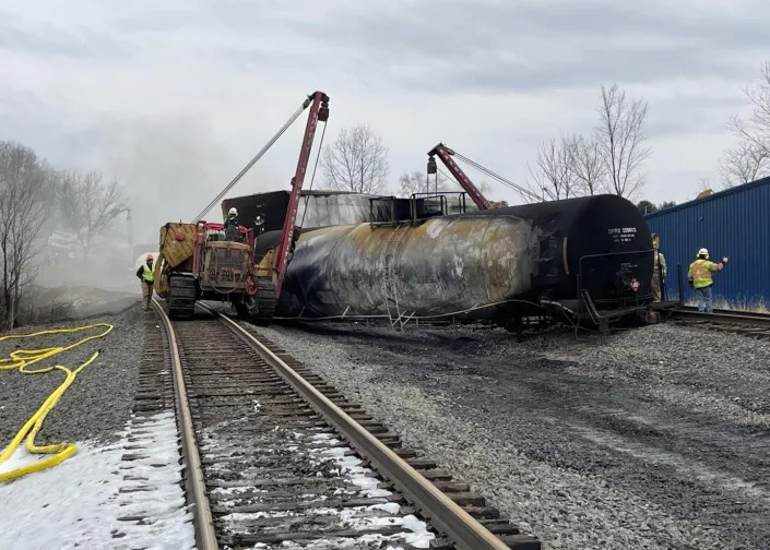
State officials offered more details of the cleanup process and a timeline of the environmental disaster during a news conference on Feb. 14, 2023. Nearly a dozen cars carrying chemicals, including vinyl chloride, a carcinogen, derailed on the evening of Feb. 3, and fire from the site sent up acrid black smoke. Officials said they had tested over 400 nearby homes for contamination and were tracking a plume of spilled chemicals that had killed 3,500 fish in streams and reached the Ohio River.

However, the slow release of information after the derailment has left many questions unanswered about the risks and longer-term impact. We put five questions about the chemical releases to Andrew Whelton, an environmental engineer who investigates chemical risks during disasters.

Let’s start with what was in the train cars. What are the most concerning chemicals for human health and the environment long term, and what’s known so far about the impact?

The main concerns now are the contamination of homes, soil and water, primarily from volatile organic compounds and semivolatile organic compounds, known as VOCs and SVOCs.

The train had nearly a dozen cars with vinyl chloride and other materials, such as ethylhexyl acrylate and butyl acrylate. These chemicals have varying levels of toxicity and different fates in soil and groundwater. Officials have detected some of those chemicals in the nearby waterway and particulate matter in the air from the fire. But so far, the fate of many of the chemicals is not known. A variety of other materials were also released, but discussion about those chemicals has been limited.

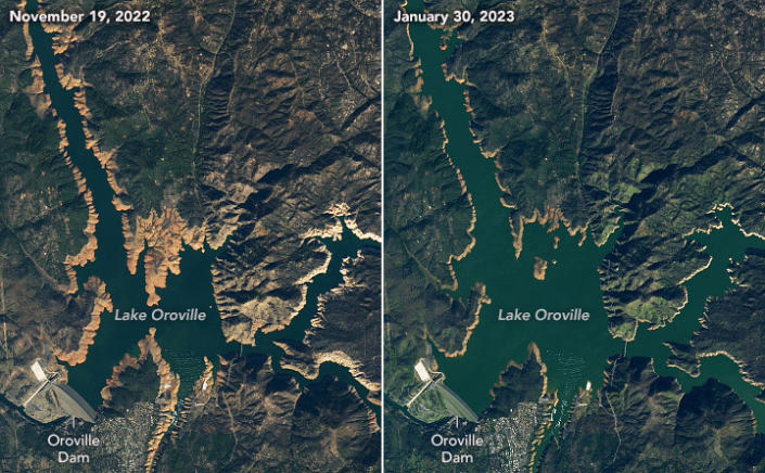
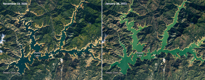
State officials disclosed that a plume of contamination released into the nearby creek had made its way into the Ohio River. Other cities get their drinking water from the river, and were warned about the risk. The farther this plume moves downstream, the less concentrated the chemical will be in water, posing less of a risk.

Long term, the greatest risk is closest to the derailment location. And again, there’s limited information about what chemicals are present – or were created through chemical reactions during the fire.

It isn’t clear yet how much went into storm drains, was flushed down the streams or may have settled to the bottom of waterways.

There was also a lot of combusted particulate matter. The black smoke is a clear indication. It’s unclear how much was diluted in the air or fell to the ground.

How long can these chemicals linger in soil and water, and what’s their potential long-term risk to humans and wildlife?

The heavier the chemical, often the slower it degrades and the more likely it is to stick to soil. These compounds can remain for years if left unaddressed.

After the Kalamazoo River oil pipeline break in Michigan in 2010, the U.S. Environmental Protection Agency excavated a tributary where the oil settled. We’ve also seen from oil spills on the coasts of Alaska and Alabama that oil chemicals can find their way into soil if it isn’t remediated.

The long-term impact in Ohio will depend in part on how fast – and thoroughly – cleanup occurs.

If the heavily contaminated soils and liquids are excavated and removed, the long-term impacts can be reduced. But the longer removal takes, the farther the contamination can spread. It’s in everyone’s best interest to clean this up as soon as possible and before the region gets rain.

Air-stripping devices, like this one used after the derailment, can help separate chemicals from water. <a href=
Air-stripping devices, like this one used after the derailment, can help separate chemicals from water. U.S. EPA

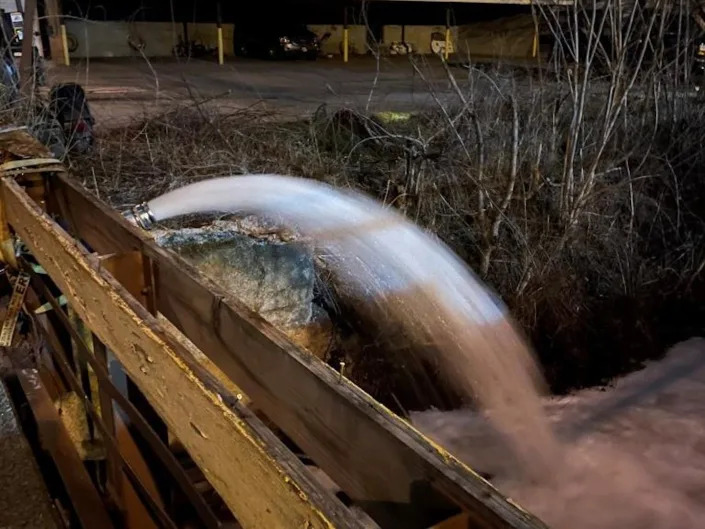
Booms in a nearby stream have been deployed to capture chemicals. Air-stripping devices have been deployed to remove chemicals from the waterways. Air stripping causes the light chemicals to leave the water and enter air. This is a common treatment technique and was used after an 2015 oil spill in the Yellowstone River near Glendive, Montana.

At the derailment site in Ohio, workers are already removing contaminated soil as deep as 7 feet (about 2 meters) near where the rail cars burned.

Some of the train cars were intentionally drained and the chemicals set on fire to eliminate them. That fire had thick black smoke. What does that tell you about the chemicals and longer-term risks?

Incineration is one way we dispose of hazardous chemicals, but incomplete chemical destruction creates a host of byproducts. Chemicals can be destroyed when heated to extremely high temperatures so they burn thoroughly.

The black smoke plume you saw on TV was incomplete combustion. A number of other chemicals were created. Officials don’t necessarily know what these were or where they went until they test for them.

We know ash can pose health risks, which is why we test inside homes after wildfires where structures burn. This is one reason the state’s health director told residents with private wells near and downwind of the derailment to use bottled water until they can have their wells tested.

The EPA has been screening homes near the derailment for indoor air-quality concerns. How do these chemicals get into homes and what happens to them in enclosed spaces?

Homes are not airtight, and sometimes dust and other materials get in. It might be through an open door or a window sill. Sometimes people track it in.

So far, the U.S. EPA has reported no evidence of high levels of vinyl chloride or hydrogen chloride in the 400 or so homes tested. But full transparency has been lacking. Just because an agency is doing testing doesn’t mean it is testing for what it needs to test for.

Media reports talk about four or five chemicals, but the manifest from Norfolk Southern also listed a bunch of other materials in tanks that burned. All those materials create potentially hundreds to thousands of VOCs and SVOCs.

Are government officials testing for everything they should?

People in the community have reported headaches, which can be caused by VOCs and other chemicals. They’re understandably concerned.

Ohio and federal officials need to better communicate what they’re doing, why, and what they plan to do. It’s unclear what questions they are trying to answer. For a disaster this serious, little testing information has been shared.

In the absence of this transparency, misinformation is filling that void. From a homeowner’s perspective, it’s hard to understand the true risk if the data is not shared.

‘There’s No Spring Break Here’: Florida’s Gulf Coast Fights to Rebound After Hurricane Ian

The New York Times

‘There’s No Spring Break Here’: Florida’s Gulf Coast Fights to Rebound After Hurricane Ian

Shannon Sims – February 14, 2023

Al Marti, 80, watches the waves roll in on a Sanibel beach as work continues to rebuild the area's infrastructure devastated by Hurricane Ian, on Sanibel Island, Fla., Feb. 9, 2023. (Scott McIntyre/The New York Times)
Al Marti, 80, watches the waves roll in on a Sanibel beach as work continues to rebuild the area’s infrastructure devastated by Hurricane Ian, on Sanibel Island, Fla., Feb. 9, 2023. (Scott McIntyre/The New York Times)

On Sept. 28, Hurricane Ian made landfall on Cayo Costa, a barrier island northwest of Cape Coral and Fort Myers, Florida, as a Category 4 storm with sustained winds of more than 150 mph. Killing 149 people in Florida, it was the state’s deadliest hurricane since 1935. More than four months later, the storm’s extraordinary power remains evident: In Fort Myers Beach, multistory oceanfront apartment buildings are still just piles of twisted steel and concrete rubble, and massive shrimping boats sit tilted and smashed together like toys in the corner of a tub.

The storm’s wrath extended up and down the west coast of Florida. But Sanibel Island, one of the area’s most popular vacation destinations, was hit especially hard. The fish-hook-shaped barrier island, some 12 miles long and 3 miles across at its widest, was devastated. Even the causeway that connects it to the mainland was partly destroyed.

On a recent afternoon, sitting at a table outside the Sanibel Grill, which roof and water damage kept closed for months, the mayor of Sanibel, Holly Smith, 61, was blunt. “There’s no spring break here,” she said. “As far as the recovery of tourism, we have a long way to go.”

Smith said that during the storm, the island had “a complete washover” — the 12-foot storm surge covered everything.

Beth Sharer, 66, a homeowner on the island, said when she went back to her ravaged condo, she couldn’t find the high-water mark that flooding usually leaves. “And then I realized there wasn’t one: The water was higher than the entire apartment,” she said.

When Smith visited the island with Gov. Ron DeSantis in the days after the storm, the area looked like a war zone, she said. “It was like ‘Mad Max,’ with dirt across the roads.”

Fears of Becoming a ‘New Miami’

Before the hurricane, Sanibel and Captiva, a smaller island connected to the north of Sanibel by a short bridge, offered an estimated 2,800 lodging units, including hotel rooms and short-term rentals, according to the Sanibel & Captiva Islands Chamber of Commerce. Today there are just 155 available, the chamber said. “We’ve changed our communication strategy from promoting the island to helping manage guest expectations for the next 12 months,” said John Lai, CEO of the chamber, which is now encouraging visitors to sign up for “voluntourism” options like helping to clear trails at the nature reserve or clean debris from the beaches.

By comparison, Fort Myers Beach had 2,384 hotel rooms before the storm, according to the Lee County government. In the wake of the storm, none of those rooms were open. As of this month, 360 of those rooms were available — just 15% of prehurricane inventory.

Before the hurricane, JPS Vacation Rentals, a local agency, had 32 properties available in Fort Myers Beach, said Heidi Jungwirth, the owner. Seven of those remain standing, but all were damaged, and none are currently rentable, she said. She has turned her office into a distribution center for donations. Distinctive Beach Rentals, which used to be the largest vacation management company in Fort Myers Beach, with 400 properties, saw 380 of those units “wiped out,” said Tom Holevas, the area manager, adding that the company has now pivoted to offering more inland rentals.

At the Lighthouse Resort’s Tiki Bar & Grill, where today the bathroom doors are shower curtains and the kitchen consists of a grill behind the outdoor bar, Betsy Anderson, 50, expressed concern about the area’s future. She owns an apartment in Cape Coral, just inland from the beach, that she rents via Airbnb. She said she had several guests cancel after the storm because the beaches were closed, and she is currently renting to a couple fixing up their own flooded house on Sanibel.

She worries that the storm will accelerate change. “We don’t think it can come back,” she said, referring to the area’s laid-back character and “old Florida” style. “Now people are saying big investors are going to come in with big money and turn this into the new Miami.”

Reviving an Economic Lifeline

On Sanibel, the push to rebuild began early, in part because the island draws so many visitors from across the country to its famous shelling beaches. A temporary causeway opened less than two weeks after the storm, allowing a convoy of electrical companies’ cherry picker trucks to reach the island. On Oct. 19, the bridges — one lane in each direction, with reduced speed limits — were opened to residents. For the rest of 2022, piece by piece, the area started to come back online.

“This place is on a lot of people’s bucket lists,” said Smith, alluding to visitors who “just want a shell from Sanibel.” But it will be at least a year before the island can accommodate tourists in any numbers, she said.

It doesn’t help that the island’s beaches are currently suffering from Florida’s persistent red tide, which is caused by a higher-than-normal level of microscopic algae that produce toxins in the water, turning it a rusty brown color and killing fish. The tide can significantly affect visitors’ experiences, aggravating respiratory problems, leaving beaches littered with rotting sea life and discouraging time spent near the water.

Still, residents and businesses are trudging toward getting tourists — their economic lifeline — back to the shore.

In just the past month, the first hotel rooms reopened for visitors at Sanibel’s Island Inn and the ’Tween Waters Resort & Spa on Captiva Island.

Some restaurants that were only lightly damaged have reopened quickly. Others are now operating out of food trucks. Some shops are back open, too, and many outdoor activities are once again available: renting kayaks and stand-up paddleboards or chartering fishing boats.

In early February, the first wedding since the storm was held at ’Tween Waters; the Bailey-Matthews National Shell Museum reopened with limited hours; and the doomsday-ish electronic sign that met visitors as they came off the bridge into Sanibel — “ALL SANIBEL BEACHES CLOSED” — was turned off, as the first beaches were officially reopened to the public. There is a sense on the island now that the wheels of tourism are finally beginning to turn.

Still, many hotels, restaurants and businesses that cater to tourists are a long way from reopening their doors. Some, like Sanibel Inn, are essentially starting from scratch, their buildings in ruins.

That’s why businesses are handing visitors the most useful item a tourist can pick up in Sanibel today: a printed list of what’s open, where and when.

‘It Breaks Your Heart’

For now, a visit to the area is more a pledge of support than a vacation.

On a sunny day in early February, Lisa Taussig of Overland Park, Kansas, and Christy, her adult daughter, were among the few tourists on the beach in front of the Island Inn, where they were staying. They come to the island about three times a year, Taussig said, and this year is no different. “After the storm passed, we just said, ‘You know what? We’re going to come down here and support Sanibel,’” she said.

“You feel welcome here,” she added, before turning and gesturing to the series of plywood-covered, battered condo buildings behind her. “Now it feels isolated, and there aren’t the lush trees that are usually here.

“It breaks your heart,” she said.

In Fort Myers Beach, residents still pick up their mail at a trailer. Glass, nails and unidentifiable twisted debris remain scattered along the ground. Around town, many flags, bumper stickers and T-shirts are emblazoned with “FMB STRONG.”

On a recent Saturday, a tiny spot called the Beach Bar was packed with a crowd of locals who looked storm-weary but exuded an ornery refusal to retreat. Even before the storm, the bar’s physical structure — right off Estero Boulevard, the beach strip that’s historically packed with visitors cruising in top-down vehicles — didn’t amount to much: It was a two-story, open-air wooden building facing the water. Now only the concrete slab remains.

But that hasn’t stopped the regulars. The crowd showed up with beach chairs and coolers, which they set up on the concrete. “They’re operating right now with a trailer, two outhouses and a band,” said Randy Deutsch, 72, from Chicago, who said he’d been coming to the bar since 1972.

“Our concept didn’t change,” said Matt Faller, the manager. “Cold beer, live music, toes in the sand.”

California Reservoirs Refilled by Winter Deluges, Satellite Images Show

Yale Environmental 360

California Reservoirs Refilled by Winter Deluges, Satellite Images Show

February 13, 2023

Lake Oroville before and after December's heavy rainstorms. NASA
Lake Oroville before and after December’s heavy rainstorms. NASA

In the wake of a series of destructive storms in late December and early January, California’s long-ailing mountain reservoirs have risen, satellite images from NASA show.

Lake Oroville, which sits in the northern reaches of the Sierra Nevada mountain range, was at just 28 percent of capacity in late November and is now at 69 percent capacity, following the winter deluge. Long depleted by drought, the reservoir is now close to its historical winter level. Lake Shasta, in far northern California, was at just 31 percent of capacity in late November and is now at 58 percent capacity, bringing it in line with the historical average.

Recent storms “certainly helped reservoir storage in California following the driest three years in the state’s recorded history,” Jeanine Jones, an official with the California Department of Water Resources, told the Los Angeles Times. “Over the next two months, it is important that we still see periodic rain and snowstorms to keep an above-average pace for our precipitation totals.”

Shasta Lake before and after December's heavy rainstorms. NASA
Shasta Lake before and after December’s heavy rainstorms. NASA

Experts warn, however, that recent storms will likely do little to ameliorate long-term shortfalls. While this winter’s snow and rain will help recharge stores of groundwater in the near term, “if the climate pattern is the same as before — dry and hot in summer followed by low precipitation — and the water demands are still high, then we expect the groundwater drawdown will continue,” Pang-Wei Liu, a NASA scientist involved in groundwater monitoring, said in a statement.

recent study found that the drop in groundwater in California’s Central Valley has accelerated over the last two decades. “The years 2000–2021 represent the driest 22-year period since at least 800,” authors wrote. They highlighted the need for better management of groundwater “to ensure its availability during the increasingly intense droughts of the future.”

Natural disasters, boosted by climate change, displaced millions of people in U.S. in 2022

NBC News

Natural disasters, boosted by climate change, displaced millions of people in U.S. in 2022

Lucas Thompson – February 12, 2023

Ricardo Arduengo

Natural disasters forced an estimated 3.4 million people in the U.S. to leave their homes in 2022, according to Census Bureau data collected earlier this year, underscoring how climate-related weather events are already changing American communities.

The overwhelming majority of these people were uprooted by hurricanes, followed by floods, then fires and tornados. Nearly 40% returned to their homes within a week. Nearly 16% have not returned home (and may never do so), and 12% were evacuated for more than six months.

The Census Bureau count is based on 68,504 responses it received as part of the Household Pulse Survey conducted Jan. 4-Jan. 16. The data collection is one of the few federal efforts to track displaced people, starting only in 2020. The bureau does note that the data is “experimental,” and is extrapolated based on its sample data.

“These numbers are very distressing,” said Michael Gerrard, director of the Sabin Center for Climate Change Law at Columbia University, who was not involved in the data collection. “These numbers are what one would expect to find in a developing country. It’s appalling to see them in the United States. … They’re only going to get worse in the years to come because climate change is making extreme weather events more frequent and more severe.”

Some states experienced far more of an impact than others. Florida had more than 888,000 people displaced. Louisiana had more than 368,000 displaced.

The U.S. was hit by a series of major disasters in 2022. The National Oceanic and Atmospheric Administration said that 18 extreme weather events had each caused at least $1 billion in damage. Climate experts have warned for years to expect more intense weather disasters as global temperatures rise.

The Census Bureau estimate, almost 1.4% of the U.S. adult population, is higher than other estimates. Data from the Internal Displacement Monitoring Center, part of the humanitarian organization The Norwegian Refugee Council, previously estimated that disasters displaced an average of 800,000 U.S. residents a year from 2008 through 2021.

“The United States is not in the least prepared for this,” Garrard said. “Our settlement patterns have not reflected the emerging risks of climate change to the habitability of some parts of the country.”

The data showed that the more than half a million people who never returned home experienced multiple hardships, including lack of housing, food, water, sanitation and child care.

“These are all things that we take for granted in a modern society,” Gerrard added. “Its absence is deeply disruptive to physical and emotional health as well as to child development.”

The data also showed disparities between people of different economic status, race and identities. Those earning less than $25,000 a year had the highest evacuation rate of any economic group, and Black and Hispanic residents had slightly higher evacuation rates than white residents.

According to the data, adults who identify as LGBTQ were disproportionately affected — 4% of LGBTQIA+ adults had to leave their homes compared with 1.2% of straight, cisgender people.

“It’s important to note that a lot of these individuals that are LGBTQ are often also considered to be socially vulnerable, and really putting a strong intersectional lens to disaster response preparedness and recovery,” said Michael Méndez, a professor of environmental policy and planning at the University of California, Irvine.

“Much of the LGBT community that’s vulnerable, and most socially vulnerable to disasters, are those that are African American, transgender and low income,” he said. “Oftentimes, that’s why they’re rendered invisible in the context of disaster policy and planning and preparedness. People write them off as not needing to provide extra resources for this community.”

Imperial Valley has made enough sacrifices already in the water rights war

Palm Springs Desert Sun

Imperial Valley has made enough sacrifices already in the water rights war

Craig William Morgan – February 12, 2023

There is an old saying in the water world that it is better to be upstream with a shovel than downstream with a law book, which is the position California finds itself in as it stands apart from its neighbors on the Colorado River in negotiations over the use of the river’s water.

On Jan. 31, representatives for the six other basin states submitted a proposal to the Bureau of Reclamation describing the measures by which the supply deficit on the Colorado River should be closed in the near term. Not surprisingly, the other basin states have asked that California reduce its water use beyond that which the state had previously proposed last fall. California was right to decline its neighbors’ new proposal notwithstanding its position on the river.

As many readers know, California water users have priority rights to Colorado River water that allow them to receive water first in times of drought. These rights are derived under the appropriative rights doctrine known as “first in time, first in right” that has been a mainstay of western water law for more than a century and a half. Those without such rights are legally bound to reduce their use.

Not surprisingly, those without such rights have developed a new theory of law that effectively says the priority system of water allocation is no longer applicable because of climate change.

The new buzzword describing this change is “aridification.” The terms “shortage” and “drought” that have historically been used they claim are no longer relevant to describing water conditions. The reason for this change in nomenclature is because existing law is very clear that water is apportioned based on priority during times of shortage and drought.

They argue that aridification is somehow different. It is not.

If state and federal courts were to interpret a distinction in such terms, water law would not only be upended along the Colorado River system, but indeed across the entire United States.

The Upper Basin states of Colorado, Wyoming, Utah and New Mexico have joined the chorus of Nevada and Arizona in arguing that aridification demands the priority system be ignored. They also argue that the requirement under the 1922 Colorado River Compact among the basin states guaranteeing a fixed quantity of water be delivered to the Lower Basin states should be ignored on the same grounds. Their fears are that such a requirement will limit their existing and proposed future diversions of Colorado River water. To date, these states’ diversions have been well below their junior allotment. The imbalance on the Colorado River they argue is a Lower Basin concern, not an Upper Basin concern.

But such a position is inconsistent and self-serving. If in fact, aridification demanded that the priority system be ignored along the river, wouldn’t it make sense that all water users within the Colorado River basin take a reduction, not just those in the Lower Basin as Upper Basin users have proposed? It is noteworthy that Upper Basin states thus far have not meaningfully participated in reducing demands on the Colorado River. Yet they should.

Why haven’t Arizona and Nevada looked harder at the Upper Basin states to reduce their water use to balance demands instead of focusing on California? Perhaps they are hoping that California’s Imperial Valley will once again come to the rescue of the river’s water users as was done in 2003 when the Imperial Irrigation District signed the Quantification Settlement Agreement (QSA) and reduced its water use by more than 15 %. As the river’s biggest water user (and least politically potent), surely, they must have more water to spare.

The residents of Imperial Valley are right to be concerned about the future of their community. In 2003, the Imperial Irrigation District, despite holding senior water rights to the river for the benefit of its farming community, succumbed to the political pressures within California and from other basin states to reduce their demands on the Colorado River.

The argument made at the time by the river’s other water users was that the district was wasting water. However, the fact of the matter was that the district’s water use was no different than that of other irrigation districts across the west. The QSA water transfers have created significant hardships on the local communities and an ecological nightmare for the Salton Sea.

As the basin states and federal government move forward in crafting solutions to the water shortage problem on the Colorado River, they must consider the sacrifices that have already been made by those living in Imperial Valley: Sacrifices that have been made by those holding senior water rights. They must also consider the damage that would be done to the legal structure governing water use across the west if the priority system is to be ignored.

Craig William Morgan is a water resources engineer who served as consultant to farmers opposing the QSA. He is the author of the recently published book about the QSA and the fight for Imperial Valley’s water called “The Morality of Deceit.” 

California fuel pipeline to resume service Saturday after fuel leak caused disruption

ABC News

California fuel pipeline to resume service Saturday after fuel leak caused disruption

Nadine El Bawab – February 11, 2023

A California pipeline, that delivers the majority of fuel to the Las Vegas Valley and surrounding areas, is expected to resume operations Saturday afternoon, the pipeline operator announced.

The Kinder Morgan gas pipeline, which supplies about 90% of needed gas, diesel, jet fuel and other refined petroleum products to the Las Vegas Valley and surrounding areas, experienced a disruption that resulted in a temporary shutdown of the line.

“We have isolated the source of the release within our Watson Station in Long Beach, California. Restart activities are underway for Watson Station’s associated SFPP West and CalNev pipelines. We expect these pipelines to resume operations this afternoon and begin delivering fuel to their respective market areas later today. We continue to be in close contact with our customers and the appropriate regulatory agencies as we work to resolve this issue,” Kinder Morgan, the pipeline operator, said in a statement to ABC News.

MORE: US shoots down unknown ‘high-altitude object’ over Alaska, White House says

Nevada Gov. Joe Lombardo declared a state of emergency Friday due to the disruption.

On Thursday, Kinder Morgan, the pipeline operator, began investigating a leak inside its Watson Station in Long Beach, California, the company said in a statement.

PHOTO: In this March 7, 2011, file photo, a motorist fuels up at a gas station in Santa Cruz, Calif. (Marcio Jose Sanchez/AP, FILE)

“Watson Station and its associated SFPP West and CALNEV pipelines have been isolated and shut down while we work to resolve this issue. There are no injuries or fire reported as a result of this incident,” Kinder Morgan said in its statement.  Kinder Morgan’s 566-mile CALNEV pipeline system transports gasoline, diesel and jet fuel from Los Angeles to terminals in Barstow, California, and Las Vegas.

“The appropriate regulatory agencies have been notified, and an investigation into the cause and quantity of the release will be conducted. We are working closely with our customers on potential impacts,” Kinder Morgan said.

The disruption may cause a shortage of fuel supplies in Nevada, according to the declaration of emergency.

PHOTO: In this Nov. 14, 2022, file photo, Nevada Gov.-elect Joe Lombardo speaks at his alma mater, Rancho High School, in North Las Vegas, Nevada. (Ethan Miller/Getty Images, FILE)

The emergency declaration will allow Nevada to receive federal waivers, resources to repair the pipeline and allow the state to increase the transportation of fuel by other means, according to Lombardo.

“To avoid any unnecessary shortages, I strongly urge all Las Vegas residents to avoid panic buying while awaiting repair timeline updates,” Lombardo said in a statement posted on Twitter.

The declaration expires in 15 days unless it is renewed.

Living with natural gas pipelines: Appalachian landowners describe fear, anxiety and loss

 The Conversation

Living with natural gas pipelines: Appalachian landowners describe fear, anxiety and loss

Erin Brock Carlson, Assistant Professor of Professional Writing and Editing, West Virginia University and Martina Angela Caretta, Senior Lecturer in Human Geography, Lund University – February 11, 2023

Pipeline construction cuts through forests and farms in Appalachia. Provided by Erin Brock Carlson, <a href=
Pipeline construction cuts through forests and farms in Appalachia. Provided by Erin Brock Carlson, CC BY-SA

More than 2 million miles of natural gas pipelines run throughout the United States. In Appalachia, they spread like spaghetti across the region.

Many of these lines were built in just the past five years to carry natural gas from the Marcellus Shale region of Ohio, Pennsylvania and West Virginia, where hydraulic fracturing has boomed. West Virginia alone has seen a fourfold increase in natural gas production in the past decade.

Such fast growth has also brought hundreds of safety and environmental violations, particularly under the Trump administration’s reduced oversight and streamlined approvals for pipeline projects. While energy companies promise economic benefits for depressed regions, pipeline projects are upending the lives of people in their paths.- ADVERTISEMENT -https://s.yimg.com/rq/darla/4-10-1/html/r-sf-flx.html

As a technical and professional communication scholar focused on how rural communities deal with complex problems and a geography scholar specializing in human-environment interactions, we teamed up to study the effects of pipeline development in rural Appalachia. In 2020, we surveyed and talked with dozens of people living close to pipelines in West Virginia, Ohio and Pennsylvania.

What we found illuminates the stress and uncertainty that communities experience when natural gas pipelines change their landscape. Residents live with the fear of disasters, the noise of construction and the anxiety of having no control over their own land.

‘None of this is fair’

Appalachians are no strangers to environmental risk. The region has a long and complicated history with extractive industries, including coal and hydraulic fracturing. However, it’s rare to hear firsthand accounts of the long-term effects of industrial infrastructure development in rural communities, especially when it comes to pipelines, since they are the result of more recent energy-sector growth.

For all of the people we talked to, the process of pipeline development was drawn out and often confusing.

Some reported never hearing about a planned pipeline until a “land man” – a gas company representative – knocked on their door offering to buy a slice of their property; others said that they found out through newspaper articles or posts on social media. Every person we spoke with agreed that the burden ultimately fell on them to find out what was happening in their communities.

A map shows U.S. pipelines carrying natural gas and hazardous liquids in 2018. More construction has been underway since then. <a href=
A map shows U.S. pipelines carrying natural gas and hazardous liquids in 2018. More construction has been underway since then. GAO and U.S. Department of Transportation

One woman in West Virginia said that after finding out about plans for a pipeline feeding a petrochemical complex several miles from her home, she started doing her own research. “I thought to myself, how did this happen? We didn’t know anything about it,” she said. “It’s not fair. None of this is fair. … We are stuck with a polluting company.”

‘Lawyers ate us up’

If residents do not want pipelines on their land, they can pursue legal action against the energy company rather than taking a settlement. However, this can result in the use of eminent domain.

Eminent domain is a right given by the Federal Energy Regulatory Commission to companies to access privately held property if the project is considered important for public need. Compensation is decided by the courts, based on assessed land value, not taking into consideration the intangibles tied to the loss of the land surrounding one’s home, such as loss of future income.

Through this process, residents can be forced to accept a sum that doesn’t take into consideration all effects of pipeline construction on their land, such as the damage heavy equipment will do to surrounding land and access roads.

One man we spoke with has lived on his family’s land for decades. In 2018, a company representative approached him for permission to install a new pipeline parallel to one that had been in place since 1962, far away from his house. However, crews ran into problems with the steep terrain and wanted to install it much closer to his home. Unhappy with the new placement, and seeing erosion from pipeline construction on the ridge behind his house causing washouts, he hired a lawyer. After several months of back and forth with the company, he said, “They gave me a choice: Either sign the contract or do the eminent domain. And my lawyer advised me that I didn’t want to do eminent domain.”

Pipeline construction cuts through a farmer’s field. Provided by Erin Brock Carlson, <a href=
Pipeline construction cuts through a farmer’s field. Provided by Erin Brock Carlson, CC BY-SA

There was a unanimous sense among the 31 people we interviewed that companies have seemingly endless financial and legal resources, making court battles virtually unwinnable. Nondisclosure agreements can effectively silence landowners. Furthermore, lawyers licensed to work in West Virginia who aren’t already working for gas companies can be difficult to find, and legal fees can become too much for residents to pay.

One woman, the primary caretaker of land her family has farmed for 80 years, found herself facing significant legal fees after a dispute with a gas company. “We were the first and last ones to fight them, and then people saw what was going to happen to them, and they just didn’t have – it cost us money to get lawyers. Lawyers ate us up,” she said.

The pipeline now runs through what were once hayfields. “We haven’t had any income off that hay since they took it out in 2016,” she said. “It’s nothing but a weed patch.”

‘I mean, who do you call?’

Twenty-six of the 45 survey respondents reported that they felt that their property value had decreased as a result of pipeline construction, citing the risks of water contamination, explosion and unusable land.

Many of the 31 people we interviewed were worried about the same sort of long-term concerns, as well as gas leaks and air pollution. Hydraulic fracturing and other natural gas processes can affect drinking water resources, especially if there are spills or improper storage procedures. Additionally, methane, a potent greenhouse gas, and volatile organic compounds, which can pose health risks, are byproducts of the natural gas supply chain.

Oil spills are a major concern among land owners. Provided by Erin Brock Carlson, <a href=
Oil spills are a major concern among land owners. Provided by Erin Brock Carlson, CC BY-SA

“Forty years removed from this, are they going to be able to keep track and keep up with infrastructure? I mean, I can smell gas as I sit here now,” one man told us. His family had watched the natural gas industry move into their part of West Virginia in the mid-2010s. In addition to a 36-inch pipe on his property, there are several smaller wells and lines. “This year the company servicing the smaller lines has had nine leaks … that’s what really concerns me,” he said.

The top concern mentioned by survey respondents was explosions.

According to data from 2010 to 2018, a pipeline explosion occurred, on average, every 11 days in the U.S. While major pipeline explosions are relatively rare, when they do occur, they can be devastating. In 2012, a 20-inch transmission line exploded in Sissonville, West Virginia, damaging five homes and leaving four lanes of Interstate 77 looking “like a tar pit.”

A gas line explosion near Sissonville, West Virginia, sent flames across Interstate 77. <a href=
A gas line explosion near Sissonville, West Virginia, sent flames across Interstate 77. AP Photo/Joe Long

Amplifying these fears is the lack of consistent communication from corporations to residents living along pipelines. Approximately half the people we interviewed reported that they did not have a company contact to call directly in case of a pipeline emergency, such as a spill, leak or explosion. “I mean, who do you call?” one woman asked.

‘We just keep doing the same thing’

Several people interviewed described a fatalistic attitude toward energy development in their communities.

Energy analysts expect gas production to increase this year after a slowdown in 2020. Pipeline companies expect to keep building. And while the Biden administration is likely to restore some regulations, the president has said he would not ban fracking.

“It’s just kind of sad because they think, once again, this will be West Virginia’s salvation,” one landowner said. “Harvesting the timber was, then digging the coal was our salvation. … And then here’s the third one. We just keep doing the same thing.”

[Deep knowledge, daily. Sign up for The Conversation’s newsletter.]

This article is republished from The Conversation, a nonprofit news site dedicated to sharing ideas from academic experts. The Conversation is trustworthy news from experts. Try our free newsletters.

It was written by: Erin Brock CarlsonWest Virginia University and Martina Angela CarettaLund University.

Read more:

Dr. Carlson has received funding this project from the West Virginia University Humanities Center.

Dr Caretta has received funding for this project from the Heinz Foundation and the West Virginia University Humanities Center.

Turkey earthquake fault lines mapped from space

BBC News

Turkey earthquake fault lines mapped from space

Jonathan Amos – BBC Science Correspondent – February 10, 2023

Satellite map
Satellite map

It seems almost insensitive to start to have a deep dive into the science behind Monday’s earthquake events in Turkey.

More than 22,000 people are already confirmed dead and an unknown number still lie trapped, with the window for their rescue closing rapidly.

And yet the science will go on. The insights gleaned from this event will save lives in the future.

Take a look at the map on this page. It is the most precise yet produced of how the ground lurched in response to the enormous energies that were unleashed.

The data behind it was acquired in the early hours of Friday by the European Union’s Sentinel-1A satellite as it traversed north to south over Turkey at an altitude of 700km (435 miles).

The Sentinel carries a radar instrument that is able to sense the ground in all weathers, day and night.

It is routinely scanning this earthquake-prone region of the world, tracing the often very subtle changes in elevation at the Earth’s surface.

Except, of course, the changes on Monday were not subtle at all; they were dramatic. The ground bent, buckled and in places ripped apart.

Researchers use the technique of interferometry to compare “before” and “after” views. But you do not really need to be an expert to see the consequences for Turkey in the latest Sentinel map.

The red colours here describe movement towards the satellite since it last flew over the country; the blue colours record the movement away from the spacecraft.

It is abundantly clear how the ground has been deformed along and near the East Anatolian Fault line.

For both the Magnitude 7.8 quake that struck first on Monday at 01:17 GMT and the Magnitude 7.5 event at 10:24, the motion is “left-lateral”. That is to say: whichever side of the fault you are on, the other side has moved to the left. And by several metres in places.

The shocking thing is that the lines of rupture have gone right through settlements; in lots of places they will have gone right through buildings.

Sentinel-1
Artist’s impression: The Sentinel routinely maps earthquake-prone Turkey

The Sentinel map will help scientists understand exactly what happened on Monday, and this knowledge will feed into their models for how earthquakes work in the region, and then ultimately into the risk assessments that the Turkish authorities will use as they plan the recovery.

There is sure to be a lot of discussion about how the two major tremors were related and what that could mean for further instability.

The map was processed by the UK Centre for Observation and Modelling of Earthquakes, Volcanoes and Tectonics (Comet). Its director, Prof Tim Wright, said the Sentinel observations vividly brought home the scale of the forces involved.

“News outlets always show earthquakes as ‘the epicentre’, as if it is a single point source (like a bomb). Actually, all earthquakes are caused by slip on extended faults, and the bigger the quake the bigger the fault that ruptured,” he told BBC News.

“We can map those ruptures with satellites because the ground around them is displaced, in this case by up to 5m or 6m. The rupture of the first event was 300km or so long and the second big event ruptured another 140km or so of a different fault. To put those distances in context, London to Paris is roughly 345km.

“Damage will be highest near the fault but of course spreads over a wide region either side of the fault, too. It’s absolutely horrific.”

Collapsed house
The insights will assist Turkish authorities as they plan the recovery

In the era before satellites, geologists would map earthquake faults by walking the lines of rupture. It was a laborious process that naturally also missed a lot of detail. Radar interferometry from space was developed in the 1990s, and in recent years it has become a particularly compelling tool.

In part that is down to the quality of the sensors now in orbit, but it is also the result of more powerful computers and smarter algorithms.

It is possible today to get a data product on to the computers of experts, ready for analysis, within hours of a satellite making an overhead pass. Comet, unfortunately, had to wait several days for Sentinel-1A to be in the right part of the sky to get an optimal view of Turkey. But this will improve as more and more radar satellites are launched.

“By the end of the decade, we should be able to do this kind of analysis within a day of most damaging earthquakes, and then we would be more useful for the relief effort. As things stand, we are of course outside the 72-hour window for search and rescue,” Prof Wright said.

Daunting medical issues for earthquake survivors are just beginning

The Washington Post

Daunting medical issues for earthquake survivors are just beginning

David Ovalle – February 9, 2023

Members of the Lebanese Red Cross carry the corpse of a victim retrieved from the rubble of a collapsed building in the Syrian town of Jableh northwest of Damascus on Thursday. (Louai Beshara /AFP/Getty Images)

As international medical teams stream into the earthquake-ravaged areas of Turkey and Syria, the injuries they are encountering are horrific but no surprise: broken bones, arms and legs crushed by collapsed buildings, infected gashes.

But that’s only the beginning for doctors and paramedics working feverishly to save lives in a disaster that has already claimed more than 20,000 people, experts say.

In coming weeks, as search efforts turn to the grim task of recovering bodies, countless survivors will need medications for high blood pressure, diabetes and asthma left behind in the rubble. Many who are pregnant will give birth in makeshift shelters and refugee camps. Cancer patients will go without treatment.

Freezing temperatures mean survivors in thrown-together shelters face hypothermia or frostbite. Close quarters in shelters could also lead to the spread of the coronavirus and other respiratory viruses.

And there’s another looming risk: waterborne diseases such as cholera, which had already appeared in the affected war-torn region of northwest Syria because of poor water quality and sanitation.

“It’s a horrible situation. You can’t do everything you want to do and you have to adapt to a whole different way of treating people. It’s a mentally and morally taxing situation,” Thomas Kirsch, a professor of emergency medicine at the George Washington University School of Medicine and Health Sciences, said of the coming challenges for medical workers.

Paul Spiegel, director of the Center for Humanitarian Health at the Johns Hopkins Bloomberg School of Public Health, said the time period after the search-and-rescue efforts will be crucial, if less dramatic.

“You likely will save a lot more people by ensuring you have surveillance and thinking about continuing care and supplies,” he said.

Those efforts are already being spearheaded by the Turkish government, the World Health Organization and other aid groups that regularly send emergency teams into earthquake zones.

The challenges to providing medical care are especially daunting in Turkey and Syria, which was rocked by a 7.8-magnitude quake early Monday morning, and a second one hours later that was recorded at 7.5.

The disaster toppled hospitals and other medical facilities that would have been crucial for treating those injured in building collapses, not to mention other ailments. Buckled and impassible roads won’t make it any easier for medical organizations, said Kirsch, who has worked extensively in disaster zones, including in Haiti after it was devastated by a 2010 earthquake.

“The logistics and coordination of the health-care response is really a problem,” he said.

Syria is of particular concern because of the destruction of its health care infrastructure after years of civil war, Iman Shankiti, the WHO’s representative in the country, told reporters Wednesday.

“Definitely, the health needs are tremendous. It’s important to note that the health system has suffered for the last 12 years, and continues to suffer and continues to be strained by the ongoing emergencies, and the last one is this earthquake,” Shankiti said.

The WHO said it was sending three flights with medical supplies to both countries, including trauma kits, from a logistics hub in Dubai. It also has released $3 million in funding.

The Israeli Defense Forces has said it is setting up a field hospital in Turkey.

Nongovernmental groups will also be key. Doctors Without Borders, which was already in northwest Syria, said it is continuing to support seven hospitals, health-care centers and a burn unit in the area.

Americares, a Connecticut-based health-focused relief group, has already sent a shipment of hygiene kits, IV fluids and some chronic-disease medicines. A four-person team is already on the ground in southern Turkey.

“In the coming days, there’s going to be a tremendous need for those chronic-need medicines,” said Julie Varughese, the organization’s chief medical officer.

Project Hope, a global health and humanitarian aid organization, is also in Gaziantep, Turkey, a city hit hard by the earthquakes. Like many medical relief organizations, it is assessing what help each area will need with short- and long-term health care, as search-and-rescue operations continue to look for survivors.

The organization’s humanitarian health adviser, Pranav Shetty, fears that in coming days, doctors will see many of the same medical conditions that unfolded in Haiti after its devastating earthquake in 2010.

Doctors will need to work quickly to remove dead tissue from wounds, lest it lead to dangerous infections, he said.

Another pressing concern is what’s known as “crush syndrome,” which happens when survivors are pulled from the rubble, releasing pressure on muscles and releasing toxins from damaged tissue. That can wreak havoc on survivors’ kidneys, requiring dialysis – no easy task to provide when hospitals are destroyed.

“That’s a pretty robust intervention that requires a lot of resources,” Shetty said.

Still, the everyday maladies may end up being a wider problem as the months pass.

Kirsch, of George Washington University, said foreign medical assistance will be needed to help with everyday conditions such as diabetes, heart attacks and strokes.

“Turkey has a pretty strong health-care system, so its recovery will be better than a lot of less economically robust countries,” he said.

And both countries will need to pour resources into mental health treatment, not just for survivors but for medical personnel who have been overwhelmed ministering to those in need.

“At times you make decisions about life and death you wouldn’t have to make in other situations,” Kirsch said of medical personnel in earthquake zones. “That’s the struggle early on.”

To avert ‘poppy apocalypse,’ California city closes canyon to visitors

The Washington Post

To avert ‘poppy apocalypse,’ California city closes canyon to visitors

Hannah Sampson – February 9, 2023

Visitors pose for a picture among wildflowers in bloom in March 2019 in Lake Elsinore, Calif. (Gregory Bull/AP)

Wildflower lovers won’t be able to get their fix this year in one Southern California city after officials announced that they were closing trails, roads and parking at a canyon that attracted thousands of visitors during an earlier poppy bloom.

The superbloom of 2019 blanketed Lake Elsinore’s Walker Canyon with a layer of vibrant orange poppies. They proved irresistible to phone-wielding, Instagram-posting visitors, who clogged roadways and trails, trampled the growth and occasionally needed rescuing due to heat and exertion and at least one rattlesnake bite.

“The flowers were beautiful,” Lake Elsinore Mayor Natasha Johnson said during a news conference this week with patches of California poppies in the background. “The scene was a nightmare.”

Facing another seasonal bloom – though likely not a supersized one – city, county and law enforcement officials decided not to risk a repeat. Johnson announced that the trails on Walker Canyon, as well as parking around it and an access road, are all closed. Shuttles will not run to the canyon, as they did for part of the 2019 season. Trails were closed in the spring of 2020 due to the pandemic, and drought kept blooms away for the last couple of years.

“While typically the city of Lake Elsinore welcomes visitors to enjoy our vibrant community and boost our economy, the overwhelming number and unfortunate behavior of our visitors to Walker Canyon in 2019 came at a cost that was way too steep for our residents and our wildlife,” Johnson said.

Riverside Sheriff Chad Bianco warned that the penalty for visiting anyway could be steep, though he said courts would determine any fine.

“We don’t want anybody coming here thinking that they’ll pay the fine and be good with it,” he said. “It’s a misdemeanor infraction subject to arrest.”

Walker Canyon, which closed in 2019 due to the crowds, has become the latest popular destination to close because of overtourism. A daffodil-dotted ranch east of Sacramento that had been open to the public for decades announced it was closing indefinitely in 2019 after being overwhelmed by a “crush of visitors.” Comparing the influx of tourists to a “zombie apocalypse,” Ontario farmers shut down access to their sunflower fields after a little more than a week, the New York Times reported in 2018.

The story has been similar around the globe, with a canyon in Iceland, an island in the Philippines and a bay in Thailand closing, at least temporarily, due to an influx of tourists.

In Lake Elsinore, reaction on the Facebook page that carried the news conference ranged from laudatory to disappointed to politically charged.

“So instead of responsibility, City officials decide to take away our rights,” one person wrote. “Taking their orders from the progressives.”

Another was more succinct: “Poppy police,” they wrote.

Some residents said they had been excited to explore the canyon, though others – still scarred from 2019 – were glad to escape a few weekends of gridlock. Many chastised officials for missing out on the chance to make some money from the phenomenon.

“You’re going to lose million in tax and tourist revenue,” one commenter wrote. “Should have leaned in and had a poppy festival with shuttles etc. Missed opportunity.”

But Bianco, the county sheriff, said there was no way to safely accommodate the crowds that have shown up in the past.

“Your warning is right now; we will have a zero-tolerance policy for people that are here trespassing and parking on sides of the roadways,” he said. “If you are going to come here and you are going to park your car, you are subject to citation and possibly the towing of your vehicle.”

For poppy fans who need updates on the bloom, the city has live video footage of Walker Canyon linked from its website.

“We understand that this is not the news that everybody may want to have heard, but our community’s safety as well as preservation is our main focus,” Johnson said. “Thank you for your support and especially your poppy patience. This weekend I encourage you to focus on the Super Bowl and not the superbloom that we’re not having.”