Arizona is not out of water, despite all those headlines you might read
Joanna Allhands, Arizona Republic – January 25, 2023
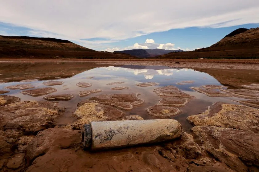
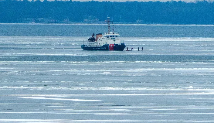
Michael Rudolph (Dynamite Water) loads his water truck at the Scottsdale fill station on Dec. 29, 2022, located northwest of the intersection of Pima and Jomax roads in Scottsdale, Ariz. Rudolph was delivering water to a client in Rio Verde Foothills.
The national press has had a field day with two not-so-positive Arizona water stories.
About 500 homes in the unincorporated community of Rio Verde Foothills can no longer haul water from Scottsdale, the neighboring city to the south.
Meanwhile, a state-produced model has found that the area north and west of Buckeye does not have enough groundwater to support future massive developments.
They’re alarming stories, but the coverage has piled on the hyperbole. Some headlines have made it sound as if an entire “Arizona town” was cut off.
The Colorado River – once 40% of the state’s water supply – is dwindling. About 80% of Arizona and about 20% of its population has no rules on groundwater pumping, which is draining many of our rural aquifers.
Add in these troubles sprouting in metro Phoenix, an area covered by the state’s most stringent groundwater management rules, and we’ve got urgent issues that require urgent responses.
But the headlines make it sound as if we’re completely botching our jobs as water stewards.
Most metro Phoenix cities have spent decades storing water underground for a (non-)rainy day, for example. They have long recycled most of their wastewater, though we don’t yet drink it.
And while much of the coverage has focused on the fact that there isn’t enough water in parts of the far West Valley to support thousands of acres of future development, it glosses over why that growth may never occur:
Because we had the foresight decades ago to create an assured water supply program, which requires builders to prove they have secured enough water for the long haul before they can plat lots.
We have water protections. They need shoring up
Is that program fail proof? No.
The root cause of Rio Verde Foothills’ water problems is that state law allows property owners to subdivide land into less than six lots and avoid requirements to prove they have secured a 100-year water supply.
Homes were built solely on the promise of hauled water. The potential risk of such a deal was glossed over with homeowners. And despite all the negative coverage lately, people are still building in the area.
It doesn’t matter that these so-called wildcat lot splits encompass a fraction of the homes we build every year. Or that not all homes in Rio Verde Foothills are affected, just those that relied on Scottsdale for hauled water.
The headlines on repeat are that Arizona doesn’t have enough water to grow or even sustain existing residents.
The story is more nuanced than the headlines
The full story is more nuanced.
Water is still being hauled to Rio Verde Foothills, albeit from other spotty sources that are vastly more expensive. Residents haven’t lost water; they’ve lost access to cheap water.
That is unlikely to change if EPCOR, a private water provider, is given the green light in April to more permanently serve these residents. Solving the affordability problem won’t be easy.
Meanwhile, on the far west side of the Valley, developers either must find renewable water sources to build on large swaths of open desert or find affordable ways to grow closer in areas with the capacity to serve new residents.
Fixing the cracks through which some development has fallen would be a good start.
In Rio Verde Foothills, the solution cannot simply be to force Scottsdale to serve non-residents. We need to tackle the root problem, which means we need to rein in wildcat lot splits.
Lawmakers could change how we define “subdivisions” – that might be the cleanest fix. Or they could give counties more power to say no to homes that plan to haul water, particularly in areas like Rio Verde Foothills where groundwater is spotty.
In the West Valley, lawmakers must address a proliferation of “build-to-rent” homes, which are touted as a much-needed affordable housing alternative but also aren’t required to prove a long-term water supply before building.
If civic and elected leaders want to counter the narrative that Arizona is irresponsible, they need to get better at telling the full story – which, yes, means more clearly touting the things we’ve done well.
But because perception is reality in water, and virtually everyone else has similar success stories, they also need a clear plan – shared loudly and on repeat – for how they intend to up our game.
US moves to protect Minnesota wilderness from planned mine
Steve Karnowski – January 26, 2023
Area Wilderness in northeastern Minnesota. The Biden administration moved Thursday, Jan. 26, 2023, to protect the pristine Boundary Waters Canoe Area Wilderness in northeastern Minnesota from future mining, dealing a potentially fatal blow to the proposed Twin Metals copper-nickel project. (AP Photo/Steve Karnowski, File)Supporters of the Campaign to Save the Boundary Waters drive past the residence of Minnesota Gov. Tim Walz as part of an Earth Day drive-in rally to Protect the Boundary Waters Canoe Area Wilderness on April 22, 2020, in St. Paul, Minn. The Biden administration moved Thursday, Jan. 26, 2023, to protect the pristine Boundary Waters Canoe Area Wilderness in northeastern Minnesota from future mining, dealing a potentially fatal blow to the proposed Twin Metals copper-nickel project. (AP Photo/Jim Mone, File)
ST. PAUL, Minn. (AP) — The Biden administration moved Thursday to protect northeastern Minnesota’s pristine Boundary Waters Canoe Area Wilderness from future mining, dealing a potentially fatal blow to a copper-nickel project.
Interior Secretary Deb Haaland signed an order closing over 350 square miles (900 square kilometers) of the Superior National Forest, in the Rainy River Watershed around the town of Ely, to mineral and geothermal leasing for 20 years, the longest period the department can sequester the land without congressional approval.
The order is “subject to existing valid rights,” but the Biden administration contends that Twin Metals Minnesota lost its rights last year, when the department rescinded a Trump administration decision to reinstate federal mineral rights leases that were critical to the project. Twin Metals, which is owned by the Chilean mining giant Antofagasta, filed suit in August to try to reclaim those rights, and reaffirmed Tuesday that it’s not giving up despite its latest setback.
“Protecting a place like Boundary Waters is key to supporting the health of the watershed and its surrounding wildlife, upholding our Tribal trust and treaty responsibilities, and boosting the local recreation economy,” Haaland said in a statement. “With an eye toward protecting this special place for future generations, I have made this decision using the best available science and extensive public input.”
Critics of the project hailed the decision as a massive victory and called for permanent protections for the wilderness. But supporters of Twin Metals said the order runs counter to the administration’s stated goal of increasing domestic supplies of metals that are critical to the clean energy economy.
“The Boundary Waters is a paradise of woods and water. It is an ecological marvel, a world-class outdoor destination, and an economic engine for hundreds of businesses and many thousands of people,” Becky Rom, national chair of the Campaign to Save the Boundary Waters, said in a statement.
The proposed underground mine would be built southeast of Ely, near Birch Lake, which flows into the Boundary Waters. The project has been battered by shifting political winds. The Obama administration, in its final weeks, chose not to renew the two leases, which had dated back more than 50 years. The Trump administration reversed that decision and reinstated the leases. But the Biden administration canceled the leases last January after the U.S. Forest Service in October 2021 relaunched the review and public engagement process for the 20-year mining moratorium.
While the Biden administration last year committed itself to expanding domestic sources of critical minerals and metals needed for electric vehicles and renewable energy, it made clear Thursday that it considers Boundary Waters to be a unique area worthy of special protections. A day ago, the administration said it would reinstate restrictions on road-building and logging in the country’s largest national forest, the Tongass National Forest in Alaska.
Twin Metals said it was “deeply disappointed and stunned” over the moratorium.
“This region sits on top of one of the world’s largest deposits of critical minerals that are vital in meeting our nation’s goals to transition to a clean energy future, to create American jobs, to strengthen our national security and to bolster domestic supply chains,” the company said in a statement. “We believe our project plays a critical role in addressing all of these priorities, and we remain committed to enforcing Twin Metals’ rights.”
Twin Metals says it can mine safely without generating acid mine drainage that the Biden administration and environmentalists say makes the $1.7 billion project an unacceptable risk to the wilderness. Twin Metals says its design would limit the exposure of the sulfide-bearing ore to the effects of air and water. And it says the mine would create more than 750 high-wage mining jobs plus 1,500 spinoff jobs in the region.
Republican U.S. Rep. Pete Stauber, who represents northeastern Minnesota, condemned the decision as “an attack on our way of life” that will benefit only foreign suppliers such as China that have fewer labor and environmental protections. “America needs to develop our vast mineral wealth, right here at home, with high-wage, union protected jobs,” he said in a statement.
“Ultimately, this sends a chilling message to hardworking Minnesotans who need the widespread economic benefits of mining in our state and sends an even harsher message to the business community that they cannot expect fair treatment in Minnesota or the United States,” the Jobs for Minnesotans coalition of business and labor groups said in a statement.
While Democratic U.S. Rep. Betty McCollum, who represents the St. Paul area, applauded the order, she also warned in a statement that a future administration could reverse the decision.
The 1,700 square mile (4,400 square kilometer) Boundary Waters Canoe Area is the most-visited federally designated wilderness area in the U.S. It draws more than 150,000 visitors from around the world who paddle its more than 1,200 miles (1,900 kilometers) of canoe routes and over 1,100 lakes. According to the Interior Department, it contributes over $17 million annually to the outdoor recreation and tourism economy in northeastern Minnesota. Three Ojibwe tribes exercise treaty rights in the area covered by the moratorium.
The order does not affect two other proposed copper-nickel projects in northeastern Minnesota — the PolyMet mine near Babbitt and Hoyt Lakes and the Talon Metals mine near Tamarack — which lie in different watersheds.
The Colorado River is overused and shrinking. Inside the crisis transforming the Southwest
Ian James, Molly Hennessy-Fiske, January 26, 2023
(Luis Sinco / Los Angeles Times)
The Colorado River begins as melting snow, trickling from forested peaks and coursing in streams that gather in the meadows and valleys of the Rocky Mountains.
Like arteries, its major tributaries take shape across Colorado, Wyoming, Utah and New Mexico, coming together in a great river like no other — a river that travels more than 1,400 miles and has defined the rise of the American Southwest over the last century.
Water diverted from the river has enabled agriculture to spread across 5 million acres of farmland and has fed the growth of cities from Denver to Los Angeles, supplying about 40 million people. Harnessing the river’s bounty has provided the foundation for life and the economy across seven states and northern Mexico.
But the region has for years depended too heavily on the river, taking more than its flows can support. And in recent years, the river’s water-generating heart in the Rocky Mountains has begun to fail.
The Colorado River can no longer withstand the unbridled thirst of the arid West.
A century ago, the signing of the Colorado River Compact divided the water among the states. The agreement established a system that overpromised what the river could provide. That system, after years of warnings from scientists and insufficient efforts to adapt, is now colliding with the reality of a river that is overused and shrinking.
In the last 23 years, as rising temperatures fueled by the burning of fossil fuels have intensified the worst drought in centuries, the flow of the Colorado has declined about 20%.
Reservoirs have dropped to record-low levels, and the shortage continues to worsen. Scarcity is pushing the region toward a water reckoning.
The looming consequences include major cuts in the supplies used for growing crops and sustaining cities. How those water reductions are divided among states, water districts and tribes has yet to be determined, and could end up being negotiated, dictated by the federal government or fought in court. But the need to shrink overall water use will probably result in less water flowing to farms, more water restrictions for residents and fewer green lawns, while also bringing calls for limiting growth, shifting away from thirsty crops like alfalfa, and dedicating less water to golf courses and other water-guzzling businesses.
The Colorado River Basin, which stretches from Wyoming to northern Mexico, is facing unresolved questions about how to adapt, at what cost, and where the cuts will fall the hardest.
The task of downsizing water use is complicated by an allocation system that promised now-nonexistent water on paper, as well as a legal system that benefits those with the oldest, most senior water rights.
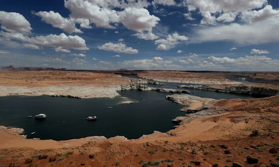
White surfaces along the banks show previous water levels in Lake Powell on May 16. (Luis Sinco / Los Angeles Times)
Over the last several years, managers of water agencies have reached deals to take less water from the river. But those reductions haven’t been nearly enough to halt the river’s spiral toward potential collapse.
As Lake Mead, the nation’s largest reservoir, continues to decline toward “dead pool” levels, the need to rein in water demands is growing urgent.
Efforts to adapt will require difficult decisions about how to deal with the reductions and limit the damage to communities, the economy and the river’s already degraded ecosystems. Adapting may also drive a fundamental rethinking of how the river is managed and used, redrawing a system that is out of balance. This reckoning with the reality of the river’s limits is about to transform the landscape of the Southwest.
Navigating through a forest of snow-covered pines, Brian Domonkos skied up to a site high in the Rocky Mountains, the source of the Colorado River.
He had come to check the snowpack at an isolated stand of monitoring equipment near Berthoud Pass, Colo., where the day before 5 inches of snow had fallen.
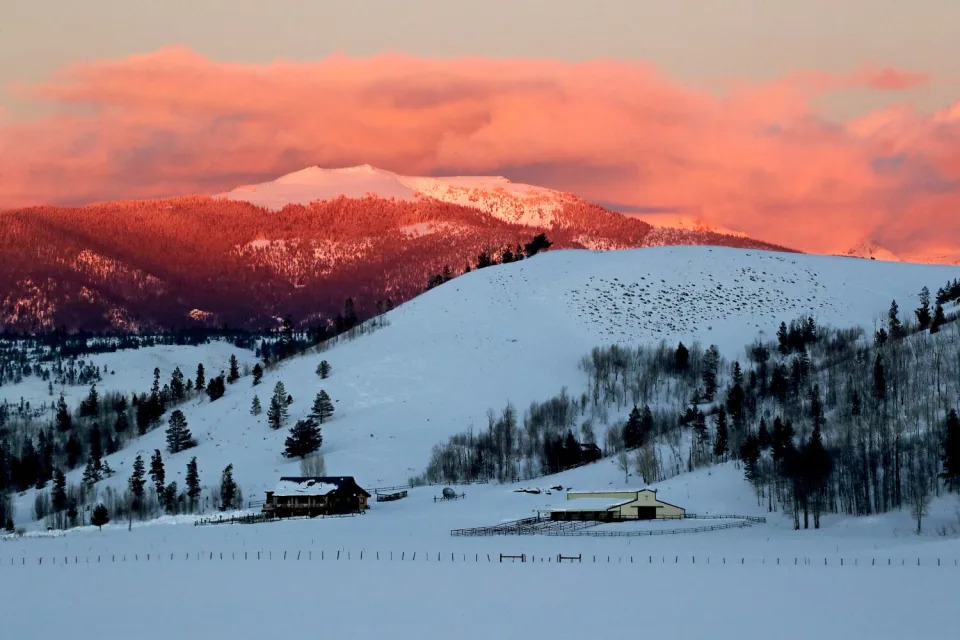
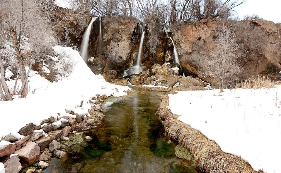
The foothills of the Rocky Mountains shelter a ranch near the headwaters of the Colorado River. (Luis Sinco / Los Angeles Times)Rifle Falls sets a wintry scene near the community of Rifle, Colo., at the headwaters of the Colorado River. (Luis Sinco / Los Angeles Times)
“I hope this holds on a little while longer,” said Domonkos, a snow survey supervisor for the federal Natural Resources Conservation Service. He was concerned that even with the snowfall, Colorado seemed headed for a below-average snow year.
Last spring, the snowpack across the Upper Colorado River Basin stood at 86% of average. By the end of July, however, the melting snow brought runoff that measured just 67% of average.
This pattern has emerged year after year in the river’s headwaters. A near-average snowpack has often translated into meager flows in the Colorado River and its tributaries.
This winter, storms have brought an above-average snowpack in the watershed. But that snow can go only so far in boosting reservoirs that have been dropping for more than two decades.
Average temperatures across the upper watershed — where most of the river’s flow originates — have risen about 3 degrees since 1970. That has contributed to the driest 22-year period in at least 1,200 years.
With higher temperatures, trees and other plants have been absorbing more water, and more moisture has been evaporating off the landscape.
In recent years, long dry spells in the mountains have left the soils parched. And when the snow has melted in the spring, the amount of runoff flowing in streams has often been diminished.
“We are seeing less water,” Domonkos said. “And we’re going to have to adapt.”
The river’s mainstem takes shape in Rocky Mountain National Park, winding through an alpine valley, then flows into reservoirs and meanders through ranchlands.
On one of these ranches, Wendy Thompson can see the river standing outside her house. She walked to the banks, where muddy brown water flowed swiftly past.
“This time of year, it ought to be another foot, 2 feet deeper,” Thompson said.
Clumps of snow cling to dry foliage along the banks of the Colorado River near Dotsero, Colo. (Luis Sinco / Los Angeles Times)
Thompson is 67 and remembers much more snow in Colorado when she was growing up. The flooding river used to swell across the pastures.
“In 1985 was the last time we really had a flood here,” she said.
Upstream diversions and dry years have left the river smaller. Some sections on her ranch now usually flow less than 2 feet deep.
In late spring and early summer, Thompson pumped from the river to irrigate her hay fields, and sold the crop to other ranchers.
Many ranchers have had less water for their pastures lately, and some have sold cattle to reduce their herds.
“Everyone knows that we’re dry,” Thompson said. “In this area, when there’s no water, you just don’t irrigate.”
Upstream from western Colorado’s ranchlands, water is diverted and routed to the east, flowing through a series of tunnels that pass beneath the Continental Divide to supply Denver and other growing Front Range cities. Two new reservoir projects are under construction to hold more water — the Chimney Hollow Reservoir and the expansion of Gross Reservoir.
The diversions from Grand Lake are a source of concern for Ken Fucik, a retired environmental scientist and board member of the Upper Colorado River Watershed Group. He said he is worried about water quality and recent algae blooms in the lake and adjacent reservoirs.
Fucik questioned whether the new reservoir projects make sense when the river’s existing reservoirs are rapidly declining.
“Where is that water going to come from?” he said.
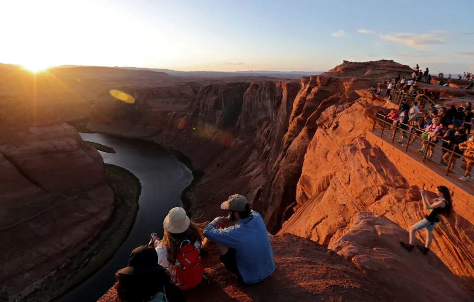
Scores of visitors get a view and pictures of the sun setting on Horseshoe Bend on the Colorado River near Page, Ariz., the gateway to the Glen Canyon Dam Recreation Area. (Luis Sinco / Los Angeles Times)
For more than a century, the history of the Colorado River has been shaped by monumental human efforts to control and exploit its waters to the maximum.
Indigenous peoples have lived along the river and its tributaries for thousands of years, adorning rocks on canyon walls with petroglyphs and pictographs.
The river’s Spanish name, colorado, or red, described the muddy, silt-laden waters that coursed through canyons.
In the mid-1800s, as white settlers moved west, steamboats chugged up the lower Colorado River, paddlewheels turning. Settlers began diverting water from streams and rivers, taking water rights under the prior appropriation system — “first in time, first in right.”
Water was seen as a source of wealth to be seized. The great ambition of politicians, engineers and fortune-seekers was to tame the river and harness its water.
In the early 1900s, they focused on building irrigation projects to “reclaim” the arid lands, a phrase central to the purpose of the Reclamation Service, which was created in 1902 under President Theodore Roosevelt and which later became the Bureau of Reclamation.
From the beginning, some warned against relying too heavily on the river. John Wesley Powell, leader of the historic 1869 expedition down the river through the Grand Canyon, famously told attendees at an 1893 irrigation congress in Los Angeles: “I tell you, gentlemen, you are piling up a heritage of conflict and litigation over water rights, for there is not sufficient water to supply these lands.”
Before the signing of the 1922 Colorado River Compact, some scientists warned that there was insufficient water, but those warnings went unheeded.
The compact apportioned the river “in perpetuity,” allocating 7.5 million acre-feet of water for the Upper Basin states — Colorado, Wyoming, Utah and New Mexico — and 7.5 million acre-feet for the Lower Basin states of California, Arizona and Nevada. Mexico later secured 1.5 million acre-feet under a 1944 treaty.
The river was divided among the states during an especially wet period in the early 20th century.
Visitors walk around Hoover Dam, where severe and prolonged drought conditions have exposed the rocky sides of Black Canyon and the intake towers that feed the dam’s power generators. (Luis Sinco / Los Angeles Times)
Hoover Dam was built during the Great Depression in the 1930s. Workers finished pouring the concrete at Glen Canyon Dam in 1963. As described by Los Angeles Times columnist Michael Hiltzik, the dams and reservoirs “created only the illusion of abundant water, not the reality.”
Over the last half a century, so much water has been diverted that for many years the river has been entirely used up, leaving dusty stretches of desert where it once flowed to the sea in Mexico.
Even in the 1980s, when plentiful water filled the reservoirs, some presciently warned that the Colorado could not withstand all the demands placed upon it.
In the seminal 1986 book “Cadillac Desert,” Marc Reisner predicted chronic shortages in the years to come, saying the region had already begun to “founder on the Era of Limits.”
The strains on the river have grown more acute with humanity’s heating of the planet. In the 1990s and 2000s, scientists repeatedly warned that chronic overuse of the river combined with the effects of climate change would probably drain reservoirs to dangerously low levels.
During the last decade, scientists have found that roughly half the decline in the river’s flow has been due to higher temperatures; that climate change is driving the aridification of the Southwest; and that for each additional 1 degree Celsius (1.8 degrees Fahrenheit), the river’s average flow is likely to decrease about 9%.
The drying of the Colorado’s upper reaches has shrunk the flow and accelerated the declines of Lake Powell and Lake Mead.
The system of dividing the water, including the agreement signed a century ago, was designed for a climate that no longer exists, said Becky Bolinger, assistant state climatologist at the Colorado Climate Center. Continuing this pattern of overuse, she said, is like depleting a bank account by overspending, edging closer to bankruptcy.
“It’s not going to work for anybody,” Bolinger said. “What we really need to do is just completely readjust the budget.”
The federal government has begun to lay the groundwork for scaling back water use.
Interior Department officials have said annual diversions need to be reduced by 2 million to 4 million acre-feet, or about 15% to 30%. They have urged the seven states that rely on the river to reach a consensus, while warning they may need to impose cuts.
So far, negotiators for states and water agencies have failed to agree on how to share such large reductions. Some fear these disputes could lead to lawsuits.
As the reservoirs’ levels continue to drop, time is swiftly running out.
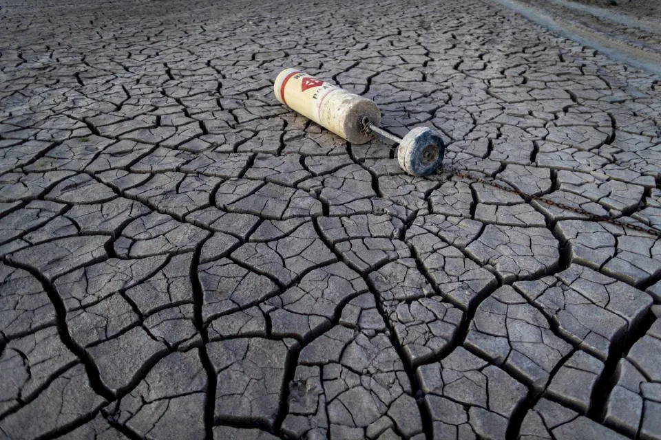
A buoy lies on a dried mud flat at a shuttered marina at drought-stricken Lake Mead. (Gina Ferazzi / Los Angeles Times)
“We have got to put the kibosh on these extra water uses right now, the uses of water beyond what’s being supplied. Either we stop them or nature will,” said Brad Udall, a water and climate scientist at Colorado State University. “Make no mistake. This is a full-on five-alarm fire going on right now.”
The Colorado River has reached this critical stage in a decade when extreme droughts have shrunk other rivers to historic lows around the world, from the Mississippi and the Rio Grande to the Yangtze in China, and the Danube and Rhine in Europe.
Research has shown that climate change is intensifying the water cycle, bringing more intense and frequent droughts, as well as more intense rainfall and floods. In one recent study, researchers found that streams in the western and southern United States have been drying over the last 70 years, with flow data revealing longer and more severe low-flow periods.
Even as wet and dry cycles continue to come and go, the Colorado River is on a long-term downward trend of aridification because of higher temperatures, Udall said.
“It’s fundamentally changing, and it’s not going to go back to how it was before,” Udall said. “We’re going to have to talk about permanent reductions in water use.”
‘A perfect storm for the whole food system right now’: One of the world’s largest fertilizer companies warns that every country—even those in Europe—is facing a food crisis
Tristan Bove – January 26, 2023
The Ukraine war upended the global economy in many ways. Energy markets have been among the most affected, with declining Russian oil and natural gas exports to the West sparking a domino effect of fuel crises worldwide. But the war has also warped another critical facet of the global economy: food.
Prior to the war, Russia and Ukraine were global breadbaskets as top producers and exporters of wheat, sunflower seeds, and barley. The fighting ended up aggravating hunger and food crises in low-income countries that are dependent on imports. But both Russia and Ukraine are also key cogs in the global fertilizer industry, and the war has triggered a shortage of the critical commodity that few people consider but is nevertheless essential to global food security.
Much as Russian President Vladimir Putin leveraged the world’s reliance on his country’s fossil fuels to weaponize energy supplies during the war, he is doing something very similar with fertilizer and food, Svein Tore Holsether, CEO of Norwegian chemical company Yara International, among the world’s largest fertilizer producers and suppliers, told the Financial Times in an interview published Thursday.
Putin’s energy gambit, which sent fossil fuel prices soaring and left Europe on the brink of recession last year, has so far not gone as expected, with a warm winter working against him and Europe able to buy natural gas from elsewhere. But Holsether warned the world’s reliance on Russia for fertilizer threatens more disruption of food supply, adding to existing challenges of logistics bottlenecks and climate change.
“If you look at the role that we have allowed Russia to have in global food supply, we depend on them. How did that happen? What kind of weapon is that? And Putin is weaponizing food,” Holsether said.
“It is sort of a perfect storm for the whole food system right now: very challenging in Europe, of course, with higher prices; even worse in other parts of the world where a human being dies every four seconds as a result of hunger,” he added.
Global fertilizer crisis
When natural gas prices surged last year after Russia invaded Ukraine, so did prices for fertilizer, which manufacturers such as Yara produce with ammonia and nitrogen obtained as a byproduct from natural gas. Fertilizer prices had already begun increasing in 2021 due to high energy costs and supply-chain issues.
Declining natural gas prices and weak demand among farmers have eased pressures somewhat over the past few months. Earlier this month, fertilizer prices fell to their lowest level in nearly two years in tandem with natural gas prices. But despite falling prices, Holsether insists that the global fertilizer market is precarious, and countries should shift from relying on Russian natural gas, to safeguard their agricultural industries.
“Putin has weaponized energy and they’re weaponizing food as well,” Holsether told the BBC at last week’s World Economic Forum in Davos, Switzerland. “It’s the saying, ‘Fool me once, shame on you. Fool me twice, shame on me.’”
Fertilizer prices remain high by historical standards, and the World Bank warned earlier this month that global supply is still tight due to the war, production cuts in Europe, and stricter export controls in China.
Averting a food crisis
If fertilizer is in short supply or prices remain unaffordable to many countries, farmers may be unable to keep their soil fertile enough for crops.
Concerns over fertilizer have taken center stage in recent weeks in Africa, which is heavily reliant on Russian food imports, and where agricultural production has taken a blow in recent years due to drought in many countries. The eastern Horn of Africa—including Somalia, Sudan, and Kenya—has been particularly hard-hit, as it is likely on the verge of a sixth straight failed rainy season, the worst drought conditions in 70 years of recorded data.
Securing additional sources of fertilizer was the cornerstone of a $2.5 billion U.S. food assistance package to Africa signed last month, while Treasury Secretary Janet Yellen noted the importance of stabilizing fertilizer supply in Africa multiple times during a visit to Zambia this week.
“Now we’re in 2023, it’s tragic and shouldn’t be like that,” Holsether told the FT about the state of global hunger. “That should be a very strong reminder of the need to have a more robust food system—from a climate perspective, from a logistics perspective, but also from a political perspective.”
Holsether said that all countries must become more self-sufficient with their food production. For fertilizer, he touted the promise of “green fertilizers” that use hydrogen and renewable energy to produce ammonia rather than natural gas, saying that clean and local solutions are critical to decoupling the global food system from Russia’s war.
Holsether also warned that European nations should not rely on their wealth to avert a food or fertilizer crisis. Like with natural gas, Europe has in recent months turned to the U.S. for nitrogen to replace Russian imports, but Holsether warned that Europe buying its way out of a food crisis is no remedy for global food insecurity.
“Yes. Not near term…there will be a shortage and there will be a global auction for food—but Europe is a wealthy part of the world,” Holsether said when asked if Europe should be concerned for its food security.
“But we need to think it through,” he added, saying that Europe buying food and fertilizer products from other countries will only create more global supply shortages and take away from other countries in dire need.
“In terms of food and food security, when you have that, you see wars or mass migrations, extremism, all these things,” he said.
Startup aims to convert invasive zebra mussels in Lake Michigan into a renewable product
Alex Garner – January 25, 2023
Zebra mussels are an invasive species in the US.
PLYMOUTH, Wisc.— AntiMussel hopes to mitigate trillions of invasive zebra mussels infiltrating the Great Lakes by harvesting them for use in paper and pharmaceutical products.
The Plymouth, Wisc.-based startup, which has raised nearly $20,000 in funding and placed second at county and regional pitch competitions, will launch a pilot program this spring to remove the mollusk from Lake Michigan.
In a 250-square-meter and 80-foot-deep area, AntiMussel will connect a suction to the lake floor and transport them to shore. Wind speed and water temperature data will also be collected.
AntiMussel hopes to use the abundance of zebra mussels as a renewable resource for calcium carbonate, which is typically processed from limestone into varying products like Tums, white melamine paint and plastic.
Ideally, the company wants to create a renewable calcium carbonate product with a corporate partner.
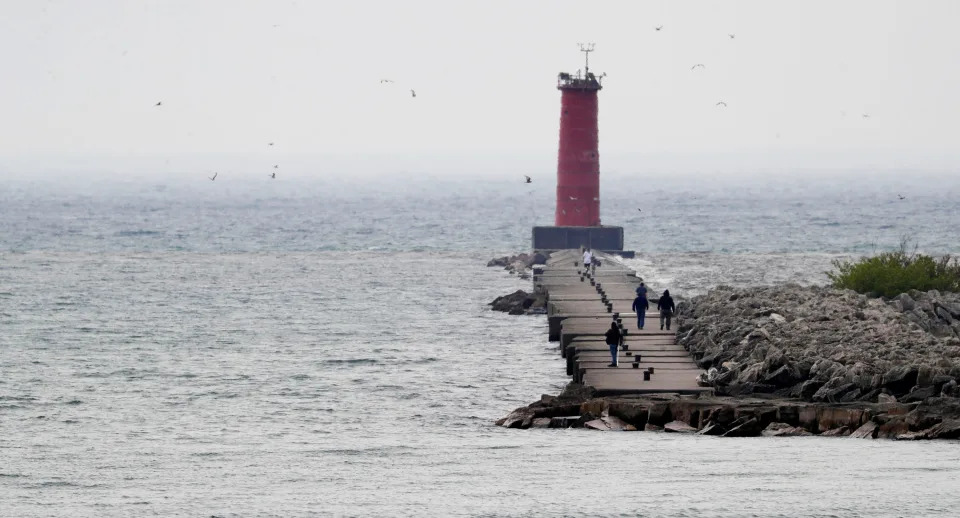
A view of the Sheboygan lighthouse as seen, Tuesday, May 31, 2022, in Sheboygan, Wis. A search for a man who was last seen near a break wall on Lake Michigan will continue today, according to the Sheboygan Fire Department
“I want to skip that 6 to 8 million years of geology that it takes to make limestone and instead remove the mussels from the lake where we don’t want them, process them, and we end up with a ground calcium carbonate material that is exactly what is being sold on the market now,” Tyler Rezachek, AntiMussel founder and U.S. veteran, said.
Participating in the pitch competitions helped Rezachek connect with University of Wisconsin-Milwaukee professors, who will take him along on a research boat this spring to study zebra mussels, too.
“I was really kind of an entrepreneur in search of a problem,” Rezachek said about starting AntiMussel. “And zebra mussels (have) been something that I’ve heard about my whole life but never heard anything else about other than how to stop them from spreading.”
Zebra mussels were likely brought to the Great Lakes from Europe and Asia via ship ballast water in the 1980s. Since then, they’ve completely invaded the region and have riddled waterways feeding into the Mississippi River and western states Texas and California, according to the U.S. Geological Survey.
They negatively impact ecosystems in several ways, like outcompeting and incapacitating native mussel and other aquatic species.
Additionally, a female zebra mussel can release up to 1 million eggs per year once reaching reproductive age of two, according to the National Parks Service.
Not much can be done to remove them once a large population has invaded a lake or river.
“At this point, they’re so well established that I could have boats out there sucking zebra mussels all day every day and probably never put a dent in the population,” he said.
Today, an estimated 300 to 750 trillion zebra mussels are in the Great Lakes.
Zebra mussels can also overwhelm commercial, agricultural, forestry and aquaculture industries in the state, according to the Wisconsin Department of Natural Resources.
They also burden taxpayers.
According to some estimates, broad removal and resulting increases in water bills can cost taxpayers up to $1.5 billion a year.
Rezachek said only 3% of the costs is dedicated to preventing further spread.
According to Rezachek, efforts to get rid of zebra mussels center on taking them off infrastructure, like applying chemicals or pressure washing, rather than completely removing them from the water.
“None of those solutions stop mussels from reproducing or remove the resulting shell,” he said. “They just push them away.”
A young woman checks over her cell phone while getting some beach time in at Deland Park, Saturday, July 9, 2022, in Sheboygan, Wis.
The remaining shells wash onto beaches.
“We can’t walk on a lot of beaches on Lake Michigan now because they’re covered in mussel shells, and they’re razor sharp and they’ll cut your feet and your dog’s feet,” Rezachek said. “And they’re just going to keep collecting there, and the waves just keep pushing them on the beaches. So, unless we remove those in mass, we can never make beaches reusable for people again.”
Heavily infested water bodies like Lake Michigan are beyond the point for a complete elimination of zebra mussels, but there is still hope for smaller lakes.
While AntiMussel will focus on the Great Lakes, it also hopes to conduct customer surveys to see if landowners across the state need zebra mussel clean-ups on private beaches or in lakes.
“The smaller lakes that maybe only have a few thousand mussels in them, they’re not lost,” Rezachek said. “We can get those back and eliminate the mussels there, but then we have to stop them from getting there.”
To help prevent the spread, the National Parks Service suggests boaters drain boats, motors and livewells (circulating tank) before leaving an area of water, wash boats and trailers, and let them dry for at least five days before taking the boat out again because zebra mussels, dependent on water currents and transportation, can infest boat motors and livewells.
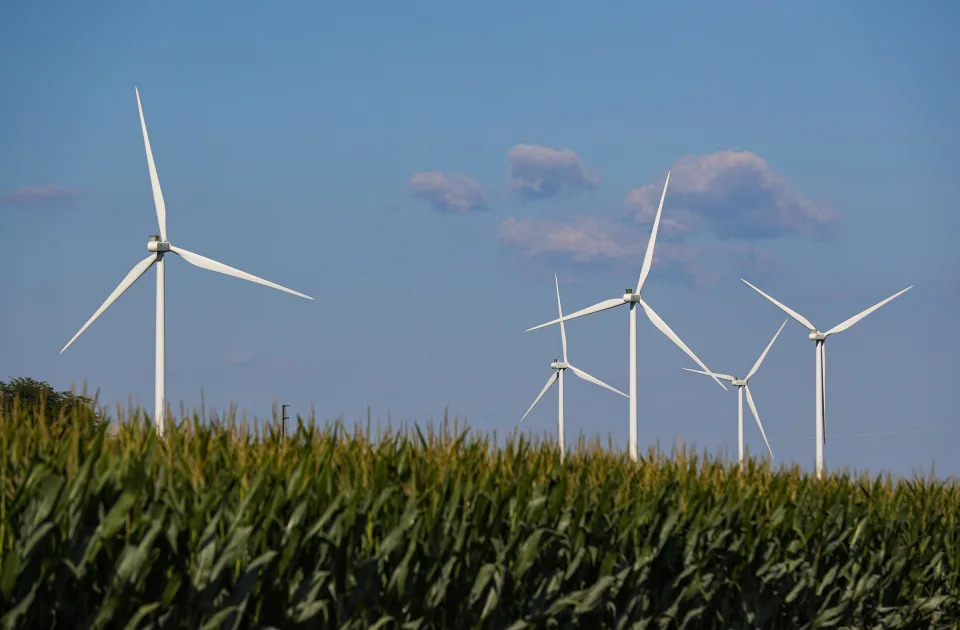
Scrub Hub: Passing a wind farm, I see some turbines spinning and others motionless. Why?
Karl Schneider, Indianapolis Star – January 23, 2023
Wind farms are becoming more common in Indiana. The state already boasts the fourth largest “farm” in the U.S. and produces nearly 3,500 megawatts of wind energy, with more on the horizon.
The towering windmills reaching up to the sky produce slightly more than 9% of all the electricity used in the state. That’s enough to power more than 1 million homes, according to the American Clean Power Association.
With more projects in the works that will produce another 302 megawatts, and a handful of bills proposed in this session of the General Assembly, wind power is likely to continue to grow across the state. And with the increasing presence of the conspicuous energy generators comes some curiosity.
So, for this edition of Scrub Hub, we took to our trusty submission form and chose a question from Teresa, who asked: Why are the wind turbines not turning right now?
Wind turbines operate in a rural area north of Lafayette, Indiana, on Wednesday, August 4, 2021.
It’s possible for the blades on wind turbines to reach up to speeds of 200 mph, so it may seem odd when some are spinning very quickly while the blades on others nearby are not moving.
We dug around in some state, federal and industry reports and reached out to academic experts in energy technology to determine why some turbines in a wind farm spin while others remain still.
Short Answer: The turbine is down for maintenance
Wind turbines, like all machines, need both scheduled and unscheduled maintenance. In some instances that explains why some are operating but not others.
The basic components of a wind turbine are the visible tower and rotor blades, as well as the gearbox and generator located at the top of the tower.
Scheduled maintenance helps prevent wear and tear from breaking parts and unscheduled maintenance occurs when the turbine experiences any of a number of failures.
Regular preventative maintenance can include periodic equipment inspection, oil and filter changes, calibration and adjustment of various parts, as well as replacing brake pads and seals. General housekeeping and blade cleaning can also temporarily keep a turbine from spinning.
In larger wind farms, several turbines on a circuit can be inoperable and not spinning because they are all down for maintenance, said John Roudebush, program chair of Ivy Tech College’s Energy Technology program.
Long answer: Curtailment, congestion and wind speed
Energy transmission in Indiana is run through the Midcontinent Independent System Operator, commonly known as MISO. The group manages the flow of electricity by balancing demand versus what’s being generated, which means there are times where excess electricity is being produced.
“(Sometimes) we don’t need the power as demand is down or another power plant is selling power to the customers instead,” Roudebush wrote in an email. “Power plants compete on the grid. A coal plant, a natural gas plant, or a wind farm will all bid to sell power during some part of the day and MISO will pick the cheapest bid for the day. Generally, wind is the cheapest but not always.”
John Hall, assistant professor at the University of Buffalo’s Engineering and Applied Sciences, focuses his research on the technical aspects of wind energy. While some wind turbines will operate normally, he said others may be stopped to match production with grid demand.
“Basically, you have the utility company distributing power and buying and selling in real time,” Hall said. “Based on how much they need, wind farms would turn turbines off accordingly.”
The industry calls a wind turbine that is not spinning “parked,” Hall said, and this is done with a braking system that holds the rotor in place. Once energy demand rises, the brake is released and almost immediately the turbine starts delivering electricity to the grid again.
Another obvious answer to why the turbines may not be spinning is that the wind speed is not high enough.
Generally, turbines can generate power with wind speeds as low as 5 mph. If speeds fall below that, there just isn’t enough to turn the sometimes massive blades.
On the other hand, wind that is too fast can cause damages to the turbines, so operators of wind farms will park the rotors until the wind calms down. Turbines generally shut down when wind speeds hit about 55 mph.
“The system is not designed for that, so they shut it down,” Hall said. “That’s OK because we rarely get winds over that speed, and it would not be worthwhile to design for that for the few instances.”
To help improve the efficiency of wind farms, Hall said banking excess power is a huge research area right now.
“There are studies on new battery technology and super capacitors and different ways to get around that issue,” Hall said.
Another solution for storing excess electricity is by making hydrogen, Hall said. Wind farm operators would be able to create hydrogen and store it for use later when the grid demand increases.
While fossil fuel plants may be more responsive to the constantly moving supply and demand for electricity, Hall said the future depends on renewables.
“If folks are concerned about climate and want a better future for the next generation and everything, renewable energy like wind and hydro-electric and tidal power are all really not just sources of energy but vital to perhaps our existence,” Hall said.
Karl Schneider is an IndyStar environment reporter.
IndyStar’s environmental reporting project is made possible through the generous support of the nonprofit Nina Mason Pulliam Charitable Trust.
Native Hawaiians flock to Las Vegas for affordable living
Jennifer Sinco Kelleher – January 22, 2023
Doreen Hall Vann walks with son Zaiden after tryouts for a club baseball team Saturday, Jan. 21, 2023, in Las Vegas. In 2019 Vann moved from Hawaii to Las Vegas to be closer to her daughter in Seattle. (AP Photo/John Locher)Doreen Hall Vann wathes her son Zaiden during tryouts for a club baseball team Saturday, Jan. 21, 2023, in Las Vegas. In 2019 Vann moved from Hawaii to Las Vegas to be closer to her daughter in Seattle. (AP Photo/John Locher)
KAPOLEI, Hawaii (AP) — Kona Purdy never wanted to live anywhere but Hawaii. As a Native Hawaiian, he wanted his children to grow up like he did: rooted in their culture, and nourished by the mountains and ocean.
But raising a family in Hawaii meant squeezing nine people into a four-bedroom house — rented with extended family — in Waipahu, a Honolulu suburb. It felt cramped, but the Purdys accepted that this was the price to survive in their homeland.
“We stuffed ourselves into one room,” Purdy said of his four-member family’s living arrangements.
Their share of the monthly rent was $2,300. When rent increased, the Purdys realized that they could no longer afford to live in Hawaii.
“I was so busy working, trying to make ends meet,” he said. “We never took our kids out to the beach. We didn’t go hiking.”
It’s increasingly common for Hawaii residents to be priced out of the Aloha State, where the median price for a single-family home topped $900,000 during the pandemic. On Oahu, the most populous island and where Honolulu is, the median price is more than $1 million.
Many residents work in low-wage service jobs, and the financial strain is especially significant for Hawaii’s Indigenous people. A state analysis published last year showed that a single person working 40 hours a week would need to earn $18 an hour to pay for housing and other necessities in Hawaii, but the state minimum wage is currently $12 an hour.
Many, like the Purdys, have headed to Las Vegas.
According to 2021 population estimates from the U.S. Census Bureau, the biggest growth of Native Hawaiian and other Pacific Islander populations was in Clark County, Nevada, which includes Las Vegas, and Sacramento County, California. The biggest decline of Native Hawaiian residents was in Honolulu.
Hawaii residents are spending on average 42.06% of their income on rent, which is the highest of any state, according to a Forbes Home analysis. California ranks second, but at a much smaller proportion of income going toward rent: 28.47%.
Estimates from the American Community Survey showed that in 2011, there were about 296,400 Native Hawaiians in Hawaii and about 221,600 on the continental U.S. Just a decade later, those numbers flipped. In 2021, there were about 309,800 Native Hawaiians in Hawaii and about 370,000 in other states.
“There’s no Hawaii without Hawaiians,” said Honolulu City Council Chair Tommy Waters, who is Native Hawaiian. His five siblings have all moved to the continental U.S. “That’s just incredibly sad to me, that Hawaiians cannot afford to live in Hawaii.”
Las Vegas was desirable to the Purdys because it’s a popular vacation destination for Hawaii residents, which meant family would likely visit often. Also, the cost of living is significantly lower.
So in 2017, they uprooted their family and moved to Henderson, a Las Vegas suburb in Clark County, where they could afford to rent a two-bedroom apartment for $1,000 a month.
Far from Hawaii’s shores, they felt like “fish out of water,” Purdy said.
“So it’s real ‘eha,’” Purdy said, using the Hawaiian word for painful, “because you do get disconnected from the land, which we’re so connected to, being born and raised here.”
But even though they were nearly 3,000 miles from home, Hawaiian culture was all around them. Thanks to many other transplants, the Las Vegas area is full of restaurants catering to Hawaiian taste and cultural events expressing Hawaiian pride.
There’s even a real estate brokerage that helps families relocate from the islands — run by mostly former Hawaii residents.
“You go into any store in any part of the valley and you’ll find someone from Hawaii working there or shopping there,” Purdy said.
A three-bedroom home priced at $300,000 in a Las Vegas suburb would be $1.2 million in Honolulu, said Terry Nacion, a Native Hawaiian realtor. She left Hawaii for Las Vegas in 2003 because home ownership felt unattainable. “Back home, you either had to have your home passed down to you or you have to work four jobs,” she said.
A few months after they moved, about 20 other relatives, including Purdy’s mother, uncle and sister Lindsay Villarimo, followed them.
“Over time, it just became exhausting trying to make ends meet,” said Villarimo. “It’s heartbreaking that’s the choice we make. The majority of us, I think we just got priced out of home.” When Villarimo and her family decided to move to Nevada, her husband Henry had never even left Hawaii.
Las Vegas’ affordability was “liberating,” she said. With cheaper rent and groceries, and no state income tax, she could stretch her paycheck further.
“We were just living it up in the dollar store,” she said. In Hawaii, that type of store doesn’t exist.
For Hawaii residents, the draw to Las Vegas can all be traced back to a downtown hotel that opened in 1975, author Dennis M. Ogawa said.
The hotel originally catered to Californians, but he struggled to get business. Reminded of gambling’s popularity in Hawaii, it shifted focus to visitors from the islands. “Aloha Spoken Here” became the hotel’s slogan.
In 2019, Doreen Hall Vann decided to move to Las Vegas to be closer to her daughter, who had moved to Seattle for more job opportunities.
On Facebook, she gushed about how much cheaper everything was, from bread to rent. But she started to worry about staying connected to her culture while living far from home, especially because she uprooted her son, who was then 6 years old, from his Hawaiian language immersion school.
“It’s just like when you give birth and you cut your umbilical cord. For us Native Hawaiians, our ‘piko’ is the source of life,” Hall Vann said, using the Hawaiian word for navel or umbilical cord. “When we move off island … we are disconnected because we’re not on our land anymore.”
But in her new home, she found she had more time and less stress.
“I was so busy back home trying to make a living,” she said. “When I moved to Vegas, it really put a pause in my life and I could see things a lot clearer.”
That allowed her to get involved in the Las Vegas Hawaiian Civic Club, where she now teaches Hawaiian.
“We have our people, our home, our community is thriving,” she said.
In Las Vegas, Purdy’s children began to learn hula and the family enjoyed “hoolaulea,” cultural festivals that were bigger than celebrations back in Hawaii.
But in August 2021, exactly four years after leaving Hawaii, the Purdys moved back home.
Purdy said that his wife wanted to take care of her mother, who began showing signs of dementia. Their daughter also got accepted to Kamehameha Schools, a highly selective and relatively affordable private school system that gives admissions preference to students with Hawaiian ancestry.
The family moved to Kapolei, a Honolulu suburb not far from where they once lived, to share a five-bedroom house with their extended family. Now that the Purdys have three children, they rent two of the bedrooms.
Purdy is trying to find time to take his kids to hula lessons. Since moving back, the family has only been to the beach once.
“It’s a grind, it’s hard, it’s really expensive,” he said. “But I also feel like we’re exactly where we’re supposed to be right now.”
Western Kansas farmers are pushing to save the Ogallala Aquifer before it’s too late
David Condos – January 22, 2023
David Condos/Kansas News Service
Travis Leonard had seen all the signs.
Plummeting water levels. Clogged sprayer nozzles. Then as drought parched southwest Kansas this fall, the well next to his farmhouse in Haskell County began pumping up a muck of sand instead of clear water.
After more than six decades of irrigating the family’s grain field, he shut the well down for the last time.
“I just took a deep breath,” Leonard said, “knowing this is the last crop that I’m going to have here that has water on it.”
Leonard remembers when the underground water supply seemed endless. When he took over the farm 16 years ago, it had more than a dozen irrigation wells pumping. Today, it’s down to three.
A decade or two from now, he figures, his area won’t have any irrigation wells left.
“We didn’t have any idea when it was going to end, but that day is coming,” Leonard said. “It will happen to everybody eventually.”
Fly over these dry plains and you won’t see many rushing rivers or glimmering lakes. You’ll see circles. Mile after mile of green geometric crop fields spun into the near-desert landscape by wells that tap water hidden beneath the surface and the center pivot irrigation sprayers splayed around them.
But across western Kansas, more and more wells sit abandoned as underground water levels drop and drop some more. Vast swaths of the region have seen more than half of their water disappear since the dawn of irrigation. Wallace County on the Colorado state line has lost roughly 80%.
The subterranean reservoirs of the sprawling Ogallala Aquifer make life possible here — from powering the multibillion-dollar agricultural economy to filling up cups at the kitchen sink.
But after decades of large-scale crop irrigation, that water is running out. And now farmers and state leaders struggle to agree on how to save the future of life in western Kansas without choking the livelihoods of the people who live here.
The good news? There’s still time. After all, an aquifer that’s half-empty is also half-full.
Even with all the depletion, billions and billions of gallons remain stored away in the Ogallala’s craggy layers of saturated rock. And a new effort in west-central Kansas aims to save more of what’s left.
Katie Durham, who leads that groundwater management district, said it’s not too late to preserve the aquifer — and the western Kansas farms, businesses and communities that depend on it — for future generations.
But only if big changes start now.
“This is do or die,” Durham said. “Water is everything out here. … We would not be here without it.”
Now or never
In a wood-paneled room at the Scott County fairgrounds, dozens of farmers gather for the first public hearing to discuss this latest effort in west-central Kansas. It’s called a local enhanced management area, or LEMA, and it’s been nearly a decade in the making.
The plan is to get farmers to cut irrigation by an average of 10% over the next five years in four western Kansas counties — Wallace, Greeley, Scott and Lane. Those counties have been some of the hardest hit by aquifer declines, losing nearly two-thirds of their water since irrigation began.
And the flow of moisture that’s trickling back down to refill the aquifer is a drop in the bucket. Across the four counties, the amount of water pumped up is nearly 10 times the amount that seeps back underground from rain and snow.
Any change is hard, Durham said, and discussions about using less water in a place with so little precipitation are bound to be prickly. But she said the alternative — a depleted aquifer that can’t support any irrigation — would essentially end life in western Kansas as we know it.
Residents and businesses leaving town. Empty storefronts on Main Street.
“It would be devastating,” Durham said. “You would see the exact thing that we’re trying to prevent.”
The LEMA plan would customize each farmer’s water limits on a case-by-case basis. Those who have been pumping the most would need to cut irrigation by up to 25%. Others who have been voluntarily conserving the most water already might not need to make any changes.
Data from the Kansas Geological Survey shows that the four counties would need to reduce pumping by one-third to stop the aquifer’s depletion over the next decade. In drought conditions like we’re seeing now, they would need to cut pumping by half.
So trimming irrigation by 10% isn’t going to solve the problem permanently. But, Durham said, it’s a start. If this plan can double the aquifer’s lifespan, that could mean it’s still around for the grandchildren of the people who make those changes today.
“This is a huge and significant step,” Durham said, “toward changing what this part of western Kansas could look like in 50 years.”
If the state approves the plan after its second public hearing in early February, it would likely go into effect from the beginning of this year through 2027. Farmers would be able to use their five-year water allotment as they wish, meaning they could pump extra during a dry year as long as they irrigate less in a subsequent year to even things out.
The key to this LEMA program is putting water conservation decisions in the hands of a local board, rather than the state. But that doesn’t mean it’s all kumbaya.
Water has long been a point of contention in dry western Kansas. That’s because water means money. Even as wells run out, pumping the aquifer continues to prop up the regional economy — from corn and wheat growers to irrigation equipment dealers to cattle feedlots.
The groundwater district proposing the new LEMA is the smallest in western Kansas, but it still covers more than one million acres and nearly 2,000 wells. With that many voices in the discussion, it can be a challenge to get everyone on board.
Many irrigators remain wary of any program that might force them to use less water.
Lane County farmer Camron Shay came to the hearing with his own concerns about how the limits could be fair for everyone across a region that has so much diversity in how much water has been used, how much water is needed to nurture a crop and how much water is left.
“It can’t just be done by a bunch of activists,” Shay said, “who come in and don’t know what they’re talking about and strong arm it and do radical things.”
But the locally driven approach of the LEMA may help ease those fears. That was the point of the public hearing and the series of community meetings that came before. After getting some of his questions answered, Shay said, he walked away feeling better about the plan.
“We all know that we have a groundwater problem,” he said. “I don’t know if there’s a good solution for it, but these guys look like they’re at least trying.”
Proof of concept
Fortunately, farmers in the four counties don’t have to look far to find examples of how these irrigation limits work in the real world.
The state’s first LEMA began in a small portion of northwest Kansas a decade ago. The plan was to reduce irrigation by 20%. When the results came in, farmers ended up cutting pumping by nearly one-third. And some of those farmers actually saw profits go upas they spent less to pump water and buy seed and fertilizer.
That initial LEMA was deemed so successful that a similar plan to cover parts of 10 northwest Kansas counties went into effect five years ago — although that expansion faced a lawsuit from dozens of irrigators who said it infringed on their water rights — and was recently renewed for another five years.
And right next to where the new limits are proposed, Wichita County started its own LEMA two years ago to cut irrigation by 25%.
That’s where Brian Bauck sat in a combine harvesting his last cornfield of the year.
Most of his fields are now non-irrigated, or dryland, and the sections that see a center pivot get less water than they did decades ago. So the past year of drought has left its mark.
As he makes one last pass with his combine, its wide green header has to skim the ground to reach the rows of short corn plants out the front window. It scoops up its fair share of dry tumbleweeds that have blown in with the punishing winds, too.
But thanks to new drought-tolerant seed varieties and farming practices that conserve soil and moisture, he had crops to harvest on just about every acre this season.
“It feels great,” Bauck said. “Anytime you can get something, even though it may not be what you wanted, tells you that you’re probably doing a few things right.”
So far, Wichita County’s irrigation restrictions appear to be making a dent in depletion. Countywide aquifer declines averaged 0.54 feet per year from 2010 to 2017, according to Kansas Geological Survey data. But from 2018 to 2021, the county lost an average of 0.09 feet per year. As the programs produce more real-world data, it might reassure crop growers in neighboring areas that irrigation reductions are worth a shot.
Farmers are naturally independent thinkers, Bauck said, so it’s always a challenge when somebody comes in and tries to tell them how to do their jobs. He used to be skeptical about irrigation cuts too.
And changing farmers’ mindsets about water use isn’t a simple task because their livelihoods are at stake. In a dry year like this, turning the sprayer on could make the difference between growing some crops or none at all.
But, he said, the golden kernels filling his grain tank prove that farming with less irrigation can work in western Kansas, even in a historically dry season.
It shows that a future with less water may not be painless, but it is possible. And in western Kansas, he said, it’s a matter of survival.
“Regardless of whether somebody likes it or not,” Bauck said, “we’ve got to do something in order to extend the life of this aquifer, or it’s not gonna be there.”
Gallons and dollars
Another reason for urgency? Climate change. As the H2O buffet dwindles down, Kansas heats up.
With dry western weather shifting eastward, more of the state will likely face a future with worse droughts and less precipitation — a process called aridification.
Vaishali Sharda, assistant professor of biological and agricultural engineering at Kansas State University, studies how a drier, hotter future threatens the state’s farms. Aridification paired with a declining aquifer, she said, sets up a potential time bomb for western Kansas agriculture.
“There is no guessing,” Sharda said. “If we continue irrigating at the pace at which we have done in the past, the Ogallala won’t be able to sustain it.”
Even if irrigators could save a relatively small percentage of the water they’ve been using, the impact could be enormous — simply because of how many gallons we’re talking about.
In the four counties with the proposed LEMA, for instance, 94% of all water used goes to irrigate crops.
Statewide, roughly three-fourths of all water used in Kansas comes from the High Plains aquifer, and nearly all of that goes to irrigation. Over the course of a year, that averages out to 2.5 billion gallons of groundwater used to water crops each day.
But finding consensus on new rules to curb aquifer use is an uphill climb when using that water is the foundation that virtually everything else in western Kansas is built on.
Take southwest Kansas. It has — and uses — the biggest chunk of the state’s aquifer. And its agriculture relies more on irrigation than anywhere else in Kansas. Cattle feedlots, meatpacking plants and dairy farms all depend on the corn feed that’s grown here.
District director Mark Rude expects conversations about irrigation limits — maybe even a new LEMA — to start back up in his district over the next few years. And the district recently began sending its irrigators detailed reports about their water use and comparing it to their neighbors in an attempt to get farmers to change their mindsets.
But even with more information about depletion and conservation than ever, he still believes his members aren’t ready for widespread irrigation cuts. Strict rules to save the aquifer don’t make sense, he said, if they come at the expense of the economy.
“To get growth,” Rude said, “you’ve got to have water.”
He’s exploring a plan to bring in water from the Missouri River — potentially flowing across the state in an aqueduct hundreds of miles long — to replace what’s lost in the Ogallala.
While the district hasn’t figured out how to make that plan’s $18 billion price tag financially feasible, he said, it might be the only way to keep the region’s industries — from corn to cattle to ethanol — booming for future decades.
Converting western Kansas to dryland farming may be sustainable, he said, but it would mean a smaller economy with fewer jobs and fewer people in a region where most counties already struggle with population decline.
The real question, he said, is what kind of economic future does western Kansas want to sustain?
“It’s important that we not forget that what we’re trying to preserve here is not only the community as a whole,” Rude said, “but the business strategy, the overall viability of that community.”
But whether or not a groundwater district or state entity decides to impose irrigation limits, farmers across western Kansas are already adjusting to the realities of a life with less water — because they have to.
Many have adopted smarter irrigation technology, such as soil moisture sensors and systems that customize irrigation rates across a field. Some have switched to crops that require less water than corn, such as cotton.
Others have stopped irrigating entirely on a majority of their acres. That’s the case for Leonard, the farmer with the dry well whose land lies within the southwest Kansas groundwater district.
The thought of leaving irrigation behind, he said, doesn’t have to be scary. In a way, it’s coming full circle.
When his great-grandfather started the Leonard farm, there wasn’t an irrigation well or center pivot in sight. And by the time he retires, Leonard expects his entire farm will return to its dryland roots.
“Life will go on,” Leonard said. “We’re still running a farm here. And it looks a little bit different than it used to but we’re still doing what we love.”
David Condos covers western Kansas for High Plains Public Radio and the Kansas News Service.
The Kansas News Service is a collaboration of KCUR, Kansas Public Radio, KMUW and High Plains Public Radio focused on health, the social determinants of health and their connection to public policy.
And in an environment where every drops of water matters, that unusually deep snowpack is a rare bit of good news, especially for farmers. While every snowstorm is different, there’s about an 1 inch of water contained in a foot of snow.
Water users all across west are carefully watching snowfall-measuring sites so they can plan for the coming summer. Here’s what to know:
How much snow has California gotten?
Many snow-measuring sites in the Sierra Nevada on the California-Nevada border are showing double the amount of snow they usually have — and some are two or three times higher.
At Mammoth Mountain Ski Area, workers are still digging out of the 17 feet of snow that fell on the base area in the first 16 days of this year, said spokeswoman Lauren Burke. The ski area near Mammoth Lakes, Calif., has received more than 31 feet of snow already this winter at its summit.
“The skiing and riding has just been next-level. But it’s safe to say we are excited to see some blue-sky days in the next week or so,” Burke said.
Around Lake Tahoe, some measuring sites have recorded 300 or even 400% of the median amount, compared to data going back to 1991. And January and February are typically the snowiest months there, so more will likely pile up. Last year, Mammoth Mountain only got 21 feet of snow for the entire season — 10 feet less than it’s already gotten this winter.
In the Rocky Mountains of Colorado and Utah, snow fall is up to 200% above average along the Continental Divide in Colorado.
The Sierra snowpack, which supplies 30% of California’s water, stands at 245% of its average for this date and at 126% of the traditional April 1 peak. All three sections of the Sierra – north, central and south – are registering above 200% of normal for the date, according to the state Department of Water Resources.
Unlike the East Coast and midwest, where rain falls more consistently, California and the West depend heavily on snow to provide irrigation water for crops, and to provide drinking water for growing cities like Las Vegas. About half of the West’s water comes from snowfall.
Large reservoir systems divert water from melting snow hundreds of miles from mountain areas to farmland or cities, particularly the Colorado River. Water users all across the West are carefully watching snowfall-measuring sites so they can plan for the coming summer.
Knowing just how much snow will melt and feed the water supply helps growers adjust.
“Being able to do that has been able to keep our water district more flush, pardon the pun, and weather the drought a lot better,” said almond grower Christine Gemperle, 51, who runs Gemperle Orchards in Turlock, Calif., with her brother.
How is climate change affecting snowfall?
More snow falling as rain: Rain is harder to capture in reservoirs because it comes all at once, instead of melting slowly like snow.
Less snow on the ground means the air stays warmer: This creates a feedback loop where the warmer air causes precipitation to fall as rain, instead of snow.
Climate change alters how and where snow falls: This means historical records are no longer as accurate when it comes to predicting water flows later in the summer.
How is snowfall measured? NASA is helping.
Mountainous snowfall covers vast, sparsely populated regions. So how do authorities know exactly just how much snow has fallen?
For generations, most snow measurements were made by jamming an aluminum pole into the snow and pulling out a core sample. A quick calculation of the weight allowed scientists to know how much “snow water equivalent” was inside the snowpack in a certain area. Scientists returned to the same snow course survey areas month after month, year after year, building up a picture of snowfall in those areas.
Starting in the 1980s, scientists developed remote snow-measuring systems that could automatically weigh and report snowfall, broadening our understanding of snowfall across remote areas. There are now more than 900 remote sites across the western United States.
NASA helped develop a more accurate snow measuring system using a small airplane fitted with LiDAR, which provides a much more comprehensive picture of the entire snowpack, not just a few hundred areas.
It’s mid-January and the Great Lakes are virtually ice-free. That’s a problem.
Caitlin Looby – January 20, 2023
It’s the middle of January, and the Great Lakes are basically ice-free.
Ice has been slow to form this year, with only 3.2% of the lakes covered as of Jan. 19. That’s a near-record low, and roughly 18% below average for this time of year.
And while it’s still unclear how things will shake out for the rest of the season, no ice isn’t a good thing for the lakes’ ecosystem. It can even stir up dangerous waves and lake-effect snowstorms.
So, what happens when the lakes are ice-free? What does it mean for the lakes’ food web? Is climate change to blame?
Here are five things you should know.
Ice fishermen stay close to shore Wednesday, January 18, 2023 on Green Bay off of Bay Shore Park in New Franken, Wis. Ice has been slow to form this year with only 3 percent of the lakes covered as of Jan. 13. The near-record low is roughly 18 percent below average for this time of year. Lake whitefish, a mainstay in the lakes’ fishing industry and an important food source for other fish like walleye, are one of the many Great Lakes fish that will be impacted by less ice cover.Lake whitefish spawn in the fall in nearshore areas, leaving the eggs to incubate over the winter months. Without ice, strong winds and waves can stir up the sediment, reducing the number of fish that are hatched in the spring.
Ice cover is at a near-record low, but things can change
The U.S. National Ice Center Forecast releases a seasonal outlook at the beginning of December, which showed a mix of predictions. According to the forecast, Lakes Michigan, Erie and Ontario are predicted to have less ice, while Lake Superior is expected to be above normal. Lake Huron is expected to have an average year.
But this three-month prediction has a great deal of uncertainty, and much can change, said Ayumi Fujisaki Manome, a scientist at the Cooperative Institute for Great Lakes Research at the University of Michigan who models ice cover and hazardous weather across the lakes.
Ice growth is pretty dynamic; it’s course can realign in a matter of days, especially on the shallower lakes.
Ice cover jumped up to 7% on average across all the lakes after the December cold snap, for example, but then quickly fell as milder temperatures rolled in. The change was especially pronounced on Lake Erie, where ice cover rose to 23% and now sits at around 3%. Lake Erie typically freezes over the quickest and has the most ice cover because it’s the shallowest of the Great Lakes.
Lake Michigan saw more than 7.5% ice coverage after the December cold spell, and measured at nearly 3.2 percent last Friday. Nearly all of that ice is in the bay of Green Bay.
Less ice cover doesn’t mean that residents around the Great Lakes are getting an easier winter. In fact it can be the opposite.
In the winter, when cold, dry air masses move across the lakes, they pick up water along the way through evaporation. When the air mass hits land, it drops all that water through lake-effect snow.
Ice cover acts as a shield, stopping water from evaporating off the lake, Fujisaki Manome said. So, when there is less ice people around the lakes typically see more lake-effect snow.
Most lake evaporation actually happens in the fall and winter months opposed to the summer, Fujisaki Manome said.
Little ice cover can be disastrous
This winter has already proven how dangerous lake-effect snow can be.
At the end of November, more than six feet of snow fell on Buffalo, N.Y., which sits on the shores of Lake Erie. A few weeks later on Dec. 23, more than four feet of snow covered the city and surrounding areas once again. The storm resulted in 44 deaths in Erie and Niagara counties, which sit on Lakes Erie and Ontario, respectively.
During stormy winter months, ice cover tempers waves. When there is low ice cover, waves can be much larger, leading to lakeshore flooding and erosion. That happened in January 2020 along Lake Michigan’s southwestern shoreline. Record high lake levels mixed with winds whipped up 15-foot waves that flooded shorelines, leading Gov. Tony Evers to declare a state of emergency for Milwaukee, Racine and Kenosha counties.
And while less ice may seem like a good thing for the lakes’ shipping industry, those waves can create dangerous conditions.
The Great Lakes are losing ice with climate change
The Great Lakes have been losing ice for the past five decades, a trend that scientists say will likely continue.
Personnel from the U.S. Coast Guard cutter Mobile Bay walk in the ice Wednesday, January 18, 2023 on Green Bay about 10 miles north of Green Bay, Wis. Ice has been slow to form this year with only 3 percent of the lakes covered as of Jan. 13. The near-record low is roughly 18 percent below average for this time of year.
Of the last 25 years, 64% had below-average ice, said Michael Notaro, the director of the Center on Climatic Research at the University of Wisconsin-Madison. The steepest declines have been in the north, including Lake Superior, northern Lake Michigan and Huron, and in nearshore areas.
But this also comes with a lot of ups and downs, largely because warming is causing the jet stream to “meander,” Fujisaki Manome said.
There is a lot of year-to-year variability with ice cover spiking in years like 2014, 2015 and 2019 where the lakes were almost completely iced over.
No ice makes waves in the lakes’ ecosystems
A downturn in ice coverage due to climate change will likely have cascading effects on the lakes’ ecosystems.
Lake whitefish, a mainstay in the lakes’ fishing industry and an important food source for other fish like walleye, are one of the many Great Lakes fish that will be impacted, said Ed Rutherford, a fishery biologist who also works at the Great Lakes Environmental Research Laboratory.
Lake whitefish spawn in the fall in nearshore areas, leaving the eggs to incubate over the winter months. When ice isn’t there, strong winds and waves can stir up the sediment, reducing the number of fish that are hatched in the spring, Rutherford said.
Walleye and yellow perch also need extended winters, he said. If they don’t get enough time to overwinter in cold water, their eggs will be a lot smaller, making it harder for them to survive.
Declining ice cover on the lakes is also delaying the southward migration of dabbling ducks, a group of ducks that include Mallards, out of the Great Lakes in the fall and winter, Notaro said. And if the ducks spend more time in the region it will increase the foraging pressure on inland wetlands.
Warming lakes and a loss of ice cover over time also will be coupled with more extreme rainfall, likely inciting more harmful algae blooms, said Notaro. These blooms largely form from agricultural runoff, creating thick, green mats on the lake surface that can be toxic to humans and pets.
Lakes Erie and Michigan are plagued with these blooms every summer. And now, blooms are cropping up in Lake Superior for the first time are raising alarm.
“Even deep, cold Lake Superior has been experiencing significant algae blooms since 2018, which is quite atypical,” Notaro said.
There is still a big question mark on the extent of the changes that will happen to the lakes’ ecosystem and food web as ice cover continues to decline. That’s because scientists can’t get out and sample the lakes in the harsh winter months.
“Unless we can keep climate change in check… it will have changes that we anticipate and others that we don’t know about yet,” Rutherford said.
Caitlin Looby is a Report for America corps member who writes about the environment and the Great Lakes.