What the Ottoman Empire can teach us about the consequences of climate change

What the Ottoman Empire can teach us about the consequences of climate change – and how drought can uproot peoples and fuel warfare

<span class="caption">Drought's effects on the population slowed the Ottoman Empire's expansion in the 16th century.</span> <span class="attribution"><a class="link rapid-noclick-resp" href="https://commons.wikimedia.org/wiki/File:Ottoman_army_at_Tiflis_in_1578_(Nusretname_miniature).jpg" rel="nofollow noopener" target="_blank" data-ylk="slk:Lessing Archives">Lessing Archives</a></span>
Drought’s effects on the population slowed the Ottoman Empire’s expansion in the 16th century. Lessing Archives.


In the late 16th century, hundreds of bandits on horseback stormed through the countryside of Ottoman Anatolia raiding villages, inciting violence and destabilizing the sultan’s grip on power

Four hundred years later and a few hundred miles away in the former Ottoman territory of Syria, widespread protests escalated into a bloody civil war in 2011 that persists to this day.

These dark episodes in Mediterranean history share key features that offer a warning for the future: Both forced waves of people from their homes. Both were rooted in politics and had dramatic political consequences. And both were fueled by extreme weather associated with climate change.

As an environmental historian, I have researched and written extensively about conflict and environmental pressures in the Eastern Mediterranean region. While severe droughts, hurricanes, rising oceans and climate migration can seem new and unique to our time, past crises like these and others carry important lessons about how changing climates can destabilize human societies. Let’s take a closer look.

Three men and two boys stand on a dry landscape
Drought in the heartland of an empire

We live in an era of global warming largely due to unsustainable human practices. Generally known as the Anthropocene, this era is widely considered to have emerged in the 19th century on the heels of another period of major global climate change called the Little Ice Age.

The Little Ice Age brought cooler-than-average temperatures and extreme weather to many parts of the globe. Unlike current anthropogenic warming, it likely was triggered by natural factors such as volcanic activity, and it affected different regions at different times, to different degrees and in vastly different ways.

Its onset in the late 16th century was particularly noticeable in Anatolia, a largely rural region that once formed the heartland of the Ottoman Empire and is roughly coterminous with modern-day Turkey. Much of the land traditionally was used for cultivating grain or herding sheep and goats. It provided a critical food source for the rural population as well as residents of the bustling Ottoman capital, Istanbul (Constantinople).

<span class="caption">Lands of the Ottoman Empire.</span> <span class="attribution"><a class="link rapid-noclick-resp" href="https://upload.wikimedia.org/wikipedia/commons/thumb/1/19/Ottoman_empire.svg/2458px-Ottoman_empire.svg.png" rel="nofollow noopener" target="_blank" data-ylk="slk:André Koehne/The Historical Atlas by William R. Shepherd, 1923">André Koehne/The Historical Atlas by William R. Shepherd, 1923</a>, <a class="link rapid-noclick-resp" href="http://creativecommons.org/licenses/by-sa/4.0/" rel="nofollow noopener" target="_blank" data-ylk="slk:CC BY-SA">CC BY-SA</a></span>

Lands of the Ottoman Empire. Andre Koehne/The Historical Atlas by William R. Sheperd, 1923, CC BY -SA.


The two decades surrounding 1600 were especially tough. Anatolia experienced some of its coldest and driest years in history, tree rings and other paleoclimatological data suggest. This period also had frequent droughts, frosts and floods. At the same time, the region’s inhabitants reeled under an animal plague and oppressive state policies, including the requisitioning of grain and meat for a costly war in Hungary.

Prolonged poor harvests, war and hardship exposed major shortcomings in the Ottoman provisioning system. While inclement weather stalled state efforts to distribute limited food supplies, famine spread across the countryside to Istanbul, accompanied by a deadly epidemic.

By 1596, a series of uprisings collectively known as the Celali Rebellion had erupted, becoming the longest-lasting internal challenge to state power in the Ottoman Empire’s six centuries of existence.

An old illustration of men fighting on horseback


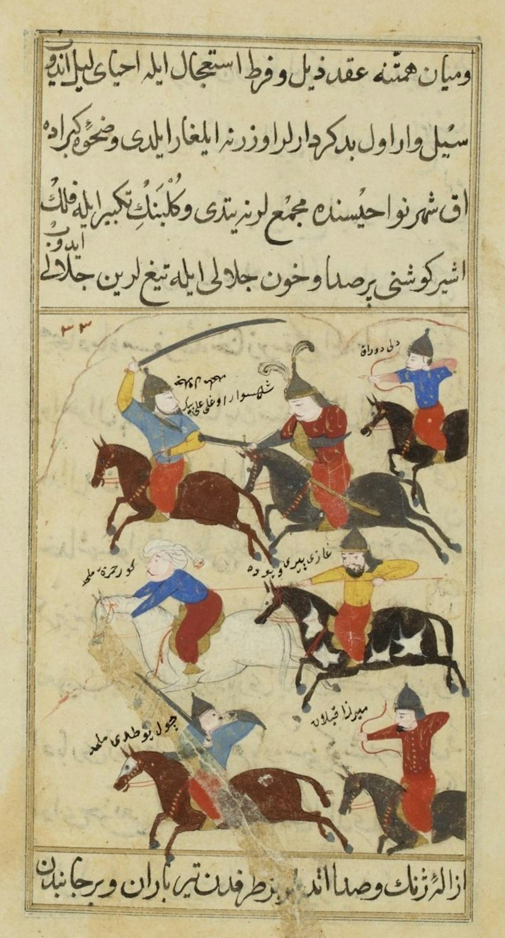
Peasants, semi-nomadic groups and provincial leaders alike contributed to this movement through a rash of violence, banditry and instability that lasted well into the 17th century. As drought, disease and bloodshed persisted, people abandoned farms and villages, fleeing Anatolia in search of more stable areas, while famine killed many who lacked the resources to leave.

Weakening of the Ottoman Empire

Before this point, the Ottoman Empire had been one of the most powerful regimes in the early modern world. It included large swaths of Europe, North Africa and the Middle East and controlled the holiest sites of Islam, Christianity and Judaism. Over the previous century, Ottoman troops had pushed into Central Asia, annexed most of Hungary, and advanced across the Hapsburg Empire to threaten Vienna in 1529.

The Celali Rebellion had major political consequences.

The Ottoman government succeeded in reestablishing relative calm in rural Anatolia by 1611, but at a cost. The sultan’s control over the provinces was irreversibly weakened, and this internal check on Ottoman authority helped curb the trend of Ottoman expansion.

The Celali Rebellion closed the door on the Ottoman “Golden Age,” sending this monumental empire into a spiral of decentralization, military setbacks and administrative weakness that would trouble the Ottoman state for its remaining three centuries of existence.

Climate change as a threat multiplier

Four hundred years later, environmental stress coincided with social unrest to launch Syria into an enduring and devastating civil war.

This conflict emerged in the context of political oppression and the Arab Spring movement, and on the tail end of one of Syria’s worst droughts in modern history.

The magnitude of the environment’s role in the Syrian civil war is difficult to gauge because, as in the Celali Rebellion, its impact was indelibly linked to social and political pressures. But the brutal combination of these forces can’t be ignored. It’s why military experts today talk about climate change as a “threat multiplier.”

Dry, empty landscape with a tractor
Farmers ride in a tractor in the drought-hit region of Hasaka, Syria, in 2010. Louai Beshara/AFP via Getty Images


Now entering its second decade, the Syrian war has driven over 13 million Syrians from their homes. About half are internally displaced, while the rest have sought refuge in surrounding states, Europe and beyond, greatly intensifying the global refugee crisis.

Lessons for today and the future

The Mediterranean region may be particularly prone to the negative effects of global warming, but these two stories are far from isolated cases.

As Earth’s temperatures rise, the climate will increasingly hamper human affairs, exacerbating conflict and driving migration. In recent years, low-lying countries such as Bangladesh have been devastated by flooding, while drought has upended lives in the Horn of Africa and Central America, sending large numbers of migrants into other countries.

Mediterranean history offers three important lessons for addressing current global environmental issues:

  • First, negative effects of climate change fall disproportionately on poor and marginalized individuals, those least able to respond and adapt.
  • Second, environmental challenges tend to hit hardest when combined with social forces, and the two are often indistinguishably connected.
  • Third, climate change has the potential to prompt migration and resettlement, spur violence, unseat regimes and dramatically transform human societies throughout the world.

Climate change ultimately will affect everyone – in dramatic, distressing and unforeseen ways. As we contemplate this future, there is much we can learn from our past.

Read more:

Andrea Duffy does not work for, consult, own shares in or receive funding from any company or organization that would benefit from this article, and has disclosed no relevant affiliations beyond their academic appointment.

“Mega-drought” depletes system that provides water to 40 million

“Mega-drought” depletes system that provides water to 40 million


This morning, our series “Eye on Earth” looks at the punishing drought gripping much of the western U.S.

Scientists are calling it a “mega-drought” brought on by climate change.

The latest U.S. Drought Monitor Map shows large areas of the Southwest are “exceptionally dry,” the worst category.

 / Credit: National Drought Mitigation Center
/ Credit: National Drought Mitigation Center


It’s taking a dramatic toll on the Colorado River system that provides water to 40 million people in seven states — and may force the federal government to make a drastic and historic decision.

For more than eight decades, the iconic Hoover Dam has relied on water from Nevada’s Lake Mead to cover up its backside. But now, at age 85, it finds itself uncomfortably exposed. Much of the water the dam is supposed to be holding back is gone.

“This is like a different world,” said Pat Mulroy, the former head of the Southern Nevada Water Authority. She told CBS News senior national and environmental correspondent Ben Tracy that Lake Mead, the nation’s largest reservoir, is on track to soon hit its lowest level ever recorded.

This part of the Colorado River system is a crucial water supply for Las Vegas, Phoenix and Southern California. It makes the vast agricultural land of the desert Southwest possible.

Mulroy said, “This landscape screams problems to me. I mean, just look at the bathtub rings. To me, that is an enormous wake up call.”

Water levels at Lake Mead have dropped precipitously due to the ongoing western drought.&#xa0; / Credit: CBS News
Water levels at Lake Mead have dropped precipitously due to the ongoing western drought. / Credit: CBS News

Lake Mead is at just 37% of its capacity.

It hasn’t been full since back in 2000, when the water came right up to the top of Hoover Dam:

A view of the Hoover Dam in 2000. / Credit: U.S. Bureau of Reclamation

This is what it looks like now:

The view at Hoover Dam, 2021.&#xa0; / Credit: CBS News
The view at Hoover Dam, 2021. / Credit: CBS News


Since 2000, Lake Mead has dropped 130 feet, about the height of a 13-story building. Islands in the lake that used to be completely submerged are now visible.

Back in 2014 Tracy had visited the dam, and asked Mulroy about water levels at Lake Mead, which she described as being at “a pretty critical point.”

Today, Tracy asked, “If you look at 30 feet lower now, what point are we at?”

“We’re at a tipping point,” said Mulroy. “It’s an existential issue for Arizona, for California, for Nevada. It is just that simple.”

For the first time ever, the federal government is expected to declare a water shortage on the lower Colorado River later this summer. That will force automatic cuts to the water supply for Nevada and Arizona starting in 2022. Homeowners have higher priority and, at first, won’t feel the pain as badly as farmers.

Dan Thelander is a second-generation family farmer in Arizona’s Pinal County. The water to grow his corn and alfalfa fields comes from Lake Mead. “If we don’t have irrigation water, we can’t farm,” he said. “So, next year we are going to get about 25% less water, means we’re going to have to fallow or not plant 25% of our land.”

In 2023 Thelander and other farmers in this part of Arizona are expected to lose nearly all of their water from Lake Mead, so they are rushing to dig wells to pump groundwater to try to save their farms.

“The future here is, honestly I hate to say it, pretty cloudy,” Thelander said.

Back at Hoover Dam, facility manager Mark Cook has his own concerns. Lake Mead has dropped so much that it has cut the dam’s hydropower output by nearly 25%.

Cook wanted to show Tracy the brand-new turbine blades they just installed, designed to keep power flowing efficiently at rapidly-dropping lake levels. At some point, the dam could stop producing electricity altogether.

“Our previous number [for cutoff] was at elevation 1,050, and now we’ve lowered that number to 950,” Cook said. “So, we bought ourselves 100 feet.”

Mulroy said a rapidly-retreating reservoir may be the new normal – and the millions of people who rely on this water supply will have to quickly learn to live with less of it. “We don’t change unless we absolutely have to,” she said. “Well, when you look out at this lake, I think that moment of ‘it’s absolutely necessary’ has arrived.”

See also:

Sir David Attenborough on climate change: “A crime has been committed” (“60 Minutes”)Climate tipping points may have been reached already, experts sayFor many climate change finally hits home (“Sunday Morning”)Western U.S. may be entering its most severe drought in modern history

‘Truly an emergency’: how drought returned to California – and what lies ahead

‘Truly an emergency’: how drought returned to California – and what lies ahead

<span>Photograph: Josh Edelson/AP</span>
Photograph: Josh Edelson/AP


Just two years after California celebrated the end of its last devastating drought, the state is facing another one. Snowpack has dwindled to nearly nothing, the state’s 1,500 reservoirs are at only 50% of their average levels, and federal and local agencies have begun to issue water restrictions.

Governor Gavin Newsom has declared a drought emergency in 41 of the state’s 58 counties. Meanwhile, temperatures are surging as the region braces for what is expected to be another record-breaking fire season, and scientists are sounding the alarm about the state’s readiness.

Related: California faces another drought as lake beds turn to dust – a photo essay

“What we are seeing right now is very severe, dry conditions and in some cases and some parts of the west, the lowest in-flows to reservoirs on record,” says Roger Pulwarty, a senior scientist in the National Oceanic and Atmospheric Administration (Noaa) physical sciences laboratory, adding that, while the system is designed to withstand dry periods, “a lot of the slack in our system has already been used up”.

How did we get here?

A creeping trend

Drought is not unnatural for California. Its climate is predisposed to wet years interspersed among dry ones. But the climate crisis and rising temperatures are compounding these natural variations, turning cyclical changes into crises.

Drought, as defined by the National Weather Service, isn’t a sudden onset of characteristics but rather a creeping trend. It’s classified after a period of time, when the prolonged lack of water in a system causes problems in a particular area, such as crop damages or supply issues. In California, dry conditions started to develop in May of last year, according to federal monitoring systems.

Dry banks rise above water in Lake Oroville on Sunday 23 May in Oroville, California.
Dry banks rise above water in Lake Oroville on Sunday 23 May in Oroville, California. Photograph: Noah Berger/AP


The effects really began to show in early spring 2021, when the annual winter rainy season failed to replenish the parched landscape and a hot summer baked even more moisture out of the environment. By March, conditions were dire enough for the US agriculture secretary, Tom Vilsack, to designate most of California as a primary disaster area. Just two months later, 93% of the south-west and California was in drought, with 38% of the region classified at the highest level.

“When you have droughts with warm temperatures, you dry out the system much faster than you’d expect,” says Pulwarty, adding that climate change can make droughts both more severe and harder to recover from. “It is not just how much precipitation you get – it is also about whether or not it stays as water on the ground.”

Dwindling water, rising temperatures

The state’s previous drought lasted roughly seven long years, from December 2011 to March 2019, according to official estimates. But some scientists believe it never actually ended. These researchers suggest that the west is gripped by an emerging “megadrought” that could last for decades. A 2020 study that looked at tree rings for historical climate clues concluded that the region may be entering the worst prolonged period of drought encountered in more than 1,200 years and attributed roughly half of the effects to human-caused global heating.

Meanwhile, California has been getting warmer, and 2020 brought some of the highest temperatures ever recorded. In August of last year, Death Valley reached 130F (54C) and a month later, an area in Los Angeles county recorded a 121F (49.4C) day – the hottest in its history.

When we do not have the snowpack, it puts our water system under tremendous pressure

Safeeq Khan, professor and climate researcher

Heat changes the water cycle and creates a thirstier atmosphere that accelerates evaporation. That means there’s less water available for communities, businesses, and ecosystems. It also means there will be less snow, which California relies on for roughly 30% of its water supply.

“The snowpack, in the context of the western US and specifically in California, is really critical for our water supply,” says Safeeq Khan, a professor at University of California, Merced, who researches the climate crisis and water sustainability. “The snowpack sits on the mountain and melts in the spring and early summer. That provides the buffer to overcome the extreme summer heat,” he explains.

But in recent years, even during wet winters, he says, the snowpack wasn’t as strong as it used to be. This year, even before the summer, it is already nearly gone. The melt has also produced less runoff than expected, meaning less trickled into streams, rivers and reservoirs.

“Years like this, when we do not have the snowpack, it really puts our water system under tremendous pressure,” Khan says. He doesn’t think that will change anytime soon, adding that, while drought isn’t new in the west, “the kind of drought we are experiencing is new. The impact is a lot more than it was in the past.”

What will the impact be?

Drought disasters are among the most costly, according to the US National Centers for Environmental Information, running an average of $9.3 bn in damage and loss. Dry conditions are also expected to fuel another potentially devastating wildfire season. In 2020, roughly 4.1 m acres were consumed by the flames, tens of thousands of buildings burned and 31 people lost their lives.

The browning hillsides and dying trees are not only increasing the risk of ignitions, they also cause fire behavior to be more extreme when blazes erupt, according to Scott Stephens, a fire ecologist at the University of California, Berkeley. “We’ll probably get to typical fire season moisture levels six weeks early this year because of the drought,” he said as part of an interview series for the Public Policy Institute of California.

Along with wildfire risks, short water supply is putting immense pressure on the state’s agricultural industry, which grows over a third of the country’s vegetables and supplies two-thirds of the fruits and nuts in the US. Already farmers are culling crops and fallowing fields in anticipation of water shortages. Karen Ross, California’s food and agriculture secretary, told the California Chamber of Commerce that she expected 500,000 acres would have to sit idle this year.

Shallow, stagnant water lines the &#x002018;A Canal&#x002019; in Klamath Falls, Oregon, on Tuesday.
Shallow, stagnant water lines the ‘A Canal’ in Klamath Falls, Oregon, on Tuesday. Photograph: Dave Killen/AP


The federal government has already announced a dramatic reduction in water allotments to farmers in California’s Central Valley, while further north, tensions are running high in the Klamath Basin, where a federal canal servicing 150,000 acres of farmland will run dry for the first time in 114 years.

Cities and other urban regions are also set to receive less water, and residents are being asked to conserve where they can.

“We are truly in an emergency situation,” Rick Callender, CEO of the Santa Clara Valley Water District, which delivers water to 2 million residents south of the San Francisco Bay Area, told the Mercury News last week. The agency will enact mandatory restrictions across the county, adding that the public should anticipate cutbacks to increase as the situation intensifies. “We’re going to be seeking everything we can do to address this emergency.”

Related: ‘Mind-blowing’: tenth of world’s giant sequoias may have been destroyed by a single fire

Worsening drought will also exacerbate longstanding problems for people in the Central Valley, who have suffered through shortages in water for drinking, cooking and sanitation. During the previous drought, wells ran dry and never recovered. More than a million Californians still don’t have access to safe drinking water.

Low water levels also have the potential to affect the state’s electrical grid, which depends on hydroelectric power plants, the Los Angeles Times has reported. Lake Oroville is expected to fall below 640 ft – the level state officials say is required to run a plant – by August. Currently, it stands just above 700ft.

How ready is the state?

California has already invested billions to prepare and has learned key lessons from the last round, when the state experienced its driest four-year stretch in history. In 2014, the state also passed the Groundwater Management Act, landmark legislation that requires communities to monitor groundwater basins and develop plans to protect them. But implementation is still in its early stages.

Newsom has proposed a $5.1 bn investment over the next four years to respond to the disaster and improve infrastructure. Cal Fire, the state’s firefighting agency, has also added 1,400 new firefighters to its ranks, along with picking up new helicopters and fire engines.

“California has done a remarkable job,” says Pulwarty, but he adds that more ambitious solutions are still needed.

“There are innovations that we need to scale up,” he says, from urban conservation and reuse to upping agricultural efficiency and creating land reserves that will help regions become more resilient when drought disasters strike.

Others warn the state must take the long view, with drought conditions likely to get worse before they get better.

“If we are worried about this year we are really playing the short game,” says Doug Parker, the director of the California Institute for Water Resources. “It’s next year that I think is more important.”

The water system, he says, is designed to handle short-term shortages. “When you get into three, four, five years in a row of drought – that’s when things really start to get serious. We all wish we knew what was going to happen next winter.”

We’re Inching Towards Actual Violence Over Access to Water

We’re Inching Towards Actual Violence Over Access to Water

Photo credit: Robert Alexander - Getty Images
Photo credit: Robert Alexander – Getty Images


Here at the shebeen, one of the larger elements in our portfolio is water—specifically, the increasing political salience of water, especially in the West, where they are experiencing such profound drought conditions that the Hoover Dam, of all things, is losing its reason for being. From CBS News:

For more than eight decades, the iconic Hoover Dam has relied on water from Nevada’s Lake Mead to cover up its backside. But now, at age 85, it finds itself uncomfortably exposed. Much of the water the dam is supposed to be holding back is gone. “This is like a different world,” said Pat Mulroy, the former head of the Southern Nevada Water Authority. She told CBS News senior national and environmental correspondent Ben Tracy that Lake Mead, the nation’s largest reservoir, is on track to soon hit its lowest level ever recorded.

The dam is estimated to have lost a quarter of its customary hydroelectric power. Worse, the lower Colorado River, without which the country would have a lot of new deserts, is at a crisis stage, and the federal government may have to take serious action that will affect the region’s farmers—and that I guarantee you will set off the Bundy-ite fringe.

For the first time ever, the federal government is expected to declare a water shortage on the lower Colorado River later this summer. That will force automatic cuts to the water supply for Nevada and Arizona starting in 2022. Homeowners have higher priority and, at first, won’t feel the pain as badly as farmers. Dan Thelander is a second-generation family farmer in Arizona’s Pinal County. The water to grow his corn and alfalfa fields comes from Lake Mead. “If we don’t have irrigation water, we can’t farm,” he said. “So, next year we are going to get about 25% less water, means we’re going to have to fallow or not plant 25% of our land.” In 2023 Thelander and other farmers in this part of Arizona are expected to lose nearly all of their water from Lake Mead, so they are rushing to dig wells to pump groundwater to try to save their farms.

Meanwhile, a few degrees north, the High Country News reports the drought is killing fish and local economies, in that order.

Fish have been dying on the Klamath since around May 4, according to the Yurok Tribal Fisheries Department. At that time, 97% of the juvenile salmon caught by the department’s in-river trapping device were infected with the disease C. shasta, and were either dead, or would die within days. Over a two-week period, 70% of the juvenile salmon caught in the trap were dead.

Irrigators upriver from the fish kill were told in mid-May that for the first time since “A” Canal in the Klamath Project began operating in 1907, they would not receive any water from it. The irrigators say they need 400,000 acre-feet of water but this year, they will receive just 33,000 acre-feet from the Klamath Project — a historic low. The situation has put pressure on an embattled region already caught in a cyclical mode of crisis due to a drying climate. “For salmon people, a juvenile fish kill is an absolute worst-case scenario,” Myers said in a statement.

As is obvious, this is all yet another crisis within the general climate crisis. We are inching closer to the days when we might see actual violence over access to water. As if we all need another excuse.

Arizona farmers to bear brunt of cuts from Colorado River

Arizona farmers to bear brunt of cuts from Colorado River


FLAGSTAFF, Ariz. (AP) — Arizona is prepared to lose about one-fifth of the water the state gets from the Colorado River in what could be the first federally declared shortage in the river that supplies millions of people in the U.S. West and Mexico, state officials said Thursday.

Arizona stands to lose more than any other state in the Colorado River basin that also takes in parts of Wyoming, New Mexico, Utah, Colorado, Nevada and California. That’s because Arizona agreed long ago to be the first in line for cuts in exchange for federal funding for a canal system to deliver the water to Arizona’s major metropolitan areas.

The Arizona Department of Water Resources and the Central Arizona Project, which manages the canal system, said the anticipated reductions will be painful, but the state has prepared for decades for a shortage through conservation, water banking, partnerships and other efforts.

“It doesn’t make it any less painful. But at least we know what is coming,” said Ted Cooke, general manager of the Central Arizona Project.

Farmers in central Arizona’s Pinal County, who already have been fallowing land amid the ongoing drought and improving wells to pump groundwater in anticipation of the reductions, will bear the brunt of the cuts. Most farms there are family farms that are among the state’s top producers of livestock, dairy, cotton, barley, wheat and alfalfa.

In Pinal County, up to 40% of farmland that relies on Colorado River water could be fallowed over the next few years, said Stefanie Smallhouse, president of the Arizona Farm Bureau Federation.

“That’s a big blow,” she said. “I can’t think of many other businesses that can take a 40% cut in their income within a few months and still be sustainable. When you farm, it’s not only a business, it’s your livelihood.”

The U.S. Bureau of Reclamation projected earlier this month that Lake Mead, which delivers water to Arizona, Nevada, California and Mexico, will fall below 1,075 feet (328 meters) for the first time in June 2021. If the lake remains below that level in August when the bureau issues its official projection for 2022, Arizona and Nevada will lose water.

The two states already voluntarily have given up water under a separate drought contingency plan.

The voluntary and mandatory Tier 1 cuts mean Arizona will lose 18% of its Colorado River supply, or 512,000 acre-feet of water. The amount represents 30% of the water that goes to the Central Arizona Project and 8% of Arizona’s overall water supply.

Some of that water will be replaced through water exchanges, transfers from cities to irrigation districts or through water that was stored in Lake Mead in a sort of shell game. The state, tribes and others also contributed financially to help develop groundwater infrastructure.

“We like to think we find ways to take care of ourselves collectively,” said Tom Buschatzke, director of the Arizona Department of Water Resources.

Smallhouse said farmers are thankful for the help coming but believes there’s more flexibility in the system to further ease the reductions. While farmers regularly face criticism for the amount of water they use, Smallhouse said the coronavirus pandemic highlighted the importance of a local supply chain for meat, dairy and crops.

Some water users simply won’t get the water they once had if the Bureau of Reclamation’s projections pan out.

The cutbacks come at a time when temperatures are rising and drought has tightened its grip on the U.S. Southwest, increasingly draining Lake Mead and Lake Powell, the two largest man-made reservoirs in the U.S., to their lowest levels since they were filled.

Lake Mead along the Arizona-Nevada border has dropped by about 16 feet (4.88 meters) feet since this time last year. Lake Powell on the Arizona-Utah border has fallen by 35 feet (10.67 meters) feet, the Bureau of Reclamation said.

The reductions in Arizona won’t hit cities or people’s homes, or affect water delivered through the canal system for Native American tribes. Still, anyone living in the desert should be concerned — but not panic — about water and think ways to live with less, said Rhett Larson, an associate professor at Arizona State University and an expert on water law and policy.

“The fact that you’re not feeling it in your tap doesn’t mean you won’t feel it at the grocery store because Pinal County farmers are growing a lot of the things you eat and use,” he said.

‘It will be beautiful again’: how California’s redwood forest is recovering after last year’s wildfires

‘It will be beautiful again’: how California’s redwood forest is recovering after last year’s wildfires


There are spots inside Big Basin Redwoods state park that appear to be frozen in time.

Roughly 10 months after the CZU Complex fire burned 97% of California’s oldest park, some trees still smoke and smolder. An open champagne bottle sits untouched atop a scorched picnic table alongside cooking utensils that are melted and singed together. Contents from a toppled cooler, left agape, have begun to blend into the forest duff. The skeletons of burnt cars and trucks are still parked in front of once-iconic headquarters, now reduced to rubble.

But, amid the wreckage, there are also signs of rebirth. Wildflowers are growing over charred debris. Blackened trees have sprung vibrant green sprouts. Birdsongs and hammering woodpeckers accent the hum of state-run construction crews working to ready the beloved park for a new chapter in its history.

“The biggest loss is the human side. This park is not going to be the same place that I saw as a little girl,” says Joanne Kerbavaz, a senior environmental scientist with California state parks on a tour of the park this week. “But as an ecologist, part of me is thrilled by the opportunity to watch how the redwood forest recovers.”

Big Basin is home to roughly 4,400 acres (1,780 hectares) of old-growth redwood trees, majestic giants that are among the oldest living things on Earth. Their lifespan can stretch beyond 2,000 years and they have adapted to survive and thrive in California’s Mediterranean fire-prone climate.

After being heavily logged in the 1800s, the Sempervirens Fund, a non-profit group, formed to protect the trees in 1900 and two years later Big Basin was created – California’s first state park – so millions of people from around the world could travel to marvel at them.

Just like the redwoods, Big Basin, too, will survive this fire. But when it reopens, it will look different. Along with new structures and facilities, many of the park’s 80 miles (128km) of trails will have to be newly carved into the rewilded landscape with new bridges, steps and railings built to support them.

We have the opportunity to reimagine how to interact with this park,” Kerbavaz says. There are discussions around how to rebuild the park back, to be even more accessible for generations to come. Attitudes have changed over the last 119 years and the park, like others across the US, has exploded in popularity. The climate is also changing, adding new pressures and threats to the ecosystems.

There is going to be a very robust planning process,” she adds, acknowledging the range of views about how old-growth forests should be protected and enjoyed into the future. “It is going to be open and inclusive and that means it is going to take a while to make some of the calls.”

Most agree that increasing resilience should be a priority. “The near-complete destruction of the buildings and facilities at Big Basin illustrates just how ill-adapted they were to fire,” the Sempervirens Fund wrote on its website in February. “If you love Big Basin, please consider this: rebuilding Big Basin can pioneer a new model for California’s state parks, just as Big Basin accomplished more than a century ago.”

Before rebuilding begins, thoughthere’s a considerable amount left to be cleared.

Along with toxic debris and crumpled buildings that need to be cleared, hazardous trees are being assessed for removal. The process of identifying which trees are dead or dying is delicate and layered. Five agencies have already weighed in, and perspectives on what should stay and what should be pulled out do not always align.

Several beloved old-growth trees have already been saved by park officials, including the famous Auto Tree, which is the most photographed Redwood in Big Basin. Estimated to be more than 1,500 years old, generations of visitors have climbed into its large opening created by fires in the past. The pictures go back to the park’s beginnings. There are photos of horses and buggies backed in and of ranger trucks in the 1970s.

“There was a mark to cut down the tree,” Kerbavaz says, “but I said, hey, this is one we really don’t want to lose.” So far, it’s showing signs of survival, with small green offshoots at the base and sparse growth in the canopy, and there’s hope that it has enough structural support to stay standing.

The process of deciding what will stay and what will go has been thorough and arduous. First, CalFire came through and cleared a path for crews. CalTrans examined what might become hazardous to the roads. Santa Cruz county officials assessed the areas managed by the municipality, and then PG&E did their analysis. California’s Department of Emergency Services is currently in the park and still finding trees to mark for removal.

Trees are painted with a series of letters and numbers, meant to catalog them and indicate to crews that they should be culled. Some also have flags and ties, showing that park officials, who have overseen the process, do not agree.

“There is a science and an art,” Kerbavaz says of the process. “I come, of course, from the parks’ perspective, which is we really would like to keep as much as we can”.

Along with tree removal, trails will have to be remade. Most of the wooden infrastructure, including steps, bridges and railings were obliterated in the fire. Some of it was put in place to hold erosive hillsides, which have since crumbled. Other hazards have to be assessed before guests can be welcomed back in. There are pits left from where subterranean roots from more flammable trees, such as Douglas Firs, burned into the earth.

Meanwhile, scientists are utilizing the opportunity to use the burn scar to learn about fire behavior, ecological resilience, and climate change. “We are trying to get baseline data so people can return in maybe 5 or 10 years down the line, and see how it grows and changes into the future,” says vegetation ecologist Alexis Lafever.

“There are so many baby redwood seedlings and they are so cute,” she says. In some areas, she’s encountered hundreds of seedlings. They won’t all survive, but, she adds, “things are growing back. The forest will be fine.”

There are also signals that animals are emerging and returning. Salamanders survived by burrowing under the duff, banana slugs took refuge underground, and birds have re-inhabited the burned branches.

“Almost everything that lives here has some strategy for avoiding fire,” Kerbavaz says. “But any kind of disturbance like that, there are some species that are harmed and some species that are favored.”

There are those that thrive after fire. The Knobcone Pine requires temperatures up to 350F (177C) to melt a resin from its cones to sprout seeds. Some woodpeckers prefer dead trees to living ones. But the fire, which burned fast and hot, with flames that licked the canopy 300 feet (91 metres) into the sky and tore through close to 18,000 acres (7,285 hectares) of the park in only 24 hours, did leave devastation in its wake. Current assessments show even with the resiliency of the redwoods, 10% of the trees won’t recover. The damage is also expected to cost nearly $200m.

“Those buildings are gone. That specific experience is gone,” Kerbavaz says. “There’s some of that loss of the big trees that make it such a special forest. But we have opened up places for the next generation of big trees to grow,” she adds. “It will be beautiful again – even if it is not as you remember it”.

Tickproof Your Yard Without Spraying Pesticides

Tickproof Your Yard Without Spraying Pesticides


For many of us this past year, our backyards took on a profoundly important role. In the era of social distancing, yards were transformed into outdoor oases, and even now, there are no signs that the trend is slowing down—increasing demand and a national lumber shortage has made it difficult to acquire wood to build a deck.

In order to stay safe in your yard this spring and summer, it’s crucial to avoid exposure to ticks, which can transmit about a dozen common diseases. The past few years have been some of the worst on record for ticks, and not just in the Northeast. At least one variety of disease-transmitting tick has been found in all of the lower 48 states, according to the Centers for Disease Control and Prevention.

And a lab at Cornell University has identified 26 species of ticks along the East Coast alone—far more than the deer ticks most of us associate with Lyme disease.

With a little bit of work, including cutting your grass more often, you can significantly limit exposure to the insects in your yard.

“Tick control is mostly about wildlife,” says Jody Gangloff-Kaufmann, coordinator of New York State’s Integrated Pest Management Program at Cornell. “If you have an open yard where animals can enter, you’re almost certainly going to have ticks.”

One way to know for sure? Perform what’s called a tick drag. Cut a 5-inch-square swatch of fabric and tie it to an 18-inch-long pole or stick. Holding the pole, drag the fabric along tall grass or weeds, particularly near woodland edges of your lawn. Ticks will typically transfer themselves to the swatch.

If you spot them on the fabric, you’ll need to deal with the problem now to safely enjoy your yard. And even if you don’t find ticks, it could pay to be proactive. Follow these five steps to deal with them effectively.

1. Keep Your Grass Short

The last few years have been some of the worst on record for ticks, and not just in the Northeast. At least one variety of disease-transmitting tick has been found in all of the lower 48 states, ...<br>

“Black-legged ticks, the type that transmit Lyme disease, don’t like dry, hot environments,” Gangloff-Kaufmann says. The taller the grass, the cooler the environment, because taller blades cast a shadow and create shade. That means that leaving your lawn a little shaggy is a bad idea in tick-rich areas.

Gangloff-Kaufmann says it’s okay to let your grass reach the 4 to 4½ inches that Consumer Reports recommends, then trim it down to about 3 inches with each cut. That strategy promotes healthy growth. If you shear your lawn down to an inch or two, you’ll send the grass into a panic and it will grow too tall, too fast, and suffer from a weak root structure. The trick is to be vigilant about keeping up with mowing and not letting grass grow to a height of 5 or 6 inches.

If you miss a week and the grass gets tall, it’s a good idea to use the bagging attachment with your tractor or lawn mower, because leaving those long lawn clippings behind can create the perfect environment for ticks.

2. Make a Mulch Moat

Many tick varieties, including the Lyme-transmitting black-legged variety, favor the dense cover of woodlands over open lawn. That makes any wooded areas adjacent to your property potential hotbeds for ticks. Adding a 3-foot-wide protective barrier of mulch around the perimeter of your yard does double duty.

First, it creates a physical barrier that’s dry and sometimes hot, something ticks can’t tolerate. Second, it serves as a visual reminder to anyone in your household to be especially careful once they step past the perimeter.

For the border, you want mulch made from broad, dry wood chips or bark, not the damp, shredded variety, which creates exactly the kind of cool, damp conditions ticks love.

3. Trim Tall Grass and Weeds

“Ticks like to climb to the top of tall grass blades and look for questing opportunities—the chance to grab on to animals like deer or humans,” Gangloff-Kaufmann says.

By keeping grass and weeds at bay with a string trimmer, you’ll minimize those chances and make it more difficult for ticks to latch on to you or members of your family, or to travel around your property by hitching a ride on your dog.

4. Eliminate Tick Habitat

CR has long recommended mulching grass clippings when you mow. That’s because these clippings break down and release nitrogen into the soil, feeding your yard and potentially reducing the amount of fertilizer you use by about 20 percent.

And in many instances, it’s okay or even preferable to leave behind fallen leaves to nourish the lawn for the same reason. But if you live in an area with a large tick population, you might benefit from a different approach.

By bagging grass and blowing leaves into piles for collection, you keep your yard clear and cut back on tick-friendly places. You’ll want to recycle leaves and grass clippings through your town if possible, or compost them in a pile far from the house.

Rather than letting them rot in a landfill, you can let your leaves and clippings break down naturally and use the resulting compost to feed and fertilize plants around your yard.

5. Consider a Targeted Approach

Following the four steps above will make your yard less inviting to ticks. But if you want to make a serious dent in the tick population on your property, you’ll need to focus on methods that kill them.

Many people opt for spraying their entire yard with pesticide, an approach that CR’s experts say is ineffective and potentially dangerous.

“Spraying your yard provides a false sense of security,” explains Michael Hansen, PhD, senior scientist at Consumer Reports. “Instead, consider products that treat the fur of mice or deer with small quantities of tick-killing agents.”

Why target mice or deer rather than your yard? “Mice play an important role in the transmission cycle of Lyme disease,” says Laura Goodman, senior research associate in Cornell’s department of population medicine and diagnostic sciences. If you can stop critters from transmitting ticks, you can curb the tick population in and around your yard.

“Tick tubes” are one product we’ve encountered. They’re essentially cardboard tubes stuffed with cotton treated with permethrin, a tick-killing chemical. Mice collect the cotton and take it back to their nests. The permethrin binds to oils on their fur, killing any ticks that try to attach without harming the mice.

The Connecticut Agricultural Experiment Station (PDF) has found that such systems have resulted in statistically meaningful drops in tick levels after several years of use. And at about $4 per tube, they’re cheaper than tick bait boxes.

Bonus: Tickproof Yourself

When working in the yard, wear a long-sleeved shirt, long pants, socks, and closed-toe shoes. Use insect repellent; the best in our tests provide more than 8 hours of tick protection.

“And regardless of the time of year, perform a tick check as soon as you return indoors,” Goodman says.

If you do suffer a bite, Goodman advises properly removing the tick. For more information about ticks in your area, check your state health department’s website. Connecticut, home to the town of Old Lyme, where the disease was first documented, has a particularly comprehensive guide to ticks (PDF).

Consumer Reports is an independent, nonprofit organization that works side by side with consumers to create a fairer, safer, and healthier world. CR does not endorse products or services, and does not accept advertising. Copyright © 2021, Consumer Reports, Inc.

The poison used to eradicate a biblical mouse plague ravaging southeast Australia is having a deadly effect on native wildlife

The poison used to eradicate a biblical mouse plague ravaging southeast Australia is having a deadly effect on native wildlife

The poison used to eradicate a biblical mouse plague ravaging southeast Australia is having a deadly effect on native wildlife. Dead Galah birds in Parkes, New South Wales. Kelly Lacey/Facebook
australia mouse plague
Mice scurrying around stored grain on a farm near Tottenham, Australia, on May 19, 2021. Rick Rycroft/AP 

  • The poison that is being used to cull Australia’s mouse infestation is damaging the native wildlife.
  • Experts say birds in New South Wales have died after ingesting poison intended for mice.
  • The infestation has ravaged large parts of southeast Australia.

The poisonous bait that is being used to eradicate a huge mouse plague ravaging large parts of Australia is having a deadly effect on native wildlife, experts have warned.

Earlier this week, an image of dozens of Galah Cockatoo birds dead in a cemetery in Parkes, New South Wales, went viral after it was shared on Facebook by Kelly Lacey, a volunteer for the NSW Wildlife Information, Rescue and Education Service (WIRES).

In the post, she said: “Seeing them sitting with each other under trees, knowing they were suffering until they have eventually died, has utterly broke me. Found 2 still alive, sadly 1 died on way home. (whatever the poison was it is more potent then I have experienced, and they have bled internally).”

Later during an interview with The Guardian, Lacey said that she found over 100 dead Galahs in the cemetery.

“I received a call from another WIRES member, saying ‘I think you might want to see this, there are dead galahs everywhere,'” she told the newspaper. “My heart sank. When I arrived and began collecting all the dead bodies I was in shock.”

In a statement released earlier this week, the New South Wales Environmental Protection Agency asked the public to “think carefully” about the location and amount of poisonous bait that is being used after an investigation by the organization found that dozens of birds in the state had died after ingesting the poison.

“The safe baiting of mice is an important step in reducing mice numbers and pesticide users must make sure they handle baits safely and are careful to always follow the directions on the label to protect their family, neighbors, domestic animals, wildlife, and the environment from harm,” the statement read.

A mixture of poisonous bait and other deadly traps have been deployed across southeast Australia to deal with the huge rise in mice populations. Experts say that the infestation is the result of wet weather that has provided ample food for the mice, fueling their fast reproductive cycle.

Farmers across the region have felt the brunt of the infestation with reports of mice ravaging crops, destroying farming equipment, and causing electricity blackouts. The state government has called the plague “absolutely unprecedented” and warned that it could cause huge economic damage.

The NSW Farmers Association, an agricultural group in the state, estimated that the plague could cost farmers a total of 1 billion Australian dollars ($771,000) during the winter crop season, which runs from June to August, the AP reported.

Earlier this month, Adam Marshall, the agriculture minister for New South Wales, announced a $50m support package to help farmers that include the wide-scale use of bromadiolone, a poison described as “napalm” for mice.

“It’ll be the equivalent of napalming mice across rural NSW,” Marshall told the ABC. “This chemical, this poison, will eliminate mice that take these baits within 24 hours.”

A ‘megadrought’ in California is expected to lead to water shortages for production of everything from avocados to almonds, and could cause prices to rise

A ‘megadrought’ in California is expected to lead to water shortages for production of everything from avocados to almonds, and could cause prices to rise

AP12271927439
Associated Press 

  • California is facing its worst drought in four years.
  • As water levels continue to fall, farmers have left large portions of their fields unseeded.
  • The state’s $50 billion agriculture industry supplies over 25% of the nation’s food.

megadrought in California is threatening to push food prices even higher.

The state is already facing its worst water shortage in four years and the its driest season has only just begun, according to data from the National Integrated Drought Information System (NIDIS).

As water levels continue to fall, farmers and ranchers will be unable to maintain key crops and feed livestock. As of Tuesday, nearly 75% of California was classified as in “extreme drought,” meaning the land does not have adequate water supplies to sustain agriculture and wildlife, according to the NIDIS.

While farmers have come to expect and prepare for droughts, this year has already been much hotter and drier than previous ones. Scorching California weather is drying up reservoirs, as well as the Sierra Nevada snowpack that helps supply them. The reservoirs are 50% lower than they should be in June, Jay Lund, co-director of the Center for Watershed Sciences at the University of California-Davis, told Associated Press.

The farmer’s plight could make products like almonds, avocados, and milk more expensive for shoppers as farmers struggle to produce crops of the state’s top exports. California produces over 25% of the nation’s food supply. California agriculture is a nearly $50 billion industry and is known for producing over 400 key commodities, according to the California Department of Food and Agriculture.

Dave Kranz, a California Farm Bureau spokesperson, told Insider it’s too soon to tell whether the drought will have a significant impact on grocery prices, but it is sure to be a “catastrophic” year for farmers. He said he’s already seen several farmers scaling back their crops and prioritizing ones that rely less on water supplies.

“A lot of factors play into the prices people see at stores,” Kranz said. “The payment that farmers receive for their crops is a very small portion of the price shoppers pay. Most of it comes from transportation, packaging, and marketing.”

The last time the state faced a drought of this magnitude, experts said shoppers could expect prices to rise about 3% and predicted the Californian agriculture industry could be handicapped for years, Gannett reported. During the 2014 drought, experts told CNBC prices for top California exports like avocados, berries, broccoli, grapes, and lettuce could rise anywhere from 17 to 62 cents, depending on the product.

Any potential price increases do not occur immediately or all at once. They are often felt long after the drought has already wreaked havoc on local farm crops, Annemarie Kuhns, a member of the Agriculture Department’s Economic Research Service, told the Des Moines Register in 2015.

“It takes time before the effects are seen at the retail level,” Kuhns said. “Once you see drought conditions start to improve you’ll see these effects further down the road.”

Droughts are nothing new for California farmers, who use conservation practices that reduce water runoff and allow moisture to enter the soil. Farmers also focus on crops that require less water, though about 40% of the 24.6 million acres of farmland in California require irrigation, Reuters reported. Many farmers told the publication that they are planning to leave large portions of their land unseeded due to this year’s drought.

The farms are allocated some water from the state, but this year the California Department of Water Resources reduced farmers and growers to 5% of their expected water allocation in March. Last month, Chris Scheuring, California Farm Bureau senior counsel, said it appears the state will soon not be able to deliver even at the 5% level.

“It’s one of those existential years in California, when we’ve got an extreme drought and farmers are going to be hurting all over the place,” Scheuring said. “Some folks may be able to default to groundwater, but it’s going to be a very, very tough year for farmers.”

Farmers can purchase supplemental water if they can find it, but it comes at a hefty price. Supplemental water was priced at $1,500 to $2,000 per acre-foot in mid-May, according to a report from California Farm Bureau.

During the state’s last drought, which ended in 2016, the agriculture industry lost roughly $3.8 billion, according to National Geographic. NIDIS analysts said in their last report that the outlook for this year is “grim.”

The California water shortage and potential for a dip in food exports from the state pile onto a growing supply chain crisis precipitated by COVID-19 shutdowns. California dairy products, almonds, grapes, lettuce, and avocados won’t be the only products in short supply in the coming months. Imported goods like olive oil and cheese are also facing shortages, while meats, including hot dogs, bacon, and chicken have become increasingly valuable.

Known carcinogen found in some popular sunscreens, tests show

Known carcinogen found in some popular sunscreens, tests show

Known carcinogen found in some popular sunscreens, tests show

Traces of a chemical tied to blood cancers including leukemia have been detected in dozens of popular sunscreens and after-sun products, according to tests conducted by online pharmacy and lab Valisure.

Benzene, a known carcinogen, was found in 78 of nearly 300 sprays and lotions tested — about 27% — including products sold by Banana Boat and CVS, according to Valisure.

In a petition, the company has asked the FDA to recall these contaminated batches. The regulating body is reviewing the claim.

“The FDA takes seriously any safety concerns raised about products we regulate, including sunscreen,” the FDA told CBS News in a statement.

Sunscreens and after-sun, classified as cosmetics, are generally subject to FDA regulation.

The chemical is identified as “a colorless or light-yellow liquid chemical at room temperature.” Valisure states that it’s been used “primarily as a solvent in the chemical and pharmaceutical industries.”

Trace levels of benzene can be found in cigarette smoke, gasoline, glues, adhesives, cleaning products and paint strippers.

Valisure also reported that 14 sun care product lots with some of the highest contaminations are sold across four different popular brands — Neutrogena, Sun Bum, CVS Health and Fruit of the Earth. Not all of the aforementioned brands’ products were found to contain benzene, and lists of products found to contain and not to contain benzene are included further down the page in Valisure’s petition form.

For example, Neutrogena’s Ultra Sheer Weightless Sunscreen Spray, SPF 100+ and Ultra Sheer Weightless Sunscreen Spray, SPF 70 were among 14 products Valisure claims have some of the highest levels of benzene tested. But products like Neutrogena’s Ultra Sheer Dry-Touch Sunscreen Lotion SPF 30 and Oil-free Facial Moisturizer with Sunscreen SPF 15 were not found to contain the carcinogen.

All of the samples tested have “contained up to three times the conditionally restricted FDA concentration limit of 2 parts per million” of benzene, according to Valisure’s website.

David Light, the founder and CEO of Valisure, believes the issue is manufacturing contamination affecting specific batches. While the source of the contaminant is unknown and more of the products tested passed than failed, Light urged manufacturers and consumers to take the matter seriously.

“Benzene is one of the most studied and concerning human carcinogens known to science. Its association with forming blood cancers in humans has been shown in numerous studies at trace levels of parts per million and below. The presence of this known human carcinogen in products widely recommended for the prevention of skin cancer and that are regularly used by adults and children is very troubling,” Light said in the company’s statement.

He is also urging the FDA to better define its standards for contamination, and “address current regulatory gaps regarding benzene in both drug and cosmetic products.”

Valisure is encouraging people to send in their own samples of sunscreen and sun care products for evaluation.

The company also made their FDA petition public, which includes a list of the batches with detected benzene levels. The products can be found on pages 12 to 15.

Johnson & Johnson, the maker of Neutrogena products, told CBS News that “benzene is not an ingredient in any of our personal care products.”

The maker of Banana Boat defended its products as well, stating that “our sun care products undergo rigorous testing to ensure safety and quality and meet all FDA regulations.”

CVS said in a statement that products they sell are “safe” and “we are in the process of reviewing and evaluating information in and related to Valisure’s petition and we will respond accordingly.”

Sun Bum told CBS News in a statement, “To further ensure the quality of our products, we will work with suppliers to understand how trace amounts may have been detected.”

However, Valisure stressed to consumers that they should not avoid using sunscreen and should continue to do so.

“It is important for people, especially heading into the summer months, to understand that many sunscreen products tested by Valisure did not have benzene contamination, and those products are presumably safe and should continue to be used, along with appropriate hats and sun-protective clothing, to mitigate skin cancer risk,” Dr. Christopher Bunick, MD, PhD, Associate Professor of Dermatology at Yale University was quoted as saying in the company’s press release.

Below is a list of sunscreens and sun care products that were tested by Valisure and found not to contain benzene.