USA Today
Climate change is bad for everyone. But this is where it’s expected to be worst in the US.
Dinah Voyles Pulver, USA TODAY – May 7, 2023
If you’re thinking about a long-term real estate investment or shopping for a place to settle down for 20 or 30 years, you might be wondering which cities or states could fare better than others in a changing climate.
“There are no winners in a world where climate change gets worse,” said Alex Kamins, director of regional economics at Moody’s Analytics and author of a recent study on climate risks in the United States.
Climate change is ramping up the long-term risk almost everywhere, said Kamins and others. Temperatures are increasing. Oceans are warming, and rising. And scientists say the heat and higher sea levels help make some natural disasters more extreme.
The impacts vary widely over time and space, so it’s difficult to make a definitive ranking that says “buy here, not there,” but a growing body of evidence helps highlight some general trends.
USA TODAY looked at data from First Street and Moody’s Analytics – two organizations examining future climate risk – to see what areas of the country are most at risk from these climate impacts over the next 30 years.
Insurers and mortgage companies are asking the same kinds of questions, Kamins said. Banks are being asked to “stress test their portfolios in preparation for the impact of climate change.”
While locations with the greatest risks seem obvious – think Florida – others might surprise you.
Here’s your guide to what, when and where you can expect climate change impacts to be the worst in the U.S.
Each region sees risks
Climate change will have uneven impacts on the U.S. in coming decades. Some areas may experience more heat, more flooding, more extreme storms, or more intense wildfires – or all of the above.
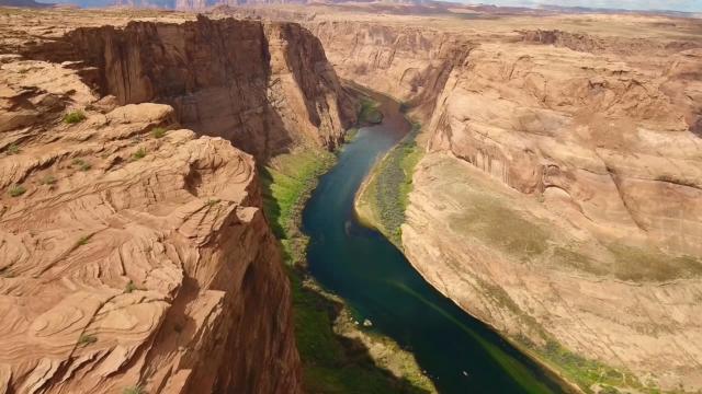
The U.S. won’t see any locations underwater or wiped off the map over the next 30 years, Kamins said, but access to fresh water and insurance premiums will become bigger challenges.
“Every year it becomes increasingly crystal clear, just the amount of risk that we face, whether it’s increasingly severe natural disasters or droughts and heat risk,” he said. “In some cases it’s creating renewed momentum or brand new momentum for governments and businesses that hadn’t been thinking seriously about the impact of climate change before.”
Everyone loses out if others are impacted, because we all rely on goods and services from other states and countries, said climate scientist Michael Mann, director of the Penn Center for Science, Sustainability and the Media at the University of Pennsylvania. “It’s a domino effect.”
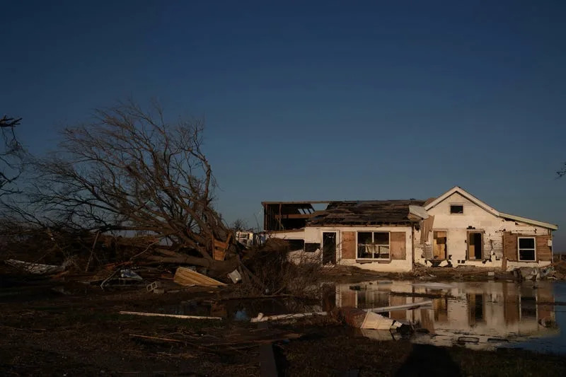
East Coast: Wind, flooding and sea level rise stack the deck against many counties and states, especially Florida and the Carolinas, Kamins said. Bustling economies and distance to the beach still attract people in droves, but at some point the tide literally will turn against communities along beaches and coastal rivers.
Southwest: Heat and fire bring increasing risks, particularly in Arizona, he said, even without factoring in the perils of a dwindling water supply.
Interior: Intense heat may affect these states the most in runaway warming scenarios, Mann said. Sudden downpours with unprecedented rain also are occurring more often, even though these states aren’t in hurricane-prone coastal areas. One study he co-authored showed some of the greatest risk of heat stress could be in urban areas in the Pacific Northwest and Great Lakes.
Idaho to Minnesota: A swath of states across the northern U.S. look better than most, with less-pronounced risks, Kamins said. Recent statistics on an influx of newcomers to Idaho and its burgeoning tech hub in Boise show people may be figuring that out. He expects Montana may be the next frontier within 10-20 years.
What are the causes of climate change? How can it be stopped?
What are the effects of climate change? Disasters, weather and agriculture impacts.
States that may face more climate change risk sooner
Texas – Its sheer size and geography means Texas has a lot of risk. First Street’s data shows some of its counties are at great risk of wildfire, some face higher potential losses from tropical cyclone winds and some have greater flood risks. The Lone Star State leads the nation in billion-dollar disasters, according to information from the National Oceanic and Atmospheric Administration. It averages 5.3 such events a year, double the number it experienced in the previous 20, even adjusted for inflation.
Florida – 8,346 miles of shoreline, surrounded on three sides by water. Need we say more? Rising sea levels and extreme rainfall fueled by warming oceans, with the potential for more intense hurricanes while more people crowd into densely populated areas, increase the risks. Florida has the most top spots on First Street’s list of counties that could see the biggest increases in the number of days with the very warmest temperatures they experience today.
New Jersey – The Garden State has counties among the top of First Street’s lists for potential increases in average annual wind losses, extreme fire risk and properties at risk of flooding. New Jersey suffered three hurricanes or their remnants in 2021-22, including Hurricane Ida, Hurricane Henri and the final vestiges of Hurricane Ian. Forecasts for higher winds from more tropical cyclones and hurricanes aren’t good news.
California – Over the past three years, the state has seen its largest wildfire season in history, its worst drought in 1,200 years and a string of record-setting atmospheric rivers. Golden State residents need no reminder of the risks they face, but First Street’s data shows some California counties high on its lists for most extreme fire risk and some cities with the greatest percentage of residential properties at risk of flooding.
Which states did Moody’s Analytics find face the greatest physical risks?
When it comes to weather-related events, hurricanes are literally the heavy hitters when accounting for acute physical risk. Climate change already is cranking up the rain in some tropical storms and hurricanes and could be slowing them down over land but that research is still underway, scientists say. Floods and wildfires also figured into Kamins’ assessment of physical risks. Here’s his list:
- Florida
- Louisiana
- South Carolina
- North Carolina
- Delaware
- Rhode Island
- New Jersey
- Virginia
- Massachusetts
- Connecticut
Other locations suffer from change happening over time rather than in single headline-grabbing events. Think the creep of rising sea levels or warmer nights and higher average temperatures.
San Francisco faces above average risk across these categories and more, and is the nation’s most exposed large city, Kamins said.

It’s one of those urban areas where residents aren’t used to temperature extremes and many homes don’t have air conditioning, he said. In a world where temperatures rise 5-10 degrees, unlike Floridians, San Francisco residents are ill-equipped for dealing with heat and it could be economically damaging.
Other cities with more gradually increasing risk on the Moody’s Analytics list are:
- Cape Coral, FL
- New York City
- Long Island, NY
- Oakland, CA
- Phoenix, AZ
- Tucson, AZ
- Wilmington, DE
- West Palm Beach, FL
- North Port, FL
Southeastern metropolitan areas are particularly risky because they’re experiencing rising sea levels and higher temperatures, in addition to a parade of cyclones that could be growing more intense, according to Kamins’ study. The top 10:
- Jacksonville, NC
- New Bern, NC
- Myrtle Beach, SC
- Wilmington, NC
- Greenville, NC
- Charleston, SC
- Punta Gorda, FL
- Deltona, FL
- San Juan, PR
- Palm Bay, FL
- Goldsboro, NC
Billion dollar disaster data helps point to states already paying the price as the climate changes.
If there’s any doubt about risks from future climate change, look no further than NOAA’s list of the weather and climate disasters that caused at least $1 billion in damages.
At least 37 states suffered twice the number of billion dollar disasters this century than during the previous 20-years.
Tornado activity appears to be expanding in the Mid-South, with more frequent outbreaks, and a USA TODAY investigation showed extreme rainfall events are occurring more often along the Mississippi River Valley. Scientists say both trends may be linked to the warming Gulf of Mexico.
USA TODAY Investigation How a summer of extreme weather reveals a stunning shift in the way rain falls in America.
But it’s not just weather events causing the disaster toll to rise, NOAA said. More extreme weather events take a greater toll when population and development increase in vulnerable areas.
“Where you live is important, but how you live is just as important,” said Stephen Strader, a meteorologist and associate professor at Villanova University. “There are things we can do to better prepare our current developments for climate change.”
Billion dollar disaster events per year since 2001 (More than 3):
- Texas – 5.3
- Illinois – 3.9
- Georgia – 3.7
- Oklahoma – 3.6
- Missouri – 3.5
- North Carolina – 3.4
- Alabama – 3.3
- Tennessee – 3.3
- Virginia – 3.2
- Kansas – 3.1
- Mississippi – 3.1
More than 300% increase in billion dollar disaster events per year since 2000:
- Arizona – 500%
- Wyoming – 450%
- Utah – 400%
- New Mexico – 367%
- Nevada – 335%
- Nebraska – 320%
- Colorado – 300%
- Wisconsin – 300%
When considering future scenarios, it’s important to note much remains within the world’s control, Mann said.
With substantial action to hold warming below 3 degrees F, “we can limit the worsening of extreme weather events,” although sea level increases would already be locked in, he said. A lack of action would mean “impacts in the interior of our continent could be every bit as bad.”
How taking action could help On Earth Day, scientists tell us what 2050 could be like. Their answers might surprise you.