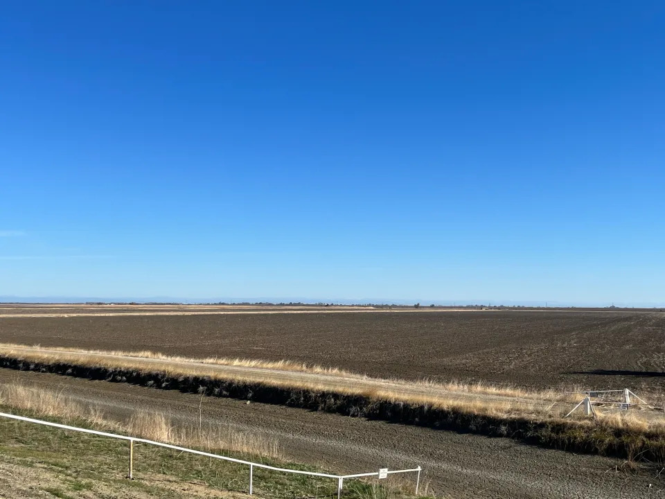
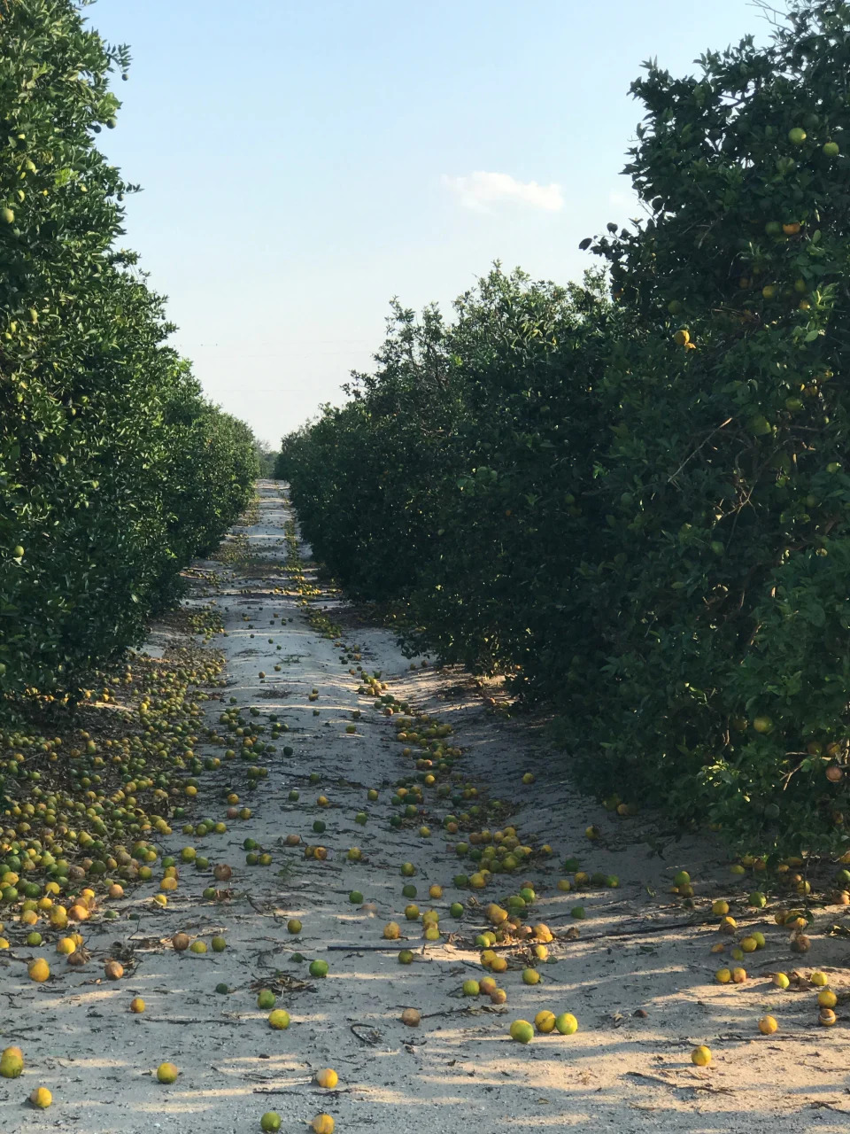
Wish You Were Here. Ignore the Floods and Fires.

The New York Times

Wish You Were Here. Ignore the Floods and Fires.

Lydia DePillis – December 11, 2022

Amy Baefsky, who had to sell 10 percent of her and her husband's hundreds of cow-calf pairs after a lack of rain and brutal winds left little grass for feeding, Ono her way to feed cattle at Fort Union ranch in Watrous, N.M., Nov. 29, 2022. (Ramsay de Give/The New York Times)
Amy Baefsky, who had to sell 10 percent of her and her husband’s hundreds of cow-calf pairs after a lack of rain and brutal winds left little grass for feeding; on her way to feed cattle at Fort Union ranch in Watrous, N.M., Nov. 29, 2022. (Ramsay de Give/The New York Times)

Rock Ulibarri had a vision for his ancestral homestead nestled in a canyon in the mountains of northeast New Mexico: Open it up to tourists, who would pay for pit-smoked pork, mountain bike tours of the craggy terrain and works by local artisans.

He wanted to build the sort of business that could raise local income levels and help rural residents stay on their land, rather than sell to outsiders. That aligned with the state’s plans, too: The governor had created a division in her economic development department to promote outdoor recreation.

So Ulibarri started building campsites and a small guesthouse, even retrofitting the one-room cabin where his father was born. Early this year, he was ready to book a summer of visits.

Then, on an April day with blistering winds following months of only trace rainfall, the mountain went up in flames.

Ulibarri and his partner, Becky Schaller, held out as long as they could, even as the electricity failed and smoke clouded the sky. When the winds turned in their direction and they saw the blaze creeping over the mountain, they loaded up their goats, dogs, horses and parrots into a big trailer and drove slowly down to safety.

Surveying the damage later, they saw their buildings had been spared, but the trees on the ridges were gone — along with the fences they needed to confine their animals, and the trails in the surrounding forest they were counting on for bikers and hikers. Also, the river was running inky black with ash. A year’s worth of food in their freezer had perished. And the business plan was on ice.

By the end of the season, they were able to host one group, and they plan to try again next year. But Ulibarri wonders whether the business model he’d hoped his neighbors could emulate is viable. Even before the fires, he noticed less snow on the mountains and fewer fish in dwindling streams. For years, fire managers had suppressed natural blazes, so there’s still plenty of timber left to burn again.

“Climate change does scare me, a lot, because we really don’t know what it’s going to look like, you know?” he said. “Just what I’ve seen so far in my lifetime, the changes are incredible.”

The changes are indeed incredible. So are the costs.

The study of how climate change affects economies is still relatively nascent, but evolving fast. Economists are grappling with bigger shocks than even scientists had anticipated, in the form of catastrophic events like hurricanes and wildfires, as well as the slow, creeping influence of drought, extreme heat and rising sea levels.

Unlike its neighbors to the east and west, New Mexico is tackling the economic challenge head-on, passing legislation and funding programs to mitigate the effects of climate change. Complicating that effort: The state’s primary taxpayer, the oil and gas industry, is also the main source of the disruption.

For that reason, New Mexico faces what economists call “physical risk” and “transition risk”: the financial damages of extreme weather and shifting temperatures, and the damage caused by doing something about it. To offset those risks, the state is working to diversify into other industries. The problem is, some of those that offer the most potential are vulnerable to climate change themselves.

“In looking for alternatives to extraction as ways to fuel New Mexico’s economy, the two that always jump out most immediately are tourism or outdoor recreation and agriculture,” said Kelly O’Donnell, an economic consultant. “And obviously those are two of the industries that very likely will suffer extreme damage from fires, floods and drought.”

Getting ‘Hit Over and Over’

The days before the fire carried a sense of foreboding — different, Phoebe Suina remembers, from years past. She had dealt with the aftermath of many blazes before, as an environmental engineer who helps communities respond to natural disaster. This time, it had barely rained in the northern part of the state in months, the snowpack was already gone, humidity was minimal and the winds were so intense that it was hard to walk outside.

“This April, I remember having that sinking feeling — how I can explain it in English is, all the elements of a major imbalance were occurring,” Suina said. “And it wasn’t going to be a one-time thing. We have to figure out how we’re going to survive.”

The Hermit’s Peak and Calf Canyon fires started in April, after the U.S. Forest Service conducted what was supposed to have been a controlled burn to thin the dense undergrowth. High winds whipped both fires into a megacomplex that ultimately torched 342,000 acres across three counties, and wasn’t fully controlled until mid-August.

Then came the flooding. With no trees to hold back the mountains, monsoon season sent rivers of sediment coursing through the gullies, spilling over roads and onto the homes below. Irrigation channels have been filled with dirt and rocks, but there’s no point in dredging them until the deluges stop.

Michael Maes’ home in Mora, an Edenic valley town a few canyons away from Ulibarri’s place, stands right in the path of this water. At one point, it rose to his waist, and even after clearing out all the mud, he had to scramble repeatedly to channel fresh flooding around the structure instead of through it. Water pressure has remained low, so he’s had to carry buckets around just to flush toilets.

“We just get hit over and over,” Maes said. All of that work kept him from his day job, cutting hair about 40 minutes down the valley, and drained his savings. Every time the sky darkens, he keeps in touch with friends on a text chain, dreading the wreckage that follows. “There’s a cloud that rolls over, all of a sudden,” he said, and the question is: “Who’s going to get it today?”

Because the U.S. Forest Service took responsibility for the fire, it is footing the bill for reconstruction and compensating those who suffered financial losses with an aid package worth $2.5 billion. Eventually, if people are able to prove their claims — a complicated endeavor in a place where property ownership often isn’t fully documented — they should be made whole. Meanwhile, the White House is asking for $2.9 billion more, as part of a $37 billion package for victims of the year’s natural disasters across the country.

In New Mexico, the physical risk from climate change comes in two forms. One is the creeping loss of prosperity brought on by prolonged drought, which in the Mora area had already completely dried up the system of ditches that had irrigated crops and watered cattle for generations. Catastrophic fire exemplifies the other kind: a destructive event that vaporizes assets all at once.

Mora County, population 4,200, has seen both. Long sustained by small-scale agriculture and logging, local nonprofits had been working to develop a tourism economy. They were building up a social media presence, and one group even talked to film studios drawn by the sweeping views and ranches that seem right out of the Old West.

The vision is to become something more like Colorado, where the Commerce Department reported that outdoor recreation generated $6.1 billion in salaries in 2021; New Mexico brought in only $1.2 billion.

This year, rather than promote economic development, Mora officials tried to just keep people alive and restore what they had lost. Airbnbs burned alongside primary residences, the few hotels filled up with reconstruction workers and the landscape was left so scarred that film studios would have to rewrite their scripts.

In Taos, Awaiting Disaster

On the other side of the mountain from Mora, Taos has been watching closely.

Although the fires never reached the posh ski town or its magnificent surroundings, Sanjay Poovadan, a real estate broker and landlord, saw the fires’ effect immediately in bookings of his rental properties. “People said, ‘We hear there’s a fire in the Hermit’s Peak area, and it’s near Taos, so we’re canceling; we don’t want to be breathing that air,’” Poovadan recalled. “And, of course, why do you come to northern New Mexico? Because you get clean air.”

That kind of hit is particularly hard for the outdoor economy, given its seasonality — a forest that’s closed for one month can wipe out one-third of a business’ profits.

A direct hit from a wildfire would multiply that effect many times over. And although there’s more forest-thinning activity around Taos than there had been around Mora — in part because of a billion-dollar effort led by the Nature Conservancy — the task is so vast that a major fire seems inevitable.

In an explicit acknowledgment of the risk, the city has devoted $10,000 of the revenue from its lodgers tax — which by statute has to fund tourism promotion — for forest restoration. “We’re making the argument that if the fire had come over to our side of the mountain, we would’ve had no tourism at all,” Mayor Pascualito Maestas said.

The Taos Ski Valley, a resort that’s been operating since the 1950s, is at a relatively high elevation and says it has more snow than other increasingly desperate ski areas across the West. But it hasn’t been unscathed: Last year, a freak windstorm took out a huge swath of mature trees, as if mowing the lawn.

Regardless of whether another fire erupts, climate change has already made living in Taos more difficult, and more expensive. Air conditioning is now needed to stay comfortable in the summer, and home insurance premiums are skyrocketing, given the likelihood of having to rebuild a burned home. Meanwhile, Taos’ relative isolation and lack of other disasters like hurricanes has attracted a new influx of high-income, part-time residents who have created a housing crunch for locals.

Poovadan sees both sides of that squeeze. He worries that when a big fire does come, the most harmed will be those with no other place to go.

“The folks who can afford to leave will leave,” Poovadan said. “And the people here will be picking up the pieces.”

From Drought to Flood

The extremes that increasingly characterize New Mexico’s climate are even harder to deal with when you don’t know when they’ll arrive. That especially applies to water: There’s not enough, except for when there’s too much.

Consider Nick Baefsky and Amy Wright, who have more food than they need for the number of mouths they have to feed. Six months ago, they had the opposite problem.

The couple, who manage cattle on a 96,000-acre ranch on a vast plain beneath the mountains that burned over the summer, had to sell 10% of their hundreds of cow-calf pairs in the spring. Rains hadn’t arrived to green up the fields, and brutal winds sheared off the grass left standing, so there wasn’t enough for them to eat.

“It felt like it was the worst it could be,” said Wright, relaxing after a long day fixing fences. They kept checking the weather forecasts but couldn’t see a safe path through to the rainy season.

The other snag: Despite investing in pipes and troughs to supplement natural watering holes, some of the 40 wells that the ranch has to keep the cows hydrated are producing less water, as the aquifers beneath them dry up. “Even if there was good grass, if you can’t water them, you can’t run them,” Baefsky said.

Then, at the end of June, it started raining. And raining. At that point, they could easily have supported the extra cattle. But buying them back is expensive.

Not everyone is so much at the mercy of rain. Some farmers of high-value cash crops have more control over their water supply, through deep aquifers and rights to divert from the state’s major rivers. They have figured out ways to maintain their yields.

Expansive pecan groves, whose owners drilled deep wells in the 1950s and which produce more of the nuts than any state save Georgia, would pay any price to avoid having to rip out their trees. Farmers of New Mexico’s iconic chiles, under pressure from drought, have invested in technology to get more from less acreage.

There are limits to even that degree of control, however.

Mike Hamman, the state engineer, is in charge of maximizing the water supply when nearly all of it is spoken for and the total pool is shrinking. After years of increasing efficiency, returns are diminishing.

“I would say we’ve squeezed that sponge out pretty good by now,” Hamman said.

What Climate Change Costs

The fires in the spring are just a snapshot of climate change’s economic impact in one year, in one corner of the state. To add it all up beyond that is a daunting task, but there have been attempts.

In 2009, Ernie Niemi, an environmental and economic development consultant, worked up a forecast for how climate change would affect New Mexico’s economy at various points in the future. It was part of a project housed at the University of Oregon that aimed to show state legislators, wary of hurting their economies by easing off fossil fuels, the cost of doing nothing.

He found the cost would be about $1.7 billion by 2020 — including $488 million for wildfire costs, $421 million for health-related expenses and $286 million for lost recreation opportunities. He imagined the figure would be much larger, in ways they couldn’t calculate. The list includes costs from more frequent and intense storms — and items like regulations for protecting additional endangered species.

In an update for the state of Oregon in 2018, Niemi found that costs had significantly escalated, and the same was likely true for New Mexico.

Now, estimates are piling up for how climate change will affect the national and even global economy — moving beyond the cost of an individual hurricane or fire, and ballparking the economic drag from rising temperatures. The World Meteorological Organization, for example, has calculated that the U.S. economy has lost $1.4 trillion to climate-related weather events over the past 50 years, while Deloitte says it stands to lose an additional $14.5 trillion over the next 50, if further warming isn’t averted. For the first time, this year the draft U.S. National Climate Assessment includes a chapter on economic effects.

But the economic damage of climate change isn’t always measurable by traditional methods, because the full value of nature isn’t computed in gross domestic product. A forest doesn’t have statistical worth until it’s cut down — even though it cleans the air and sequesters carbon in a way that blunts the damage to human civilization down the line.

That’s why the federal government is developing “natural capital accounts,” a standardized way of valuing healthy ecosystems. A state can figure out what it’s worth to keep forests thinned so they’re less likely to erupt in flames and more likely to stay in place to keep mountaintops from washing into valleys.

That’s the kind of math Joshua Sloan is doing. The associate vice president at New Mexico Highlands University, he has tried to convince the state legislature that it’s worth spending $68 million on a reforestation center. If built, it could supply seedlings to burned acreage across the western United States, generating both revenue and the forests on which communities depend.

So far, lawmakers haven’t agreed.

“Typically direct costs are much more immediately felt than those more diffuse social and ecological benefits,” Sloan said.

Predicting the Future

Two and a half billion dollars: That’s the budget surplus New Mexico ended up with for fiscal year 2024, most of it from higher gas prices that increased royalties from oil and gas extraction in the Permian Basin, the nation’s most productive oil field. All in all, the industry supplied about 40% of the state’s general fund revenues in 2022.

That money is a huge windfall for a historically poor state that has few other major industries. But it also represents “transition risk”: the collateral damage incurred by decline in the use of fossil fuels.

That dynamic was on display in October in Santa Fe, in the stately round building that houses New Mexico’s all-volunteer Legislature. Oil and gas revenues pay for lots of things, including addressing what emissions can lead to: For fiscal year 2023, out of an $8.4 billion budget, the Legislature appropriated $36.7 million for climate change resilience, mostly in drought mitigation; $42 million for energy-efficiency initiatives; and $105.8 million in water infrastructure and wildfire prevention. In the halls of the Capitol, agriculture lobbyists and environmental advocates were asking for hundreds of millions more.

Despite the riches the industry pumps into state coffers, legislators are uneasy.

“I support oil and gas, but I am concerned that they have an inordinate place in our revenue structure,” said state Sen. Patty Lundstrom, who heads the powerful Appropriations Committee.

Lundstrom is from Gallup, in the northwest part of the state. The region is facing the retirement of two coal plants required by the Energy Transition Act of 2019, which committed the state to meeting aggressive renewable energy targets for its own utilities. The state is pursuing federal funding to potentially convert some of that infrastructure to produce hydrogen. The resulting fuel emits zero carbon, but it would likely require lots of natural gas — and water — to run. For that reason, the state’s environmentalists have been dead set against the idea, which Lundstrom finds confounding.

“Because we’re looking at reducing carbon emissions, we need to embrace things like hydrogen so we can get to that point,” she said. “If we don’t, we’ve lost everything. We’ve lost not only those industrial jobs, but the opportunity for industrial jobs.”

Rather than a complicated, energy-intensive project like hydrogen, environmentalists say the state should focus on conserving land for outdoor recreation, investing in more sustainable agriculture methods such as those practiced by Native communities, and pursuing the billions of dollars unlocked by the Inflation Reduction Act for wind and solar energy.

While in-state energy needs are mostly met, demand across the West could support thousands more megawatts per year. New Mexico has the land, wind and sun for it. It also has an untapped resource: a relatively high share of people who aren’t working, which means thousands of people who could be deployed to build things.

However, even if wind and solar installations were erected as rapidly as possible, when the construction phase is over, the industry couldn’t employ everyone who might want to leave jobs in oil and gas.

“If we expect renewables to replace oil and gas 1-to-1, we will never be satisfied,” said Rikki Seguin, the executive director of Interwest Energy Alliance, a trade group of wind and solar developers.

Dealing with physical risk and transition risk at the same time is a dizzying task. One way to tackle both at once is employing people to fix the problems caused by climate change, whether it’s planting seedlings or developing drought-tolerant crops.

Getting that started is expensive, but there’s probably no better time to do it. With billions of dollars filtering down from the federal government, New Mexico has the potential to develop whole new industries devoted to restoring fire-scarred lands and adapting to survive with ever-shrinking supplies of water. Other regions face similar challenges. Such expertise could even become an export itself — partially replacing the revenues that oil and gas now supplies in abundance.

Nathan Small, a state representative from the Las Cruces area, has been among those trying to smooth New Mexico’s transition to an economy that’s viable. Its best chance to get there, he thinks, goes beyond resilience inside the state. It’s marketing techniques for how to live on a hotter planet. It is, in his view, a growth industry.

“We have to reckon with the challenge that in 10, 15, 30 years, that these might be considered pretty good years,” he said.
Arizona Gov. Ducey stacks containers on border at term’s end

Associated Press

Arizona Gov. Ducey stacks containers on border at term’s end

Anita Snow and Ross D. Franklin – December 11, 2022

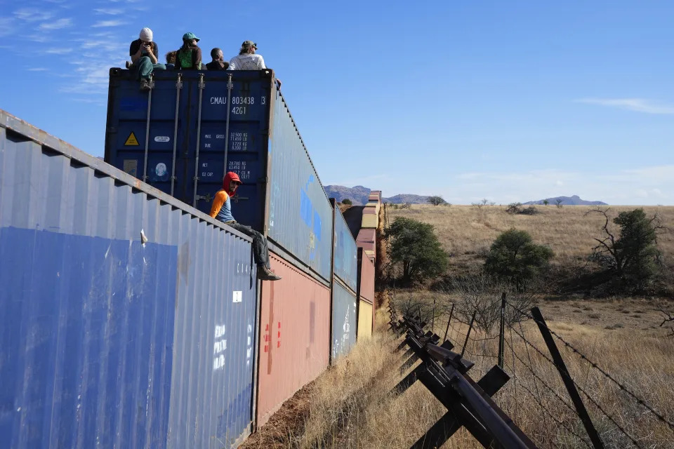
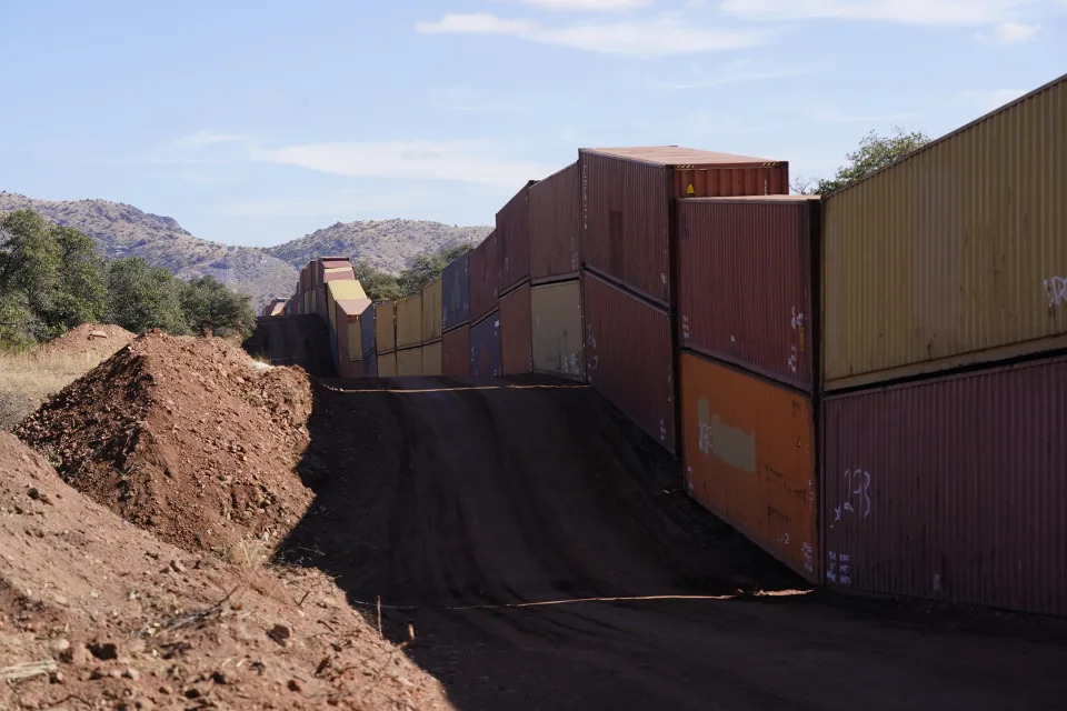
A long row of double-stacked shipping contrainers provide a new wall between the United States and Mexico in the remote section area of San Rafael Valley, Ariz., Thursday, Dec. 8, 2022. Work crews are steadily erecting hundreds of double-stacked shipping containers along the rugged east end of Arizona’s boundary with Mexico as Republican Gov. Doug Ducey makes a bold show of border enforcement even as he prepares to step aside next month for Democratic Governor-elect Katie Hobbs. (AP Photo/Ross D. Franklin)
Activists sit on newly installed shipping containers along the border creating a wall between the United States and Mexico in San Rafael Valley, Ariz., Thursday, Dec. 8, 2022. Work crews are steadily erecting hundreds of double-stacked shipping containers along the rugged east end of Arizona’s boundary with Mexico as Republican Gov. Doug Ducey makes a bold show of border enforcement even as he prepares to step aside next month for Democratic Governor-elect Katie Hobbs. (AP Photo/Ross D. Franklin)

Work crews have steadily erected hundreds of double-stacked shipping containers topped by razor wire along Arizona’s remote eastern boundary with Mexico in a bold show of border enforcement by Republican Gov. Doug Ducey even as he prepares to leave office.

Until protesters slowed, then largely halted the work in recent days, Ducey pressed forward over the objections of the U.S. government, environmentalists and an incoming governor who has called it a poor use of resources.

Democratic Gov.-elect Katie Hobbs said last week she was “looking at all the options” and hasn’t decided what to do about the containers after her Jan. 5. inauguration. She previously suggested the containers be repurposed as affordable housing, an increasingly popular option for homeless and low-income people.

“I don’t know how much it will cost to remove the containers and what the cost will be,” Hobbs told Phoenix PBS TV station KAET in an interview Wednesday.

Federal agencies have told Arizona the construction on U.S. land is unlawful and ordered it to halt. Ducey responded Oct. 21 by suing federal officials over their objections, sending the dispute to court.

Environmental groups say the containers could imperil natural water systems and endanger species.

“A lot of damage could be done here between now and early January,” said Russ McSpadden, a Southwest conservation advocate for the Center for Biological Diversity who has regularly traveled to the site since late October.

Ducey insists Arizona holds sole or shared jurisdiction over the 60-foot (18.2 meter) strip the containers rest on and has a constitutional right to protect residents from “imminent danger of criminal and humanitarian crises.”

“Arizona is going to do the job that Joe Biden refuses to do — secure the border in any way we can.” Ducey said when Arizona sued the U.S. government. “We’re not backing down.”

The federal agencies want Ducey’s complaint dismissed.

Border security was a focus of Donald Trump’s presidency and remains a potent issue for Republican politicians. Hobbs’ GOP rival, Kari Lake, campaigned on a promise to dispatch the National Guard to the border on her first day in office. Texas Republican Gov. Greg Abbott, recently reelected to a third term, has pushed to keep building Trump’s signature wall on the mostly private land along his state’s border with Mexico and has crowdsourced funds to help pay for it. He also has gotten attention for busing migrants to Democratic-led cities far from the southern border, including New York City, Chicago, Philadelphia and Washington, D.C.

Ducey’s move comes amid a record flow of migrants arriving at the border. U.S. border officials have stopped migrants 2.38 million times in the fiscal year that ended Sept. 30, up 37% from the year before. The annual total surpassed 2 million for the first time in August and is more than twice the highest level during Trump’s presidency, in 2019.

Ducey’s container wall effort began in late summer in Yuma in western Arizona, a popular crossing point, with scores of asylum-seekers arriving daily and often finding ways to circumvent the new barriers. The containers filled areas left open when Trump’s 450-mile (724 km) border wall was built. But remote San Rafael Valley — the latest construction site — is not typically used by migrants and was not contemplated in Trump’s wall construction plan. McSpadden said he has not seen migrants or Border Patrol agents there, just hikers and backpacking cyclists.

The construction there stretches from oak forests in the Huachuca foothills southeast of Tucson and across the valley’s grasslands. As of the middle of last week, cranes had transported more than 900 blue or rust-colored metal containers down a dirt road freshly scraped into the landscape, then double stacked them up to 17 feet (5.2 meters) high alongside waist-high vehicle barriers of crisscrossed steel. Workers bolted the containers together and welded sheet metal over gaps.

Still, yawning gaps remain in the new container wall, including an open space of several hundred yards (meters) on terrain far too steep to place the containers. In some low lying wash areas there are gaps nearly three feet (1 meter) wide.

Environmental activists demonstrating at the Cochise County site in the past week largely stopped the work in recent days by standing in front of construction vehicles. One recent day, a dozen demonstrators sat atop stacked containers or in camp chairs near tents and vehicles where they sleep.

The work in Yuma cost about $6 million and wrapped up in 11 days with 130 of the containers covering about 3,800 feet (about 1,160 meters). The Bureau of Reclamation told Arizona it violated U.S. law by building on federal land. The Cocopah Indian Tribe also complained the state did not seek permission to build on its nearby reservation.

The newer project is far larger, costing some $95 million and using up to 3,000 containers to cover 10 miles (16 km), in Arizona’s southeastern Cochise County. The U.S. Forest Service also told Arizona to halt its work in the Coronado National Forest, and recently alerted visitors to potential hazards posed by construction equipment involved in the state’s “unauthorized activities.”

The Center for Biological Diversity has sided with the federal government’s position that the construction violates U.S. law.

While Ducey’s lawsuit does not address environmental concerns, groups like the center say the work in the Coronado National Forest imperils endangered or threatened species like the western yellow-billed cuckoo and the Mexican spotted owl, as well as big cats including the occasional ocelot.

The biologically diverse region of southeastern Arizona is known for its “sky islands,” or isolated mountain ranges rising over 6,000 feet (1,828 meters) above “seas” of desert and grasslands. Wildlife cameras in the region regularly photograph black bears, bobcats, ringtails, spotted skunks, white-nosed coatis and pig-like javelina.

McSpadden said the work has toppled oak and juniper trees and he’s found spools of razor wire and other construction debris on national forest land.

Environmentalists warn of the dangers of placing the containers atop a watershed of the San Pedro River that floods during the monsoon season each summer. Just south of the border lies a protected area called Rancho Los Fresnos, home to the beaver, a threatened species in Mexico.

Biologist Myles Traphagen of Wildlands Network told a briefing on border issues last month that much damage caused during the Trump administration’s border wall construction was never fixed. Last year, he mapped the Arizona and New Mexico sections of that border wall to highlight damaged areas. A report this year highlights areas the group considers priorities for reconstruction.

Dynamite blasts forever reshaped the remote Guadalupe Canyon in Arizona’s southeast corner. Towering steel bollards closed off wildlife corridors, preventing animals like tiny elf owls, pronghorns and big cats from Mexico to cross into the U.S. to hunt and mate.

‘Firmageddon’: Researchers find 1.1 million acres of dead trees in Oregon

NBC News

‘Firmageddon’: Researchers find 1.1 million acres of dead trees in Oregon

Evan Bush – December 11, 2022

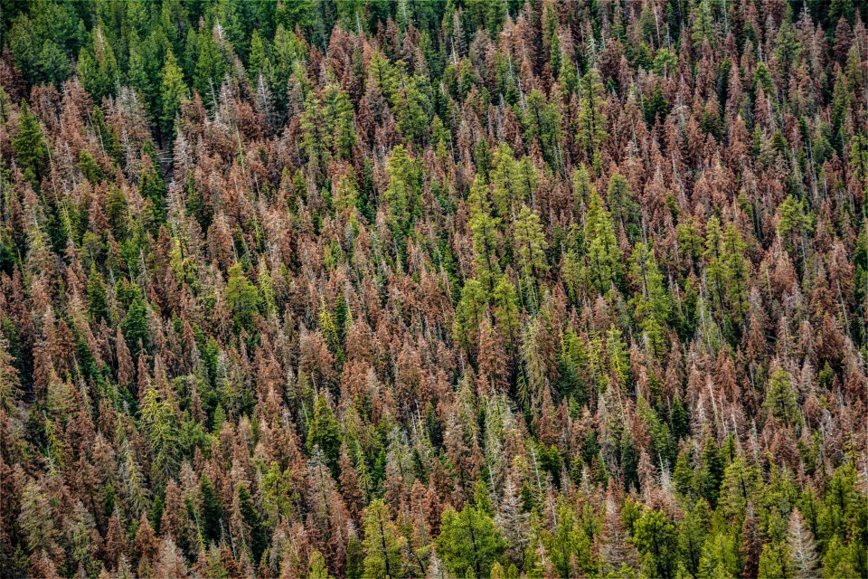
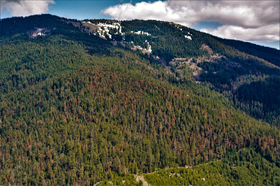
Drought-stricken Oregon saw a historic die-off of fir trees in 2022 that left hillsides once lush with green conifers dotted with patches of red, dead trees.

The damage to fir trees was so significant researchers took to calling the blighted areas “firmageddon” as they flew overhead during aerial surveys that estimated the die-off’s extent.

The surveyors ultimately tallied about 1.1 million acres of Oregon forest with dead firs, the most damage recorded in a single season since surveys began 75 years ago.

Oregon’s dead firs are a visceral example of how drought is reshaping landscapes in Western states that have been experiencing extreme heat conditions. In many areas, these firs might be replaced by more drought-hardy species in the future, reshaping how ecosystems function and changing their character.

“When I looked at it and crunched the numbers, it was almost twice as bad as far as acres impacted than anything we had previously documented,” said Danny DePinte, an aerial survey program manager for the U.S. Forest Service. “Nature is selecting which trees get to be where during the drought.”

Fir die-off as observed during this year’s aerial survey in the Fremont-Winema National Forest in southern Oregon. (Daniel DePinte / USFS)

Oregon is known for towering volcanic domes covered by a blanket of conifers that becomes sparse and patchwork on the eastern side of the Cascade Mountains before it tucks into the high desert.

The people who know the trees best say there are many signs of problems in Oregon.

“We’re seeing forms of stress in all of our species of trees,” said Christine Buhl, a forest entomologist with the Oregon Department of Forestry. “We just need to shift our expectations of what tree species we can expect to be planted where.”

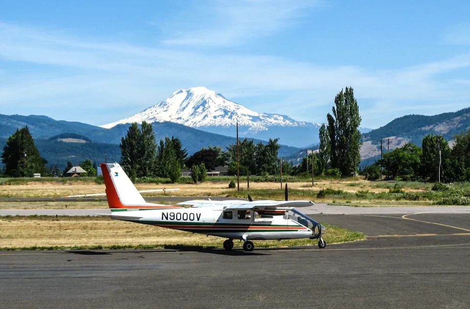
Researchers have been surveying Pacific Northwest forests by air since 1947. Little about the process has changed during that time, according to Glenn Kohler, an entomologist with the Washington State Department of Natural Resources, which operates the program alongside the U.S. Forest Service and Oregon Department of Forestry.

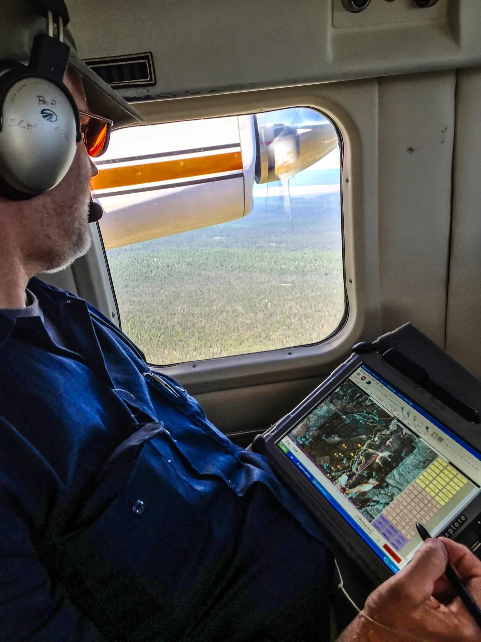
Each summer, small high-wing planes soar about 1,000 feet above the tree canopy at about 100 mph. Trained observers peer outside both sides of the plane, looking for noticeable damage to trees.

Dead trees — conifers that are completely red or orange — are the easiest to spot, but the observers can also pinpoint trees that are barren of needles in some areas.

The observers rate the intensity of damage and map its location. Pilots fly in a grid pattern with flight lines about 4 miles apart to cover every swath of the forest.

“It’s literally like mowing the lawn,” Kohler said of the flight trajectory.

Paper maps of the past have been replaced today by Samsung Galaxy tablets that track the plane’s progress and make mapping easier — and probably more accurate.

Observers require a season of training, Kohler said. It can be a dizzying task.

Brent Oblinger, a plant pathologist on the Deschutes National Forest, while in the process of conducting a portion of the survey. (USFS)

“We’re analyzing 16-30 acres per second,” DePinte said, noting that small planes can offer a more turbulent ride. “You definitely have to have a stomach of steel.”

This year, the aerial observation program flew over about 69 million acres of Washington and Oregon forest in about 246 hours.

“We’re just really painting the picture. It’s not hard science. You’re not counting individual trees or inspecting individual trees. The purpose is — what are the major trends and to detect outbreaks,” Kohler said.

The scale of damage in Oregon, which was first reported by the environmental journalism nonprofit Columbia Insight, was staggering to the researchers and begs for a more thorough study.

“We had never seen anything to this level,” DePinte said. “It sets you back and makes you pause. Your scientific mind starts questioning why. We don’t always have the answers.”

Trees are susceptible to bark beetles, root diseases and defoliators like caterpillars. Aerial surveys help researchers capture the booms and busts of these pathogens.

Healthy trees typically can defend themselves against these threats. When beetles drill into a trees’ bark, for example, a healthy tree can push the beetles out by excreting pitch, a gooey substance, where they entered the tree, Kohler said.

Each summer, small high-wing planes soar about 1,000 feet above the tree canopy at about 100 mph, trained observers peer outside both windows of the plane, looking for noticeable damage to trees.  (USFS)
Each summer, small high-wing planes soar about 1,000 feet above the tree canopy at about 100 mph, trained observers peer outside both windows of the plane, looking for noticeable damage to trees. (USFS)

But disturbances like drought, wildfire and windstorms can stress trees and weaken their defenses. Large numbers of dead and dying trees could allow bark beetles to lay eggs, feed their larvae and flourish.

Scientists still only have a coarse understanding of the factors that are causing widespread die-offs in Oregon, but many view drought as the underlying culprit.

“There are multiple factors at play here. One of the things most of us agree on: The primary factor we have going on here is hot drought,” Buhl said, meaning that the state has been hampered by higher-than-normal temperatures and also low precipitation.

DePinte said damage was most pronounced in White, Shasta and Red firs on the eastern side of the Cascade Mountain range’s crest, where the climate is drier.

Nearly half of Oregon is experiencing severe, extreme or exceptional drought, according to the U.S. Drought Monitor. The drought is worse in eastern Oregon.

Oregon’s average temperatures have risen about 2.2 degrees Fahrenheit since 1895, according to a 2021 state climate assessment delivered to the state’s Legislature. The severity of drought has increased over the past two decades in part because of human-caused climate change, the report says. Summers in Oregon are expected to become warmer and drier.

“We’ve been hearing about climate change for some time. Climate change is happening. We’re now feeling it,” Buhl said. “These summers are getting warm and long. We’re seeing evidence on the landscape. We needed to pay more attention decades ago, but we didn’t.”

Buhl said impacts to forest health are taking out roughly as many trees as wildfires, which are also now  more likely and more intense by climate change.

Heat waves are a growing threat, too. On Oregon’s west side, trees were scorched by the June 2021 heat dome, which sent Portland’s temperature as high as 116. Scientists have said the intense heat wave was “virtually impossible” without climate change.

Fir die-off as observed during this year’s aerial survey in the Fremont-Winema National Forest in southern Oregon. (USFS)

Aerial assessments last year documented nearly 230,000 acres of heat scorch across Oregon and Washington, DePinte said. Most of the damage was on hillsides with south-facing aspects that soak up more sunlight because of the sun’s angle in the sky.

“It was the combination of the high temperatures in the afternoon with the sun boring down,” said Chris Still, a professor in the College of Forestry at Oregon State University. “We think a lot of those leaves just cooked in place.”

Still speculated that the heat dome could have contributed to this year’s fir die-off, also, but more research and evidence is needed to examine any possible connection.

DePinte said the 2021 scorching was the largest ever recorded, which means the Pacific Northwest has now seen two events of record-breaking damage in its forests in as many years.

Finding safe haven in the climate change future: Alaska and Hawaii

Yahoo! News

Finding safe haven in the climate change future: Alaska and Hawaii

David Knowles, Senior Editor – December 10, 2022

This Yahoo News series analyzes different regions around the country in terms of climate change risks that they face now and will experience in the years to come. For other entries in the series, click here.

As the negative consequences of rising global temperatures due to mankind’s relentless burning of fossil fuels become more and more apparent in communities across the United States, anxiety over finding a place to live safe from the ravages of climate change has also been on the rise.

“Millions and likely tens of millions of Americans” will move for climate reasons through the end of the century, Jesse Keenan, an associate professor of real estate in Tulane University’s School of Architecture, told Yahoo News. “People move because of school districts, affordability, job opportunities. There are a lot of drivers, and I think it’s probably best to think about this as ‘climate is now one of those drivers.’”

In late October, a report by the United Nations concluded that average global temperatures are on track to warm by 2.1 to 2.9° Celsius by the year 2100. As a result, the world can expect a dramatic rise in chaotic, extreme weather events. That increase is already happening. In the 1980s, the U.S. was hit with a weather disaster totaling $1 billion in damages once every four months, on average. Thanks to steadily rising temperatures, they now occur every three weeks, according to a draft report of the latest National Climate Assessment, and they aren’t limited to any particular geographical region.

Warmly clad visitors in single file pick their way through a melting glacier.
Melting ice water flows past visitors on a guided tour July 10 on the Matanuska Glacier, which feeds water into the Matanuska River, near Palmer, Alaska. (Patrick T. Fallon/AFP via Getty Images)

To be sure, calculating climate risk depends on a dizzying number of factors, including luck, latitude, elevation, the upkeep of infrastructure, long-term climate patterns, the predictable behavior of the jet stream and how warming ocean waters will impact the frequency of El Niño/La Niña cycles.

“No place is immune from climate change impacts, certainly in the continental United States, and throughout the U.S. those impacts will be quite severe,” Keenan said. “They will be more severe in some places and less severe in other places. Certain places will be more moderate in terms of temperature and some places will be more extreme, but we all share the risk of the increase of extreme events.”

In this installment, we look at the two U.S. states separated from the lower 48, neither of which was included in the rankings of counties compiled by the ProPublica and the New York Times that formed the backbone of this series.

Alaska

Broken-up chunks of sea ice arrive at a broad swath of shoreline.
Chunks of sea ice float off Utqiagvik, formerly known as Barrow, Alaska, in July 2018. (Yereth Rosen/Reuters)

The coldest U.S. state in terms of annual mean temperature, Alaska is also America’s fastest-warming one. Since 1970, the average temperature in Alaska has risen a disconcerting 4.22°F, unleashing an array of hazards that have upended daily life.

On Monday, the northernmost city in Alaska, Utqiagvik, smashed its all-time winter high temperature record by an astonishing 6°F, when it hit 40°F, despite the fact that it lies 300 miles north of the Arctic Circle.

“Every new day brings with it new evidence of climate change in Alaskan communities — warmer, record-breaking temperatures have resulted in thawing permafrost, thinning sea ice, and increasing wildfires,” the Alaska Department of Commerce states on its website. “These changes have resulted in a reduction of subsistence harvests, an increase in flooding and erosion, concerns about water and food safety and major impacts to infrastructure: including damage to buildings, roads and airports.”

The upper third of Alaska is located inside the Arctic Circle, a place where temperatures this month have so far been observed at an average of 11.5°F above normal, according to data provided by the University of Maine.

A hybrid touristic boat threads its way through clumps of sea ice.
The Kvitbjorn (Polar Bear, in Norwegian), a hybrid boat with a diesel motor and electric batteries, makes its way on May 3 through sea ice in the Borebukta Bay, near Isfjorden, in Svalbard Archipelago, northern Norway. (Jonathan Nackstrand/AFP via Getty Images)

Until recently, the portion of Alaska inside the Arctic Circle rarely, if ever, experienced wildfires. A 2020 study by researchers at the University of Alaska, however, found that climate change has made wildfires in the state much more common, because higher temperatures dry out vegetation more rapidly and shorten the amount of time that snow covers the ground.

The snowpack in Alaska now accumulates a week later, on average, than in the 1990s, and melts away two weeks earlier. Large fires have been starting earlier and lasting longer. Fire season in the state now lasts a month longer than it did 30 years ago.

That has resulted in a steady uptick in the number of acres burned.

“From 2000 to 2020, 2.5 times more acres burned than in the previous 20 years, and 3 of the 4 highest-acreage fire years have occurred since 2000,” the U.S. Department of Agriculture notes on its website.

Also on the rise are so-called “zombie fires” that feast not just on the trees of the boreal forest but also duff, an organic layer of dead, dried-out plants that covers much of the ground and helps insulate the permafrost. Zombie fires are fires believed to have been extinguished that keep burning throughout the harsh Alaskan winter, even under snow cover. “From 2005 to 2017, fire managers in Alaska and in Canada’s Northwest Territories reported 48 zombie, or holdover, fires that survived the long winter,” Scientific American reported in 2021.

In a wooded area of downed, burned saplings, smoke rises from a hot spot.
Smoke rises from a hot spot in the Swan Lake Fire scar at Alaska’s Kenai National Wildlife Refuge in June 2020. (Dan White/AlaskaHandout via Reuters)

Higher temperatures have dramatically increased evaporation rates, so that even relatively short periods with scant precipitation have the effect of transforming Alaska’s flora into the equivalent of ready-to-burn kindling. That gives zombie fires the opportunity to reemerge, making the state much more vulnerable in general to wildfire risk.

“The frequency of these big seasons has doubled from what it was in the second half of the 20th century,” Rick Thoman, a climate specialist with the Alaska Center for Climate Assessment and Policy at the University of Alaska’s International Arctic Research Center, told the PBS News Hour. “And there’s no reason to think that’s not going to continue.”

While sea level rise in Alaska is not, for the moment, as great a problem as in other coastal areas, due to the fact that plate tectonics is pushing land higher at a rate outpacing the rising ocean, steadily dwindling sea ice has left thousands of residents, not to mention polar bears, at risk of storms, which have become more intense due to rising temperatures.

“With climate change and a warming climate, sea ice is being impacted. A lack of sea ice is going to mean that there’s no longer any protection from the fall/winter storms that come in,” Jason Geck, a glaciologist at Alaska Pacific University, told the Associated Press in October. “Instead, we’re having major storm events that are happening more frequently, and we’re having major storm events that are causing a lot more coastal erosion.”

The uncanny blue face of the melting LeConte Glacier, with a swill of broken ice chunks in front of it.
The glacier face of the LeConte Glacier, a tidal glacier in LeConte Bay, in Tongass National Forest, Southeast Alaska. (Wolfgang Kaehler/LightRocket via Getty Images)

Winter storms are not caused by climate change, but recent studies have concluded that the disappearance of sea ice and the continued warming of the ocean will continue to supercharge storms in Alaska by the end of the century.

“Alaska can expect three times as many storms, and those storms will be more intense,” Andreas Prein, a scientist with the U.S. National Center for Atmospheric Research and the author of the 2021 studies on sea ice, said in a statement. “It will be a very different regime of rainfall.”

Already, several Indigenous tribes are being forced to decide whether to abandon their waterfront villages due to persistent flooding and erosion.

“Arctic residents, communities, and their infrastructure continue to be affected by permafrost thaw, coastal and river erosion, increasing wildfire, and glacier melt,” the U.S. Climate Resilience Toolkit states on its website. “As temperatures continue increasing, individuals and even whole communities will need to decide how and where to live.”

In October, the Alaska Department of Fish and Game announced that it was, for the first time ever, canceling the snow crab fishing season due to the collapse and disappearance of 90% of the crab population. In a letter to Department of Commerce Secretary Gina Raimondo seeking a declaration of a fishery disaster for both Bristol Bay and the Bering Sea, Alaska’s Republican Gov. Mike Dunleavy laid out the climate change connection.

Gina Raimondo against a backdrop of American flags.
Gina Raimondo, U.S. secretary of commerce, at a news conference in College Park, Md., on Dec. 5. (Ting Shen/Bloomberg via Getty Images)

“Available information indicates the decline for … crab stocks resulted from natural causes linked to warming ocean temperatures,” Dunleavy wrote.

As rising global temperatures cause sea ice to melt earlier and reform later, the oceans it used to cover warm even faster. This phenomenon amplifies a feedback loop known as the albedo effect, which the Climate Resilience Toolkit describes as “the decline in cover of sea ice, glaciers, and snow cover replaces a white reflective surface with a darker, more absorptive surface of land or water. This increases the absorption of heat by the surface and thus increases the rate of Arctic warming.”

In Alaska, warmer waters are wreaking havoc on the state’s seafood industry, which generated an annual economic output of $5.6 billion in 2018. In recent years, 14 major fishery disasters there have been linked to climate change, according to a draft of the latest National Climate Assessment released in November.

On land, another feedback loop has scientists on edge. It concerns the permafrost that lies beneath the duff. When permafrost melts — and recent studies have found a growing number of places in Alaska where that is now happening — it releases methane, a greenhouse gas more potent than carbon dioxide in the short term. If the Arctic transforms into a net emitter of greenhouse gases, that could cause global temperatures to rise even further, which would result in more permafrost melt.

A ring of  bubbles of methane gas on Esieh Lake.
Methane gas released from seep holes at the bottom of Esieh Lake ripples the surface. (Jonathan Newton/The Washington Post via Getty Images)

Alaska residents have long known that climate change had the potential to negatively impact their way of life. Back in 2007, then-Gov. Sarah Palin signed an administrative order establishing the first Alaska Climate Change Sub-Cabinet, which went on to release a 2010 report that found that rising temperatures had “already begun to render ground and building foundations unstable, disrupt transportation routes, and trigger phenomena placing coastal communities in imminent danger from flooding and erosion.”

State agencies later produced documents such as the Alaska Department of Fish & Game Climate Change Strategy, and in 2017, the state’s Gov. Bill Walker established a task force to propose a climate change adaptation plan “that will safeguard Alaska now and for future generations.”

After his inauguration in 2019, Gov. Dunleavy quietly revoked Walker’s order and disbanded the climate response team.

Hawaii

Waves splash into lava rocks as the sun sets.
Sunset at Makena Beach and cove on Maui. (Jonathan Newton/The Washington Post via Getty Images)

In 2021, Hawaii became the first U.S. state to pass a resolution to declare a climate emergency. While State Senate Concurrent Resolution 44 is symbolic and nonbinding, it acknowledged “an existential climate emergency threatens humanity and the natural world, declares a climate emergency, and requests statewide collaboration toward an immediate just transition and emergency mobilization effort to restore a safe climate.”

Like island nations that climate change threatens to wipe off the map, the threats facing the seven Hawaiian islands where people live start with sea level rise. Given that nearly half of the state’s land area is within 5 miles of the ocean, exacerbated by the fact that much of the land there is sinking, rising seas should factor highly in any decision about selecting a place to live to be safe from global warming.

“The sea level around Hilo Bay [on the Big Island] has risen by 10 inches in 1950, and now, it’s rising faster, at about 1 inch every 4 years,” the state says on its climate change portal. “This increases the frequency and reach of coastal floods, which affect our communities. 2017 was a record flood year for Honolulu (37 flood days, when historically, the average has been around 4 days). These floods were fully attributed to climate change/sea level rise. Today, Hawai’i has 66,000 people regularly at risk from coastal flooding. In Kailua for example, 50% of the population is locked in below expected flood zones.”

A man picks his way through puddles on a road next to a home damaged by flooding.
A man walks next to a home damaged by flooding on the Big Island after Hurricane Lane, on Aug. 25, 2018, in Hilo, Hawaii. (Mario Tama/Getty Images)

A 2018 study by researchers at the University of Hawaii found that 34% of the state’s shorelines are already vulnerable to waves and storms made more intense by climate change. To date, coastal erosion has eaten away 13 miles of beaches in the state, and has left 70% of the existing beaches in a precarious state, according to Hawaii’s climate change portal.

“Unless we take action today, we will lose all the beauty, many of our beaches throughout not only this state, throughout the world,” Maui Mayor Mike Victorino told ABC News last year.

For any tourist who has visited Waikiki Beach more than once over several years, the reality of sea level rise is impossible to miss. Water levels now regularly lap against concrete barriers that shield the iconic strip of beachfront hotels, and the uninterrupted expanse of sand that made the beach famous exists only in memory. By 2100, projections are that Hawaii will see another 1 to 4 feet of sea level rise, possibly as much as 8 feet, potentially spelling the end of the Waikiki coastline as we know it.

But it’s not just beaches that are at risk. Coastal flooding in the state has risen sharply since the 1960s. By 2100, should sea levels rise by 3.2 feet, a 2017 report by the Hawaii Climate Change Mitigation and Adaptation Commission projected that 25,800 acres of land will become unusable and “6,500 structures located near the shoreline would be compromised or lost.”

Two bodyboarders holding their boards wait to enter the ocean near the remains of trees destroyed by flooding after Hurricane Lane.
Bodyboarders wait to enter the ocean near the remains of trees destroyed by flooding from Hurricane Lane at Honoli’i Beach Park on Aug. 26, 2018, in Hilo, Hawaii. (Mario Tama/Getty Images)

The primary cause of global sea level rise in Hawaii is the warmer temperatures melting polar ice caps and glaciers. While temperatures are rising fastest in the Arctic, they have also gone up in Honolulu by 2.6°F since 1950, with the bulk of this warming in the past decade, according to data from NOAA. In the years to come, if greenhouse gas emissions are not slashed, Hawaii will become much warmer still. “Average temperatures could increase by as much as 5-7.5° F by the end of the century,” state officials warn.

The world’s oceans have absorbed 90% of the warming in recent decades caused by the burning of fossil fuels, according to NASA. In Hawaii, as elsewhere, higher ocean temperatures threaten another local treasure: coral reefs. The Environmental Protection Agency has predicted that if warming continues at its current pace, 40% of Hawaii’s coral reefs could be lost by the end of this century.

Climate change is also changing rainfall patterns in the state.

“Hawai‘i is getting drier. Rainfall has declined significantly over the past 30 years, with widely varying rainfall patterns on each island,” the state says on its climate change portal. “This means some areas are flooding and others are too dry. Since 2008, overall, the islands have been drier, and when it does finally rain, it rains a lot.”

A Big Island firefighter hoses a blaze as a curtain of smoke rises.
A Big Island firefighter puts out a blaze near Waimea, Hawaii, in August 2021, after the area was scorched by the state’s largest ever wildfire. (Caleb JonesAP Photo)

In April 2018, epic rainfall hit the island of Kauai. An all-time-U.S.-record 50 inches of rain fell in a 24-hour period, damaging or destroying 532 homes, wrecking roads and racking up damages of almost $180 million.

Climate scientists noted the Clausius-Clapeyron effect, which established that for every degree Celsius of temperature rise, 7% more moisture is added to the atmosphere. In short, when conditions are right, rain is abundant, including in the place that already receives the most annual rainfall on Earth.

Such overwhelming downpours will become an increasingly common feature of life on Hawaii going forward, research shows, forcing officials to prepare.

“We need to get used to climate events like this,” Honolulu’s mayor, Rick Blangiardi, told the Associated Press. “A tremendous concentration of rain in a small amount of time in focused areas is going to result in flooding anywhere. If we have situations like that, then we need to really approach and attack.”

On the bright side, a 2022 study by researchers at the University of Hawaii at Manoa and published in the journal Global Environmental Change found that, thanks to rising temperatures, Hawaii can expect about 5% more days with a rainbow in the next 80 years.

Beavers are moving into the warming Arctic. It could be a threat like ‘wildfire.’

USA Today

Beavers are moving into the warming Arctic. It could be a threat like ‘wildfire.’

Sharon Levy – December 10, 2022

It began decades ago, with a few hardy pioneers slogging north across the tundra. It’s said that one individual walked so far to get there that it rubbed the skin off the underside of its long, flat tail. Today, its kind have homes and colonies scattered throughout the tundra in Alaska and Canada — and their numbers are increasing. Beavers have found their way to the far north.

It’s not yet clear what these new residents mean for the Arctic ecosystem, but concerns are growing, and locals and scientists are paying close attention.

Researchers have observed that the dams beavers build accelerate changes already in play due to a warming climate. Indigenous people are worried the dams could pose a threat to the migrations of fish species they depend on.

“Beavers really alter ecosystems,” says Thomas Jung, senior wildlife biologist for Canada’s Yukon government. In fact, their ability to transform landscapes may be second only to that of humans: Before they were nearly extirpated by fur trappers, millions of beavers shaped the flow of North American waters. In temperate regions, beaver dams affect everything from the height of the water table to the kinds of shrubs and trees that grow.

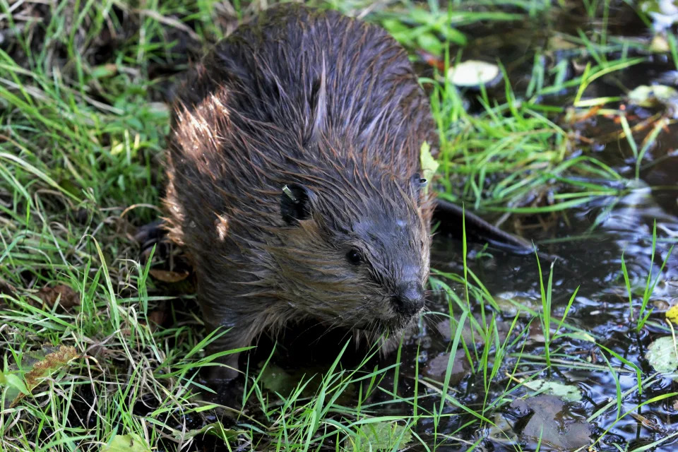
In this Sept. 12, 2014, photo, a tagged young beaver explores water hole near Ellensburg, Wash., after he and his family were relocated by a team from the Mid-Columbia Fisheries Enhancement Group.

Until a few decades ago, the northern edge of the beaver’s range was defined by boreal forest because beavers rely on woody plants for food and material to build their dams and lodges. But rapid warming in the Arctic has made the tundra more hospitable to the large rodents: Earlier snowmelt, thawing permafrost and a longer growing season have triggered a boom in shrubby plants like alder and willow that beavers need.

Aerial photography from the 1950s showed no beaver ponds at all in Arctic Alaska. But in a recent study, Ken Tape, an ecologist at the University of Alaska Fairbanks, scanned satellite images of nearly every stream, river and lake in the Alaskan tundra and found 11,377 beaver ponds.

Further expansion may be inevitable.

How does climate change affect you? Subscribe to the weekly Climate Point newsletter

Beaver hotspots

All these new dams could do far more than alter the flow of streams. “We know that beaver dams create warm areas,” Tape explains, “because the water in the ponds they create is deeper and doesn’t freeze all the way to the bottom in the winter.” The warm pond water melts the surrounding permafrost; the thawed ground, in turn, releases long-stored carbon in the form of the greenhouse gases carbon dioxide and methane — contributing to further atmospheric warming.

While changes to the Arctic brought on by warming will happen with or without beavers, the fragility of the far-north ecosystems leaves them especially vulnerable to the kinds of disturbances beavers may cause. In fact, the tundra may be the environment most threatened by climate change on the planet, according to paleobotanist Jennifer McElwain of Trinity College Dublin, author of an article about plant reactions to ancient warming episodes in the Annual Review of Plant Biology.

READ MORELatest climate change news from USA TODAY

McElwain and her colleagues examine fossil leaves and use the number and size of pores, or stomata, on the leaves to infer the level of carbon dioxide in the atmosphere those plants breathed. “When there’s very high carbon dioxide atmospheres, you see plants with bigger and fewer stomata,” she explains. At times when atmospheric CO2 was higher than around 500 ppm, forests grew in the high Arctic.

“During greenhouse intervals in the Earth’s deep past, we have forested ecosystems all the way up to 85, 86 degrees north and south latitude,” McElwain says. There were no places on Earth where the climate was too cold for trees to grow during these times. And where there are trees, the animals that depend on them — such as beavers — can thrive. In fact, there is evidence that a forested Arctic is where the beaver’s dam-building skills first evolved, millions of years ago (see sidebar).

In the past, as now, the polar regions warmed faster than the rest of the planet because heat is carried poleward by the global circulation patterns of the oceans and atmosphere. And since human combustion of fossil fuels has now pushed atmospheric COlevels to 415 ppm and climbing, the spread of shrubs and trees onto today’s warming tundra appears unavoidable — as does the spread of animals that need those plants to survive.

Tape has tracked both beavers and other creatures that have moved north onto the tundra in the wake of climate change, including moose that feast on tall, dense growths of shrubs that didn’t exist there 70 years ago. But the impact of beavers on the landscape is unique.

“It’s best to think of beavers as a disturbance,” Tape says. “Their closest analogue is not moose. It’s wildfire.”

CLIMATE POINT: Feds make big commitments to tribal communities and the Salton Sea

Meet the new neighbors

Scientists like Tape are only just beginning to study what that disturbance means for other Arctic animals, including fish and the people who depend on them.

Inupiat people near Kotzebue in northwest Alaska first noticed beavers living in local streams in the 1980s and 1990s. Inuvialuit hunters on the north slope of the Yukon saw their first beaver dams in 2008 and 2009. Because beavers can have such a dramatic impact on the landscapes they inhabit, seeing these animals in the fragile tundra ecosystem sparked concern.

“The Inuvialuit and Inuit people that I’ve heard from do have some big questions about what changes will happen because of beaver arriving in the Arctic,” says the Yukon biologist Jung.

Those concerns have grown as the beaver numbers increased. Tape and his colleagues’ work tracking the expansion of the beaver population has shown that the tundra around Kotzebue hosted only two beaver dams in 2002, but had 98 dams by 2019. In the adjacent Baldwin Peninsula, he has seen the number of dams grow from 94 to 409 between 2010 and 2019.

READ: Native villages fleeing climate change effects get millions in aid from Biden administration

But how the beavers will affect specific areas and species in the Arctic is an open question.

In the beaver’s traditional range, which before the arrival of fur trappers stretched from south of the Arctic tundra to northern Mexico and from the Pacific to the Atlantic, the dams they build provide a haven from predators as well as habitat for an array of creatures, including insects, frogs and songbirds. Scientists have come to view their landscape engineering as beneficial, and even critical in some vulnerable ecosystems. In many places south of the tundra, conservationists have moved to protect and reintroduce beavers to restore stream and wetland habitats.

But in the Arctic, beavers are sometimes seen as unwelcome intruders that could disrupt life on the tundra. Beaver dams are already making hunting and fishing more difficult for some people in the Arctic, forcing them to portage their canoes around the dams, for example. But scientists are only beginning to investigate whether larger concerns about impacts on the health of both humans and fish are warranted. Studies are underway to see, for example, if beaver dams increase the risk of the parasite Giardia in tundra streams — a charge that has been leveled against beavers, which can carry  Giardia but are a less likely source of infection than humans, pets and livestock.

Some Indigenous people who live by fishing and hunting are worried that beaver dams may block the migration of fish like the Dolly Varden, an Arctic salmonid that lives in the ocean for part of its life cycle but spawns and overwinters in tundra streams. The fish may be able to cope, says Michael Carey, a research fish biologist with the US Geological Survey.

In northwestern Alaska where Carey studies Dolly Varden and Arctic grayling, almost all the beaver dams he’s seen are on small side channels. “We don’t see them cutting off the system for fish to migrate up and down,” he says.

It’s possible that beaver dams could actually benefit fish in some parts of the Arctic. On Alaska’s Seward Peninsula, researchers have found evidence that beaver dams create good rearing habitat for juvenile coho salmon. In northwest Alaska, Tape and his colleagues have found that the unfrozen water in beaver ponds creates potential refugia for Arctic fish.

As beavers settle in and their numbers increase, things may change. To understand the ongoing impacts of beavers’ range expansion, Tape has helped establish the Arctic Beaver Observation Network, and is participating in a roundtable discussion about beaver activities with native residents, land managers and research scientists in Yellowknife, Canada.

People in the Arctic are used to living with wildlife, but peacefully coexisting with beavers may require clever strategies that accommodate both species.

In 2010, for example, beavers settled in at Serpentine Hot Springs, an ancient cultural site in the Bering Land Bridge Natural Preserve in Alaska. Beaver dams have caused flooding of the bunkhouse there. The isolated spot can only be reached by plane or snowmobile, and a new beaver dam built in 2021 threatened to flood the runway, making it unusable. The National Park Service responded by installing a beaver flow device — a pipe built through the dam to moderate the water level in the beaver pond. This allows the animals to live there while protecting the runway — a win for beavers and people alike.

The beaver dam’s Arctic origins

Paleobiologist Natalia Rybczynski will never forget her first visit to the Beaver Pond fossil site on Ellesmere Island, in the Canadian High Arctic. “You’re standing there in barren tundra, but you look on the ground, and it’s got these pieces of trees with cut marks,” she says. “There’s this whole different forest ecosystem” — one in which tree-gnawing beavers thrived.

Beavers first reached the North American Arctic from Eurasia by crossing the Bering Land Bridge perhaps 7 million years ago, when global temperatures and levels of atmospheric CO2 were higher, enabling forests to grow at high latitudes.

Rybczynski, now with the Canadian Museum of Nature, believes high-latitude forests are where the beaver’s dam-building skills evolved, driven by the need to adapt to cold, dark winters. Caching willow branches in water for winter food may have come first; heaped branches would have acted as weak dams. Over time, the beavers developed complex dam-building behaviors and a whole survival strategy centered on dams.

The Beaver Pond site also holds bones of Dipoides, an extinct beaver species that lived around 3.9 million years ago. It was about two-thirds as large as a modern beaver and had less powerful jaws. But the patterns of cut sticks and sediments found with the bones show strong similarities to those left behind at a 9,400-year-old fossil dam built by members of the modern genus of beaver,  Castor, in northeast England. This suggests that  Dipoides were also builders, and if the assemblage on Ellesmere Island was a dam,  it would be the oldest one yet found.

This article originally appeared in Knowable Magazine, an independent journalistic endeavor from Annual Reviews. Sign up for the newsletter.

Kansas residents hold their nose as crews mop up massive U.S. oil spill

Reuters

Kansas residents hold their nose as crews mop up massive U.S. oil spill

Erwin Seba and Nia Williams – December 10, 2022

Investigators, cleanup crews begin scouring oil pipeline spill in Kansas

WASHINGTON, Kan. (Reuters) -Residents near the site of the worst U.S. oil pipeline leak in a decade took the commotion and smell in stride as cleanup crews labored in near-freezing temperatures, and investigators searched for clues to what caused the spill.

A heavy odor of oil hung in the air as tractor trailers ferried generators, lighting and ground mats to a muddy site on the outskirts of this farming community, where a breach in the Keystone pipeline discovered on Wednesday spewed 14,000 barrels of oil.

Pipeline operator TC Energy said on Friday it was evaluating plans to restart the line, which carries 622,000 barrels per day of Canadian oil to U.S. refineries and export hubs.

“We could smell it first thing in the morning; it was bad,” said Washington resident Dana Cecrle, 56. He shrugged off the disruption: “Stuff breaks. Pipelines break, oil trains derail.”

TC Energy did not provide details of the breach or say when a restart on the broken segment could begin. Officials are scheduled on Monday to receive a briefing on the pipeline breach and cleanup, said Washington County’s emergency preparedness coordinator, Randy Hubbard, on Saturday.

OIL FLOWS TO CREEK

Environmental specialists from as far away as Mississippi were helping with the cleanup and federal investigators combed the site to determine what caused the 36-inch (91-cm) pipeline to break.

Washington County, a rural area of about 5,500 people, is about 200 miles (322 km) northwest of Kansas City.

The spill has not threatened the water supply or forced residents to evacuate. Emergency workers installed booms to contain oil that flowed into a creek and that sprayed onto a hillside near a livestock pasture, said Hubbard.

TC Energy aims to restart on Saturday a pipeline segment that sends oil to Illinois, and another portion that brings oil to the major trading hub of Cushing, Oklahoma, on Dec. 20, Bloomberg News reported, citing sources. Reuters has not verified those details.

It was the third spill of several thousand barrels of crude on the 2,687-mile (4,324-km) pipeline since it opened in 2010. A previous Keystone spill had caused the pipeline to remain shut for about two weeks.

“Hell, that’s life,” said 70-year-old Carol Hollingsworth of nearby Hollenberg, Kansas, about the latest spill. “We got to have the oil.”

TC Energy had around 100 workers leading the cleanup and containment efforts, and the U.S. Environmental Protection Agency was providing oversight and monitoring, said Kellen Ashford, an EPA spokesperson.

U.S. regulator Pipeline and Hazardous Materials Administration (PHMSA) said the company shut the pipeline seven minutes after receiving a leak detection alarm.

CRUDE BOTTLENECK

A lengthy shutdown of the pipeline could lead to Canadian crude getting bottlenecked in Alberta, and drive prices at the Hardisty storage hub lower, although price reaction on Friday was muted.

Western Canada Select (WCS), the benchmark Canadian heavy grade, for December delivery last traded at a discount of $27.70 per barrel to the U.S. crude futures benchmark, according to a Calgary-based broker. On Thursday, December WCS traded as low as $33.50 under U.S. crude, before settling at around a $28.45 discount.

“The real impact could come if Keystone faces any (flow) pressure restrictions from PHMSA, even after the pipeline is allowed to resume operations,” said Ryan Saxton, head of oil data at consultants Wood Mackenzie.

(Reporting by Erwin Seba in Washington, Kansas, and Nia Williams in Calgary, Alberta;Additional reporting by Arathy Somasekhar in Houston, Rod Nickel in Winnipeg and Stephanie Kelly in New YorkEditing by Gary McWilliams, Stephen Coates and Matthew Lewis)

Attacks on Pacific north-west power stations raise fears for US electric grid

The Guardian

Attacks on Pacific north-west power stations raise fears for US electric grid

Dani Anguiano in Los Angeles – December 10, 2022

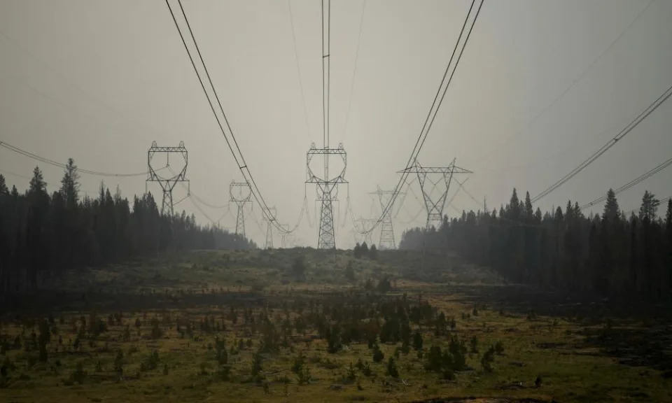
<span>Photograph: Mathieu Lewis-Rolland/Reuters</span>
Photograph: Mathieu Lewis-Rolland/Reuters

A string of attacks on power facilities in Oregon and Washington has caused alarm and highlighted the vulnerabilities of the US electric grid.

The attacks in the Pacific north-west come just days after a similar assault on North Carolina power stations that cut electricity to 40,000 people.

As first reported by Oregon Public Broadcasting and KUOW Public Radio, there have been at least six attacks, some of which involved firearms and caused residents to lose power. Two of the attacks shared similarities with the incident in Moore county, North Carolina, where two stations were hit by gunfire. Authorities have not yet revealed a motive for the North Carolina attack.

The four Pacific north-west utilities whose equipment was attacked have said they are cooperating with the FBI. The agency has not yet confirmed if it is investigating the incidents.

It’s unknown who is behind the attacks but experts have long warned of discussion among extremists of disrupting the nation’s power grid.

Related: FBI joins investigation into attack on North Carolina power grid

Bonneville Power Administration (BPA) said in a statement on Thursday that it was seeking tips about “trespassing, vandalism and malicious damage of equipment” at a substation in Clackamas county on 24 November that caused damage and required cleanup costing hundreds of thousands of dollars.

“Someone clearly wanted to damage equipment and, possibly, cause a power outage,” said John Lahti, the utility’s transmission vice-president of field services. “We were fortunate to avoid any power supply disruption, which would have jeopardized public safety, increased financial damages and presented challenges to the community on a holiday.”

Any attack on electric infrastructure “potentially puts the safety of the public and our workers at risk”, said BPA, which delivers hydropower across the Pacific north-west .

Portland General Electric, a public utility that provides electricity to nearly half of the state’s population, said it had begun repairs after suffering “a deliberate physical attack on one of our substations” that also occurred in the Clackamas area in late November 2022. It said it was “actively cooperating” with the FBI.

Puget Sound Energy, an energy utility in Washington, reported two cases of vandalism at two substations in late November to the FBI and peer utilities, but said the incidents appeared to be unrelated to other recent attacks.

“There is no indication that these vandalism attempts indicate a greater risk to our operations and we have extensive measures to monitor, protect and minimize the risk to our equipment and infrastructure,” the company said in a statement.

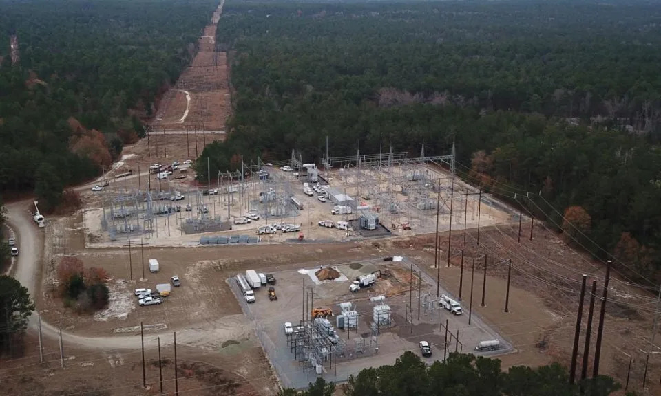
overhead view of substation
Duke Energy workers repair an electrical substation that they said was hit by gunfire, near Pinehurst, North Carolina, on Tuesday. Photograph: Drone Base/Reuters

Experts and intelligence analysts have long warned of both the vulnerability of the US power grid and talk among extremists about attacking the crucial infrastructure.

“It’s very vulnerable,” said Keith Taylor, a professor at the University of California, Davis, who has worked with energy utilities. “[These attacks] are a real threat.”

The physical risks to the power grid have been known for decades, Granger Morgan, an engineering professor at Carnegie Mellon University, told CBS. “We’ve made a bit of progress, but the system is still quite vulnerable,” he said.

US Department of Homeland Security (DHS) report released in January warned that domestic extremists have been developing “credible, specific plans” to attack electricity infrastructure since at least 2020.

The DHS has cited a document shared on a Telegram channel used by extremists that included a white supremacist guide to attacking an electric grid with firearms, CNN reported.

“These fringe groups have been talking about this for a long time,” Taylor said. “I’m not at all surprised this happened – I’m surprised it’s taken this long.”

Three men who law enforcement identified as members of the Boogaloo movement allegedly planned to attack a substation in Nevada in 2020 to distract police and attempt to incite a riot.

In 2013, still unknown assailants cut fiber-optic phone lines and used a sniper to fire shots at a Pacific Gas & Electric substation near San Jose in what appeared to be a carefully planned attack that caused millions of dollars in damage. The attack prompted the Federal Energy Regulatory Commission (Ferc) to order grid operators to increase security.

“They knew what they were doing. They had a specific objective. They wanted to knock out the substation,” Jon Wellinghoff, the then chair of Ferc, told 60 Minutes, adding that the attack could have “brought down all of Silicon Valley”.

After the 2013 attack in California, a Ferc analysis found that attackers could cause a blackout coast-to-coast if they took out only nine of the 55,000 substations in the US.

The US electrical grid is vast and sprawling with 450,000 miles of transmission lines, 55,000 substations and 6,400 power plants. Power plants and substations are dispersed in every corner of the country, connected by transmission lines that transport electricity through farmland, forests and swamps. Attackers do not necessarily have to get close to cause significant damage.

“In a centralized system, if I [want] to take out one coal-fired plant, I don’t even have to take out the plant, I just have to take out the transmission line,” said Taylor. “You can cause a ripple effect where one outage can cause an entire seaboard to go down.”

The Associated Press contributed to this report

Tornadoes, blizzard conditions, floods all possible from upcoming massive storm in central US

AccuWeather

Tornadoes, blizzard conditions, floods all possible from upcoming massive storm in central US

Alex Sosnowski – December 9, 2022

An enormous cross-country storm is likely to be at its worst over the central United States early next week when a potential tornado outbreak may occur at the same time a blizzard rages about 1,000 miles farther to the north, AccuWeather meteorologists warn.

The same storm will also raise the risk of flooding in the Tennessee Valley, causing temperatures to plunge and winds to howl in the Southwest. It could even spread some snow and ice into the Northeast later in the week.

“You name it, this storm will bring it in terms of wild weather next week,” AccuWeather Chief On-Air Meteorologist Bernie Rayno said.

Much of the extreme weather will occur during the three-day period from Monday to Wednesday in the middle of the nation.

The storm will be in a strengthening phase as it pushes onshore and moves inland over the Pacific Coast states this weekend. Many low-elevation areas from western Washington to Southern California will be drenched by heavy rain as feet of snow pile up in the mountains.

The storm system will spread broad areas of heavy snow and gusty winds over the Intermountain West later this weekend and into early next week before it expands across the northern Plains.

Several inches will pile up in the major metro area of Salt Lake City, as well as Flagstaff, Arizona, from the storm. Blowing and drifting snow on top of the heavy accumulation will lead to difficult travel even outside of the major mountain passes in the region.

The full fury of the storm’s wintry side will be on display from later Monday to Wednesday across the Great Plains. Temperatures will drop, and snow will expand from parts of Colorado to the Dakotas and northern Minnesota.

For example, in Rapid City, South Dakota, temperatures will plummet from the mid-50s on Sunday to the teens on Monday night and remain there through Tuesday and Wednesday as winds gusts of between 30 and 60 mph howl and snow spreads through the area.

While the worst of the snowstorm may occur to the north and west of Denver, blizzard conditions will unfold over tens of thousands of square miles from parts of Colorado, Wyoming and Montana to near the Canada border in North Dakota and Minnesota.

The extensive blowing of the dry, powdery snow is likely to create massive drifts that can block roads and strand motorists along vast portions of interstates 25, 29, 70, 80, 90 and 94, forecasters say.

About 500 to 1,000 miles farther to the south, a significant risk to lives and property will unfold as thunderstorms erupt, become severe and likely unleash multiple tornadoes.

“It does not matter what time of time of the year it is for severe weather,” Rayno said. “If the ingredients are there, then severe weather can occur any time of the year.”

Last year, on Dec. 10-11, 2021, a swarm of tornadoes struck part of the Mississippi Valley, killing dozens of people and injuring numerous others.

As stiff breezes rapidly transport Gulf of Mexico moisture northward next week, stronger and shifting winds higher up in the atmosphere will cause thunderstorms to rotate. Rotating thunderstorms can carry a high risk of spawning tornadoes.

Surging humidity levels, combined with an incredible amount of jet stream energy, will lead to a major severe weather outbreak, according to Rayno.

As if the risk of multiple strong tornadoes was not serious enough, a number of the violent storms are likely to occur after dark on both Monday and Tuesday nights. This means that millions of people in the path of the storm should closely monitor severe weather alerts as visual confirmation of tornadoes on the ground may not be possible in every case.

Following a few scattered thunderstorms this weekend from central Texas to Tennessee, severe thunderstorms will ramp up on Monday afternoon from north-central Texas to western and central Oklahoma. All types of severe weather are possible in this zone that will focus on an area just west of the major metro areas of Oklahoma City and Dallas. Potent storms could wander into these locations prior to daybreak on Tuesday, forecasters warn.

During Tuesday and Tuesday night, the severe weather and tornado threat will expand and cover an area farther to the east, reaching areas from northeastern Texas and eastern Oklahoma to the Mississippi River.

Multiple strong tornadoes are possible in this zone, along with large hail, high winds and torrential downpours. Even where tornadoes occur during the daylight hours, they may be difficult to see in advance due to hilly, wooded terrain and poor visibility due to rain in some cases.

The severe thunderstorm and tornado threat will occur mostly during the nighttime hours on Tuesday and may be focused near and east of the Mississippi River in areas as far along as western Kentucky middle Tennessee, all of Mississippi and western and central Alabama.

It is possible the severe weather threat continues on Wednesday along a portion of the interstate 10 and 20 corridors farther to the east in the South.

Since much of the south-central region has been receiving rain on a more regular basis in recent weeks, not only have drought conditions improved, but the soil has gotten progressively wetter. The saturated ground means that where downpours persist for a longer period of time, the risk of urban and small stream flooding will be significantly higher when compared to recent weeks. The massive storm next week could bring a fresh 1-2 inches of rain in 12-24 hours with locally higher amounts.

Substantial rises are likely on some of the secondary rivers, but river flooding is not expected along the Ohio and lower Mississippi due to very low levels. On a positive note, the additional rain forthcoming from the storm will provide yet another boost in river levels. Minor surges in water levels have allowed some increase in barge operations along the lower portion of the Mississippi in recent days.

The storm may deliver some significant impacts to the East later next week as well.

The initial surge of moisture may occur before the atmosphere has a chance to warm up in portions of the Appalachians, New England and the eastern Great Lakes region late Wednesday night to Thursday. This could lead to a zone of accumulating snow or dangerous ice in some locations. Rain will push toward the southeastern U.S. coast by the end of the week.

However, there is also the possibility of a spin-off storm developing at the end of the week. If all the pieces fall into place, the storm could strengthen quickly, producing wind, heavy rain and even heavy snow for some areas of the Northeast as well.

Want next-level safety, ad-free? Unlock advanced, hyperlocal severe weather alerts when you subscribe to Premium+ on the AccuWeather app. AccuWeather Alerts are prompted by our expert meteorologists who monitor and analyze dangerous weather risks 24/7 to keep you and your family safer.

Thanks in part to climate change, vegetable prices have soared in the U.S.

Yahoo! News

Thanks in part to climate change, vegetable prices have soared in the U.S.

David Knowles, Senior Editor – December 9, 2022

A cluster of red Roma tomatoes, shriveled and rotten, hang on the vine, with a farmer looking on from above.
Tomatoes for processing damaged by heat and drought hang on vines in a field belonging to farmer Aaron Barcellos in Los Banos, Calif., in September. (Nathan Frandino/Reuters)

Vegetable prices in the United States were up nearly 40% in November over the previous month, according to new figures from the Labor Department, and climate change is one of the reasons why.

In California, an ongoing drought that studies have shown has been been exacerbated by climate change, has led to $3 billion worth of agriculture losses in a state that grows much of the nation’s food. The megadrought, which covers much of the American West, has forced cuts in the amount of water that states like California and Arizona receive from the Colorado River.

That has left tomatoes to wither on the vine, and lettuce to shrivel.- ADVERTISEMENT -https://s.yimg.com/rq/darla/4-10-1/html/r-sf-flx.html

“There’s just not enough water to grow everything that we normally grow,” Don Cameron, president of the State Board of Food and Agriculture, told the Times of San Diego.

Thanks to a significantly diminished snowpack in 2022, following the driest January and February in recorded history in the state, California’s Central Valley has also struggled to produce its usual output of fruits and vegetables.

Making matters even worse, and more expensive for consumers, lettuce production in the Salinas Valley has fallen further, thanks to an outbreak of the impatiens necrotic spot virus, which spreads from plant to plant and can decimate entire greenhouses.

“In October, most of the nation’s lettuce comes from the Salinas Valley, and they are having very low production because the virus affected their crop,” Bruce Babcock, an agricultural economist at the University of California Riverside, told NBC Bay Area. “A case of romaine is $75 now, and last January, it was $25, so that’s almost a tripling of prices at the wholesale level.”

An unripe orange, surrounded by several rotten brown oranges.
Oranges lie on the ground in a grove in Arcadia, Fla., in October after Hurricane Ian. (Joe Raedle/Getty Images)

The long-term climate change trend in California, however, is causing the state’s government to take action. In August, California Gov. Gavin Newsom announced an $8 billion plan aimed at increasing the state’s water supply and “adapting to a hotter, drier future.”

“We are experiencing extreme, sustained drought conditions in California and across the American West caused by hotter, drier weather,” a policy outline released by the governor’s office stated. “Our warming climate means that a greater share of the rain and snow fall we receive will be absorbed by dry soils, consumed by thirsty plants, and evaporated into the air. This leaves less water to meet our needs.”

The negative farming impacts in California from climate change are much the same story in Arizona, which provides more than 9% of the country’s leafy greens during the winter months, Bloomberg reported. The combination of the drought and Colorado River water cuts have severely affected the growing season, and more cuts are coming in the new year. In August, the federal government announced that water deliveries to Arizona would be reduced by another 20%, starting in January of next year.

“Prolonged drought is one of the most profound issues facing the U.S. today,” Tommy Beaudreau, assistant secretary of the interior, said in announcing the cuts.

In Florida, the top supplier of fruits and vegetables in the U.S. during autumn and winter, Hurricane Ian caused up to $1.9 billion in damages to the state’s agricultural industry, hitting orange and tomato crops particularly hard.

Studies have shown that Ian was wetter and more intense as a consequence of climate change.

Weird weather hit cattle ranchers and citrus growers in 2022. Why it likely will get worse.

USA Today

Weird weather hit cattle ranchers and citrus growers in 2022. Why it likely will get worse.

Elizabeth Weise, USA TODAY – December 8, 2022

This has been a year of extreme weather,  including ruinous floodshorrific hurricanesunrelenting heatdrought and massive rainfall events. Farmers, always at the mercy of the weather, have taken a hit.

In 2022, so far there have been over a dozen climate disaster events with losses exceeding $1 billion, according to the National Oceanic and Atmospheric Administration.

While harvests in the U.S. overall have been good, some crops were devastated.

In Texas, the cotton harvest was hit hard by drought. Hurricane Ian blew oranges off the trees in Florida. Rice farmers in California have left fields empty for lack of water, and cattle ranchers are sending more cows to slaughter because drought-stunted pastures can’t support normal calving activity.

Climate change can’t be directly blamed for every bad harvest or extreme weather event this year, but the effects of climate change – including drought and rainier hurricanes – hurt harvests across the nation in 2022.  Climate models make clear more is coming.

It’s a pattern scientists have been warning about for decades, that higher global temperatures will bring on “weather weirding.”

Every year the farmers who feed our nation get smarter and more resilient, but it’s increasingly stressful to adapt to the extreme variability they face, said Erica Kistner-Thomas, with the U.S. Department of Agriculture’s National Institute of Food and Agriculture.

“One year they’ll have the best year ever and then the next year they’ll be hit with a major flooding event or drought,” she said.

Here are some crops for which 2022 was a hard year:

Rice in California

The “megadrought” in the West, the worst in 1,200 years, has had an enormous impact on farming in California. Seven percent of the state’s cropland went unplanted due to lack of water for irrigation.

Rice, which relies on surface water, was hardest hit. Over half the state’s rice acres went unplanted, according to the USDA.

A fallow rice field near Dunnigan, California in 2022. Sean Doherty of Sean Doherty Farms was only able to plant four of his 20 rice fields in 2022 due to drought conditions.

“Rice is a major crop in California. We lead the nation in medium and short grain acres,” said Gary Keough with the National Agricultural Statistics Service.

“A significant number of acres were not planted just because of a lack of water,” he said.

In Colusa County north of San Francisco, fifth-generation rice farmer Sean Doherty was able to plant only four of his usual 20 rice fields.

“I’ve never experienced a year like this,” he said. “There’s just no comparison to other years whatsoever.”

READ: What is climate change?

There was so little water that his fields, which normally would have held thousands of pounds of premium sushi rice, are instead bare dirt. “Just to keep my guys busy we re-leveled some fields to improve water efficiency,” he said. But no amount of efficiency helps when there’s simply no water to be had.

“You can’t conserve your way out of an empty bucket,” Doherty said.

At least for now Doherty is doing all right because he has crop insurance. But that won’t help the businesses in his county that depend on farmers to survive. “My crop dusters don’t have insurance; my parts store and fertilizer dealers, they’ve got no business,” he said.

Citrus in Florida

Hurricane Ian hit John Matz’s orange and grapefruit groves hard. He lost over 50% of his crop from it being blown off the trees.

“It’s pretty disgusting to look at the amount of fruit that was on the ground,” the grower in Wauchula, Florida, said.

Oranges in a Florida grove that were blown off trees after Hurricane Ian in October 2022. The state's citrus crop was significantly damaged by the hurricane and subsequent flooding.
Oranges in a Florida grove that were blown off trees after Hurricane Ian in October 2022. The state’s citrus crop was significantly damaged by the hurricane and subsequent flooding.

The winds were only the beginning. Standing water damaged root systems. Even now, when the waters have receded and the fallen fruit has been counted for insurance purposes, more bad news is coming, said Roy Petteway, president of the Peace River Valley Citrus Growers Association.

“Trees are very sensitive; they’re not like squash or cucumber,” he said. “You might not see the full extent of the damage for eight months to a year.”

He’s not convinced that human-caused global warming is behind the weather shifts he’s seeing, but there is definitely change in the land his family has held for generations in Zolfo Springs, Florida.

“I’m 36, and I’ve gotten through three once-in-a-lifetime storms.” he said.

How is climate change affecting the US?: The government is preparing a nearly 1,700 page answer.

HURRICANES: Is climate change fueling massive hurricanes in the Atlantic? Here’s what science says.

But after six generations in Florida, he’s not about to give up. “We don’t know how to fail. There’s a reason there’s an orange on our license plates.”

Florida mostly grows citrus for juice, so there shouldn’t be a big impact on consumer fruit prices, said Ray Royce, with the Highlands County Citrus Growers. But every time there’s a storm that damages the crops, it’s one more blow to U.S.-produced fruit.

“Replacement juice will be brought in from Brazil and Mexico,” he said. “At some point for processors it’s cheaper to ship it in. All the juice you drink now is a blended product of domestic and offshore juice.”

Cattle in Texas

Look for beef prices to rise in 2023 and 2024 – in part because drought in Texas is forcing ranchers to send more cows to slaughter.

“There isn’t enough grass to eat, and it’s become too expensive to buy feed. We’ve had a large amount of culling this year because of drought,” said David Anderson, a livestock specialist at Texas A&M University.

“We’re sending young female heifer cows to feed lots because we don’t have the grass to keep them,” he said. Cows that would normally have a calf in the next few years are instead going to slaughter.

Beef slaughter is up 13% nationwide and in the Texas region, it’s up 30%.

“In the short term, that means beef will be cheaper. This year we’re going to produce a record amount of beef, over 28 million pounds,” said Anderson.

But long term it will mean higher prices.

Those calves that might have been born in the spring of 2023 would be ready for slaughter in about 20 months. So in the fall of 2025, there will be fewercattle to slaughter and higher prices.

“There’s going to be a shortage of beef, and prices are probably going to go up,” said the USDA’s Kistner-Thomas. “This could also have a compounding effect on other meat prices as people switch from beef to chicken.”

Today, Texas has about 14% of the nation’s beef cow herd but as the climate changes, ranchers will face growing challenges.

“These events are getting more frequent,” said Anderson. The state’s experiencing more frequent severe droughts. And when the rains do come, they come differently than before, in intense bursts rather than over a longer period of time.

“You may get the same total rainfall, but you’re going to get it all in one afternoon,” he said. “The plants are adapted for one pattern, and we’re not going to have that pattern anymore.”

More: How a summer of extreme weather reveals a stunning shift in the way rain falls in America.

Almonds in California

This year’s marzipan for Christmas won’t be affected, but next year’s might be, given the one-two punch California’s almond groves took this year.

First, an unseasonable freeze in the last week of February killed some of the fruit just as it was forming. Then the ongoing Western megadrought forced farmers to choose between which trees could get enough water to actually produce.

A California almond orchard in bloom. In 2022, erratic weather and drought cut 11% out of the nation's almond harvest. An unseasonable cold snap in February kills some early fruit just after bloom while ongoing drought meant many growers didn't have enough water for their trees.
A California almond orchard in bloom. In 2022, erratic weather and drought cut 11% out of the nation’s almond harvest. An unseasonable cold snap in February kills some early fruit just after bloom while ongoing drought meant many growers didn’t have enough water for their trees.

Some farmers are getting out of the business entirely or watering trees just enough to keep them healthy but not enough for good harvests — hoping for more water in the future, said Richard Waycott, CEO of the California Almond Board.

“Generally speaking, you grit your teeth and bear it.”

The United States produces 82% of the world’s almonds, almost all in California. In 2022, the harvest was down 11% from the year before. This year’s production is expected to drop as much as 2.6 billion pounds.

Cotton in Texas

Texas is the largest cotton producer in the United States, but this year’s drought has cut the harvest by at least a third, said John Robinson, a professor and specialist in cotton marketing at Texas A&M University in College Station, Texas.

“This year they’re projecting less than 4 million bales; in an average year it’s 6 million,” he said. “Cotton was planted, then it just didn’t even come up. There was a whole lot of land that was simply plowed up because the seeds never germinated.”

That’s called the “abandonment rate,” the percentage of unharvested acres compared to total planted acres. This year’s abandonment rate for cotton in Texas is 68%, “which is a record,” said Robinson.

What does climate change mean for the future of US farming? Preparation is key.

Things would have been much worse if it weren’t for advances in plant breeding, said Paul Mitchell, a professor of agriculture and applied economics at the University of Wisconsin, Madison.

“Crops are more resilient to dry weather than they were 20 years ago,” he said.

As the kind of severe weather events that can devastate crops become more frequent, better breeds won’t necessarily be able to save farmers, said Ariel Ortiz-Bobea, an economist at Cornell University who studies how agriculture is coping with environmental change.

“U.S. agricultural productivity is rising, but it’s not becoming more resilient to extremes,” he said. “When bad years start to line up, are we doing things to prepare for the unusual as it becomes more usual?”

Elizabeth Weise covers climate and environmental issues for USA TODAY. She can be reached at eweise@usatoday.com.