Diet change may make biggest impact on reducing heart risk in people with hypertension

New Media Wire

Diet change may make biggest impact on reducing heart risk in people with hypertension

September 7, 2022

Research Highlights:

  • In a simulation study using the latest U.S. statistics for stage 1 hypertension, researchers found that lifestyle changes to reduce systolic blood pressure to below 130 mm Hg may prevent 26,000 heart attacks and strokes and reduce health care costs over the next ten years.
  • Among several lifestyle changes considered, such as diet, weight loss, physical activity, etc., the study found the largest impact on reducing cardiovascular events may come from adopting the Dietary Approaches to Stop Hypertension (DASH) diet.
  • Analysis found that widespread adoption of non-pharmacologic interventions in lower-risk U.S. adults with Stage 1 hypertension may prevent nearly 26,000 cardiovascular disease events, avoid 2,900 deaths and save about $1.6 billion in associated health care costs over ten years.

Embargoed until 6 a.m. PT/8 a.m. CT/9 a.m. ET Wednesday, Sept. 7, 2022

(NewMediaWire) – September 07, 2022 – SAN DIEGO Among several lifestyle changes that may reduce cardiovascular disease, adopting the DASH (Dietary Approaches to Stop Hypertension) diet may have the greatest impact for young and middle-aged adults with stage 1 hypertension, according to new research presented at the American Heart Association’s Hypertension Scientific Sessions 2022, held Sept. 7-10, 2022, in San Diego. The meeting is the premier scientific exchange focused on recent advances in basic and clinical research on high blood pressure and its relationship to cardiac and kidney disease, stroke, obesity and genetics.

According to the 2017 joint American Heart Association and American College of Cardiology High Blood Pressure Guideline, stage 1 hypertension is defined as having a systolic (top number) level of 130-139 mm Hg or having a diastolic (bottom number) measure of 80-89 mm Hg.

The researchers estimate widespread adoption of lifestyle changes, such as limiting heavy alcohol consumption and exercising regularly, may prevent thousands of deaths and save more than one billion dollars in health care costs over the next 10 years. Their analysis found that adoption of the DASH diet could have the greatest benefit, with an estimated 15,000 heart disease events prevented among men and 11,000 event among women.

The DASH eating plan is specifically designed to help manage blood pressure. The diet emphasizes foods including fruits, vegetables, lean meat sources, nut, seeds and grains and limiting consumption of red meat, sodium, sugars and sugar-sweetened beverages.

The research team estimated that 8.8 million U.S. adults, ages 35-64, have untreated stage 1 hypertension and would be recommended lifestyle changes, such as physical activity, sustained weight loss, moderating alcohol intake and adoption of the DASH diet.

In the absence of other health conditions, such as type 2 diabetes or kidney disease, and a predicted >(10%) 10-year CVD risk, people with stage 1 hypertension are considered at low risk for heart attack or stroke compared to people with stage 2 or higher hypertension. Stage 2 hypertension is defined as systolic measures of 140 mm Hg or higher, or diastolic measures of 90 mm Hg or higher. The recommendations for treatment for people with stage 1 hypertension is based primarily on lifestyle changes rather than medication.

“Nearly nine million young and middle-aged adults with untreated stage 1 hypertension represent a significant, impending burden for health care systems,” said Kendra D. Sims, Ph.D., M.P.H., a postdoctoral fellow at the University of California, San Francisco and co-lead researcher of this study. “Our results provide strong evidence that large-scale, healthy behavior modifications may prevent future heart disease, related complications and excess health care costs.”

To simulate heart disease and stroke events, mortality and health care costs between 2018 and 2027, the researchers applied evidence from published meta-analyses and trial data about the blood-pressure reducing effects of lifestyle changes: dietary changes, sustained weight loss, physical activity, smoking cessation and alcohol moderation. About half of the modeled population were women and 61% (5.5 million) had regular health care access.

The researchers found that making recommended lifestyle changes to control blood pressure to below 130 mm Hg systolic or 90 mm Hg diastolic may have substantial health and economic benefits. They estimated that lifestyle changes could:

  • Prevent 26,000 cardiovascular disease events, such as stroke, heart failure or heart attack;
  • Avoid 2,900 deaths; and
  • Save $1.6 billion in associated health care costs.

“Unfortunately, the availability and affordability of healthy food sources does not easily allow people to follow the DASH diet. Clinicians should consider whether their patients live in food deserts or places with limited walkability. Health counseling should include addressing these specific challenges to blood pressure control,” Sims said.

In May, the Association published a policy statement, Strengthening U.S. Food Policies and Programs to Promote Equity in Nutrition Security, which recommends expanding and improving U.S. nutrition policies and programs to ensure all American can access nutritious food. In 2020, the Association launched the National Hypertensive Control Initiative, a collaborative initiative with the U.S. Department of Health and Human Services that aims to improve blood pressure control among the most vulnerable populations, including racial and ethnic minorities.

“Members of many disadvantaged communities face barriers to healthy food and regular health care access,” Sims said. “This means they will not be able to benefit from a counseling from a doctor. Future research should investigate the big picture: social conditions granting people the time and resources to make healthy lifestyle choices. Only with this information can we develop policies for the prevention of heart disease, especially for vulnerable adults.”

Co-authors of the study are Pengxiao C. Wei, M.P.H.; Brandon K. Bellows, Pharm.D., M.S.; Joanne Penko, M.S., M.P.H.; Susan Hennessy, Ph.D.; Dhruv S. Kazi, M.D., M.S.; Ross Boylan, Ph.D.; Andrew E. Moran, M.D., M.S.; and Kirsten Bibbins-Domingo, Ph.D., M.D.

Note: Sims will present Projected Impact Of Non-pharmacologic Management Of Stage 1 Hypertension Among Lower-risk U.S. Adults at 11:15 a.m. PST on Saturday, Sept. 10. Presentation #137; Session 21D

Statements and conclusions of studies that are presented at the American Heart Association’s scientific meetings are solely those of the study authors and do not necessarily reflect the Association’s policy or position. The Association makes no representation or guarantee as to their accuracy or reliability. Abstracts presented at the Association’s scientific meetings are not peer-reviewed, rather, they are curated by independent review panels and are considered based on the potential to add to the diversity of scientific issues and views discussed at the meeting. The findings are considered preliminary until published as a full manuscript in a peer-reviewed scientific journal.

The Association receives funding primarily from individuals; foundations and corporations (including pharmaceutical, device manufacturers and other companies) also make donations and fund specific Association programs and events. The Association has strict policies to prevent these relationships from influencing the science content. Revenues from pharmaceutical and biotech companies, device manufacturers and health insurance providers and the Association’s overall financial information are available here.

Additional Resources:

About the American Heart Association

The American Heart Association is a relentless force for a world of longer, healthier lives. We are dedicated to ensuring equitable health in all communities. Through collaboration with numerous organizations, and powered by millions of volunteers, we fund innovative research, advocate for the public’s health and share lifesaving resources. The Dallas-based organization has been a leading source of health information for nearly a century. Connect with us on heart.org, Facebook, Twitter or by calling 1-800-AHA-USA1.

US Consumers See Home Prices Falling for First Time Since 2020

Bloomberg

US Consumers See Home Prices Falling for First Time Since 2020

Alex Tanzi – September 7, 2022

(Bloomberg) — For the first time in two years, US consumers expect home prices to fall over the next 12 months.

An August survey by Fannie Mae found that respondents see a 0.4% decline in housing prices compared with the prior month’s expectations for a 1.9% increase.

Consumers also anticipate that rental price growth will slow, with year-ahead expectations dropping nearly two percentage points, the steepest slide in data back to 2010, according to the survey released Wednesday.

The Fannie Mae report found that the share of respondents who say home prices will go up in the next 12 months decreased to 33% from 39%, while the percentage who expect them to fall increased 3 percentage points to 33%.

“The share of consumers expecting home prices to go down over the next year increased substantially in August,” said Doug Duncan, chief economist at Fannie Mae. “We also observed a large decline in consumers reporting high home prices as the primary reason for it being a good time to sell a home, suggesting that expectations of slowing or declining home prices have begun to negatively affect selling sentiment.”

Potential buyers anticipating further price declines and sellers not keen on giving up their lower, fixed mortgage rate may contribute to a further cooling in home sales through the end of the year, Duncan said.

A separate survey conducted by the Mortgage Bankers Association found that the average effective rate on 30-year fixed mortgage increased to 6.17%, the highest since mid-June, from 6.01%.

The Fannie Mae survey found that half of consumers think it would be difficult for them to get a home mortgage today — the largest share since October 2014.

Here’s why some homeowners skipped the refinance boom — and don’t regret it

Yahoo! Money

Here’s why some homeowners skipped the refinance boom — and don’t regret it

Gabriella Cruz- Martinez, Personal finance writer – September 7, 2022

As mortgage rates remain well above 5%, it seems homeowners who had the chance to refinance into historically low rates in the last two years but didn’t must be kicking themselves.

Instead, many probably made a financially savvy move, according to experts.

Nearly one-fourth of all homeowners refinanced their mortgage in 2021, according to data from the Federal Reserve Bank, when mortgage rates dropped below 3%. That refi boom is over, with activity falling to the lowest level since 2000, according to the Mortgage Bankers Association, leaving the 14.6% of homeowners with a current rate above 5% without many options.

“There are a lot of reasons why people don’t refinance,” Keith Gumbinger, vice president of HSH.com, told Yahoo Money. “You might find that loan amounts are too small to be bothered with, or you might be thinking about selling at some point in the future.”

Changing circumstances

Life happens and that can change your financial situation from where it was when you first purchased your home. For instance, a couple may have bought soon after marrying when they both had paying jobs. Five or six years later, things may look different and refinancing may not be in the cards even if rates are under 3%.

“You’ve since started a family and only one spouse is working or the other isn’t working full time to care for the child,” Gumbinger said. “Now your income might not even be enough to qualify you for the mortgage you’re already paying.”

Too small loan

Even if you want to refinance, a lender may not be interested because the outstanding balance is too small. “[The] paper work’s the same for a $1 million loan,” Gumbinger said, “but not nearly as profitable.”

Plus, what you would save overall on interest wouldn’t be as much with a smaller loan balance.

Planning to sell or tap
If you're planning on selling your home in a few years, a loan modification may be less expensive than refinancing your mortgage. (Credit: Getty Images)
If you’re planning on selling your home in a few years, a loan modification may be less expensive than refinancing your mortgage. (Credit: Getty Images)

Another “not-worth-it reason,” according to Gumbinger, may be when a homeowner plans to sell in the next year or two, so there’s little chance to get any benefit from a refinance.

“Depending on costs or the difference in monthly payment, there’s a chance that the refi can be a money-loser, too,” he added.

Similarly, older borrowers who intend to take out a reverse mortgage at some point soon — available to homeowners over 62 — may also want to avoid a refi no matter where rates are because the process pays off the existing loan and leaves no monthly payments.

The math doesn’t make sense

At least 15.2% of existing homeowners have a mortgage that’s over 10 years old, the FHFA survey found. Another 27.5% are right at the middle – with mortgages between 4 and 10 years old

“When you are well into the principal repayment portion of your loan — that is, you have far fewer than 30 years remaining on the term — almost the only way to achieve savings is to select a term that is only about as long as the remaining term or slightly longer, provided there is still a break in the interest rate compared to the existing loan,” Gumbinger said, “or to get a significantly lower interest rate compared to what your existing loan has.”

 Gabrielle Smychynsky, left, a first time home buyer, and her fiancé Wes White, right, take their dog Lucy and their seven-week-old puppy Ada for a walk in their neighborhood in Myrtle Beach, South Carolina on July 13, 2022. (Credit: Madeline Gray for The Washington Post via Getty Images)
Gabrielle Smychynsky, left, a first time home buyer, and her fiancé Wes White, right, take their dog Lucy and their seven-week-old puppy Ada for a walk in their neighborhood in Myrtle Beach, South Carolina on July 13, 2022. (Credit: Madeline Gray for The Washington Post via Getty Images)

You also have to consider your break-even point – or the amount of time it will take you to recoup your new loan’s closing costs — along with balancing what your monthly payment will be with the total interest you’ll pay over the life of the loan.

“Even with a lower interest rate, it can sometimes be difficult to overcome the costs of restarting the loan all over again — paying for a home for 37 years instead of the 30 you may have started with, for example,” Gumbinger said. “A lower payment may be the outcome of a refinance, but at the cost of a higher total interest charge.

Gabriella is a personal finance reporter at Yahoo Money. 

How has climate change hit Boise? What 150 years of weather data tells us

Idaho Statesman

How has climate change hit Boise? What 150 years of weather data tells us

Nicole Blanchard – September 7, 2022

Sarah A. Miller/smiller@idahostatesman.com

After a scorching August — the hottest ever recorded here — the effects of climate change may feel closer to Boise than ever. And according to local weather statistics, temperatures, precipitation and other environmental factors have shifted noticeably in the last few decades and the 150 years since record-keeping began.

National Weather Service data shows Idaho’s summers are becoming hotter, overnight low temperatures are warming, and the average number of days with temperatures over 100 degrees has more than doubled in the last 30 years.

“It’s a totally different climate than our parents and grandparents grew up in,” Jay Breidenbach, a meteorologist at the Weather Service Boise office, told the Idaho Statesman in a phone interview.

Boise heats up

Breidenbach said scientists tend to look at climate change in 30-year periods. That gives them enough data to detect trends while still measuring the shifts in a way the public can understand.

“It helps us see (climate change) relative to our lives,” Breidenbach told the Statesman.

Data from the last 30 years is telling. The National Weather Service has been keeping weather records in Boise since the 1870s, and records show many of the hottest summers in that period have happened in the past three decades. Every summer in the last decade would make the list of Boise’s 30 hottest summers since the 1870s, Breidenbach said.

This summer is Boise’s second-hottest on record, following last summer, when a record-breaking heat wave hit the Northwest. The average temperature this August was 81.9 degrees — more than 3 degrees hotter than the previous record of 78.7, which was set in 2001. Breidenbach said average temperatures are calculated by taking the sum of each day’s minimum and maximum temperature and dividing it by two.

Numbers from the National Weather Service’s earliest records showed even more temperature shifts. The average annual temperature has risen from 50.3 degrees in the late 1870s to 52.7 in recent years. Average minimum and maximum temperatures have also warmed, meaning Boise’s hottest temperatures are a few degrees hotter, and its coldest temperatures are also toastier.

Breidenbach said extreme hot weather is becoming more common in Boise.

“The number of days each summer with max temperature reaching or exceeding 100 degrees has risen from about six days in 1992 to about 13 days now,” he said in an email to the Statesman.

This summer, Boise reached 100 degrees or hotter 23 times.

Less snow, rain in Boise

Boise has also become drier over the years, data shows. Josh Smith, a meteorologist who focuses on climate change at the Weather Service Boise office, said the temperature and precipitation shifts are linked.

“There is a subtle but noticeable warming that’s affecting precipitation and snowfall,” Smith told the Statesman in a phone interview. “That is really important for our area. We get most of our water from snowfall.”

When record-keeping began, the National Weather Service recorded an average of 13.1 inches of precipitation per year in Boise. By 1992, that number had fallen to around 11.6 inches. In recent years, the average is about 11.2 inches of precipitation annually.

Idaho has been in the midst of a multiyear drought, with nearly 90% of the state experiencing some level of water shortage as of Tuesday, the U.S. Drought Monitor showed.

The drought is due in part to poor snowpack. Weather Service data shows an average of 24.4 inches of snow fell in Boise annually in the late 1800s, but that number has fallen to 18.2 inches of snow on average. Snow depth has also decreased over the years.

How accurate is Boise weather data?

Smith said some Boise residents question the accuracy of the National Weather Service data. The statistics are recorded at the agency’s office, which has changed location over the years.

But Smith said variability caused by change in location is accounted for in the agency’s data, and the office has been around long enough to establish some solid trends.

The meteorologists said the 150 years of data helped show the realities of a changing climate despite the occasional unusual snowstorm or record cold day. Breidenbach said record cold days do still happen, but with much less frequency than new high temperature records.

Smith said the key is to look at the trends.

“When you look at the data without any frame of reference, you could get lost in the variability of each year,” Smith said. “It’s important to look at a larger window of time.”

Deeply Problematic’: Experts Question Judge’s Intervention in Trump Inquiry

The New York Times

‘Deeply Problematic’: Experts Question Judge’s Intervention in Trump Inquiry

Charlie Savage – September 6, 2022

Former President Donald Trump speaks at a rally in Wilkes-Barre, Pa., Saturday, Sept. 3, 2022. (AP Photo/Mary Altaffer) (ASSOCIATED PRESS)

WASHINGTON — A federal judge’s extraordinary decision Monday to interject in the criminal investigation into former President Donald Trump’s hoarding of sensitive government documents at his Florida residence showed unusual solicitude to him, legal specialists said.

This was “an unprecedented intervention by a federal district judge into the middle of an ongoing federal criminal and national security investigation,” said Stephen I. Vladeck, a law professor at the University of Texas.

Siding with Trump, the judge, Aileen M. Cannon, ordered the appointment of an independent arbiter to review the more than 11,000 government records the FBI seized in its search of Mar-a-Lago last month. She granted the arbiter, known as a special master, broad powers that extended beyond filtering materials that were potentially subject to attorney-client privilege to also include executive privilege.

Cannon, a Trump appointee who sits on the U.S. District Court for the Southern District of Florida, also blocked federal prosecutors from further examining the seized materials for the investigation until the special master had completed a review.

In reaching that result, Cannon took several steps that specialists said were vulnerable to being overturned if the government files an appeal, as most agreed was likely. Any appeal would be heard by the 11th U.S. Circuit Court of Appeals in Atlanta, where Trump appointed six of its 11 active judges.

Paul Rosenzweig, a former homeland security official in the George W. Bush administration and prosecutor in the independent counsel investigation of Bill Clinton, said it was egregious to block the Justice Department from steps like asking witnesses about government files, many marked as classified, that agents had already reviewed.

“This would seem to me to be a genuinely unprecedented decision by a judge,” Rosenzweig said. “Enjoining the ongoing criminal investigation is simply untenable.”

Born in Colombia in 1981, Cannon graduated from Duke University in 2003 and the University of Michigan Law School in 2007. After clerking for a Republican-appointed appeals court judge in Iowa, she worked as an associate for a corporate law firm for three years before becoming an assistant federal prosecutor in Florida.

In her Senate questionnaire, she described herself as having been a member of the conservative Federalist Society since 2005. Trump nominated her in May 2020, and the Senate confirmed her on Nov. 12, nine days after he lost reelection.

After Cannon was assigned to Trump’s special master lawsuit, she made the unusual move of publicly declaring that she was inclined to instate one even before hearing arguments from the Justice Department. But she could have done so in a far more modest fashion.

“Judge Cannon had a reasonable path she could have taken — to appoint a special master to review documents for attorney-client privilege and allow the criminal investigation to continue otherwise,” said Ryan Goodman, a New York University law professor. “Instead, she chose a radical path.”

A specialist in separation of powers, Peter M. Shane, who is a legal scholar in residence at NYU, said there was no basis for Cannon to expand a special master’s authority to screen materials that were also potentially subject to executive privilege. That tool is normally thought of as protecting internal executive branch deliberations from disclosure to outsiders like Congress.

“The opinion seems oblivious to the nature of executive privilege,” he said.

The Justice Department is itself part of the executive branch, and a court has never held that a former president can invoke the privilege to keep records from his time in office away from the executive branch itself.

The department had argued that even if a special master were appointed, there would be no legal basis for that person to examine issues of executive privilege. It cited a 1977 Supreme Court case involving the papers of former President Richard Nixon, who had tried to use executive privilege to shield them even though the sitting president disagreed.

But Cannon wrote that she was not convinced and believed the Justice Department’s stance “arguably overstates the law.” In that case, she said, the Supreme Court also stated that former presidents retained some residual power to invoke executive privilege.

The Supreme Court also said the incumbent officeholder is in the best position to assess such issues. But Cannon wrote that the justices had not “ruled out the possibility” that a former president could ever prevail over the current one.

“Even if any assertion of executive privilege by plaintiff ultimately fails in this context,” she wrote, “that possibility, even if likely, does not negate a former president’s ability to raise the privilege as an initial matter.”

She did not address a 1974 Supreme Court case that upheld the Watergate prosecutor’s demand for White House tapes as part of a criminal investigation despite the attempt by Nixon, then the sitting president, to block it by asserting executive privilege.

“Even if there is some hypothetical situation in which a former president could shield his or her communications from the current executive branch,” Shane said, “they would not be able to do so in the context of a criminal investigation — and certainly not after the material has been seized pursuant to a lawful search warrant.”

Cannon allowed a separate review of the documents, by the Office of the Director of National Intelligence, to continue. It is assessing the risk to national security that the insecure holding of sensitive documents at Mar-Lago may have caused.

David Alan Sklansky, a Stanford University law professor, said he was glad that work had been allowed to continue given its importance. But he said there was an inherent contradiction in allowing the executive branch to use the files for that purpose while blocking it from using them for an active criminal investigation.

“There is this odd situation where one part of the executive branch can use the materials and another not,” he said.

In reasoning that she had a basis to install a special master, Cannon relied heavily on a 1975 appeals court ruling. It held that courts had jurisdiction to decide whether to order the IRS to return a businessman’s records that he claimed had been taken unlawfully, and laid out a multipronged test for such situations.

One part of the test is whether the government had displayed a “callous disregard” for the constitutional rights of the person subjected to the search. On that issue, she sided with the Justice Department, which had obtained a warrant from a magistrate judge.

But she said the other parts of the test favored Trump. They included whether he had an individual interest in and need for the seized property, would be “irreparably harmed” by a denial of that request and lacked any other remedy.

While Trump does not own the government documents he repeatedly failed to return, the warrant permitted the FBI to take anything else of his that he had left in the same containers as evidence of how he stored sensitive information.

Cannon noted that a department report said this had included “medical documents, correspondence related to taxes and accounting information.”

“In addition to being deprived of potentially significant personal documents, which alone creates a real harm,” she wrote, Trump faced “an unquantifiable potential harm by way of improper disclosure of sensitive information to the public.” A footnote insinuated that the Justice Department might leak those files to reporters.

In weighing such factors, she emphasized Trump’s status as a former president.

“As a function of plaintiff’s former position as president of the United States, the stigma associated with the subject seizure is in a league of its own,” she wrote. “A future indictment, based to any degree on property that ought to be returned, would result in reputational harm of a decidedly different order of magnitude.”

Ronald S. Sullivan Jr., a Harvard Law School professor, said anyone targeted by a search warrant fears reputational harm, but that does not mean they can get special masters appointed. He called Cannon’s reasoning “thin at best” and giving “undue weight” to the fact that Trump is a former president.

“I find that deeply problematic,” he said, emphasizing that the criminal justice system was supposed to treat everyone equally. “This court is giving special considerations to the former president that ordinary, everyday citizens do not receive.”

Samuel W. Buell, a Duke University law professor, agreed.

“To any lawyer with serious federal criminal court experience who is being honest, this ruling is laughably bad, and the written justification is even flimsier,” he wrote in an email. “Donald Trump is getting something no one else ever gets in federal court, he’s getting it for no good reason, and it will not in the slightest reduce the ongoing howls that he is being persecuted, when he is being privileged.”

Climate Change Is Ravaging the Colorado River. There’s a Model to Avert the Worst.

The New York Times

Climate Change Is Ravaging the Colorado River. There’s a Model to Avert the Worst.

Henry Fountain – September 5, 2022

Apricots from an orchard in the Roza Irrigation District, in Washington State on July 18, 2022. (Ruth Fremson/ The New York Times)

YAKIMA, Wash. — The water managers of the Yakima River basin in arid central Washington know what it’s like to fight over water, just like their counterparts along the Colorado River are fighting now. They know what it’s like to be desperate, while drought, climate change, population growth and agriculture shrink water supplies to crisis levels.

They understand the acrimony among the seven Colorado Basin states, unable to agree on a plan for deep cuts in water use that the federal government has demanded to stave off disaster.

But a decade ago, the water managers of the Yakima Basin tried something different. Tired of spending more time in courtrooms than at conference tables, and faced with studies showing the situation would only get worse, they hashed out a plan to manage the Yakima River and its tributaries for the next 30 years to ensure a stable supply of water.

The circumstances aren’t completely parallel, but some experts on Western water point to the Yakima plan as a model for the kind of cooperative effort that needs to happen on the Colorado right now.

“It’s going to require collaboration on an unprecedented level,” said Maurice Hall, vice president for climate resilient water systems at the Environmental Defense Fund. The Yakima Basin plan, he said, “is the most complete example of what we need that I have observed.”

Rep. Melanie Stansbury, D-N.M., who worked on the Yakima Basin and other water issues for years before being elected to Congress in 2021, said the plan “represents the best of a collaborative, science-based process.”

“It’s a successful model of bringing science and stakeholders to the table,” she said.

But it began out of a strong sense of desperation.

Climate change and recurring drought had wreaked havoc with the water supply for irrigation managers and farmers in the Yakima Basin, one of the most productive agricultural regions in the country. Conservationists were concerned that habitats were drying up, threatening species. Old dams built to store water had blocked the passage of fish, all but eliminating the trout and salmon that the Indigenous Yakama Nation had harvested for centuries. In droughts, water allocations to many farms were cut.

Years of court fights had left everyone dissatisfied, and a proposal in 2008 for a costly new dam and reservoir that favored some groups over others had not helped.

Ron Van Gundy, manager of the Roza Irrigation District at the southern end of the basin, went to see Phil Rigdon, director of the Yakama Nation’s natural resources division. The two had been battling for years, largely through lawyers. They both opposed the dam, but for different reasons.

“I was walking into a meeting,” Rigdon recalled in an interview. “And he said, ‘Hey Phil, can we talk?’ I started laughing and said, ‘I don’t know, can we? Our attorneys would probably freak out if we did.’”

The two met, and eventually other stakeholders joined them in developing a plan for better management of the river. After several years of give-and-take, the result was the Yakima Basin Integrated Plan, a blueprint for ensuring a reliable and resilient water supply for farmers, municipalities, natural habitats and fish, even in the face of continued warming and potentially more droughts.

A decade into the plan, there are tens of millions of dollars’ worth of projects up and down the river designed to achieve those goals, including canal lining and other improvements in irrigation efficiency, increasing reservoir storage and removing barriers to fish.

“It’s an amazing collaboration of all of these different agencies with all of these different interests, coming together and realizing that we can’t just focus on our agenda,” said Joe Blodgett, a fisheries project manager for the Yakama Nation.

Now, hundreds of miles to the south and east, there’s a similar sense of desperation among the users of the Colorado.

With the river’s two main reservoirs at all-time lows, the federal government is asking the seven states that use the Colorado to cut consumption next year by a staggering amount, up to one-third of the river’s normal annual flow. And beyond 2023, as climate change continues to take a toll on the river, painful long-term cuts in water use will be necessary.

All the reductions will have to be negotiated among states that, more often than not have been fiercely protective of their share of the river’s water. Those shares were originally negotiated during wetter times a century ago.

The states have negotiated some important agreements over the years, including one that prescribed cuts, based on water levels at Lake Mead on the lower Colorado, that were first implemented last year. But the demand for much larger reductions has put a spotlight on perennial tensions between the upper basin states of Colorado, Utah, New Mexico and Wyoming, who collectively use less than their allotted share, and the lower basin states of California, Nevada and Arizona, who use their full allotment or more.

The states missed a mid-August deadline to negotiate next year’s cuts. The federal government has effectively given them more time, but is threatening to step in and order the reductions.

The Yakima Basin is far smaller than the Colorado, with a population of 350,000 compared with the 40 million people who rely, to varying degrees, on the Colorado’s supply. While farmland in the basin is important (among other things, it produces about 75% of the country’s hops that impart a tang to countless beers and ales), agricultural production along the Colorado is much larger.

The Yakima River, itself a tributary of the Columbia, is only 210 miles long, one-seventh the Colorado’s length, and lies within a single state, not seven plus Mexico. Thirty Native tribes have rights to Colorado water, compared with just the Yakama Nation.

All of that makes some water managers on the Colorado doubt that the Yakima plan could be much of a model.

“The Colorado River is orders of magnitude more complex and difficult than the Yakima,” said Jim Lochhead, CEO of Denver Water, which supplies drinking water to the city and surrounding communities. “That makes it extremely difficult to sit down a group of stakeholders and agree on a grand solution.”

But those who are intimately familiar with the Yakima plan say the plan’s fundamental principle, of shared sacrifice and cooperation among groups that were often adversaries, can apply anywhere.

“Everyone can’t get everything that they want,” said Thomas Tebb, director of the Columbia River office of the state Department of Ecology. “But if they can get something, that’s really the basis of the plan.”

The Yakima River has a long history of overuse, dating to the early white settlers who arrived after a treaty was signed between the federal government and the Yakama Nation in 1855. The river and its tributaries were dammed and diverted, and irrigation systems were built. Water shortages quickly became an issue, especially in dry years, leading to decades of conflicts among users.

As on the Colorado, there were earlier efforts to ensure a stable supply, especially following droughts in the 1930s and ’40s. After another severe drought, in 1977, state and federal officials developed a “watershed enhancement” plan to try to improve fish passage.

But it wasn’t enough. For one thing, the droughts kept coming, said Urban Eberhart, who grew up on a farm in the basin and now manages the Kittitas Reclamation District in the northern part.

“Instead of just being one of these droughts, we started getting them back-to-back and then three in a row,” he said.

In 2010, the federal Bureau of Reclamation undertook a study of the basin, looking at how it would fare as the world continued to warm. The findings added impetus to the drive to develop a plan.

“What we went through from 1977 to 2009 was nothing in comparison to where we were headed,” Eberhart said. There was a growing sense that drastic action was needed. “We won’t recognize this economy or this ecosystem if we don’t act.”

With so much information to discuss, the meetings on the plan were intense and time consuming, Eberhart said. But that had a benefit: Pressed for time, participants started taking breaks and lunches together.

“Pretty soon, over time, all of us who were very suspicious of each other would talk, and that turned into friendship, trust and respect,” he said.

Rigdon said that now, as likely as not, a project gets widespread support, even from groups that might not see as much benefit from it. Although challenges remain, he said, “We’ve understood what the other side needs. And they’re no longer the other side.”

The fruits of those relationships can be seen throughout the basin, in projects that usually serve more than one purpose and benefit more than one group of stakeholders.

In the Yakama Nation’s irrigation district, canal work and dam improvements are saving water and improving fish habitat.

In his irrigation district, Eberhart has led successful efforts to use the canals to deliver water to long-dried-up streams, to restore fish.

There are several projects, under construction and proposed, to increase water storage to help make it through dry years. And in the city of Yakima itself, Nelson Dam, an old diversion dam on a tributary has been removed, replaced by an engineered channel that will allow passage of both fish and boats, redistribute sediment through the river system and reduce flooding, all while continuing to divert water for the city’s needs.

“It’s not doing one thing — do things that meet everybody’s criteria,” said George Brown, the city’s assistant public works director. “If you do that, everybody agrees.”

On the Gulf Coast, a Quiet Hurricane Season (So Far!) Brings Little Relief

The New York Times

On the Gulf Coast, a Quiet Hurricane Season (So Far!) Brings Little Relief

Rick Rojas – September 5, 2022

Susie Fawvor in her family home, which has withstood every major hurricane since its construction in 1915, but was damaged in Hurricane Laura in 2020, in Grand Chenier, La., Sept. 3, 2022. (Emily Kask/The New York Times)

IOWA, La. — In a community still etched with the scars of past storms that charged in from the Gulf of Mexico, the congregants at St. Pius X begin each service this time of year by petitioning God with the same solemn appeal: Please, spare us.

“We live in the shadow of a danger over which we have no control,” they say, repeating the prayer at every Mass from the start of hurricane season in June through the end in November. “The Gulf, like a provoked and angry giant, can awaken from its seeming lethargy, overstep its conventional boundaries, invade our land, and spread chaos and disaster.”

But so far this year, there has been no invasion. Any chaos and disaster are the residuals of devastating hurricanes that pummeled this stretch of the Louisiana coast two years ago.

It has been a hurricane season without hurricanes. But the quiet, however appreciated, does not bring much comfort.

“Who knows what next week holds?” said the Rev. Jeffrey Starkovich, the pastor at St. Pius X, a Catholic parish in Ragley, Louisiana, an unincorporated community about 20 miles north of Lake Charles. “You can’t rest. You can’t be confident it’s going to stay quiet.”

Last month was the first August in 25 years without a named storm in the Atlantic Ocean. No hurricanes have made landfall this year in the United States. And though hurricane season spans six months, it is this time of year — from late August through October — when the season typically packs its most powerful punch.

A weather system named Danielle strengthened last week into a Category 1 storm, becoming the first hurricane of the season; it weakened briefly to a tropical storm before regaining hurricane status. Entering the week, Danielle cut a meandering path over the Atlantic and posed little threat to land.

In a part of the world where so many routines and rituals are shaped by the rhythms of hurricane season, the relative calm has done anything but inspire complacency. Instead, it has offered communities often in the path of hurricanes yet another vivid illustration of how capricious nature can be.

“We really don’t have any sighs of relief until hurricane season is completely over,” said Nic Hunter, the mayor of Lake Charles, a working class city in southwestern Louisiana still staggering its way back from a powerful pair of storms in 2020. “With all we’ve been through, I don’t think anyone wants to test fate.”

The very existence of this article and others like it is a source of considerable unease. Asked about hurricane season while she and a friend were outside working on a lawn mower last week, Ricki Lonidier pressed her finger to her lips and glared.

“Don’t speak it into existence!” her friend, Richelle Wiley, said.

But she knew their luck would last only so long. “We know it’s coming,” she said. “It’s inevitable.”

That evening, the humid air was thick with mosquitoes. She took it as a sign of brewing trouble.

Scientists still expect an “above normal” hurricane season this year, with 14 to 20 named storms in the Atlantic and up to 10 of those strengthening into hurricanes. Last year, there were 21 named storms. The year before that set a record with 30.

On the Gulf Coast, hurricanes are more than just weather events. Their names — Audrey, Katrina, Rita, Ike, Laura — become chronological reference points for marking history. Chain-link fences are often referred to as hurricane fences, and for several years, a newspaper on the Texas coast called its weekly entertainment guide “cat5,” for a Category 5 hurricane, because, well, why not?

Like clockwork, around June, hurricane-themed public service announcements start filling commercial breaks on TV and radio and appearing on highway signs. It is time to start stockpiling water, canned goods and batteries. It is time to use up the food in the freezer so you will not have to toss out too much when a storm surely will knock out power.

Then, the anxiety sets in.

“It’s kind of like the proverbial sword of Damocles — it hangs over your head,” said Bishop Glen John Provost of the Diocese of Lake Charles, who leads worshippers through a “Mass to Avert the Storms” every year at the beginning of hurricane season. “The apprehension grows from the unknown.”

But in recent years, along this slice of the Louisiana coast, the tumult and torment of a hurricane have become far less abstract. A changing climate has intensified the threat, and powerful storms are likely to become more frequent.

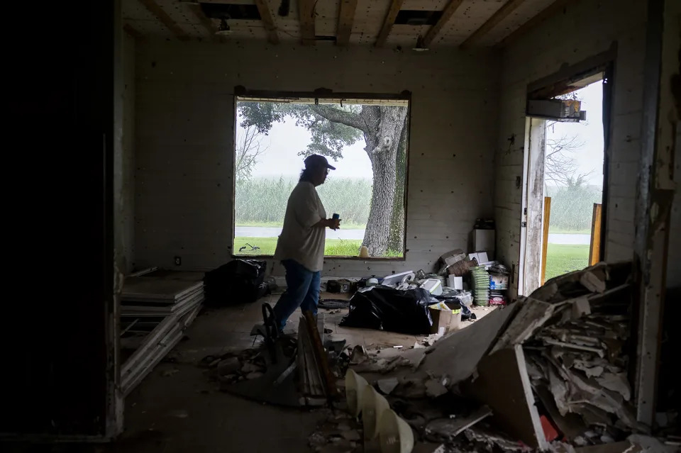
In 2020, Hurricane Laura made landfall in Cameron Parish, south of Lake Charles, as a Category 4 storm with 150 mph winds — one of the most powerful storms to strike Louisiana. Roughly six weeks later, Hurricane Delta hit, cutting a nearly identical path. “What wasn’t taken out by Laura was finished by Delta,” Curtis Prejean said last week as he sat on his back porch with his wife, Shirley.

In the communities in and around Lake Charles, the recovery had been long and uneven. Curtis Prejean has a brother who has been living in a camper for two years. Wiley’s home had been stripped down to its studs inside and the outside was still battered. She is in a constant fight to fend off black mold.

The next storm could take what little some have left.

“We were talking about the hurricanes yesterday,” Wiley said, “and reality is stopping me, because I have nowhere to go. I’m about to be homeless.”

During one recent storm, the Prejeans put down a mattress pad in the hallway of the modest home where they have lived for 33 years and rode it out with two dogs and a cat. The house vibrated, and the noise was terrifying. “I told my husband we’re never doing that again,” Shirley Prejean said.

“I’m going to stay for a Cat. 1,” Curtis Prejean said. “A Cat. 2 …” He shrugged. That’s where he was unsure.

No matter the category, Curtis Goodwin — or as everyone knows him, Warrior War Dog — vowed to stay put. Blue tarps covered parts of his roof, and his exterior walls were still damaged. But he had fortified part of his house with the expectation that his family and dogs would pile inside.

“I’m going to stay right here, and I’m going to ride it out,” he said.

He knew what his cousin and her family had gone through when they left town in anticipation of Hurricane Laura. A few frightening hours at home were better than the weeks of frustration and turbulence that come with evacuating, he reasoned.

Katina Jackson, his cousin, was gone for several months. First, she fled her home in Lake Charles for San Antonio. On the way, the axle on her car broke. If it were not for a mechanic giving her a deal, her family would have been stranded. They stayed in hotels in San Antonio and Fort Worth, Texas, before going home.

The return of hurricane season dredged up all of that.

“It’s just going to be catastrophic again,” Jackson said outside her cousin’s house, helping her daughter take out her braids on a hot but otherwise pleasant evening. “I feel like it’s always quiet before the storm.”

A few minutes later, ominous clouds that had been lurking in the distance swarmed the neighborhood in darkness, and a surge of lightning ripped through the sky.

Scorching Temperatures Just Broke A World Record In California’s Death Valley

HuffPost

Scorching Temperatures Just Broke A World Record In California’s Death Valley

Ben Blanchet – September 3, 2022

Scorching Temperatures Just Broke A World Record In California’s Death Valley

Death Valley National Park in California scorched a world record for high temperatures on Thursday.

The park’s Furnace Creek thermometer hit 127 degrees this week, marking a world record for the hottest temperature ever recorded in September, CBS News reported.

Visitors flocked to the park on Thursday to experience the record-breaking heat, which came less than a month after 1,000 people were stranded in Death Valley due to flash flooding.

The rainfall, the park’s second-highest single-day total since 1936, reportedly buried some 60 vehicles in debris and mud, and washed away boulders and trees in the park.

Thursday’s record temperatures may not last long, according to KABC-TV.- ADVERTISEMENT -https://s.yimg.com/rq/darla/4-10-1/html/r-sf-flx.html

The news station reported that the weekend’s temperatures look like they’ll peak on Monday or Tuesday.

While historic, Death Valley’s incredible heat this week is not expected to break the world’s highest-ever recorded temperature of 134 degrees, CBS News noted.

That temperature occurred on July 10, 1913, also in Death Valley. It was recorded during a heat wave that featured multiple consecutive days with temperatures of 129 degrees or above, according to the National Park Service.

Earlier this week, California Gov. Gavin Newsom (D) declared a state of emergency as high temperatures continued to rock the state’s energy grid, KTVU-TV reported.

The move will allow people in the state to temporarily increase their energy usage as demand grows.

“This is just the latest reminder of how real the climate crisis is, and how it is impacting the everyday lives of Californians,” Newsom said. “While we are taking steps to get us through the immediate crisis, this reinforces the need for urgent action to end our dependence on fossil fuels that are destroying our climate and making these heat waves hotter and more common.”

Plane lands after pilot threatens to hit Walmart

BBC News

Plane lands after pilot threatens to hit Walmart

James FitzGerald – BBC News – September 3, 2022

A pilot who circled above a Mississippi city for hours and threatened to crash into a branch of Walmart has landed the plane safely after talks with police.

State Governor Tate Reeves tweeted that no one had been injured, offering his thanks to law enforcement in Tupelo.

A livestream by a reporter of local television station WTVA appeared to show the vehicle sitting in a field.

The Walmart and another nearby store were earlier evacuated, while citizens were asked to avoid the area.

Details of the conversation between the pilot and police while he was in the air, or his identity, were not immediately made public.

However, local media report the pilot was arrested after landing the plane.

Police were originally notified at around 05:00 local time on Saturday (10:00 GMT) of a plane flying above the city, an earlier statement said.

At the time, police described it as a “dangerous situation”.

The statement added that the plane was possibly a “King Air type” – referring to a small utility plane.

The pilot was said to have made contact with E911 – an emergency number – and proceeded to make their threat to intentionally collide with the Walmart.

Leslie Criss, a local journalist, told The Associated Press news agency she had never seen anything like it in the city, and that it was a “scary way to wake up on a Saturday morning”.

UPDATE: Mill Fire explodes to 3,921 acres with no containment, Mountain Fire at 600 acres

Redding Record Searchlight

UPDATE: Mill Fire explodes to 3,921 acres with no containment, Mountain Fire at 600 acres

David Benda, Michele Chandler, Jessica Skropanic and Jenny Espino, Redding Record Searchlight

September 3, 2022

The fast-moving Mill Fire erupted on Friday near the area of the Roseburg Forest Products mill in Weed, a small city just over 50 miles from the Oregon border. 

There were reports of burn victims and destroyed homes in a neighborhood. Thousands were forced to leave their homes in the communities of Weed, Lake Shastina and Edgewood.

We’ve made these updates free to readers as an important public service to our North State communities. If you are able, help local journalism thrive by subscribing to your local newspaper, and check back here for updates.

10:20 p.m.: Mill Fire still growing, with no containment

Cal Fire on Friday night said sensor aircraft estimated the size of the Mill Fire to be 3,921 acres, roughly 1,300 acres more than fire officials believed earlier in the evening.

The fire, first reported at 12:49 p.m. on Friday, broke out at Woodridge Court and Woodridge Way, near the area of the Roseburg Forest Products mill in Weed. The Cal Fire-Siskiyou Unit via Twitter said the cause of the fire is under investigation.

Evacuations in Weed, Lake Shastina and Edgewood remain in place and Highway 97 remains closed.

8:40 p.m.: Mountain Fire doubles in size, Mill Fire unstable, Sheriff’s Office said

The Mountain Fire grew to 600 acres, twice its size two hours ago, according to Cal Fire.

Both the Mill Fire and Mountain Fire remain uncontained, according to Cal Fire.

“This incident (Mill Fire) is rapidly changing and our staff and partners are doing everything they can to get everyone to safety,” the Siskiyou County Sheriff’s Office said.

The sheriff’s office posted information to help those unable to reach family and friends in evacuation areas. They can call 530-842-8746.

An evacuation shelter is in use at the Yreka Community Center at 810 North Main St. in Yreka.

For information on evacuation zones go to www.zonehaven.com.

8:15 p.m.: Help available for animals in fire evacuation zones

The Siskiyou County Sheriff’s Office is offering animal welfare checks for people who had to evacuate from Mill and Mountain fire areas without their pets or livestock.

Evacuees can go to the Siskiyou County website at bit.ly/3Qc9Hsf and fill out a form to request a welfare check.

6:50 p.m.: Mill Fire explodes Friday afternoon

The Mill Fire exploded in size to 2,580 acres — up from 900 acres at 3 p.m., according to Cal Fire.

There is no containment on the fire, burning north of Weed near Lake Shastina.

The blaze damaged and destroyed multiple structures, including homes, but Cal Fire has not yet released the total number of structures.

The cause of the fire remains under investigation, Cal Fire said.

6:30 p.m.: Mountain Fire grows to 300 acres

The Mountain Fire burned 300 acres of forest eight miles southeast of the small town of Gazelle, according to Cal Fire.

It is not contained, Cal Fire said.

The fire started before 4 p.m. near China Mountain Road, west of Interstate 5, north of Weed.

5:30 p.m.: Some tankers being sent to nearby Mountain Fire

While firefighters continue to battle the Mill Fire burning in the area of Weed and Lake Shastina, six air tankers are being diverted to a second fire that started about an hour ago in the area of Gazelle.

The Mountain Fire is burning in heavy brush on the west side of Interstate 5 north of Weed. Firefighters there have reported that no structures are threatened.

5 p.m.: Wind pushing fire over dry hot terrain

Firefighters continue to battle strong winds while they fight the Mill and Mountain fires.

Those conditions won’t change until Friday night, said Jay Stockton, meteorologist with the National Weather Service in Medford. Weather conditions are ripe for fires to continue spreading until 11 p.m.

Friday afternoon, strong southeast winds blew up to 24 mph, with 36 mph gusts, Stockton said. Temperatures reached 98 degrees in Weed and brush is incredibly dry: 5% humidity.

“That combination of windy and dry is what’s creates conditions for rapid fire growth,” he said.

A red flag warning is in effect until 11 p.m. Friday, at which time the winds should calm down, Stockton said. Temperatures should cool to the mid-50s, increasing moisture in the air.

All that could help firefighters get a better handle on the fires, he said.

4:14 p.m.: Power outage reported in Weed, Mount Shasta, Lucerne

About 8,300 residents in Weed and Mount Shasta in Siskiyou County and Lucerne in Lake County were hit by a power outage shortly before 1 p.m. on Friday, according to electric power company PacifiCorp.

A cause of the outage is under investigation, said company spokesman Brandon Zero. Crews have been dispatched to the area, he said.

A smoke plume from the Mill Fire rises over downtown Weed on Friday, Sept. 2, 2022.
3:55 p.m.: Fire threatening Carrick outside Weed

Firefighters are communicating to each that the fire is threatening to jump Highway 97 and burn into the small community of Carrick just outside Weed.

3:20 p.m.: Mill Fire balloons to 900 acres

The Mill Fire burning north of Weed toward Lake Shastina is now more than 900 acres, Cal Fire reports.

Firefighters are asking for all strike teams to come to the Jackson Ranch Road area. Earlier, the fire jumped Jackson Ranch Road and started burning into Lake Shastina.

Currently, there is no containment.

All zones east of Interstate 5 from Weed to county road A12, south of county road A12 from Grenada to Highway 97, west of Highway 97 from A12 to I-5, Cal Fire said.

There is an evacuation Shelter at the Karuk wellness center in Yreka at 1403 Kahtishraam.

Meanwhile, all remaining Weed High School students were bussed to Mt. Shasta High School for pick up, officials said.

2:50 p.m.: Fire burning into Lake Shastina

The Mill Fire has jumped Jackson Ranch Road and is burning into the community of Lake Shastina, which is north of Weed, crews battling the blaze report. Firefighters also have asked for at least five more strike teams to help fight the fire.

Meanwhile, a temporary evacuation center is being set up at the Siskiyou County Fairgrounds in Yreka, according to scanner reports.

2:45 p.m.: Mill Fire grows to 555 acres

The communities of Weed, Lake Shastina and Edgewood are under evacuation orders as of 2 p.m. Friday due to the Mill Fire, according to the Siskiyou County Sheriff Office’s Facebook page.

Residents in those areas are asked to leave immediately.

Use caution, as emergency vehicles are assisting with evacuations, structure protection and fire suppression efforts. For more information, call 2 1 1. Real-time evacuation zone statuses are available on aware.zonehaven.com.

The Mill Fire near Weed has grown to 555 acres since first being reported on Friday afternoon, officials said.

The wildfire broke out the same day that the area was under a red flag warning due to high temperatures, gusty winds and low humidity. The chance of rain in the area remains in the single digits through Tuesday.

The wind was blowing north at 20 mph in the Weed and Lake Shastina areas on Friday afternoon, according to Windfinder.com.

Southerly winds of about 20 mph, with gusts as high as 30 mph, could emerge through Friday night, according to the National Weather Service.

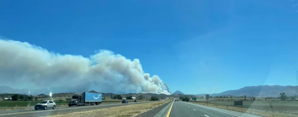
The Mill Fire as seen from Interstate 5. The fire started on Friday afternoon, Sept. 2, 2022.

Saturday’s forecast calls for sun with widespread haze and a high near 89. Calmer winds becoming northwest at between 5 to 8 mph are expected in the afternoon, according to the weather service.

Pacific Power had not reported any outages in greater Weed as of mid-afternoon on Friday.

1:55 p.m.: Students to stay on campus

Firefighters battling the Mill Fire are recommending not to release students at Weed High School. They are asking the students to stay on campus for now, according to scanner reports.

Meanwhile, mandatory evacuations are being called for all residents east of Interstate 5 to Jackson Ranch Road. Firefighters say the blaze has reached Jackson Ranch Road.

Also, all of Lake Shastina is under a mandatory evacuation order.

Evacuation warnings are in place along Highway 97 in the Mt. Shasta Vista neighborhood.

1:49 p.m.: Evacuations ordered

Evacuation orders have been issued in the community of Weed due to a fire that started Friday afternoon in the area of Roseburg Forest Products mill.

Highway 97 is closed from the junction of Highway 265 in Weed to south of Macdoel due the Mill Fire, the California Department of Transportation said.

Firefighters are also asking for Jackson Ranch Road to be closed so residents who are evacuating in that area have a clear route out of the neighborhood, according to emergency scanner reports.

The fire also has reached Hoy Road.

Firefighters report that traffic in the area is backed up due to all the evacuations.

At least one ambulance has been dispatched to treat a burn victim and a medical triage has been set up to treat other burn victims, scanner reports said.