‘A year-after-year disaster:’ The American West could face a ‘brutal’ century under climate change

USA Today

‘A year-after-year disaster:’ The American West could face a ‘brutal’ century under climate change

Elizabeth Weise – April 2, 2022

SAN FRANCISCO – The West, once a beacon for all that was new and hopeful in America, could become an example of the grim, apocalyptic future the nation faces from climate change.

The last five years already have been harrowing.

Whole neighborhoods burned down to foundations. Children kept indoors because the air outside is too dangerous to play in. Killer mudslides of burned debris destroying towns. Blood-red skies that are so dark at midday, the streetlights come on and postal workers wear headlamps to deliver the mail.

And it’s going to get worse unless dramatic action is taken, two studies published this week forecast.

The first predicts the growth of wildfires could cause dangerous air quality levels to increase during fire season by more than 50% over the next 30 years in the Pacific Northwest and parts of northern California.

A second shows how expected increases in wildfires and intense rain events could result in more devastating flash floods and mudslides across a broad portion of the West.

“These studies reinforce the likelihood of a brutal future for the West,” said Jonathan Overpeck, a climate scientist and dean of the University of Michigan’s School for Environment and Sustainability.

“Even climate scientists are scared,” he said. If climate change isn’t curbed, a “dystopian” landscape could be the result.

El Dorado County firefighters battle a fire close to a home off of U.S. Highway 89 in the Christmas Valley community near Meyers, Calif., on Monday, Aug. 30, 2021.

Deadly mudslides: More Americans are threatened as heavy rains loom over scorched lands

Each study, based on evermore-precise climate modeling, follows previous research showing the recent red skies, torched forests and neighborhoods, and catastrophic flooding and mudslides could be the new normal unless carbon emissions are halted soon.

“These papers echo an overwhelming trend,” said Rebecca Miller, who studies the impact of fire on the West at the University of Southern California. “Fires and their impacts are getting more severe and are projected to just get worse, becoming a year-after-year disaster.”

What this means for the West, home to 79 million people, is in some ways a return to the past.

“When you moved to the West a century ago, it was an inhospitable place. There was an underlying danger,” said Bruce Cain, director of the Bill Lane Center for the American West at Stanford University. “We’re returning to that.”

The dire consequences, however, may be an incentive for Americans to take meaningful climate action.

“It’s a kick in the pants to get stuff done,” Cain said.

Bad air days

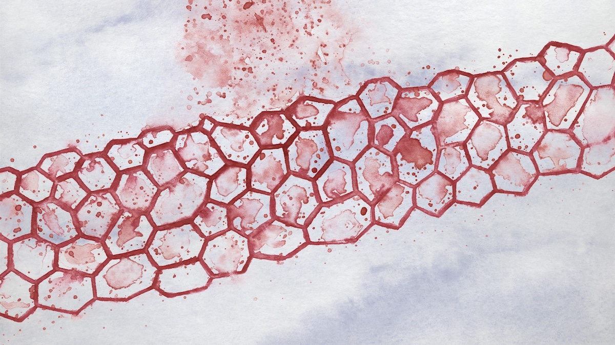
Rising levels of dangerous particles in the air due to smoke from wildfires are a growing threat not just in the American West but across the country, the paper published Monday in the Proceedings of the National Academy of Science showed.

In just the last five years, the West saw a series of historically large and destructive fires that burned millions of acres, destroyed thousands of homes and killed hundreds of people. The annual area burned by forest fires in the region has increased tenfold over the past half-century.

The smoke from those fires turned skies red and was so pervasive that Pacific Coast cities from Los Angeles to Seattle kept children indoors during recess and canceled sporting events. Residents were advised not to go outside and to tightly close windows and doors. Sales of air filters skyrocketed.

Downtown Los Angeles and Dodger Stadium are shrouded, looking south from Elysian Fields through the smoke from the Bobcat and the El Dorado fires, Friday, Sept. 11, 2020.

‘It could happen tomorrow’: Experts know disaster upon disaster looms for West Coast

By the end of the century, these kinds of dangerous, polluting fires could occur every three to five years across the Pacific Northwest and parts of northern California, the study by scientists at Princeton University and the National Oceanic and Atmospheric Administration found.

“These unhealthy particle pollution levels that occurred in the recent large fires may become the new norm in the late 21st century,” said Yuanyu Xie, a researcher in atmospheric and oceanic sciences at Princeton and one of the paper’s authors.

The scientists modeled several scenarios. In what’s known as the “middle of the road” climate change scenario, in which carbon emissions don’t start to fall before mid-century and don’t reach net-zero until 2100, the models show smoke pollution increasing by 100% to 150%.

In the “business as usual” scenario, in which society doesn’t make concerted efforts to cut greenhouse gases, smoke increases 130% to 260%.

The danger stretches across the United States. Wildfire smoke can travel hundreds and even thousands of miles. In July, smoke from Western wildfires triggered air quality alerts and caused smoky skies and red-orange haze in New York, Washington, Baltimore, Philadelphia and Boston.

Staten Island ferry commuters take in the view of the Statue of Liberty seen through the haze on July 20, 2021, in New York. Smoke from wildfires across the U.S. West, including Oregon's Bootleg Fire, has wafted over large swaths of the eastern United States. New York City's skies were hazy with smoke from fires thousands of miles away.
Staten Island ferry commuters take in the view of the Statue of Liberty seen through the haze on July 20, 2021, in New York. Smoke from wildfires across the U.S. West, including Oregon’s Bootleg Fire, has wafted over large swaths of the eastern United States. New York City’s skies were hazy with smoke from fires thousands of miles away.

“It’s not simply a health threat to people who lives in Western states. We’re seeing impacts hundreds and sometimes thousands of miles away,” said the American Lung Association’s senior vice president for public policy Paul Billings.

The particles in smoke can penetrate deep into the lungs, creating and exacerbating multiple health issues.

“It can cause asthma attacks, strokes, heart attacks and increases in cardiovascular problems,” said Billings. There’s also evidence that smoke may impact pregnancy and birth outcomes.

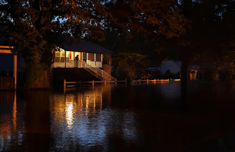
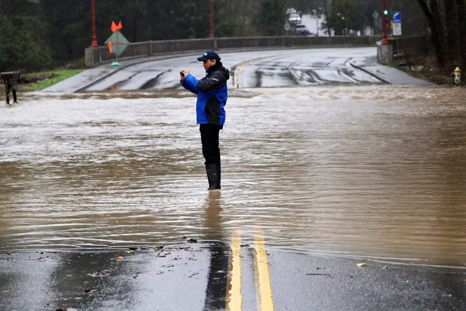
Cloudbursts, floods and mudslides

A second paper, published Friday in the journal Science Advances, modeled two separate trends in the West – increasing “fire weather” and increased extreme rainfall events – that together spell trouble.

In the past, extreme rainfall was unlikely to follow a major wildfire, but the one-two punch is becoming more common and can be a dangerous combination.

Westerners have long lived with so-called fire weather, times of exceptional heat, dryness and wind that increase fire danger. The National Weather Service even produces fire weather forecasts. The researchers’ models show that these extreme events will increase in the coming decades.

Extreme rain: How a summer of extreme weather reveals a stunning shift in the way rain falls in America.

At the same time, the frequency and intensity of extreme rain events are projected to also increase in much of the western United States, the study showed. By mid-century, midsized heavy rain events are expected to increase by more than 30%.

“It’s like rolling dice, you have your set of fire dice and your set of rain dice. Sometimes it comes up fire and rain in the same year,” said Samantha Stevenson, a climate modeler at the University of California, Santa Barbara, a co-author of the paper.

That poses an additional risk to anyone living downhill from charred areas. Fires destroy vegetation that holds soils in place and can sometimes harden the ground, lessening its ability to absorb water. Both contribute to the possibility of catastrophic flash floods and what scientists call debris flows.

“It’s a mixture of rocks, soil, vegetation and water that’s moving downhill at a rate you can’t outrun,” said Matthew Thomas, a research hydrologist with the U.S. Geological Survey. “A flood can inundate a home, but a debris flow can take it off its foundation.”

Models run by scientists predict that in the Pacific Northwest, more than 90% of fire weather days will be followed within six months by extreme rain events. Over five years, almost all fire weather will be followed by at least one extreme rainfall event – and it can take that long for scorched land to recover.

The findings were similar, though less extreme for California and Colorado.

The results surprised Danielle Touma, an environmental engineering researcher at the University of California, Santa Barbara, who co-authored the paper.

“Seeing the numbers on your screen, it’s quite shocking,” she said.

The phenomenon is already visible.

A man stands in a roadway flooded by Issaquah Creek and takes photos Thursday, Feb. 6, 2020, in Issaquah, Wash. Heavy rain sent the creek over a major roadway, under an apartment building east of Seattle and up to the foundations of homes as heavy rains pounded the region. A flood watch was in effect through Friday afternoon across most of western Washington.

A USA TODAY investigation last year found that between 2018 and 2021, fast-moving debris flows have damaged and destroyed hundreds of homes, closed major transportation routes across at least three states and caused more than $550 million in property damage. Close to 170 people have been injured and 28 people died since 2018.

Last year, flash floods in Colorado’s Poudre Canyon killed at least three people. It occurred in the burn scar left by the 2020 Cameron Peak Fire, the largest recorded fire in Colorado history.

In 2018 the Montecito mudslide killed 23 people near Santa Barbara, and properly loss claims totaled $421 million. It came just a month after the Thomas fire, one of the largest in state history, killed two people, destroyed at least 1,000 structures and cost $1.8 billion in property damages.

The speed at which wildfires have worsened across much of America has exceeded predictions by the scientific community, said Overpeck.

“If anything, the theory and the models were underestimating how hard and fast these impacts would accumulate,” he said. “Mother Nature is making that crystal clear.”

Contact Elizabeth Weise at eweise @usatoday.com

San Francisco's Glen Park neighborhood at 9:55 am Pacific Daylight Time on Wednesday, September 9, 2020. Smoke from numerous wildfires over a layer of marine fog turned the sky an eerie orange color. Cars were using headlines and some street lights were still on.
San Francisco’s Glen Park neighborhood at 9:55 am Pacific Daylight Time on Wednesday, September 9, 2020. Smoke from numerous wildfires over a layer of marine fog turned the sky an eerie orange color. Cars were using headlines and some street lights were still on.

Mystery Chemicals in Plastics Might Lead to Obesity

EcoWatch

Mystery Chemicals in Plastics Might Lead to Obesity

Olivia Rosane – April 01, 2022

Storing food in plastic boxes in a refrigerator

Chemicals that encourage fat growth might leach into our food via household plastics. Wachirawit Iemlerkchai

Is plastic making you fat? 

It’s well known that plastics contain endocrine-disrupting chemicals like bisphenol A (BPA) and phthalates. However, a recent study published in Environmental Science and Technology found that these infamous chemicals may just be the tip of the trashberg. The researchers tested 34 common plastic products from bath slippers to yogurt cups and found that a third of them contained chemicals that induced the growth of fat cells in the lab. 

“The most important finding, I think, is that everyday plastic products contain chemicals that can disrupt our metabolism in a process we call adipogenesis,” study co-author and Norwegian University of Science and Technology (NTNU) associate professor Martin Wagner told EcoWatch. “And we know that adipogenesis is like the first step towards developing obesity or becoming overweight later.”  

Mystery Chemicals

The researchers used mass spectrometry to identify the chemicals in 34 common plastic items, including food packaging like yogurt cups and plastic bottles as well as household items like kitchen sponges or placemats. The goal, Wagner said, was to cover the major types of plastic polymers. 

They found a total of 55,300 distinct chemical features, but were only able to identify 629 of them. Among them were 11 previously-known metabolism disrupting chemicals (MDCs). However, the scientists then tested whether or not exposure to the plastics would encourage precursor cells to transform into fat cells. Some of the plastics that encouraged fat-cell growth did have one of the 11 known MDCs in their chemical makeup, but others did not.

“It’s very likely that it is not the usual suspects, such as Bisphenol A, causing these metabolic disturbances,” first-study author Johannes Völker of NTNU’s Department of Biology said in a press release emailed to EcoWatch. “This means that plastic chemicals other than the ones we already know could be contributing to overweight and obesity.”

Causes of a Pandemic 

The study adds to a growing body of research that suggests the obesity pandemic isn’t just a question of poor diets and sedentary lifestyles. Almost three times more people are obese today than they were in 1975, and this is a major public health concern. Obesity contributes to many of the most common causes of death including cancer and heart disease and can increase the risk of contracting infections including COVID-19. 

At first, health experts thought that obesity was caused by a mix of genetics and lifestyle factors, but this doesn’t explain all the data. For example, a 2016 study found that the body mass index (BMI) for 36,377 U.S. adults between 1988 and 2006 rose by as much as 2.3kg/m(2) even when caloric intake and physical activity stayed constant. This led to the conclusion that there must be another factor promoting weight gain. But what? One potential culprit was chemicals that mess with the endocrine system, which controls appetite, metabolism and weight. 

“Connecting endocrine disruption and obesity gave rise to the so-called obesogen hypothesis, which poses that environmental chemicals (obesogens) contribute to obesity,” the study authors wrote. 

Plastics aren’t the only potential source of exposure to these chemicals. Pesticides are another. For example, a 2021 study found that chlorpyrifos can slow the calorie-burning efforts of brown fat in mice. However, plastics are an increasingly ubiquitous part of our daily lives. The obesogen hypothesis indicates that obesity, like many public health and environmental problems, will not be solved by appeals to personal responsibility alone. 

“It puts the responsibility, in our case, I think, really on the plastic producers, because they should make sure that their products that they’re selling us are safe,” Wagner told EcoWatch. 

But what is the chance that the chemicals contained in the 34 plastic products are actually ending up in people’s bodies? There are several ways that this could happen, Wagner said. Chemicals can leach from plastic food containers, especially when heated. Children might chew on toys or items like plastic sponges. It’s also possible that the chemicals could migrate through the skin when you wear plastic gloves or slippers. Finally, we might breathe them in; phthalates have been found in household dust. While more research would be needed to test whether the chemical mixtures discovered in the study would encourage obesity in animals, there is evidence from both animal and epidemiological studies that BPA at least is strongly associated with obesity. 

Losing the Plastic Weight

In the meantime, what can consumers do to make sure the plastic products in their lives aren’t working against their diets or gym memberships? Wagner said that PVC and polyurethane products “really stood out” when it came to MDC content. PVC is often found in flooring and also placemats, while polyurethane is a foam used for insulation but also other squishy materials like sponges. 

These two polymers can therefore be avoided, or at least kept out of the mouths of babes. But for the other polymers like polystyrene and polyethylene, which are often used in food containers, the results were more ambiguous. One polystyrene sample had very active MDCs, while the others did not. This can make things more difficult for conscientious shoppers. 

“If you buy [a] yogurt cup from polystyrene, you don’t know which one contains the toxicity,” Wagner said. 

However, it also provides an opportunity for plastics manufacturers. 

“Apparently you can make a polystyrene yogurt cup that actually doesn’t contain endocrine disrupting chemicals or metabolism disrupting chemicals,” Wagner said. 

Wagner’s team hopes to next work on identifying which of the unknown chemicals they discovered are truly active MDCs. This will help regulators and manufacturers to know what to look out for. But Wagner also thought that plastic makers should work on designing products that have simpler chemical recipes. This will be especially important if we succeed in switching to a circular economy, because more chemicals usually have to be added to a plastic when it is recycled and reused. 

“How can we design a yogurt cup that only contains ten chemicals that we can analyze and assess and make sure that they are safe?” Wagner challenged.

Russian Troops Suffer ‘Acute Radiation Sickness’ After Digging Chernobyl Trenches

Daily Beast

Russian Troops Suffer ‘Acute Radiation Sickness’ After Digging Chernobyl Trenches

Barbie Latza Nadeau – March 31, 2022

Several hundred Russian soldiers were forced to hastily withdraw from the Chernobyl nuclear power plant in Ukraine after suffering “acute radiation sickness” from contaminated soil, according to Ukrainian officials.

The troops, who dug trenches in a contaminated Red Forest near the site of the worst nuclear disaster in history, are now reportedly being treated in a special medical facility in Gomel, Belarus. The forest is so named because thousands of pine trees turned red during the 1986 nuclear disaster. The area is considered so highly toxic that not even highly specialized Chernobyl workers are allowed to enter the zone.

Energoatom, the Ukrainian agency in charge of the country’s nuclear power stations, said the Russian soldiers had panicked and fled.

“It has been confirmed that the occupiers who seized the Chernobyl nuclear power plant and other facilities in the Exclusion Zone set off in two columns towards Ukraine’s border with Belarus. The occupiers announced their intentions to leave the Chernobyl nuclear power plant this morning to the Ukrainian personnel of the station,” the agency said in a statement on Telegram, adding that a small number of Russians still remained at the facility.

The agency said it had also confirmed reports of Russian forces digging trenches in the Red Forest, “the most polluted in the entire exclusion zone.”

“Not surprisingly, the occupiers received significant doses of radiation and panicked at the first sign of illness. And it showed up very quickly.”

Local reports suggest that seven buses with the zapped troops arrived in Gomel early Thursday. Journalists on the ground have also reported “ghost buses” of dead soldiers being transported from Belarus to Russia under the cover of dark.

Ukraine Admits It’s ‘Impossible’ to Say if Chernobyl Is Safe

U.S. intelligence reported Wednesday that Russian forces began withdrawing from the defunct site. Russia said the withdrawal from Chernobyl was part of a pledge to scale back the invasion. But Ukrainian media says it is actually because the troops were “irradiated” from the contaminated soil.

“Another batch of Russian irradiated terrorists who seized the Chernobyl zone was brought to the Belarusian Radiation Medicine Center in Gomel today,” Yaroslav Yemelianenko, who works for the Public Council at the State Agency of Ukraine for Exclusion Zone Management, posted on Facebook. “There are rules for dealing with this territory.”

The Chernobyl facility fell to Russian control on Feb. 24, the first day of the invasion. Workers were on duty for more than 600 hours before being allowed a shift change. International concern grew immediately when Russian troops moved heavy military hardware through the area, kicking up radioactive dust without any protective equipment. Forest fires in the area also raised concern about environmental contamination.

Digging trenches in the forest—considered the most contaminated area of the site—drew widespread ridicule from Ukrainians who work at the site.

The debacle is the latest in a series of missteps by the Russian troops struggling to keep their footing in their increasingly failed war.

Ukraine says most Russian forces have left Chernobyl nuclear plant, cites radiation concerns

Reuters

Ukraine says most Russian forces have left Chernobyl nuclear plant, cites radiation concerns

March 31, 2022

FILE PHOTO: A general view shows a New Safe Confinement structure over the old sarcophagus covering the damaged fourth reactor at the Chernobyl nuclear power plant, in Chernobyl

LVIV, Ukraine (Reuters) -The Ukrainian state nuclear company said on Thursday most of the Russian forces that occupied the Chernobyl nuclear power station after invading Ukraine have left the defunct plant, and suggested radiation concerns had driven them away.

Though Russian troops seized control of Chernobyl soon after the Feb. 24 invasion, the plant’s Ukrainian staff continued to oversee the safe storage of spent nuclear fuel and supervise the concrete-encased remains of the reactor that exploded in 1986, causing the world’s worst nuclear accident.

State-owned Energoatom said these workers had flagged earlier on Thursday that Russian forces were planning to leave the territory.

“The information is confirmed that the occupiers, who seized the Chernobyl nuclear power plant and other facilities in the exclusion zone, have set off in two columns towards the Ukrainian border with the Republic of Belarus,” it said in a statement.

It said a small number of Russian troops remained at Chernobyl, but did not specify how many. Russian forces have also retreated from the nearby town of Slavutych, where workers at Chernobyl live, it said.

In a separate online post, Energoatom said the Russian side had formally agreed to hand back to Ukraine the responsibility for protecting Chernobyl. It shared the scan of a document setting out such an arrangement and signed by individuals it identified as a senior staff member at Chernobyl, the Russian military official tasked with guarding Chernobyl, and others.

Reuters could not immediately verify the authenticity of the document. There was no immediate comment from the Russian authorities, who have denied that its forces have put nuclear facilities in Ukraine at risk.

‘ALMOST A RIOT’

Energoatom said it had also confirmed information that Russian troops had built fortifications including trenches in the so-called Red Forest – the most radioactively contaminated part of the zone around Chernobyl.

As a result of concerns about radiation, “almost a riot began to brew among the soldiers,” it said in the statement, suggesting this was the reason for their unexpected departure.

Ukraine has repeatedly expressed safety concerns about Chernobyl and demanded the withdrawal of Russian troops, whose presence prevented the rotation of the plant’s personnel for a time.

Earlier this week, workers at the site told Reuters that Russian soldiers had driven without radiation protection through the Red Forest, kicking up clouds of radioactive dust.

Asked to comment on the accounts from Chernobyl staff, Russia’s defence ministry did not respond.

Earlier on Thursday, the head of Energoatom urged the U.N. nuclear watchdog to help ensure Russian nuclear officials do not interfere in the operation of Chernobyl and the Zaporizhzhia nuclear power plant, Europe’s largest, which is also occupied by Russian soldiers.

(Reporting by Pavel Polityuk; Writing by Alessandra Prentice; editing by Timothy Heritage and Jonathan Oatis)

Workers at Chernobyl site say Russian soldiers drove through the highly-radioactive ‘Red Forest’ with no protective gear

Business Insider

Workers at Chernobyl site say Russian soldiers drove through the highly-radioactive ‘Red Forest’ with no protective gear

Marianne Guenot – March 31, 2022

A sign with the symbol for radioactivity is shown outside of the red forest.
A sign warns of radiation at the “red forest” near the former Chernobyl nuclear power plant on September 29, 2015.Sean Gallup/Getty Images
  • Russian soldiers drove armored vehicles through the ‘Red Forest’ as they invaded Chernobyl, per Reuters.
  • Reuters spoke to two unnamed Ukrainian staff at the decommissioned Chernobyl nuclear power plant.
  • The soldier didn’t wear protective gear and exposed themselves to radioactive dust, they said.

Russian soldiers drove armored vehicles through the most contaminated area of Chernobyl’s exclusion zone with protection, two sources told Reuters.

The trip kicked up clouds of radioactive dust that could be damaging to the troops’ health, the outlet said.

One source told the outlet that the soldiers appeared to have no idea about Chernobyl’s history as a nuclear disaster site.

Reuters spoke to two Ukrainian workers who were on duty in the decommissioned power plant when Russian soldiers invaded the site on February 25 in the first days of the invasion of Ukraine.

The workers, who asked not to be named for fears about their safety, spoke to Reuters in late March.

By that time they had just been allowed home after being confined to the decommissioned power plant by Russian soldiers for almost a month.

A yellow sign shows in Cyrillic indicates the limit of the red forest in Ukraine.
The sign marks the territory of the Red Forest, Kyiv Region, northern Ukraine on April 21, 2021.Volodymyr Tarasov/ Ukrinform/Future Publishing via Getty Images

The workers said that Russian soldiers drove armored vehicles through the Red Forest, 1.5 square miles of pine forest that died as a result of exposure shortly after the 1986 Chernobyl nuclear accident. The Red Forest remains the most contaminated area of the zone around Chernobyl, per Reuters.

“The convoy kicked up a big column of dust,” one source said, per Reuters.

One worker told Reuters that some of the soldiers he had spoken to in the plant “did not have a clue” about the 1986 catastrophe at Chernobyl, the world’s worst nuclear disaster.

“They had no idea what kind of facility they were at,” the worker said.

The worker’s accounts are in line with reports from the International Atomic Energy Agency, which said shortly after Russian troops moved into the exclusion zone that remote sensors showed the invasion had disturbed radioactive dust, raising the level of radiation around the site.

The plant has been under the control of Russian troops since February 24. The power plant was fully decommissioned after the 1986 nuclear accident and the remaining work at the site is mostly directed toward decontamination.

An active nuclear power plant in Zaporizhzhia in the south of Ukraine has also been captured and has been operating under the control of Russian troops since March 4.

The invasion of nuclear sites by the military caused outrage among nuclear experts.

Several told Insider that the risk of a catastrophic nuclear accident at either of the nuclear sites remains low, but is more likely because of the nearby fighting.

The occupation of the Chernobyl site might soon be coming to an end, according to an unnamed US defense official.

The official told France 24 on Wednesday that the Russian troops looked like they were being removed from Chernobyl and repositioned in Belarus, which has a border with Ukraine around 10 miles from the Chernobyl site.

Norway told to get Cold War bunkers ready amid fears of nuclear fallout

Yahoo! News

Norway told to get Cold War bunkers ready amid fears of nuclear fallout

Andy Wells, Freelance Writer – March 31, 2022

Pripyat , Ukraine; 14 June 2019; Pripyat is a ghost city in northern Ukraine, founded as the ninth nuclear city in the Soviet Union, to serve the nearby Chernobyl Nuclear Power Plant. It was officially proclaimed a city in 1979 and had grown to a population of 49,360 by the time it was evacuated on the afternoon of April 27, 1986, the day after the Chernobyl disaster.
A radiation warning at Pripyat, Ukraine, a ghost city that was evacuated the day after the Chernobyl disaster. (Getty)

Fears of another Chernobyl-like disaster in Ukraine have prompted warnings in Norway for citizens to “dust off” Cold War bunkers.

Since invading Ukraine last month, Russian troops have occupied Europe’s largest nuclear power plant at Zaporizhzhia as well as at the now defunct plant at Chernobyl, the scene of the world’s worst nuclear accident in 1986.

Odd Roger Enoksen, Norway’s defence minister, has now aired concerns that any accident at a Ukrainian power plant that cause a radiation leak could impact his own country if the wind travels in its direction.

According to The Times, defence sources have told civilians in Norway to start “dusting off” their bunkers at home “in case of nuclear alert”.

A view shows the abandoned city of Pripyat near the Chernobyl Nuclear Power Plant, Ukraine, April 12, 2021. Picture taken with a drone April 12, 2021. REUTERS/Gleb Garanich
A view shows the abandoned city of Pripyat near the Chernobyl Nuclear Power Plant, Ukraine. (Reuters)
Service members take part in tactical exercises, which are conducted by the Ukrainian National Guard, Armed Forces, special operations units and simulate a crisis situation in an urban settlement, in the abandoned city of Pripyat near the Chernobyl Nuclear Power Plant, Ukraine, February 4, 2022. REUTERS/Gleb Garanich
Service members take part in tactical exercises in the abandoned city of Pripyat near the Chernobyl Nuclear Power Plant, Ukraine. (Reuters)

The source told the paper: “Everyone has been warned so if they are using them for storage now they need to make a plan for taking things out.”

A 72-hour warning would be given in advance to get bunkers ready for use.

Enoksen calmed fears that the warning was due to the threat of a nuclear war, rather than fallout from an accident.

He said: “Ukraine has the most production of nuclear power in Europe and if an accident happens, as with Chernobyl, we will all in western Europe be affected by that if the wind goes in this direction.”

Watch: Ukraine warns of Chernobyl radiation leak after power cut

Ukraine warns of Chernobyl radiation leak after power cut

Ukraine has warned that radiation could be released from Chernobyl. The nuclear power plant, which is currently under the control of Russian troops, has been knocked off the power grid and cannot cool spent nuclear fuel.

He said Norway was still able to see the effects of Chernobyl adding: “In summer time we can actually see ashes from burning grass in Ukraine.”

The warning comes as US defense officials said Russian forces may have begun to pull out of Chernobyl.

According to the AFP news agency, US defense officials said troops had begun walking away from Chernobyl and moving to Belarus. “We think that they are leaving. I can’t tell you that they’re all gone,” they said.

Norway, which shares a 12-mile land border with Russia, made it compulsory for bunkers to be built in civilian infrastructure like hotels during the Cold War-era.

Norwegians have also been told to stock up on medicines for children in case of radioactive fallout.

Norway's defence minister Odd Roger Enoksen said Norway was still able to see the effects of the Chernobyl disaster. (Reuters)
Norway’s defence minister Odd Roger Enoksen said Norway was still able to see the effects of the Chernobyl disaster. (Reuters)

The warnings come as the head of Ukraine’s state nuclear company urged the UN nuclear watchdog to help ensure Russian nuclear officials do not interfere in the operation of nuclear power plants occupied by Russian forces.

Energoatom CEO Petro Kotin said earlier this month that Russia’s state nuclear company Rosatom had sent officials to the Zaporizhzhia plant to try to take control of it.

Representatives from the International Atomic Energy Agency (IAEA) arrived in Ukraine on Tuesday to inspect the country’s nuclear facilities after Kyiv claimed that munitions stored near Chernobyl could explode.

An aerial view from a plane shows a New Safe Confinement (NSC) structure over the old sarcophagus covering the damaged fourth reactor at the Chernobyl Nuclear Power Plant during a tour to the Chernobyl exclusion zone, Ukraine April 3, 2021. Ukraine International Airlines made a special offer marking the 35th anniversary of the Chernobyl nuclear disaster. Tourists get a bird's eye view of abandoned buildings in the ghost town of Pripyat and the massive domed structure covering a reactor of the Chernobyl Nuclear Power Plant that exploded on April 26, 1986. Picture taken April 3, 2021. REUTERS/Gleb Garanich
A New Safe Confinement (NSC) structure over the old sarcophagus covering the damaged fourth reactor at the Chernobyl Nuclear Power Plant, Ukraine. (Reuters)

IAEA chief Rafael Grosso, along with various experts and equipment aimed at keeping nuclear facilities there safe, are on hand for assistance.

Since Russia’s invasion, Grossi has called on both countries to urgently agree a framework to ensure nuclear facilities are safe and secure.

Ukraine has repeatedly expressed safety concerns about Chernobyl and demanded Russian forces occupying the plant pull out of the area.

The Russian military said after capturing the plant that radiation was within normal levels and their actions prevented possible “nuclear provocations” by Ukrainian nationalists.

Russia has denied that its forces have put nuclear facilities inside Ukraine at risk.

Scientists Achieve Record Energy Efficiency for Thin Solar Panels

EcoWatch – Renewable Energy

Scientists Achieve Record Energy Efficiency for Thin Solar Panels

Paige Bennett – March 30, 2022

A disordered honeycomb layer used on top of the silicon panel

Scientists collaborated with AMOLF in Amsterdam to use solar panels one micrometer thick with a disordered honeycomb layer on top of the silicon panel. AMOLF

Scientists from the University of Surrey and Imperial College London have achieved an increase in energy absorption in ultra-thin solar panels by 25%, a record for panels of this size.

The team, which collaborated with AMOLF in Amsterdam, used solar panels just one micrometer thick with a disordered honeycomb layer on top of the silicon panel. The biophilic design draws inspiration from butterfly wings and bird eyes to absorb sunlight from every possible angle, making the panels more efficient.

The research led to a 25% increase in levels of energy absorption by the panels, making these solar panels more efficient than other one-micrometer-thick panels. They published their findings in the American Chemical Society’s journal, Photonics.

“One of the challenges of working with silicon is that nearly a third of light bounces straight off it without being absorbed and the energy harnessed,” said Marian Florescu from the University of Surrey’s Advanced Technology Institute (ATI) in a statement. “A textured layer across the silicon helps tackle this and our disordered, yet hyperuniform, honeycomb design is particularly successful.”

The panels in the study reached absorption levels of 26.3 mA/cm2, compared to a previous absorption record of 19.72 mA/cm2 from 2017.

Increasing the efficiency and absorption of ultra-thin panels is crucial to achieving low-cost photovoltaics.

“Micrometer-thick silicon photovoltaics (PV) promises to be the ultimate cost-effective, reliable, and environmentally friendly solution to harness solar power in urban areas and space, as it combines the low cost and maturity of crystalline silicon (c-Si) manufacturing with the low weight and mechanical flexibility of thin films,” the authors of the study explained.

The researchers expect that more design improvements will push the efficiency of macrometer-thin panels even higher, and they will be able to compete with existing commercial solar panels. Plus, these flexible panels could offer versatility in how they are used.

“There’s enormous potential for using ultra-thin photovoltaics. For example, given how light they are, they will be particularly useful in space and could make new extra-terrestrial projects viable,” Florescu said. “Since they use so much less silicon, we are hoping there will be cost savings here on Earth as well, plus there could be potential to bring more benefits from the Internet of Things and to create zero-energy buildings powered locally.” 

Outside of photovoltaics, the research could also be useful for other industries, like photo-electrochemistry, solid-state light emission and photodetectors, that focus on light management.

Following the successful absorption rate increase of the ultra-thin panels in this study, the scientists plan to start looking for commercial partners and develop a plan for manufacturing.

50% of U.S. Lakes and Rivers Are Too Polluted for Swimming, Fishing, Drinking

EcoWatch – Health – Wellness

50% of U.S. Lakes and Rivers Are Too Polluted for Swimming, Fishing, Drinking

Olivia Rosane – March 29, 2022

A steel mill on Indiana’s Grand Calumet River. Cavan Images / Getty Images

Fifty years ago, the U.S. passed the Clean Water Act with the goal of ensuring  “fishable, swimmable” water across the U.S. by 1983. 

Now, a new report from the Environmental Integrity Project (EIP) finds the country has fallen far short of that goal. In fact, about half of the nation’s lakes and rivers are too polluted for swimming, fishing or drinking. 

“The Clean Water Act should be celebrated on its 50th birthday for making America’s waterways significantly cleaner,” EIP Executive Director Eric Schaeffer said in a press release announcing the report.  “However, we need more funding, stronger enforcement, and better control of farm runoff to clean up waters that are still polluted after half a century. Let’s give EPA and states the tools they need to finish the job – we owe that much to our children and to future generations.”

The report was based on reports that states are required to submit under the Clean Water Act on the pollution levels of their rivers, streams, lakes and estuaries. According to the most recent reports, more than half of the lakes and rivers are considered “impaired,” meaning that they fall short of standards for fishing, swimming, aquatic life and drinking. 

Specifically, around 51 percent of rivers and streams and 55 percent of lake acres are considered impaired, The Hill reported. Further, 26 percent of estuary miles are also impaired. 

The Clean Water Act was a landmark legislative achievement when it was passed in 1972. It promised to end the discharge of all pollutants into navigable waters by 1985, according to the press release. However, it has fallen short of that goal for several reasons, according to the report. 

  1. The act has strong controls for pollution pumped directly into waterways from factories or sewage plants but not for indirect pollution such as agricultural runoff from factory farms.
  2. The Environmental Protection Agency (EPA) has dragged its feet in updating industry-specific technology-based limits for water pollution control systems. By 2022, two-thirds of these industry-specific limits had not been updated in more than 30 years.
  3. Budget cuts have hampered the ability of the EPA and state agencies to enforce the law.
  4. Permit requirements are poorly enforced.
  5. Total Maximum Daily Loads, a kind of pollution control plan, are insufficient. 
  6. There are problems effectively managing watersheds that cover two or more states. 

The report also broke down pollution by state. Indiana has the most miles of rivers and streams too impaired for swimming and recreation.

“Indiana’s waters have benefited from the Clean Water Act, but unfortunately, they also illustrate some of the gaps in the law,” Dr. Indra Frank, Environmental Health & Water Policy Director for the Hoosier Environmental Council, said in the press release. “We have seen persistent, unresolved impairments, especially for E coli bacteria in our rivers and streams, in part from industrial agricultural runoff.  And we have also seen examples of Clean Water Act permits used to send water contaminated with coal-ash into our rivers. We need to halt pollution like this.”

Florida, meanwhile, had the most lake acres impaired for swimming and aquatic life. 

“Florida’s toxic-algae crisis is the direct result of lax enforcement of phosphorus and nitrogen pollution limits in cleanup plans required by the Clean Water Act,” Friends of the Everglades Executive  Director Eve Samples said in the press release. “Because these limits rely on voluntary ‘best management practices’ and a presumption of compliance, agricultural polluters regularly exceed phosphorus runoff limits while dodging responsibility — leading to harmful algal blooms in Florida’s lakes, rivers, estuaries, and even on saltwater beaches.”

The report did propose several solutions that range from making sure that the EPA and other agencies carry out their duties under the existing law to strengthening the act with new legislation to control runoff pollution. 

This last is particularly important because agricultural runoff and other indirect pollution sources are the leading causes of waterway pollution. 

“Factory-style animal production has become an industry with a massive waste disposal problem and should be regulated like other large industries,” the study authors wrote.   

Microplastics have been found in air, water, food and now … human blood

USA Today

Microplastics have been found in air, water, food and now … human blood

Mike Snider – March 25, 2022

Powerful magnification allowed researchers to count and identify microplastic beads and fragments that were collected in 11 western national parks and wilderness areas over 14 months of sampling in a 2020 study.

Plastic – it’s in your blood. And we know so because researchers have just found microscopic plastic particles flowing in our bloodstream for the first time.

Previous research had found we inhale and ingest enough microscopic pieces of plastic to create a credit card each week. But until now, scientists didn’t know whether those particles were entering the bloodstream.

“It’s the first step for proper risk assessment … (of) the internal concentrations of plastic particles,” Dick Vethaak, professor of ecotoxicology, water quality and health at Vrije Universiteit Amsterdam, The Hague, the Netherlands, told USA TODAY. Vethaak is among the authors of a study published Thursday in the peer-reviewed journal Environment International.

Plastic particles were found in the blood of more than three-fourths (17 out of 22) of the Netherlands-based donors who participated in the study. Of course, knowing there is plastic in the blood of many people just leads to more questions for researchers to tackle.

“We have to find out where are these particles traveling. Do they accumulate in certain organs?” Vethaak said. “Are (accumulations) sufficiently high enough to trigger responses leading to diseases?”

Plastic particles can enter the body through your food and drink, the air you breathe – there are microscopic plastic bits flying around in the air – and even from the rain.

Finding signs of plastic in the blood

Researchers analyzed subjects’ blood samples for traces of the presence of different polymers, which are the building blocks of plastics. Most prominent was polyethylene terephthalate (PET), a common type of plastic used in making drink bottles, food packaging and fabrics, and even lip gloss.

The second most commonly found plastic in the samples: polystyrene, used to make a wide variety of common household products including disposable bowls, plates and food containers, and what we call styrofoam.

The third most likely plastic found in subjects’ blood was polyethylene, a material regularly used in the production of paints, sandwich bags, shopping bags, plastic wrap and detergent bottles, and in toothpaste.

Polypropylene, used in making food containers and rugs, was also found in subjects’ blood, but at concentrations too low for an accurate measurement.

Did you know?

  • Humans have produced 18.2 trillion pounds of plastics – the equivalent to 1 billion elephants – since large-scale plastic production began in the early 1950s. Nearly 80% of that plastic is now in landfills, researchers say. By 2050, another 26.5 trillion pounds will be produced worldwide.
  • Plastic flowing into the world’s oceans, rivers and lakes will increase from 11 million metric tons in 2016 to 29 million metric tons annually in 2040, the equivalent of dumping 70 pounds of plastic waste along every foot of the world’s coastline, according to research from The Pew Charitable Trusts.
  • You eat or breathe in about 2,000 tiny plastic particles each week, the World Wildlife Federation found in a 2019 study. Most are ingested from bottled water and tap water.
Powerful magnification allowed researchers to count and identify microplastic beads and fragments that were collected in 11 western national parks and wilderness areas over 14 months of sampling in a 2020 study.

The overall concentration of plastic particles in the donor’s blood averaged 1.6 micrograms, or one-millionth of a gram – the equivalent to one teaspoon of plastic per the amount of water in ten large bathtubs, researchers say.

That’s not much, but researchers only searched for a few plastic polymers. And plastic particles may be in different concentrations in different parts of the body.

Researchers particularly wonder whether microplastics – or even smaller particles called nanoplastics – could affect the brain, digestive system and other parts of the body. Could they help cancers develop or grow?

“More detailed research … is urgently needed,” Vethaak and other researchers say in a separate article published this week in the peer-reviewed journal Exposure and Health. “The problem is becoming more urgent with each day.”

Microplastics: A problem that’s not going away

That’s because microplastics, a type of pollution, are literally everywhere, having been found from the bottom of the ocean to Mount Everest. We’ve known that fish have been ingesting them.

More foods including fruits and vegetables may contain microplastics, too. Previous research found that infants may ingest 10 times the amount of microplastics that adults do, based on a 2021 study comparing adult and infant feces. Babies could have higher microplastics exposures from bottles and baby toys, researchers suggest.

Microplastics will continue to spread because plastic production is only increasing, said Jo Royle, CEO of Common Seas, an organization targeting plastic pollution in the oceans. Common Seas, along with the Netherlands Organisation for Health Research and Development, commissioned the research. “We need to hurry up and invest in the research to be able to understand what threats plastics pose to human health,” Royle told USA TODAY.

She said her blood, and that of Vethaak’s, was analyzed and found to have plastics in the bloodstream but was not included in the published research. “To find this plastic in my blood, it is concerning,” Royle said.

With research, “we can make informed choices,” she said. “But there’s a lot of steps that we can take each day to reduce our exposure to single-use plastics and particularly food and beverage packaging.”

What climate change will mean for your home

The Washington Post

What climate change will mean for your home

Michele Lerner – March 24, 2022

What climate change will mean for your home

When Miyuki Hino bought a house in Chapel Hill, N.C., in 2020, she checked an online map that showed the damage caused by Hurricane Matthew in 2016 to evaluate the neighborhood.

“We wanted to know our flood risk before buying, although we’re aware that every storm is different and they can be hard to predict,” says Hino, an assistant professor of city and regional planning at the University of North Carolina at Chapel Hill. “We had to make an offer quickly, so we looked at the map and we asked neighbors about which houses nearby had flooded. We found out that our street is on a slight hill and the homes at the bottom of the hill had more trouble from that hurricane.”

Hino purchased flood insurance, which costs about $300 annually, even though it isn’t required for her home.

“Our first concern is for the safety of everyone in the house,” says Hino. “Our second concern is about property damage in case of a storm. But we’re also concerned about the long-term impact of extreme events on the value of our property.”


Not every buyer is as diligent about evaluating the potential risk of a weather-related disaster, but that may change in the future. Violent storms, wildfires, floods, droughts and extreme heat are among the increasingly visible signs of climate change. While safety issues associated with these events are of prime importance, the frequency and intensity of dramatic natural disasters are beginning to have an impact on property values and the cost of homeownership in some locations. Researchers are analyzing data to help buyers, homeowners, lenders, insurance companies and appraisers evaluate what the future may hold and how that could impact the housing market.

“Most homeowners should care about climate change and the potential impact on their families and property,” says John Berkowitz, CEO and founder of OJO Labs, a real estate technology firm that owns the Movoto listing site in Austin. “Unfortunately, the people who are most likely to be hurt are already disadvantaged in the housing market, such as first-time buyers and minority buyers who are focused on affordability now. They don’t have the luxury of time or money to think about what their property value will be in 2050.”

Lack of knowledge about climate risk makes it difficult for buyers to recognize that their home could be more costly to maintain, more expensive to insure, and more exposed to damage and possible destruction from a storm or fire. All those possibilities could also contribute to a decline in a property’s value or the inability to sell the home in the future. Yet few consumers consider these issues when buying a home.

Fires, floods and home values

Numerous studies have recently looked at the current impact of hazards on property values. For example, Redfin researchers found that homes in areas prone to wildfires sold for an average of 3.9 percent less compared with homes in areas with lower wildfire risk in California, Oregon and Washington state in 2020. Between 2012 and 2020, the median sales price of homes in low-risk areas increased 101 percent compared with an 88 percent increase in the median sales price for homes in areas with a high risk for wildfire, according to the study.

But home values don’t always correlate with climate risks. Hino co-wrote a report with Marshall Burke, an associate professor in the department of Earth system science at Stanford University, titled “The Effect of Information About Climate Risk on Property Values,” that focused on flood risk.

“Our research looked at the impact of regulatory flood plain maps, which are used to determine whether a home needs flood insurance, on home prices,” says Hino. “We expected to see that homes that require flood insurance would be less costly than similar homes that don’t require flood insurance, but that’s not happening.”

The main culprit is lack of information, says Hino.

“I read one study that found that less than 10 percent of buyers know that a house is in a flood plain before they make an offer,” says Hino. “They find out later when their lender checks the [Federal Emergency Management Agency] map to see if flood insurance is required.”

Homes in coastal areas that are prone to flooding are desirable to many buyers for their water views, which keeps their prices high. A 2021 study by Redfin researchers found that homes with a high risk for flooding sold for a premium of 13.6 percent more than homes with a low risk for flooding during the first quarter of 2021, an increase in that premium over both 2020 and 2019.

Unfortunately, FEMA maps have been found to underestimate flood risk. A study by the nonprofit First Street Foundation found that more than 23.5 million properties are at risk of flooding over the next 30 years. First Street Foundation’s Flood Factor tool, which is available to consumers, includes flood risk from urban storm water flooding, storm surge and future conditions such as rising seas.

Mortgage lenders and insurance companies rely on FEMA maps to evaluate flood risk and to inform consumers about the requirement or recommendation for flood insurance. Flood damage is not covered by regular homeowners insurance policies and therefore requires a separate policy. The Research Institute for Housing America (RIHA) at the Mortgage Bankers Association released a study earlier this year – “The Impact of Climate Change on Housing and Housing Finance” – that concluded that the housing industry lacks an accepted indicator to assess climate risk.

“There’s lots of work to do in the industry because there’s no single test for climate projections that lenders can use for risk management,” says Eddie Seiler, executive director of RIHA in D.C. “There are private companies working to build models to understand the risks to homeowners and the financial risks to lenders. Freddie Mac and Fannie Mae are working to come up with climate scenarios, too.”

Seiler says he believes that eventually climate risk may become part of the mortgage underwriting process. The report found that, in addition to increased flood risk and property damage, climate change may increase mortgage default rates, increase the volatility of house prices and possibly produce climate-related migration patterns. If people choose to move away from areas with high risks from fires, floods and storms, that could reduce property values in those communities.

“After Hurricane Katrina, the mortgage industry didn’t know whether borrowers would default on their loans,” says Seiler. “The FEMA maps were way out of date, so people who were at high risk for floods didn’t know it and didn’t have flood insurance. In that case, the federal government stepped in. But we know that when people are underwater on their loans, they default more often.”

Another risk is that if insurance rates skyrocket, the cost of having a home would be so high that owners would be unable to repay their loans, Seiler says.

“Insurance companies raise rates as much as 20 or 30 percent in high-risk areas compared to low-risk areas,” says Brian O’Connell, a senior insurance analyst at InsuranceQuotes.com in Bucks County, Pa. “Buyers should expect to see rates increase as we see more floods, fires and heat waves. Alternatively, some insurance companies may simply get out of the business, which could also increase costs because of the lack of competition for customers.”

Some insurance companies also raise the deductible for specific events such as hurricanes, which leaves homeowners responsible for thousands of dollars of repair costs, according to O’Connell.

Consumers and climate risk

The unpredictability of climate change makes it difficult to evaluate the risk for a specific event to occur at any particular property. Even wildfires sometimes skip over some homes. Hurricanes and tornadoes have uneven impacts on homes within the same neighborhood.

Another obstacle for home buyers is that seller disclosure rules vary by jurisdiction. Sellers are not always required to share information about risks associated with natural disasters or previous damage.

“We found that in states with stricter disclosure laws there was a higher correlation between pricing and flood insurance,” says Hino. “In states such as Louisiana, Texas, Oklahoma and South Carolina, home prices are lower on homes that carry a risk of floods because buyers are aware of the risk.”

One solution is to provide data about possible future increases in storms and extreme heat directly to buyers and to real estate agents who can share that information with house hunters, says Berkowitz. Movoto includes information on climate risk for each listing on their site from ClimateCheck.

“Consumers can look now at listings on sites such as Redfin and Realtor.com for flood risk scores and climate scores,” says Seiler. “That helps to get people thinking earlier about the potential risk from floods, fires and storms.”

Consumers can also go directly to sites such as ClimateCheck, Flood Factor, Attom Data Solutions Home Disclosure Report and CoreLogic’s RiskMeter to review hazard risks that include storms, floods and wildfires.

“We’re working with climate scientists to develop analytics on what climate change means, such as whether there will be more hurricanes or stronger hurricanes and whether the issue will be storm surges or high winds,” says Tom Larsen, principal for insurance and spatial solutions at CoreLogic, a data analytics firm based in Irvine, Calif. “The challenge with these perils is that you don’t see identical damage to each house. So we use our spatial modeling to look on a granular level at every house. We can look at the elevation above the sea level of the first floor of a house and follow wildfire patterns property by property.”

Since CoreLogic primarily provides analytics to industry professionals such as insurance companies and lenders, its focus is on what it would cost to repair or rebuild a property. Mortgage and insurance companies need the information because of their financial commitment to the property.

“Consumers want to know if their home will lose value, but it’s tough to evaluate the market price of a property versus the physical cost of rebuilding,” says Larsen. “But consumers also need to know their total cost to live in a home. Eventually, I think predicting insurance costs based on climate risk will become part of the mortgage process because it’s part of the cost of ownership.”

For buyers today, assessing the potential cost from climate risk is one more thing to pay attention to and is challenging to evaluate, says Larsen.

“Eventually, we’ll get to the point where people can see an average score that demonstrates what the risk is now, the expected cost of possible damages and a prediction of future potential costs,” says Larsen. “That’s not necessarily to tell someone not to buy someplace, but to help them understand the risk they’re accepting by buying in certain locations.”

O’Connell recommends hiring a good buyers’ agent who will warn consumers about high insurance costs or elevated risk for natural disasters.

“Buyers should do their due diligence and check insurance premiums ahead of time for different areas, so they understand what they’re getting into if they choose to buy near water, for example,” says O’Connell. “They should also read their insurance policy, so they know what happens if there’s a weather event and to make sure they’re covered for a wildfire or wind damage. If they’re not comfortable reading it, they should ask a lawyer to review it or talk to an insurance expert.”

Buyers may want to factor in costs related to adapting their homes for climate change, says Berkowitz.

“For example, homeowners in places that are beginning to see more severe winters need to consider the cost of winterizing their homes with more insulation and better windows,” Berkowitz says. “Homeowners in traditionally cooler climates like Seattle are finding themselves investing in air conditioning now that the summers are hotter there.”

Climate awareness has received a low level of attention so far, but that won’t last forever, especially as climate risk increases, Berkowitz asserts.

However, Berkowitz acknowledges, it’s hard to predict whether climate change will decrease the desirability of homes in some areas because of safety issues or because of the higher cost of ownership. It could just mean that homes in some areas appreciate less over the next 30 years than they did over the previous 30 years.

“Home buyers and owners need to recognize the value of their house today and understand how it could change in the future,” says Berkowitz. “They need to be aware of the full cost of ownership, including maintenance and insurance and how those costs could rise.”

How to evaluate climate risk when house hunting

Check all listings on sites such as Realtor.com, Movoto and Redfin for information about climate-related risks such as floods and fires.

Ask neighbors about recent storms and damage.

Ask your real estate agent for information about floods, fires and storms in the area.

Check the address of a property on sites such as ClimateCheck, Flood Factor, Attom Data Solutions Home Disclosure Report and CoreLogic’s RiskMeter.

Depending on the local disclosure laws, ask the seller and listing agent for information about previous flood or fire damage.

Request a homeowners insurance estimate as early as possible to determine affordability.

Ask a home inspector to look for evidence of previous storm or fire damage.

Find out if storm-resistant features have been added to the house, such as hurricane shutters, stronger windows and mesh coverings for vents in fire-prone areas. If not, ask for a cost estimate to add those features.

Ask if the community is taking steps to mitigate storm risk.