Newsletter: How many abandoned oil wells threaten your favorite national park?

Newsletter: How many abandoned oil wells threaten your favorite national park?

July 1, 2021

June has barely come to an end, and parts of California and the West are already suffering through unprecedented heat, punishing drought and rapidly spreading wildfire — a harrowing preview of life on a planet that is only getting more chaotic.

In Vancouver, police responded to 65 sudden deaths over four days as temperatures soared. A town even farther north obliterated Canada’s all-time temperature record with a 121-degree reading, which also would have shattered the record high in Las Vegas.

Portland broke its heat record three days in a row, ultimately reaching 116 degrees. In Seattle, where fewer than half of homes have air conditioning, the mercury hit 108 degrees, also an all-time high. There are at least 80 deaths being reported as potentially heat-related in the Pacific Northwest, and I’d be stunned if that number didn’t grow. Pay close attention to Spokane, in eastern Washington, where thousands of people lost power as the heat forced an electric utility to implement rolling blackouts.

It was so hot that roads buckled in Washington, and a Portland-area transit agency was forced to suspend light-rail service.

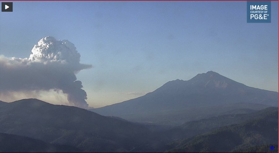
Then there are the fires. We’re not yet seeing the kinds of landscape-devouring, sky-turns-orange mega-blazes that made last summer so nightmarish, but we’re already ahead of last year’s pace in terms of acres burned in the West. In Northern California’s Siskiyou County, the lightning-sparked Lava fire forced thousands of people to evacuate and is growing. The Inyo Creek fire closed the Mt. Whitney trailhead, and the Willow fire in Los Padres National Forest, near Big Sur, led to this stunning photograph:

Captain Justin Grunewald takes a short rest amid his battle against the Willow fire.
Captain Justin Grunewald of the Mill Creek Hotshots takes a short rest amid his battle against the Willow fire.
(U.S. Forest Service)


The captain pictured is part of a hotshot crew. They’re the country’s most elite firefighting teams, but the federal government has had trouble keeping them staffed because pay is so low and the job is more grueling than ever. President Biden this week boosted firefighter pay to at least $15 an hour, up from as little as $13 today, my colleagues Chris Megerian and Anna M. Phillips report.

You probably don’t need me to tell you that climate change is the underlying condition connecting all these threads. It’s why so many scientists say we must rapidly move toward eliminating emissions from the burning of coal, oil and natural gas.

It’s also why fires, droughts and heat were on my mind as I explored a new analysis from the National Parks Conservation Assn., finding there are more than 31,000 “orphaned” oil and gas wells within 30 miles of national park sites nationwide.

These are wells that are no longer producing and yet haven’t been properly plugged, and whose operators are defunct or can’t be found, and thus can’t be forced to pay for cleanup. As The Times detailed in an investigation last year, California is littered with idle wells at risk of becoming orphaned, and cleaning them up could cost taxpayers billions of dollars. Left unplugged, they can spew planet-warming methane into the atmosphere, expose communities to toxic fumes and contaminate groundwater aquifers.

It’s no huge shock that many of these risky wells are near national park sites, considering how many park units there are — more than 400 overseen by the National Park Service, from name-brand parks such as Yosemite to national monuments, historic sites and scenic trails. Working with FracTracker Alliance, and using state-by-state orphaned-well data, the National Parks Conservation Assn. estimated there are 214,538 orphaned wells across the country, including 31,737 within 30 miles of a national park.

What really caught my eye was the park with the most risky wells nearby: Santa Monica Mountains National Recreation Area. I hike in the Santa Monica Mountains all the time, and I definitely wouldn’t have guessed there are 5,705 orphaned oil and gas wells within 30 miles — nearly twice as many as the park with the next most, Harry S Truman National Historic Site in Missouri.

The Santa Monicas are truly a national treasure, stretching from Point Mugu on the coast to the Hollywood Hills, and offering jutting sandstone cliffs, foggy ocean views and a feeling of immense wilderness just steps from a sprawling metropolis.

“People go to the Santa Monicas to get into nature, to get away from the normal urban ills that we deal with day to day,” said Dennis Arguelles, a senior program manager at the National Parks Conservation Assn. “But to think that so close to the mountains there are all these wells contributing to poor air quality in the region, contributing to climate change — it’s just a stark reminder that … it’s hard to leave behind all the damage we’ve done to the environment over the decades.”

Here are some views from Nicholas Flat Trail, which I hiked two weeks ago:

The fog begins to clear as Nicholas Flat trail ascends from Leo Carrillo State Park into the Santa Monica Mountains.
The fog begins to clear as Nicholas Flat trail ascends from Leo Carrillo State Park into the Santa Monica Mountains in June 2021.
(Sammy Roth / Los Angeles Times)
A view from Nicholas Flat trail in the Santa Monica Mountains.
(Sammy Roth / Los Angeles Times)


National parks advocates worry that abandoned oil and gas wells could pollute air and water within parks and in surrounding towns. They also know that rising global temperatures are already beginning to decimate beloved landscapes, causing ice to melt in Glacier National Park, snowfall to plummet in Yellowstone and Joshua trees to start dying off in the park that bears their name.

The Santa Monica Mountains are no exception. A recent climate change planning document from the National Park Service features a photo of the burn scar from the 2018 Woolsey fire in the Santa Monicas, alongside a warning that, across the country, “it will not be possible to safeguard all park resources, processes, assets, and values in their current form or context over the long term.”

In addition to growing fire risk in the Santa Monicas, global warming could limit the range’s suitability for dozens of bird species and potentially harm plant life, mountain streams and natural ecosystems more broadly, according to the park service.

Here are the 10 national parks with the most orphaned oil and gas wells within 30 miles, per the conservation group’s analysis:

— Santa Monica Mountains National Recreation Area (California): 5,705
— Harry S Truman National Historic Site (Missouri): 2,962
— George Rogers Clark National Historic Park (Indiana): 2,873
— Channel Islands National Park (California): 1,920
— Scotts Bluff National Monument (Nebraska): 1,751
— President William Jefferson Clinton Birthplace Home National Historic Site (Arkansas): 1,588
— Theodore Roosevelt National Park (North Dakota): 1,585
— Mammoth Cave National Park (Kentucky): 1,313
— Fort Scott National Historic Site (Kansas): 1,189
— Big South Fork National River and Recreation Area (Tennessee): 1,187

You can scroll through an interactive map of parks and orphaned wells here. Zooming in on Southern California, it becomes clear why the Santa Monica Mountains top the list. The park is sprawling, and drawing a 30-mile buffer zone around it encompasses the entirety of Los Angeles, as well as the oil fields of Ventura County. If you ever need a reminder that L.A. is an oil town, this is it.

The remains of Southern California's first commercial oil well, Pico No. 4.
The remains of Southern California’s first commercial oil well, Pico No. 4, were moved from their original location years ago and reconstructed for posterity. (Glenn Koenig / Los Angeles Times)


America Fitzpatrick, energy program manager at the National Parks Conservation Assn., cautioned that the analysis is based on state-specific data that vary in quality, and that some states probably do a better job tracking abandoned wells than others. It’s also worth keeping in mind that in a place like Southern California, the freeway capital of the world, orphaned oil and gas wells are likely only a small contributor to air pollution and climate emissions.

Still, these abandoned wells are a problem worth tackling — and by some estimations, an economic opportunity.

Researchers from Columbia University and the think tank Resources for the Future found last year that the federal government could create as many as 120,000 jobs through a program to plug half a million orphaned wells, potentially keeping oil and gas workers employed as the fossil fuel industry shrinks. Some estimates of the total number of orphaned wells are much higher.

Colorado Sen. Michael Bennet reintroduced a bill last week that would put $8 billion toward cleaning up orphaned wells over the next decade and require oil and gas companies to set aside more money for cleanup before they’re allowed to drill.

“It’s really unfortunate that the American taxpayer has (had) to address the cleanup that these oil and gas companies should really be responsible for,” Fitzpatrick said. “But we do have this moment where we can provide for the cleanup of these wells, and also reform the system so we’re not continuing to dig ourselves into this hole.”

As for the Santa Monica Mountains, there are only a few orphaned wells within the park’s boundaries, per the interactive map. But in an interesting twist, the proposed Rim of the Valley expansion — which I wrote about last year, and is currently working its way through Congress — would add the site of Southern California’s first commercial oil well, known as Pico No. 4, to the park.

Whether that oil well ultimately serves as a monument to a long-gone era of fossil fuel extraction — or as a cruel reminder of our inability to save ourselves, and our parks, from a grim reality of worsening heat, drought and fire — is yet to be seen.

For now, here’s what else is happening around the West:

TOP STORIES
The Russian River, just north of drought-stricken Lake Mendocino in Ukiah, Calif.


Folks along California’s Russian River know climate change is worsening droughts, fires, floods and heat — and they’re determined to find a way to live with it. My colleagues Diana Marcum and Brian van der Brug paddled down the Russian River, producing powerful words and pictures about a region where residents are being asked to cut water use by 20% to 40%, and where as many as 2,300 wineries and farms may have their supplies cut off. It’s just one manifestation of a climate emergency in a state that could once again suffer its worst fire season on record, as The Times’ Faith E. Pinho and Alex Wigglesworth report.

President Biden and a bipartisan group of senators agreed on a nearly $1-trillion infrastructure deal. It includes a bunch of climate-related stuff, including $7.5 billion for electric car chargers, $49 billion for public transit and $55 billion to replace lead pipes and upgrade water systems — investments Biden is eager to highlight, my colleague Eli Stokols reports. But it’s still unclear whether the package will be approved — and even if it is, it’s a far cry from the much larger clean energy plan Biden originally proposed. The fate of ambitious climate action may rest in a separate bill that Democrats hope to pass without Republican votes.

It may be a while before we know whether saltwater intrusion from rising seas contributed to the horrifying Florida building collapse. But the disaster — more than 150 people are feared dead — has residents up and down the Sunshine State’s low-lying Atlantic shoreline nervous about what comes next as the ocean continues to rise, The Times’ Jenny Jarvie reports.

DROUGHT IN THE WEST

“Drought, The Everything Disaster.” So reads the headline of this Brett Walton piece for Circle of Blue, and I’m not sure truer words have ever been written. Drought is drinking water supplies contaminated by sediment flushed out of burned forests after brutal fires. It’s household wells going dry, and an entire town in the San Joaquin Valley going without running water during a heat wave. It’s a plague of voracious grasshoppers, and it’s rattlesnakes slithering into cities — just what we need now that rising temperatures have helped make California a hot spot for disease-carrying mosquitoes, as Times columnist David Lazarus writes.

In a tiny bit of good news, drought also means less polluted beaches in Southern California. My colleague Rosanna Xia wrote about Heal the Bay’s latest beach record card, which found a big reduction in pollution last summer — seemingly because there wasn’t much rain to flush trash, pesticides and bacteria to the ocean through storm drains. Heal the Bay also published its third annual River Report Card, which is a good resource to have on hand if you enjoy fishing, swimming or kayaking in local streams.

The U.S. Supreme Court declined to hear an an appeal filed by Imperial Valley farmer Mike Abatti in a dispute over who controls the largest share of Colorado River water in the American West. The high court’s decision means the publicly owned Imperial Irrigation District will continue to shepherd the region’s 3.1 million acre-feet, the Desert Sun’s Janet Wilson reports. I wrote last year about how the case could affect the 40 million people across seven states who depend on the Colorado.

THE ENERGY TRANSITION
The Chevron oil refinery under storm clouds in El Segundo, Calif.
(Genaro Molina / Los Angeles Times)


Oil companies face growing pressure from investors to do more on climate — but whether they’re responding is another question. L.A. Times columnist Michael Hiltzik wrote about what investors are demanding, noting that 60% of Chevron shareholders voted for the company to “substantially” reduce its greenhouse gas emissions. A few weeks before that, an Exxon Mobil lobbyist acknowledged in a private meeting — which was actually a sting operation by Greenpeace UK — that the company is working to weaken federal climate action despite its public pledges of support, as the New York Times’ Hiroko Tabuchi reports.

Returning to abandoned oil and gas wells, an artificial island off the coast of Ventura County tells the story of how drilling companies can often walk away from huge liabilities. The Desert Sun’s Mark Olalde found that taxpayers have footed millions of dollars in offshore cleanup costs as a result of the island’s operator using bankruptcy to avoid paying the full bill.

California officials are ordering utilities to buy 11,500 megawatts of new clean power. That is a staggering amount, and it’s designed to help replace the Diablo Canyon nuclear reactors and several coastal gas plants, which I wrote about in May. Canary Media’s Jeff St. John notes that the requirement includes 1,000 megawatts of long-duration storage (which will make the Eagle Mountain pumped hydro folks happy) and 1,000 megawatts of 24/7 zero-carbon power (which will make the Imperial County geothermal folks happy). In Oregon, meanwhile, lawmakers passed a bill requiring the state’s major electric utilities to eliminate carbon emissions by 2040 — five years ahead of California’s timeline, as Dirk VanderHart reports for Oregon Public Broadcasting.

U.S. West faces little-known effect of raging wildfires: contaminated water

Reuters

U.S. West faces little-known effect of raging wildfires: contaminated water


FORT COLLINS, Colo. (Reuters) – Early this spring, water bills arrived with notes urging Fort Collins Utilities customers to conserve. The Colorado customers may have thought the issue was persistent drought in the U.S. West.

But the problem was not the quantity of water available. It was the quality.

Utilities are increasingly paying attention to a little-known impact of large-scale fires: water contamination.

Huge forest fires last year denuded vast areas of Colorado’s mountains and left them covered in ash – ash that with sediment has since been washed by rains into the Cache la Poudre River. The river is one of two sources for household water in this college town of 165,000. With more and fiercer storms expected this year, officials worry about water quality worsening beyond what treatment systems can handle.

The problem could apply to watersheds across the U.S. West, which has faced ever-increasing extremes in heat, drought and wildfire amid climate change in recent years. The United States relies on water originating on forested land for about 80% of its freshwater supply, according to a government report https://on.doi.gov/3qvw4hf.

“If a wildfire is not in my watershed, it will be in someone else’s watershed,” said Sean Chambers, director of water and sewer in the nearby northern Colorado town of Greeley.

So far, Chambers and other northern Colorado utilities managers have avoided clogged pipes simply by skipping the Cache la Poudre water and using other supplies. But they worry that’s not a long-term solution, and so they sent out those notes pleading with customers to voluntarily conserve: Water lawns sparingly. Don’t let the hose run on the sidewalk when washing your car.

THE COST OF WATER

Corporate headhunter Jim Croxton moved to Fort Collins so he could take in the mountain scenery while fishing.

“I really don’t care about how big the fish are,” Croxton said after buying a half dozen flies at a Fort Collins fishing and guide shop. “I just like to be out in” nature.

He had considered drought to be the West’s water concern. But the utility’s letter urging conservation struck a chord; he had read about polluting fires affecting recreational fishing, too.

“Water in the West is a central issue,” Croxton said.

Fort Collins water rates rose 2% from January. That works out to less than $1 per month for the typical home, and generates about $600,000 toward covering an estimated $45 million in potential fire-related measures, according to calculations prepared for Fort Collins City Council.

Those measures include laying mulch on burn scars to hold down soil, and funding further fire impact research. To make up the balance, officials in Fort Collins, Greeley and other communities are pooling resources and seeking state and federal help.

Katrina Jessoe is an economist at UC Davis who has advised utilities on seeking funding to decontaminate water supplies from pollutants such as fertilizers.

“You can’t get around the fact that the cost of water is getting higher,” which could be a concern for low- and middle-income earners, Jessoe said.

Water managers say they need also to explore new ways of raising funds and making capital improvements to deal with fire-related contamination, for example, removing tastes and odors left by algae fed by nutrients in the sediments washed into reservoirs. The tastes and odors don’t mean the water is unsafe, but customers don’t like it.

Water managers are “making decisions right now that will affect whether or not this is a liveable place in 50 years, 100 years,” said John Matthews, who heads the Alliance for Global Water Adaptation, a nonprofit that advises on adapting water systems for climate change.

UNPRECEDENTED FIRES

The two fires that have marred the watersheds relied on by Fort Collins, Greeley, Thornton and other towns were notable not just for the devastation they caused, but for having burned at such high elevation.

“We really don’t understand these high-elevation fires very well, because they haven’t happened very often,” said Matt Ross, an ecosystem scientist at Colorado State University who is studying how last year’s fires are impacting algae blooms now.

The Cameron Peak Fire broke out in August and was the first in Colorado history to consume more than 200,000 acres, including swathes of the Arapahoe and Roosevelt national forests and Rocky Mountain National Park. The East Troublesome came close, burning 193,812 acres across the Continental Divide.

In both cases, flames tore through forests where rivers originate and where snowpack – that frozen reservoir – builds up over winter.

Given the large region burned, researchers need to understand how long it will take for vegetation to grow back, so it can keep sediment from washing into water sources, said biogeochemist Chuck Rhoades at the U.S. Forest Service.

“The implications are that people need to think a little bit more about how to manage and sustain reservoirs,” Rhoades said.

(Reporting by Donna Bryson; Editing by Katy Daigle and Lisa Shumaker)

The affordable 3D-printed home that could transform African urbanization

World Economic Forum

The affordable 3D-printed home that could transform African urbanization

14Trees are 3D printing homes and building walls in less than 12 hours.
A lack of safe, affordable housing can trap people in poverty. Building homes can end that while creating jobs and income.
Image: CDC Group
  • Every day around 40,000 people move to one of Africa’s cities.
  • There is currently not enough housing stock to go round.
  • This company can 3D-print homes following an affordable, low-carbon process.
  • In Malawi, it has recently 3D-printed a home and a school.

There is a housing crisis taking place across many parts of Africa. Nigeria alone has an estimated shortfall of 17 million housing units. Part of the problem is that every day around 40,000 people relocate to one of Africa’s many vibrant, growing cities. But those cities are struggling to keep up with the demand for new homes, leaving many people with nowhere to live.

The World Bank’s International Finance Corporation (IFC) says the shortage is caused in part by a lack of development in the continent’s house-building industry. But that might be about to change with the availability of new technology and techniques that could speed up and streamline the building of homes.

No place like a 3D-printed home

The first 3D printed affordable house in Africa, with the walls printed in less than 12 hours.
Image: LinkedIn/14Trees


A joint venture involving CDC Group – the UK government’s development finance institution – and the European building materials multinational LafargeHolcim, is 3D-printing houses and schools in a fraction of the time it would normally take.

Called 14Trees, it has operations in Malawi and Kenya, and is able to build a 3D-printed house in just 12 hours at a cost of under $10,000. Its building process reduces CO2 emissions by as much as 70% when compared with a typical house-building project. It has also developed an online platform for the African diaspora, encouraging people to invest in a “home back home.”

The company’s first-ever affordable, 3D-printed home was built in Lilongwe, the capital city of Malawi. 14Trees has also recently completed its first 3D-printed school, also in Malawi. Built in a fraction of the time a traditionally built school would take, it opened its doors to students on 21 June.

Tenbite Ermias, managing director of CDC Africa, said: “The rollout of 14Trees’ world-class, cutting-edge technology is going to have a tremendous developmental impact on Malawi and the wider region. It is a wonderful example of how we are investing in businesses that can support the UN’s Sustainable Development Goals.”

Meeting a global need

Much of Africa has been experiencing rapid urbanization in recent decades. “As of 2015, 50% of Africa’s population lived in one of 7,617 urban agglomerations,” says a report from the US-based Brookings Institute.

Growth of urban populations across six African regions
Image: Brookings Institute


But it’s not only in Africa where 3D house printing is promising to revolutionize the homes people live in. In the Mexican state of Tabasco, a collaboration between Mexican and US businesses has helped create the world’s first 3D-printed neighborhood. Built to withstand floods, earthquakes and other natural disasters, the 50 homes have two bedrooms, a living room, plus a kitchen and bathroom.

The technique is also being used in the United States and Europe to create unique homes for private buyers and to help alleviate the problem of homelessness. Meanehile in India, the country’s first 3D-printed home was completed in five days in the city of Chennai.

The 14Trees building projects are one example of public-private cooperation helping to create jobs as well as housing across Africa. The IFC is working with a Chinese multinational construction and engineering company, CITIC Construction, and plans to build 30,000 homes over a five-year period by partnering with local businesses across Africa, and estimates that each housing unit will create five full-time positions, equating to 150,000 new jobs in all.

What is the World Economic Forum doing to promote sustainable urban development?

“As sub-Saharan Africa becomes more urbanized, the private sector can help governments meet the critical need for housing”, Oumar Seydi, IFC Director for Eastern and Southern Africa writes on the IFC website. “The platform will help transform Africa’s housing markets by providing high quality, affordable homes, creating jobs, and demonstrating the viability of the sector to local developers.”

Smoke from California wildfires could be headed to heat-choked Boise, forecasts show

Smoke from California wildfires could be headed to heat-choked Boise, forecasts show


Smoke from wildfires burning in Northern California could be headed to Boise on Thursday evening, potentially affecting air quality in a valley that’s experiencing a heatwave, according to the National Weather Service.

Bill Wojcik, a meteorologist with the National Weather Service’s Boise office, said in a phone interview that the smoke is coming from fires north of Redding, including the 17,000-acre Lava Fire and the 8,000-acre Tennant Fire.

“Both (of the fires) are in timber, that’s why they’re putting out a lot of smoke,” Wojcik said.

By Wednesday afternoon, the Lava Fire was 19% contained, while the Tennant Fire was only 5% contained, according to InciWeb, an interagency wildfire tracking website.

Satellite smoke modeling images show smoky air swirling up from the Redding area into Central Oregon before heading east to the Idaho Panhandle and south to the Treasure Valley. The worst of it appears to bypass the Boise area, but Wojcik said it’s too early to know exactly where the smoke will end up.

If the fires continue to burn at their current rate, Wojcik said, smoke could roll into the Treasure Valley by Thursday evening or Friday morning. He said the smoke could be trapped in the valley, but some of the air pollution could stay in upper levels of the atmosphere, affecting the appearance of the sky without significant impact on air quality in the lower levels of the atmosphere.

According to the Idaho Department of Environmental Quality’s air quality index, the current air quality in the Treasure Valley is “moderate,” the second-lowest level of air pollution. DEQ forecasts show the area remaining in the moderate category through Friday.

Temperatures in the Boise area continue to exceed 100 degrees as a heatwave remains in place across the Northwest. The high is expected to be 102 on Thursday and 103 on Friday.

‘Outlandish’ forecasts in Northwest suggest a feared climate reality is here decades early

‘Outlandish’ forecasts in Northwest suggest a feared climate reality is here decades early


Larry O’Neill knew a heat wave was coming, but he still couldn’t believe what the climate models were telling him.

The projected temperatures for this week were so unusually high — between 115 and 120 degrees Fahrenheit across parts of the Pacific Northwest — that O’Neill, Oregon’s state climatologist, felt something must be off.

“The predictions seemed completely outlandish,” said O’Neill, an associate professor at Oregon State University. “They were so crazy insane that professional forecasters and people like myself thought something must be wrong with the models.”

As it turned out, the forecasts were right.

With global warming making heat waves and other extreme weather events both more likely and more severe, this week’s sizzling temperatures may herald a climate reality that scientists thought was still decades in the future.

“We see evidence of climate change in the data already, but in the Pacific Northwest, we thought maybe by the middle of the century is when we would start to see really substantial and impactful events,” O’Neill said. “But we’re seeing those now.”

Across the western United States, more than 35 cities tied or set temperature records Monday, with several places shattering their all-time highs. Seattle posted a new record of 108 degrees, 5 degrees hotter than the city’s previous all-time record, and Portland, Oregon, reached a scorching 116 degrees, surpassing the city’s previous milestone by 8 degrees.

The intensity of the heat, particularly in a region of the country known for its mild conditions, has been shocking, said Nicholas Bond, a research scientist at the University of Washington and Washington’s state climatologist.

“The magnitude by which records are being broken — not by a degree or so but by 5 degrees and in some cases more — is really stunning,” Bond said. “I didn’t really expect anything like this until further into the future.”

Harrison Valetski cools off in Salmon Street Springs in downtown Portland, Ore., on Monday, where temperatures reached an all-time high of 116 degrees Fahrenheit. (Alex Milan Tracy / Sipa USA via AP)


What’s driving the oppressive heat is a ridge of high pressure parked over the Pacific Northwest that Bond said was “exquisitely poised to deliver hot temperatures.”

These giant domes of heat have been associated with tropical cyclone activity in the western Pacific Ocean, which can alter the circulation of air over the Northern Hemisphere and generate unusual weather patterns.

“The tropical cyclones tend to disrupt the jet stream all across the Pacific Ocean,” O’Neill said, adding that they can affect both high- and low-pressure systems. “If we get a tropical cyclone, we’re three times more likely to get a high-pressure ridge set up close to where we see this one.”

It’s not yet clear how climate change is affecting the jet stream and resulting weather systems, but the consequences of these complex atmospheric perturbations taking place against the backdrop of global warming is well understood.

Average temperatures in the Pacific Northwest have warmed by roughly 1.3 degrees since 1895, according to the University of Washington’s Climate Impacts Group, and most cities in the region feel more than 2 degrees warmer in the summer than they did in 1970.

“Along with that warming, we’ve seen an increase in extreme heat events, and these events are becoming more frequent, more intense and longer in duration,” said Meade Krosby, a senior scientist with the Climate Impacts Group.

It’s a trend that is playing out across the country. A national climate assessment conducted in 2018 found that heat waves in the U.S. occurred an average of six times per year in the 2010s, up from an average of two times a year five decades earlier.

The effects of extreme heat are similarly being felt around the world. Parts of eastern Europe and Russia are currently baking under record highs, with some Bulgarian cities predicted to reach 104 degrees and temperatures in Siberia soaring to nearly 90 degrees.

Though attributing any specific event to climate change is tricky, scientists say the overall effect of global warming is undeniable, creating conditions that are ripe for heat waves and other extreme weather events.

“The question is no longer if climate change caused a specific heat event, but by how much,” Krosby said.

Temperatures in parts of Oregon and Washington have likely peaked, but hotter-than-usual conditions are expected to linger through the weekend.

Experts said it’s disconcerting to see such a crippling heat wave this early in the summer, adding that the implications could be dire for this year’s wildfire season.

For O’Neill, he hopes the recent events act as a wake-up call about the immediate impacts of global warming.

“All of this adds to the danger and risk that we face,” he said. “Climate change absolutely loads the dice towards more extreme events.”

Portland, Ore., soared to 116 degrees — hotter than Dallas, Miami and L.A. have ever been

Portland, Ore., soared to 116 degrees — hotter than Dallas, Miami and L.A. have ever been


Portland, Oregon, soared to a searing 116 degrees Monday, hotter than it has ever been in cities such as Dallas, Los Angeles and New Orleans. In fact, when it comes to major U.S. cities, only Phoenix and Las Vegas have been hotter.

Meanwhile, a parallel heat wave was in full swing on the other side of the country, where Boston was forecast to touch 100 degrees Tuesday, with a forecast high of 98 degrees.

The culprit? A buckling in the jet stream causing amplified ridges to surge far north on both sides of the country, resulting in dangerous heat surging into areas unaccustomed to it. On Tuesday, 12 million Americans across much of the West were under heat watches and warnings, and 44 million were under heat alerts across the Northeast, stretching from Delaware up through Maine.

Monday was the textbook example of a summer scorcher, pumping heat into the entirety of the Pacific Northwest. More than 35 cities tied or set records, with many areas soaring an unprecedented 30 to 40 degrees above average. The record in Seattle was smashed by 5 degrees, establishing a new record of 108, and the record high in Portland was shattered, where the high temperature soared to a sizzling 116 degrees, 8 degrees higher than the old record.

The heat was so excessive that Portland streetcar power cables melted and the pavement buckled. And the heat has been so persistent that Seattle achieved a new record: three consecutive days of triple-digit temperatures for the first time.

The historic heat even jeopardized several state and national records. The record high of 119 for Oregon and the record of 118 in Washington came nearly within reach when Salem, Oregon, hit 117 and Dallesport, Washington, hit 118 Monday.

Most impressive, Lytton, British Columbia, recorded a high temperature of 118 degrees, establishing a new national record for Canada, and crushing the old record by 5 degrees. This temperature surpassed Las Vegas’ all-time high of 117.

To put this extreme heat into perspective, the hottest temperatures in traditionally hot cities are still cooler than these new records for Portland and Seattle. Miami’s record high is a mere 100 and Atlanta’s is only 106.

On Tuesday, the Northwest cities of Seattle, Portland, Boise, Idaho, Billings, Montana, and Reno, Nevada, are expected to continue to experience temperatures in the triple digits and the Pacific Northwest humidity will drive these temperatures to feel like the 110s.

A man cools off in Salmon Street Springs downtown Portland, Ore., on Monday. (Alex Milan Tracy / Sipa USA via AP)


In the Pacific Northwest, temperatures start to cool off Tuesday and Wednesday near the coast, but it will remain scorching hot in the interior, as the cooling breeze off the Pacific Ocean doesn’t reach sufficiently far inland. Tuesday will be the first day in three days that the forecast high is below 100 for Portland and Seattle, but temperatures will still remain in the 90s, 10 to 15 degrees above average. Glasgow and Helena, Montana, Boise and Spokane, Washington, can expect triple digits through the Fourth of July.

Daily records could even be broken across New England as temperatures are expected to feel well over 100.

Heat warnings cover much of New Jersey, and extend over Philadelphia. New York City will likely see its hottest temperatures so far this year, and Philadelphia and Boston have already declared heat emergencies. This is truly rare heat; New York City averages just a few days a year with temperatures above 95 degrees.

Temperatures moderate slightly through the end of the workweek, returning to about average by the weekend.

Summers are getting hotter in the Pacific Northwest as a result of climate change, with most cities feeling 2.5 to 3 degrees hotter than they did in 1970. As carbon dioxide levels continue to rise and climate change progresses, more extreme and more frequent heat waves can be expected for unprepared cities across the country.

Northern California Lava fire explodes to 13,300 acres, prompting evacuations and threatening marijuana farms

Northern California Lava fire explodes to 13,300 acres, prompting evacuations and threatening marijuana farms


Image

The Lava Fire in northern California exploded more than 12,000 acres Tuesday morning, triggering evacuations and burning brush and timber in the Shasta-Trinity National Forest.

The blaze, burning between the city of Weed and Mt. Shasta, grew from 1,446 acres on Monday to 13,300 acres Tuesday night. It’s 19% contained, said Cal Fire, and about 800 firefighters are battling the blaze.

The Lava Fire is one of several fires ignited by lightning during mountain thunderstorms last Thursday. Two others, the Tennant Fire and Beswick Fire, are not nearly as large. The area had been under a red flag warning because of high wind and low humidity, as well as temperatures ranging from 100 to 110 degrees.

Crews thought they had contained the fire Friday afternoon, but about four hours later, residents saw smoke in the direction of the fire as it reignited, said Todd Mack, Shasta Trinity National Forest Fire Management Officer, during a town hall meeting Monday.

The newly reignited fire popped up outside the fire line, he said.

California “has secured a Fire Management Assistance Grant from [the Federal Emergency Management Association] to help ensure vital resources to fight the #LavaFire burning in Siskiyou county.” Gov. Gavin Newsom said on Twitter.

The Sacramento Bee reported that nearly 3,000 people live in Lake Shastina and as many as 8,000 others live in the area to tend to the thousands of marijuana grows.

“All evacuation orders are still in place at this time. We do not know what structures have burned down and the status of many areas,” the sheriff’s office said Tuesday.

The smoke Tuesday could be seen as far as 100 miles away in Medford, Oregon.

Officers shot and killed a man who pulled a gun as they tried to keep him out of a complex of marijuana farms near the blaze.

The subdivision has been converted into a huge network of marijuana farms mostly run by Hmong and Chinese families. The county has banned large-scale marijuana cultivation but thousands of pot greenhouses have still sprung up.

The blaze comes as the West Coast is battling a deadly drought and heatwave. As of June 28, a total of 4,152 fires have been reported by Cal Fire.

It’s Some of America’s Richest Farmland. But What Is It Without Water?

It’s Some of America’s Richest Farmland. But What Is It Without Water?

Kim Gallagher, a rice farmer, in a field of her sunflowers, which require far less water than rice, in the Sacramento Valley of California on June 19, 2021. (Mike Kai Chen/The New York Times)


ORDBEND, Calif. — In America’s fruit and nut basket, water is now the most precious crop of all.

It explains why, amid a historic drought parching much of the American West, a grower of premium sushi rice has concluded that it makes better business sense to sell the water he would have used to grow rice than to actually grow rice. Or why a melon farmer has left a third of his fields fallow. Or why a large landholder farther south is thinking of planting a solar array on his fields rather than the thirsty almonds that delivered steady profit for years.

“You want to sit there and say, ‘We want to monetize the water?’ No, we don’t,” said Seth Fiack, a rice grower here in Ordbend, on the banks of the Sacramento River, who this year sowed virtually no rice and instead sold his unused water to desperate farmers farther south. “It’s not what we prefer to do, but it’s what we kind of need to, have to.”

These are among the signs of a huge transformation up and down California’s Central Valley, the country’s most lucrative agricultural belt, as it confronts both an exceptional drought and the consequences of years of pumping far too much water out of its aquifers. Across the state, reservoir levels are dropping and electric grids are at risk if hydroelectric dams don’t get enough water to produce power.

Climate change is supercharging the scarcity. Rising temperatures dry out the soil, which in turn can worsen heat waves. Recently, temperatures in parts of California and the Pacific Northwest have been shattering records.

By 2040, the San Joaquin Valley is projected to lose at least 535,000 acres of agricultural production. That’s more than a tenth of the area farmed.

And if the drought perseveres and no new water can be found, nearly double that amount of land is projected to go idle, with potentially dire consequences for the nation’s food supply. California’s $50 billion agricultural sector supplies two-thirds of the country’s fruits and nuts and more than a third of America’s vegetables — the tomatoes, pistachios, grapes and strawberries that line grocery store shelves from coast to coast.

Glimpses of that future are evident now. Vast stretches of land are fallow because there’s no water. New calculations are being made about what crops to grow, how much, where. Millions of dollars are being spent on replenishing the aquifer that has been depleted for so long.

“Each time we have a drought you’re seeing a little glimpse into what will happen more frequently in our climate future,” said Morgan Levy, a professor specializing in water science and policy at the University of California, San Diego.

For Rice Farmers, a Tricky Decision

California’s fertile Central Valley begins in the north, where the water begins. In normal times, winter rain and spring snowmelt swell the Sacramento River, nourishing one of the country’s most important rice belts. On an average year, growers around the Sacramento River produce 500,000 acres of sticky, medium-grain rice vital to sushi. Some 40% is exported to Asia.

But these are not normal times. There’s less snowpack, and, this year, much less water in the reservoirs and rivers that ultimately irrigate fields, provide spawning places for fish and supply drinking water for 39 million Californians.

That crisis presents rice farmers in the Sacramento Valley, which forms the northern part of the Central Valley, with a tricky choice: Should they plant rice with what water they have, or save themselves the toil and stress and sell their water instead?

Fiack, a second-generation rice farmer, chose to sell almost all of it.

His one 30-acre field of rice glistens green in the June sunshine, guzzling water that pours out of a wide-mouthed spigot. His remaining 500 acres are bare and brown. What water he would have used to grow rice he has signed away for sale to growers of thirsty crops hundreds of miles south, where water is even more scarce.

At $575 per acre-foot (a volume of water 1 acre in size, 1 foot deep) the revenue compares favorably to what he would have made growing rice — without the headaches. It makes “economic sense,” Fiack said flatly.

Rice is far less lucrative than, say, almonds and walnuts, which is why Fiack’s fields are surrounded by nut trees and even he is dabbling in walnuts. But rice farmers are uniquely advantaged. Because their lands have been in production for so long, they tend to have first dibs on water that comes out of the Sacramento River, before it is channeled through canals and tunnels down south.

Also, unlike the owners of fruit and nut trees, whose investments would wither in a few weeks without water, rice farmers can leave a field fallow for a year, even two. In the era of climate change, when water can be unreliable, that flexibility is an asset. Rice water transfers have been an important part of California’s drought coping strategy.

This year, rice farmers in the Sacramento Valley will produce around 20% less rice.

Not everyone is enthusiastic about that.

Kim Gallagher, a third-generation rice farmer, left fallow only 15% of her fields. She worries about the effect on the rice mills and crop-duster pilots who live off rice farming, not to mention the birds that come to winter in the flooded fields. “These are trade-offs every farmer has to make, what they can fallow and what they can’t,” she said. “Everyone has a different number.”

Fritz Durst, a fourth-generation rice farmer, worries that California rice buyers would come to see his region as an unreliable supplier.

He, too, hedged his bets. He is growing rice on about 60% of his 527 acres, which enables him to sell the Sacramento River water he would have used on the rest.

But there’s a long-term risk, as he sees it, in selling too much water, too often. “You also have people here who are concerned that we’re setting a dangerous precedent,” he said. “If we start allowing our water to go south of the Delta, those people are going to say, ‘Well, you don’t need that water. It’s ours now.’”

Fish vs. Field

Federico Barajas is in the unenviable position of having to find water. As the manager of the San Luis and Delta-Mendota Water Authority, he has negotiated a deal to buy from water districts like Durst’s.

There’s just one problem: Because the rivers are so hot and dry this year, the federal government, which runs the Shasta Dam, where cold Sacramento River water is stored, has said the water needs to stay in the reservoir through the summer months for another source of food: fish that hatch in California’s rivers.

He’s not accepting defeat. “We’re still looking for anybody out there who has any drop of water we can purchase and transfer,” he said gamely.

Nearby, off Interstate 5, Joe Del Bosque had been counting on that rice water from the north. It’s how he’s survived the droughts of the past, he said. “This is the worst year we’ve had,” Del Bosque said.

Del Bosque grew up working on melon farms with his farmworker father. Today, Del Bosque owns a melon farm near the town of Firebaugh. He grows organic cantaloupes and watermelons on most of his 2,000 acres, destined for supermarket shelves nationwide. The license plate on his GMC truck reads “MELONS.”

This year, he’s left a third of his land fallow. There’s just not enough water. He had planted asparagus on a few fields, too, only to pull it out. A neighbor pulled out his almonds.

History Shaped by Water

The hot, dry San Joaquin Valley became cotton farms at the turn of the 20th century, at the time with water flowing from the north through fields of alfalfa and then strawberries and grapes. Almonds took over as prices soared. And with more demands on the surface water flowing through the river — to maintain river flows, for instance, or flush seawater out of the California Delta — farmers turned increasingly to the water under their land.

It provides 40% of the water for California agriculture in a normal year, and far more in dry years. In parts of the state, chiefly in the San Joaquin Valley, at the southern end of the Central Valley, more groundwater is taken out than nature can replenish.

Now, for the first time, under the state’s Sustainable Groundwater Management Act, growers in some parts of the San Joaquin Valley face restrictions on how much water they can pump. That is set to transform the landscape. If you can’t pump as much water from under the ground, you simply can’t farm as much land in the San Joaquin Valley.

“There’s just no way around that,” said Eric Limas, the son of farmers who now manages one of the most depleted irrigated districts, called Pixley, a checkerboard of almond orchards and dairies. “The numbers just don’t add up.”

So thoroughly have aquifers been depleted that farmers are now investing millions of dollars to put water back into the ground They’re buying land that can absorb the rains. They’re creating ponds and ditches, carving up the landscape, again, to restore the groundwater squandered for so long.

“That is the single biggest water system adaptation we can do — getting more water into the ground,” said Ellen Hanak, director of the water policy center at the Public Policy Institute of California.

Meanwhile, towns in the Central Valley are beginning to run out of municipal water, including Teviston, just south of Limas’ office, where town officials have been delivering bottled water to 1,200 residents for nearly two weeks.

From Almond Trees to Solar Arrays

Stuart Woolf embodies the changing landscape of the San Joaquin Valley.

Woolf took over his father’s farm, headquartered in Huron, in 1986, retired most of the cotton his dad grew, switched to tomatoes and bought a factory that turns his tomatoes into tomato paste for ketchup. His operations expanded across 25,000 acres. Its highest value crop: almonds.

Woolf now sees the next change coming. The rice water from the north won’t come when he needs it. The groundwater restrictions will soon limit his ability to pump.

He has ripped out 400 acres of almonds. He’s not sure he will replant them anytime soon. In the coming years, he estimates he will stop growing on 30% to 40% of his land.

He has left one field bare to serve as a pond to recharge the aquifer and bought land in the north, where the water is, close to Fiack’s rice fields. Now, he is considering replacing some of his crops with another source of revenue altogether: a solar farm, from which he can harvest energy to sell back to the grid.

“Look, I’m a farmer in California. The tools we had to manage drought are getting limited,” he said. “I’ve got to fallow a lot of my ranch.”

Maine suffers a second day of insufferable heat and humidity

Maine suffers a second day of insufferable heat and humidity


A third straight day of oppressive heat and humidity is on tap for Maine on Wednesday, but relief from the scorching temperatures should arrive overnight, the National Weather Service said.

Portland on Tuesday tied its record high of 96 degrees, a mark set in 1944, at the Portland Jetport at 2:55 p.m., according to weather service meteorologist Chris Kimble.

With just one day left to sweat through, this is shaping up to be Maine’s hottest June on record, Kimble said. The June record was set in 2001 with an average temperature of 67.1. But this year, the average temperature stands at 67.8 and that is not likely to change by the end of the day Wednesday.

Kimble said the National Weather Service is forecasting a high of 94 Wednesday in Portland. If that happens, Portland and most of Maine will have experienced an official heat wave — defined as three consecutive days of highs of 90 or higher. Sunday’s high was 87, but highs of 97 and 96 were recorded Monday and Tuesday in Portland.

Things should start to cool down late Wednesday, accompanied by scattered, severe thunderstorms packing heavy rain and damaging winds starting in the afternoon. Forecasts call for a high of about 81 forecast for Thursday and 68 for Friday, Kimble said. In the meantime, the weather service is urging people to stay hydrated and seek shade or air conditioning whenever possible. A heat advisory will be in effect from 11 a.m. through 8 p.m. Wednesday.

Wednesday’s heat index will be dangerously high, the combination of heat and humidity making it feel like 100 degrees, Kimble said. That happened Tuesday around 4 p.m. in Portland with the temperature reaching 96 and the heat index making it feel like 101 degrees.

More records could be tied or broken Wednesday. Portland’s high of 96 degrees for June 30 was recorded in 1971.

“It’s not out of the question, we could tie or set a new record on Wednesday,” Kimble said, adding that it has not been this hot in Maine since 2016, when a high of 99 was recorded in Portland on Aug. 12.

The combination of extreme heat and lack of precipitation prompted the South Berwick Water District to issue a mandatory water conservation notice Tuesday. The outdoor water conservation measures will remain in place until further notice.

Water customers are being asked to refrain from all outdoor uses of water including the use of sprinklers and irrigation systems, washing vehicles and filling swimming pools.

Cities and towns across Maine opened cooling centers Tuesday and Wednesday, according to the Maine Emergency Management Center.

Among the cooling centers open Wednesday are the Augusta Civic Center 8 a.m. to 5 p.m.; Falmouth Ice Center on Hat Trick Drive from 4 a.m. to midnight; the South Portland Community Center from 6 a.m. to 9 p.m.; and the Troubh Ice Arena, 225 Park Ave. in Portland, from 9 a.m. through 4 p.m.

Beaches were a popular destination Tuesday. Popham Beach State in Phippsburg reached capacity at 11 a.m. and was forced to turn away visitors.

Power outages plagued some communities Tuesday, but Central Maine Power Company said it has been closely monitoring the power distribution system.

“Persistently hot days create a huge demand for energy,” CMP tweeted Tuesday night. “CMP is closely monitoring the system through the heat and proactively managing the demand to provide reliable power.”

Nearly 1,500 CMP customers in nine counties were without power as of 8 p.m. Tuesday. The number of outages dropped to 854 at 9 p.m. Only 329 Versant Power customers were without power Tuesday evening. Versant serves customers in northern and Down East Maine.

Maine is not alone in its suffering. A record breaking heat wave has been scorching the Pacific Northwest with temperatures regularly exceeding 100 degrees. Portland, Oregon, hit 108 Saturday, 112 Sunday and 116 on Monday.