Drought isn’t just a Western U.S. problem. A severe shortage has hit the Northeast, too

Los Angeles Times

Drought isn’t just a Western U.S. problem. A severe shortage has hit the Northeast, too

Jennifer McDermott – August 15, 2022

Hay farmer Milan Adams stands in a dry hay field near a wind sock, left, in Exeter, R.I., Tuesday, Aug. 9, 2022. Adams said in prior years it rained in the spring. This year, he said, the dryness started in March, and April was so dry he was nervous about his first cut of hay. (AP Photo/Steven Senne)
Hay farmer Milan Adams stands in a dry field in Exeter, R.I., on Tuesday. (Steven Senne / Associated Press)

Vermont farmer Brian Kemp is used to seeing the pastures at Mountain Meadows Farm grow more slowly in the hot late summer, but this year the grass is at a standstill.

That’s “very nerve-racking” when you’re grazing 600 to 700 cattle, said Kemp, who manages an organic beef farm in Sudbury, Vt. He describes the weather lately as inconsistent, which he attributes to a changing climate.

“I don’t think there is any normal anymore,” Kemp said.

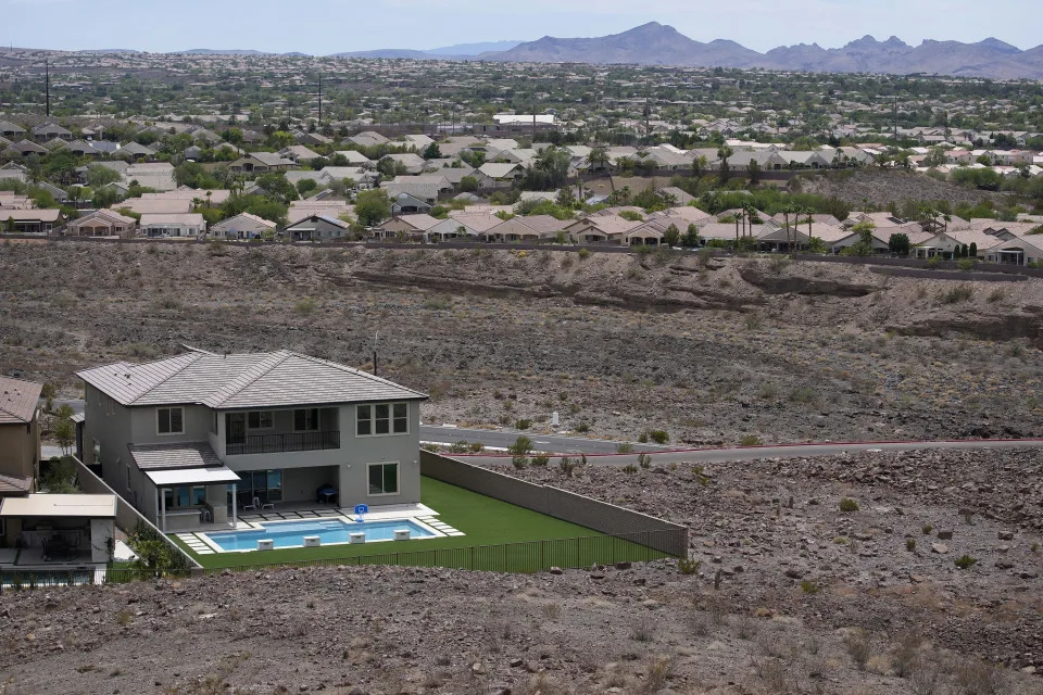
The effects of climate change have been felt throughout the northeastern U.S. with rising sea levels, heavy precipitation and storm surges causing flooding and coastal erosion. But this summer has brought another extreme: a severe drought that is making lawns crispy and has farmers begging for steady rain. The heavy, short rainfall brought by the occasional thunderstorm tends to run off, not soak into the ground.

Water supplies are low or dry, and many communities are restricting nonessential outdoor water use. Fire departments are combating more brush fires, and crops are growing poorly.

Providence, R.I., had less than half an inch of rainfall during the third-driest July on record, and Boston had 0.6 of an inch in its fourth-driest July on record, according to the National Weather Service office in Norton, Mass. Rhode Island’s governor issued a statewide drought advisory Tuesday with recommendations to reduce water use. The north end of the Hoppin Hill Reservoir in Massachusetts is dry, forcing local water restrictions.

Officials in Maine said drought conditions began there in 2020, with occasional improvements in areas since. In Auburn, Maine, local firefighters helped a dairy farmer fill a water tank for his cows when his well went too low in late July and temperatures hit 90. About 50 dry wells have been reported to state authorities since 2021, according to the state’s dry-well survey.

The continuing trend toward drier summers in the Northeast can certainly be attributed to the impact of climate change, since warmer temperatures lead to greater evaporation and drying of soils, climate scientist Michael Mann said. But, he said, the dry weather can be punctuated by extreme rainfall events since a warmer atmosphere holds more moisture, which means that when conditions are conducive to rainfall, there’s more of it in short bursts.

Mann said there’s evidence shown by his research at Penn State University that climate change is leading to a “stuck jet stream” pattern. That means huge tentacles of the jet stream, or air current, get stuck in place, locking in extreme weather events that can alternately be associated with extreme heat and drought in one location and extreme rainfall in another, a pattern that has played out this summer with the heat and drought in the Northeast and extreme flooding in parts of the Midwest, Mann added.

Most of New England is experiencing drought. The U.S. Drought Monitor issued a new map Thursday that shows areas of eastern Massachusetts outside Cape Cod and much of southern and eastern Rhode Island now in extreme, instead of severe, drought.

New England has experienced severe summer droughts before, but experts say it is unusual to have droughts in fairly quick succession since 2016. Massachusetts experienced droughts in 2016, 2017, 2020, 2021 and 2022, which is very likely due to climate change, said Vandana Rao, director of water policy in Massachusetts.

“We hope this is maybe one period of peaking of drought and we get back to many more years of normal precipitation,” she said. “But it could just be the beginning of a longer trend.”

Rao and other water experts in New England expect the current drought to last for several more months.

“I think we’re probably going to be in this for a while and it’s going to take a lot,” said Ted Diers, assistant director of the New Hampshire Department of Environmental Services water division. “What we really are hoping for is a wet fall followed by a very snowy winter to really recharge the aquifers and the groundwater.”

Rhode Island’s principal forest ranger, Ben Arnold, is worried about the drought extending into the fall. That’s when people do more yard work, burn brush, use fireplaces and spend time in the woods, increasing the risk of forest fires. The fires this summer have been relatively small, but it takes a lot of time and effort to extinguish them because they are burning into the dry ground, Arnold said.

Hay farmer Milan Adams said one of the fields he’s tilling in Exeter, R.I., is powder a foot down. In prior years it rained in the spring. This year, he said, the dryness started in March, and April was so dry he was nervous about his first cut of hay.

“The height of the hay was there, but there was no volume to it. From there, we got a little bit of rain in the beginning of May that kind of shot it up,” he said. “We haven’t seen anything since.”

Farmers are fighting more than the drought: Inflation is driving up the cost of everything, including diesel, equipment parts, fertilizer and pesticides, Adams added.

“It’s all through the roof right now,” he said. “This is just throwing salt on a wound.”

The yield and quality of hay is down in Vermont, too, which means there won’t be as much for cows in the winter, said Vermont Agriculture Secretary Anson Tebbetts. The state has roughly 600 dairy farms, a $2-billion-per-year industry. Like Adams, Tebbetts said inflation is driving up prices, which will hurt the farmers who will have to buy feed.

Kemp, the president of the Champlain Valley Farmer Coalition, is thankful to have supplemental feed from last year, but he knows other farmers who don’t have land to put together a reserve and aren’t well-stocked. The coalition is trying to help farmers evolve and learn new practices. They added “climate-smart farming” to their mission statement in the spring.

“Farming is challenging,” Kemp said, “and it’s becoming even more challenging as climate change takes place.”

Quarter of U.S. Could Be in ‘Extreme Heat Belt’ by 2053, According to Climate Crisis Research

People

Quarter of U.S. Could Be in ‘Extreme Heat Belt’ by 2053, According to Climate Crisis Research

Abigail Adams – August 15, 2022

Extreme Heat
Extreme Heat

Mario Tama/Getty

Newly released climate data suggests a quarter of the United States’ land could experience temperatures exceeding 125 degrees Fahrenheit in just 30 years.

According to a Monday press release from the First Street Foundation, an extreme heat model shows more than 1,000 counties are expected to experience the high temperatures by 2053.

These counties are currently home to 107.6 million Americans who, according to data from the U.S. Census Bureau, make up about a third of the country’s population.

The foundation is also warning of what it calls an “extreme heat belt,” which would stretch from the Northern Texas and Louisiana borders to Illinois, Indiana and Wisconsin.

RELATED: Scientists Will Give Names to Extreme Heat Waves After Crowning the First ‘Zoe’

“We need to be prepared for the inevitable, that a quarter of the country will soon fall inside the Extreme Heat Belt with temperatures exceeding 125°F and the results will be dire,” Matthew Eby, founder and CEO of First Street Foundation, said in the press release.

Extreme Heat
Extreme Heat

First Street Foundation A map showing areas at risk

Next year, 50 counties in the United States are expected to experience temperatures above 125 degrees Fahrenheit, the foundation said. More than 8 million residents currently live in those areas.

That number is expected to explode over the next three decades, especially in central states “where there are no coastal influences to mitigate extreme temperatures,” according to an article also published Monday by First Street Foundation.

Counties in Texas, California, Arizona and Florida are expected to see the largest number of dangerously hot days, per the article.

Some southern states could see more than 70 straight days of a heat index over 100 degrees, The Washington Post reported.

RELATED: At Least 14 Deaths in Oregon May Be Linked to Heat Wave, Authorities Say

However, Miami-Dade County is projected to experience “the most severe shift in local temperatures” in the coming years, with an estimated 91 days of a heat index over 100 degrees by 2053, the Post noted.

Extreme Heat
Extreme Heat

David McNew/Getty

Heat indixes between 103 and 124 degrees are considered dangerous, and can lead to heat cramps, heat exhaustion or heat stroke “with prolonged exposure” to the conditions, according to the National Weather Service.

RELATED: Easy Things You Should Do to Help the Planet, from Filling Your Fridge to Raking Your Leaves

Heat stroke is “highly likely” if the heat index reaches 125 degrees or above.

First Street Foundation is a nonprofit “research and technology group working to define America’s growing climate risk,” they say.

The foundation’s website says the group is comprised of “cutting-edge scientists, technologists, and communicators.”

Ringing in your ears? About 750 million people have this perplexing condition, study says

USA Today

Ringing in your ears? About 750 million people have this perplexing condition, study says

Christine Fernando – August 15, 2022

Tinnitus, commonly described as a ringing in the ears, may affect about 750 million people around the world, according to new research based on about 50 years of data.

The study, published this week in the research journal JAMA Neurology, suggests tinnitus is perceived as a major problem by more than 120 million people, most of whom are 65 or older.

Researchers estimate about 14% of adults experience tinnitus, and 2% experience a severe form of it. The prevalence also appears to increase with age: Tinnitus is reported in 10% of adults ages 18 to 44, 14% of adults ages 45 to 64, and 24% of those 65 and older.

The findings align with earlier estimates. The American Tinnitus Association estimates nearly 15% of people, or more than 50 million Americans, experience tinnitus. The National Institute on Deafness and Other Communication Disorders says about 10% of U.S. adults, or nearly 25 million people, have experienced tinnitus lasting at least five minutes in the past year.

“This study suggests that the global burden of tinnitus is large, similar to migraine and pain, and the lack of effective treatment options justifies a major investment in research in this area,” researchers wrote.

What is tinnitus?

While tinnitus is commonly known as a ringing sound in the ears, it can take many other forms, including buzzing, hissing, whistling, swooshing and clicking noises, according to the American Tinnitus Association (ATA). In rare cases, it can sound like music.

The sounds can be soft or loud, high- or low-pitched, and can occur in either one or both ears, according to the National Institute on Deafness and Other Communication Disorders (NIDCD).

The condition can either be temporary or chronic, the ATA said. It’s not a disease in itself but is a symptom of other underlying health conditions, according to the association.

What causes tinnitus?

In most cases, tinnitus is a reaction in the brain to damage in the ear or auditory system, according to the ATA. However, the association says, tinnitus can also be a symptom of roughly 200 health problems, including hearing loss, obstructions in the middle ear, and head and neck trauma.

Even something as simple as a piece of earwax blocking the ear canal can cause tinnitus, the NIDCD said. The condition may also be the first sign of hearing loss in older adults or can be a side effect of more than 200 different medications.

Still, some people can develop tinnitus for no obvious reason, the institute said.

“Scientists still haven’t agreed upon what happens in the brain to create the illusion of sound when there is none,” the institute said.

POLIO SPREAD: Polio virus found in NYC wastewater, showing spread of disease in New York

Effects of tinnitus

Tinnitus usually isn’t a sign of a serious health problem, according to the NIDCD. But if it’s loud and persistent, it can cause memory and concentration problems, fatigue, anxiety and depression.

“For some, tinnitus can be a source of real mental and emotional anguish,” the institute said.

The ATA also said chronic tinnitus can be a debilitating condition that can interfere with a person’s ability to work and socialize.

Who is most at risk?

People at higher risk for tinnitus include older people, active military personnel or veterans, people who work in loud environments, and musicians, according to the ATA.

Military personnel can develop tinnitus when exposed to bomb blasts, and tinnitus is among the most common service-related disabilities for veterans returning from Iraq and Afghanistan, according to the NIDCD.

Is there a cure for tinnitus?

There is “no scientifically validated cure” for most forms of tinnitus, the ATA said. But treatment options can reduce the effects and help people live more comfortably.

The NIDCD recommends going to a primary care doctor to check if anything like ear wax is blocking the ear canal.

If a primary care doctor cannot find the condition that may be causing tinnitus, the physician may refer a patient to a otolaryngologist who specializes in the ear, nose and throat.

Treatments that may help tinnitus include hearing aids, counseling and wearable sound generators, the NIDCD said. Limiting exposure to loud noise also can help prevent tinnitus from worsening.

Tensions grow over lack of a water deal for the shrinking Colorado River

Los Angeles Times

Tensions grow over lack of a water deal for the shrinking Colorado River

Ian James – August 15, 2022

Scenes around Lake Mead as persistent drought drives water levels to their lowest point in history.
Visitors walk on Hoover Dam high above Lake Mead. The reservoir near Las Vegas has shrunk during 23 years of drought intensified by climate change. (Luis Sinco / Los Angeles Times)

Two months ago, federal officials took the unprecedented step of telling the seven states that depend on Colorado River water to prepare for emergency cuts next year to prevent reservoirs from dropping to dangerously low levels.

The states and managers of affected water agencies were told to come up with plans to reduce water use drastically, by 2 million to 4 million acre-feet, by mid-August. After weeks of negotiations, which some participants say have at times grown tense and acrimonious, the parties have yet to reach an agreement.

The absence of a deal now raises the risk that the Colorado River crisis — brought on by chronic overuse and the West’s drying climate — could spiral into a legal morass.

Interior Department officials have warned they are prepared to impose cuts if necessary to protect reservoir levels. Managers of water agencies say they have been discussing proposals and will continue to negotiate in hopes of securing enough reductions to meet the Biden administration’s demands, which would mean decreasing the total amount of water diverted by roughly 15% to 30%.

But some observers worry the talks could fail, saying they see growing potential for federal intervention, lawsuits and court battles.

“There are a lot of different interests at loggerheads. And there’s a lot to overcome, and there’s a lot of animosity,” said Kyle Roerink, executive director of the Great Basin Water Network.

The latest round of closed-door talks occurred Thursday in Denver. Participants said they wouldn’t publicly discuss the offers of water reductions made, but they acknowledged those offers have amounted to far less than 2 million acre-feet. For comparison, the total annual water use of Los Angeles is nearly 500,000 acre-feet.

Those involved in the negotiations say there have been difficult discussions among the states, and among urban and agricultural water districts. There have also been growing tensions between the states of the river’s Lower Basin — California, Arizona and Nevada — and those of the Upper Basin — Colorado, Wyoming, New Mexico and Utah.

Roerink said that if the regional tensions and dividing lines continue and deepen alongside more dry winters, the Colorado River Basin seems headed for conflicts.

“It’s going to be a mess,” Roerink said. “I don’t see how we ever get over some of what I believe are irreconcilable differences among the states.”

The federal Bureau of Reclamation is scheduled to hold a news conference Tuesday to present the government’s latest projections of reservoir levels, which will dictate water cuts for the Lower Basin states under a previous 2019 deal. Lake Mead and Lake Powell have fallen to record-low levels, now nearly three-fourths empty, and are projected to continue dropping.

Reclamation officials are expected to give an update on the proposals for water cuts that have been discussed. They haven’t said how they will respond to the lack of an agreement among the states.

The federal government’s call for urgent action came in a congressional hearing on June 14, when Bureau of Reclamation Commissioner Camille Calimlim Touton announced that cuts of 2 million to 4 million acre-feet will be needed in 2023 to address declining reservoir levels. She warned that the bureau has the authority to “act unilaterally to protect the system.”

Touton called for negotiating a plan for the reductions within 60 days, a schedule that hasn’t been achieved.

The Upper Basin states have looked to the Lower Basin states, which use more water, to contribute much of the reductions. In a July 18 letter to Touton, Charles Cullom, executive director of the Upper Colorado River Commission, said the four upper states have “limited” options available to protect reservoir levels.

Cullom wrote that “previous drought response actions are depleting upstream storage by 661,000 acre-feet,” and that the four states’ water users “already suffer chronic shortages under current conditions.”

Cullom offered a plan with various steps in the Upper Basin but said “additional efforts to protect critical reservoir elevations must include significant actions focused downstream.”

One of the entities that many water managers are looking to for major contributions is the Imperial Irrigation District, which supplies farmlands in California’s Imperial Valley and controls the single largest share of Colorado River water.

IID board member J.B. Hamby said California’s water districts have made significant proposals laying out “where we think we can be in a very short period of time.” He declined to discuss how much water those proposals would conserve and leave in Lake Mead.

“We’re seeing different approaches from other states,” Hamby said. “The Upper Basin is not contributing anything firm whatsoever at this point, and things are still in flux with Arizona and Nevada.”

Even as the river is in a crisis that demands contributions from across the region, Hamby said, it remains “a ways from any agreements being inked.”

“Significant contributions are not really forthcoming at this time, which is unfortunate, because that’s really what’s needed in order to prevent the system from completely crashing,” Hamby said.

He said it’s especially critical to ensure Lake Mead doesn’t decline to “dead pool” levels, at which water would no longer pass through Hoover Dam to Arizona, California and Mexico.

“Everybody across the board needs to take a serious look at making contributions that, while not comfortable, are what’s necessary,” Hamby said. “Everybody needs to commit to a significant sacrifice in order to avoid having nothing at all.”

In a letter to Interior Department officials on Monday, John Entsminger, general manager of the Southern Nevada Water Authority, said that “despite the obvious urgency of the situation, the last 62 days produced exactly nothing in terms of meaningful collective action to help forestall the looming crisis.”

Entsminger also lamented the “absence of political will to forge collective action,” saying that missing the federal government’s deadline is “doing a disservice” to everyone who relies on the Colorado River. He criticized some water users for focusing on the prices that would be paid for each acre-foot of conserved water to growers and other water users.

“The unreasonable expectations of water users, including the prices and drought profiteering proposals, only further divide common goals and interests,” Entsminger wrote.

The Colorado River has long been severely overallocated. For decades, so much water has been diverted to supply farms and cities that the river’s delta in Mexico has dried up, leaving only remnants of its once-vast wetlands.

Since 2000, the flow of the river has shrunk dramatically during a “megadrought” that research shows is being intensified by global warming.

Even years before the current shortage, scientists and others repeatedly alerted public officials that the overuse of the river combined with the effects of climate change would probably drain the reservoirs to perilously low levels. In recent years, researchers have warned that while dry and wet cycles will continue, the West is undergoing climate-driven aridification and will have to permanently adapt to drier conditions.

Some experts, such as former Interior Secretary Bruce Babbitt, have said it’s time to revamp the 1922 Colorado River Compact, which divided the river among the states, because it allocated much more water than is available.

Thorny negotiations lie ahead over the next three years, when the states are due to negotiate rules for managing shortages after 2026, when the current rules expire.

For now, the immediate task facing water management officials is to find ways to rapidly reduce water use.

Congress’ newly passed Inflation Reduction Act included $4 billion to help address the Colorado River’s shortfall.

Much of that money is expected to be used to pay farmers and others to voluntarily use less water. Under one proposal offered by Arizona farmers, participating growers would forgo one acre-foot of water for each acre of farmland, generating roughly 925,000 acre-feet of savings.

Funds will also be available for environmental projects, such as controlling dust and restoring habitat around the shrinking Salton Sea, which is fed by agricultural runoff in the Imperial Valley. IID officials have pointed out that water reductions will hasten the shrinking of the Salton Sea, where the retreating shorelines are already releasing lung-damaging dust, and they have demanded protection of the lake as part of any deal.

Henry Martinez, the Imperial Irrigation District’s general manager, said the talks have gone over various proposals aimed at moving toward the Bureau of Reclamation’s targets.

“It’s going to require quite a bit of cooperation for everybody to achieve that goal,” Martinez said, describing the talks as being on “unsure ground at this point.”

“We see that California has a large contribution to make,” Martinez said, but those numbers “will have to be firmed up with all the California participants and then submitted to the bureau for consideration.”

Federal officials have also been negotiating separately with Mexico.

Another major player in the talks is the Metropolitan Water District of Southern California, which supplies drinking water for 19 million people. Bill Hasencamp, the MWD’s manager of Colorado River resources, said he’s hopeful the negotiations will eventually lead to a plan that meets the federal government’s goals, “maybe not next week, but at some point later this year.”

Last week, the MWD’s board held a three-hour meeting at which the district’s staff discussed the need to reduce the region’s reliance on the Colorado River.

“We are in discussions with our board about the possibility of extending mandatory conservation throughout Southern California,” Hasencamp said. The district has already ordered restrictions on outdoor watering in areas that depend on severely limited supplies from the State Water Project, which brings water from the Sacramento-San Joaquin River Delta.

How soon the district might adopt these additional conservation measures has yet to be decided, Hasencamp said. And once a plan is developed, he said, each member city and local water district would determine how to achieve the necessary reductions in 2023.

The negotiations that are happening now, Hasencamp said, are one step in a multiyear process of determining how the western United States lives with less water from the Colorado River. He said he hopes the states agree on a plan because the alternative would be worse.

“If the federal government does have to take unilateral action, it will likely lead to litigation, which will make it even harder to develop new guidelines for the Colorado River. So that’s a big risk,” Hasencamp said. “I think everyone would agree that a consensus-based plan is better than either the courts or the federal government taking action to determine our future.”

More river water tapped to meet Tampa Bay’s future thirst

Tampa Bay Times, St. Petersburg, Fla.

More river water tapped to meet Tampa Bay’s future thirst

C.T. Bowen, Tampa Bay Times – August 15, 2022

CLEARWATER — New tap water for the Tampa Bay region will come from an old source.

On Monday, the board of Tampa Bay Water — the region’s wholesale water supplier — voted unanimously to expand an existing plant in Hillsborough County to treat more water drawn from the Hillsborough and Alafia rivers and the Tampa Bypass Canal.

The vote was the culmination of a nearly four year-long study on how to meet future water demands for residents and businesses in Hillsborough, Pinellas and Pasco counties and the cities of Tampa, St. Petersburg and New Port Richey.

The expanded plant has a projected construction cost of $90.7 million and will increase the water supply as much as 12 million gallons each day. So-called surface water treatment accounted for 43% of the 189 million gallons of water the utility delivered daily during July.

The board picked the expanded plant over more costly alternatives. Building a new surface water treatment facility near the C.W. “Bill” Young Regional Reservoir in eastern Hillsborough carried a price tag of $145.6 million and expanding the desalination plant in Apollo Beach had a projected expense of $310 million.

The expanded surface water plant, west of North Falkenburg Road, is expected to be completed by the end of 2028.

Pinellas County Commissioner Dave Eggers noted the expansion helps Tampa Bay Water move “a little bit, not much, but a little bit” away from its reliance on groundwater.

“I think it’s healthy,” Eggers said.

Tampa Bay Water is required to update its master water plan every five years and it already is beginning the revision to provide new water sources for 2033 and beyond. Both the expanded desalination plant and a new surface water treatment facility will be considered again as part of the update, said Maribel Medina, the utility’s senior engineering manager.

Hillsborough County Commissioner Harry Cohen said the utility needed to diversify its portfolio of future water sources since expanding an existing treatment plant meant Tampa Bay Water was “doubling down on one.”

“I think that as we do that (updating the future plan) we’ve got to go a little outside the box and start being a little more bold,” Cohen said. “If we’re going to be conservative in our approach this time around, which I think we are, I think we really need to look at new technology, and new sources in the next round.”

Much of the US Will Be an ‘Extreme Heat Belt’ by the 2050’s

Bloomberg

Much of the US Will Be an ‘Extreme Heat Belt’ by the 2050’s

Leslie Kaufman – August 14, 2022

(Bloomberg) –

So you think it’s hot out there now? Consider the summer of 2053. That’s what researchers at First Street Foundation, a New York nonprofit that studies climate risk, have done in a report published today.

They predict that in three decades, more than 100 million Americans will live in an “extreme heat belt” where at least one day a year, the heat index will exceed 125° Fahrenheit (52° Celsius) — the top level of the National Weather Service’s heat index, or the extreme danger level. (The index combines temperature and humidity to arrive at how it feels when you go outside.)

Along with the report, First Street has released a free web tool that lets users search US addresses to determine their heat risk.

The future heat belt is a huge swath of the country that includes the Southeast and the area just west of the Appalachian Mountains, stretching from Texas and Louisiana all the way up through Missouri and Iowa to the Wisconsin border. This is not the part of the nation we most associate with heat, but since it is inland there are “no coastal influences to mitigate extreme temperatures,” and many communities “are not acclimated to warmer weather relative to their normal climate,” the report states.

The sharpest heat increase, however, will be felt in Miami-Dade County, Florida, where the hottest days now, those reaching 103°F, will increase in frequency from 7 days a year to 34 by 2053.

The findings are part of the sixth report by First Street to help Americans picture how warming will impact them at home. Previous reports looked at fire and floods, and the foundation made available fire and flood risk scores for every property in the contiguous US on its website.

Unlike those menaces, heat does not affect the survival of homes themselves and related insurance costs, so it does not have the same immediate threat to property value. But Matthew Eby, founder and chief executive of First Street, says he felt it was urgent to take on nonetheless.

“Increasing temperatures are broadly discussed in yearly averages, but the focus should be on the extension of the extreme tail events expected in a given year,” he said in a statement. In other words, when people discuss climate change they often use yearly averages, which can inadvertently blunt the severity of what is coming. Even relatively small increases in global yearly averages will include far more common extreme heat events.

According to the report, across the country, on average, peak temperatures now on the hottest 7 days per year will be reached 18 days a year in most localities.

While you might not lose your home to extreme heat, it certainly has other risks. The recent heat wave in the Pacific Northwest sent almost 1,000 people to the hospital. Power grids experience blackouts, knocking out air conditioning. People can experience exhaustion and dehydration as temperatures soar and can die from heatstroke. Bridges and roads buckle.

Temperatures are notoriously difficult to predict accurately even a few days out, much less 30 years. However, there are differences between climatology and meteorology. First Street uses climatology modeling that shows rising global temperatures based on the current level of greenhouse gas emissions to predict warming trends. Then it layers on address-specific information, such as how much tree canopy cover is nearby, or whether a home in an urban area is surrounded by impervious surfaces, like parking lots, that absorb and retain heat.

The peer-reviewed model also takes into account variables like proximity to a large body of water, which might moderate temperatures, and whether the home is high in the mountains, which is cooler. Some of these variables will change over time, but for the purposes of this exercise, First Street keeps them stable.

Jeremy Porter, the foundation’s lead researcher, says there is far less variation house to house for extreme heat than for fire or flood. Yet the scoring offers very practical financial information. Because it looks at the square footage of a house and state electricity prices, the scoring tool can estimate how much an individual home’s energy bills can be expected to rise if the owner has air conditioning.

Today we are complaining about inflation, but even with the slew of rebates in the Inflation Reduction Act, some Americans may look back at the cooling costs from the summer of 2022 as a bargain.

The U.S. could see a new ‘extreme heat belt’ by 2053

NBC News

The U.S. could see a new ‘extreme heat belt’ by 2053

Denise Chow and Nigel Chiwaya – August 14, 2022

An “extreme heat belt” reaching as far north as Chicago is taking shape, a corridor that cuts through the middle of the country and would affect more than 107 million people over the next 30 years, according to new data on the country’s heat risks.

The report, released Monday by the nonprofit research group First Street Foundation, found that within a column of America’s heartland stretching from Texas and Louisiana north to the Great Lakes, residents could experience heat index temperatures above 125 degrees Fahrenheit by 2053 — conditions that are more commonly found in California’s Death Valley or in parts of the Middle East.

The projections are part of First Street Foundation’s new, peer-reviewed extreme heat model, which shows that most of the country will have upticks in the number of days with heat index temperatures above 100 degrees over the next 30 years as a result of climate change.

The heat index represents what a temperature feels like to the human body when humidity and air temperature are combined. It is commonly referred to as the “feels like” temperature.

“Everybody is affected by increasing heat, whether it be absolute increases in dangerous days or it’s just a local hot day,” said First Street Foundation’s chief research officer, Jeremy Porter, a professor and the director of quantitative methods in social sciences at the City University of New York.

It has already been a sweltering summer for much of the U.S. and Europe. The National Oceanographic and Atmospheric Administration’s latest monthly climate report, published Aug. 8, found that last month was the country’s third-hottest July since record-keeping began nearly 130 years ago.

As humans continue to pump heat-trapping greenhouse gases into the atmosphere, temperatures around the world are rising, which increases both the frequency of extreme heat events and their severity.

Researchers at First Street used their model to create an online tool called Risk Factor to give people hyperlocal snapshots of how their property is affected by extreme temperatures and what could change over the next three decades. The organization previously created similar resources to evaluate specific addresses’ risks from wildfires and flooding.

The new model uses high-resolution measurements of land surface temperatures and incorporates the effects of canopy cover, proximity to water and other factors that determine local temperature variability. Future heat risk is then calculated using different forecast scenarios for greenhouse gas emissions in the decades to come.

The researchers looked at the seven hottest days expected for any property this year and calculated what the equivalent could be in 30 years. Across the country, they found that, on average, a community’s seven hottest days are projected to become the location’s 18 hottest days by 2053.

The most pronounced shift was found in Miami-Dade County, Porter said, where the area’s seven hottest days, with heat index temperatures at 103 degrees, are projected to increase to 34 days at that temperature in 30 years.

But in addition to widespread increases in heat exposure, First Street’s model also identified what Porter and his colleagues call an “extreme heat belt” that covers about one-quarter of the country’s land area.

About 8.1 million U.S. residents in 50 counties are at risk of experiencing heat index temperatures over 125 degrees. But by 2053, the projection expands to more than 1,000 counties across an area that is home to more than 107 million people, according to First Street’s model.

The zone’s geographic boundaries and its sheer size were surprising, Porter said.

“How far north it stretched — I think a lot of people just hearing southern Wisconsin, Chicago and those areas being part of the extreme heat belt is surprising,” he added.

The agricultural impact of such a wide-ranging heat belt in the country’s heartland is particularly worrisome, said Noboru Nakamura, a professor of geophysical sciences at the University of Chicago, who was not involved with First Street’s research.

“If there are hot spots and dry spells in these places, farmers will have to shift their priorities and what types of crops they’ll plant, and that will all have a lot of long-term consequences,” Nakamura said.

There are also enormous public health and safety concerns with heat exposure, he added. Across the country, heat causes more deaths every year than any other weather event, according to the National Weather Service.

Sharp increases in extreme heat are likely to affect people’s lives and livelihoods in certain places, Nakamura said, and they could even play a factor in where people choose to call home.

“If a certain fraction of days per year are over 100 degrees, then unless you have the resources and infrastructure to stay cool, then it makes certain places very difficult to survive,” Nakamura said. “I can certainly envision that would shake up peoples’ decisions about where to live.”

Deadline looms for drought-stricken states to cut water use

Associated Press

Deadline looms for drought-stricken states to cut water use

Sam Metz and Felicia Fonseca – August 14, 2022

FILE - Visitors view the dramatic bend in the Colorado River at the popular Horseshoe Bend in Glen Canyon National Recreation Area, in Page, Ariz., on Sept. 9, 2011. Some 40 million people in Arizona, California, Colorado, Nevada, New Mexico, Utah and Wyoming draw from the Colorado River and its tributaries. The U.S. Bureau of Reclamation is expected to publish hydrology projections on Tuesday, Aug. 16, 2022, that will trigger agreed-upon cuts to states that rely on the river. (AP Photo/Ross D. Franklin, File)
Visitors view the dramatic bend in the Colorado River at the popular Horseshoe Bend in Glen Canyon National Recreation Area, in Page, Ariz., on Sept. 9, 2011. Some 40 million people in Arizona, California, Colorado, Nevada, New Mexico, Utah and Wyoming draw from the Colorado River and its tributaries. The U.S. Bureau of Reclamation is expected to publish hydrology projections on Tuesday, Aug. 16, 2022, that will trigger agreed-upon cuts to states that rely on the river. (AP Photo/Ross D. Franklin, File)
ASSOCIATED PRESS
FILE - Farmer John Hawk looks over his land as his seed onion fields are watered in Holtville, Calif., Sept. 3, 2002. For the seven states that rely on the Colorado River that carries snowmelt from the Rocky Mountains to the Gulf of California, that means a future with increasingly less water for farms and cities although climate scientists say it's hard to predict how much less. The U.S. Bureau of Reclamation is expected to publish hydrology projections on Tuesday, Aug. 16, 2022, that will trigger agreed-upon cuts to states that rely on the river. (AP Photo/Reed Saxon, File)
Farmer John Hawk looks over his land as his seed onion fields are watered in Holtville, Calif., Sept. 3, 2002. For the seven states that rely on the Colorado River that carries snowmelt from the Rocky Mountains to the Gulf of California, that means a future with increasingly less water for farms and cities although climate scientists say it’s hard to predict how much less. The U.S. Bureau of Reclamation is expected to publish hydrology projections on Tuesday, Aug. 16, 2022, that will trigger agreed-upon cuts to states that rely on the river. (AP Photo/Reed Saxon, File)
ASSOCIATED PRESS
FILE - A boat cruises along Lake Powell near Page, Ariz., on July 31, 2021. Seven states in the U.S. West are facing a deadline from the federal government to come up with a plan to use substantially less Colorado River water in 2023. The U.S. Bureau of Reclamation is expected to publish hydrology projections on Tuesday, Aug. 16, 2022, that will trigger agreed-upon cuts to states that rely on the river. Prolonged drought, climate change and overuse are jeopardizing the water supply that more than 40 million people rely on. (AP Photo/Rick Bowmer, File)
A boat cruises along Lake Powell near Page, Ariz., on July 31, 2021. Seven states in the U.S. West are facing a deadline from the federal government to come up with a plan to use substantially less Colorado River water in 2023. The U.S. Bureau of Reclamation is expected to publish hydrology projections on Tuesday, Aug. 16, 2022, that will trigger agreed-upon cuts to states that rely on the river. Prolonged drought, climate change and overuse are jeopardizing the water supply that more than 40 million people rely on. (AP Photo/Rick Bowmer, File)
ASSOCIATED PRESS
FILE - A home with a swimming pool abuts the desert on the edge of the Las Vegas valley, Wednesday, July 20, 2022, in Henderson, Nev. The U.S. Bureau of Reclamation is expected to publish hydrology projections on Tuesday, Aug. 16, 2022, that will trigger agreed-upon cuts to states that rely on the river. (AP Photo/John Locher, File)
A home with a swimming pool abuts the desert on the edge of the Las Vegas valley, Wednesday, July 20, 2022, in Henderson, Nev. The U.S. Bureau of Reclamation is expected to publish hydrology projections on Tuesday, Aug. 16, 2022, that will trigger agreed-upon cuts to states that rely on the river. (AP Photo/John Locher, File)
ASSOCIATED PRESS
FILE - A formerly sunken boat sits upright into the air with its stern stuck in the mud along the shoreline of Lake Mead at the Lake Mead National Recreation Area, Friday, June 10, 2022, near Boulder City, Nev. Lake Mead water has dropped to levels it hasn't been since the lake initially filled over 80 years earlier. Prolonged drought, climate change and overuse are jeopardizing the water supply that more than 40 million people rely on. States are acknowledging that painful cuts are needed, but also stubbornly clinging to the water they were allocated a century ago. (AP Photo/John Locher, File)
A formerly sunken boat sits upright into the air with its stern stuck in the mud along the shoreline of Lake Mead at the Lake Mead National Recreation Area, Friday, June 10, 2022, near Boulder City, Nev. Lake Mead water has dropped to levels it hasn’t been since the lake initially filled over 80 years earlier. Prolonged drought, climate change and overuse are jeopardizing the water supply that more than 40 million people rely on. States are acknowledging that painful cuts are needed, but also stubbornly clinging to the water they were allocated a century ago. (AP Photo/John Locher, File)
ASSOCIATED PRESS
FILE - The Colorado River flows at Horseshoe Bend in the Glen Canyon National Recreation Area, Wednesday, June 8, 2022, in Page, Ariz. Seven states in the U.S. West are facing a deadline from the federal government to come up with a plan to use substantially less Colorado River water in 2023. The U.S. Bureau of Reclamation is expected to publish hydrology projections on Tuesday, Aug. 16, 2022, that will trigger agreed-upon cuts to states that rely on the river. (AP Photo/Brittany Peterson, File)
The Colorado River flows at Horseshoe Bend in the Glen Canyon National Recreation Area, Wednesday, June 8, 2022, in Page, Ariz. Seven states in the U.S. West are facing a deadline from the federal government to come up with a plan to use substantially less Colorado River water in 2023. The U.S. Bureau of Reclamation is expected to publish hydrology projections on Tuesday, Aug. 16, 2022, that will trigger agreed-upon cuts to states that rely on the river. (AP Photo/Brittany Peterson, File)
ASSOCIATED PRESS
FILE - An aerial view of Lake Powell on the Colorado River along the Arizona-Utah border on Sept. 11, 2019. The U.S. Bureau of Reclamation is expected to publish hydrology projections on Tuesday, Aug. 16, 2022, that will trigger agreed-upon cuts to states that rely on the river. (AP Photo/John Antczak, FIle )
An aerial view of Lake Powell on the Colorado River along the Arizona-Utah border on Sept. 11, 2019. The U.S. Bureau of Reclamation is expected to publish hydrology projections on Tuesday, Aug. 16, 2022, that will trigger agreed-upon cuts to states that rely on the river. (AP Photo/John Antczak, FIle )
ASSOCIATED PRESS

SALT LAKE CITY (AP) — Banks along parts of the Colorado River where water once streamed are now just caked mud and rock as climate change makes the Western U.S. hotter and drier.

More than two decades of drought have done little to deter the region from diverting more water than flows through it, depleting key reservoirs to levels that now jeopardize water delivery and hydropower production.

Cities and farms in seven U.S. states are bracing for cuts this week as officials stare down a deadline to propose unprecedented reductions to their use of the water, setting up what’s expected to be the most consequential week for Colorado River policy in years.

The U.S. Bureau of Reclamation in June told the states — Arizona, California, Colorado, Nevada, New Mexico, Utah and Wyoming — to figure out how to use at least 15% less water next year, or have restrictions imposed on them. On top of that, the bureau is expected to publish hydrology projections that will trigger additional cuts already agreed to.

“The challenges we are seeing today are unlike anything we have seen in our history,” Camille Touton, the bureau’s commissioner, said in a U.S. Senate hearing that month.

Tensions over the extent of the cuts and how to spread them equitably have flared, with states pointing fingers and stubbornly clinging to their water rights despite the looming crisis.

“It’s not fun sitting around a table figuring out who is going to sacrifice and how much,” said Bill Hasencamp, the Colorado River resources manager at Metropolitan Water District, which provides water to most of Southern California.

Representatives from the seven states convened in Denver last week for eleventh-hour negotiations behind closed doors. Officials party to discussions said the most likely targets for cuts are farmers in Arizona and California. Agricultural districts in those states are asking to be paid generously to shoulder that burden.

But the tentative agreements fall short of what the Bureau of Reclamation has demanded and state officials say they hope for more time to negotiate details.

The Colorado River cascades down from the Rocky Mountains into the arid deserts of the Southwest. It’s the primary water supply for 40 million people. About 70% of its water goes toward irrigation, sustaining a $15 billion-a-year agricultural industry that supplies 90% of the United States’ winter vegetables.

The river is divided among Mexico and the seven U.S. states under a series of agreements that date back a century, to a time when more water flowed through the river. But climate change has transformed the river’s hydrology, providing less snowmelt and causing hotter temperatures and more evaporation. As it’s yielded less water, the states have agreed to cuts tied to the levels of reservoirs that store river water.

Last year, federal officials for the first time declared a water shortage, triggering cuts to Nevada, Arizona and Mexico’s share of the river to help prevent the two largest reservoirs — Lake Powell and Lake Mead — from dropping low enough to threaten hydropower production and stop water from flowing through their dams.

The proposals for supplemental cuts due this week have inflamed disagreement between upper basin states — Colorado, New Mexico, Utah and Wyoming — and lower basin states — Arizona, California and Nevada — over how to spread the pain. The lower basin states use most of the water and have thus far shouldered most of the cuts. The upper basin states have historically not used their full allocations but want to maintain their water rights to plan for population growth.

Gene Shawcroft, the chairman of Utah’s Colorado River Authority, believes the lower basin states should take most of the cuts because they use most of the water and their full allocations.

He said it was his job to protect Utah’s allocation for growth projected for decades ahead: “The direction we’ve been given as water purveyors is to make sure we have water for the future.”

In a letter last month, representatives from the upper basin states proposed a five-point conservation plan that they said would save water but argued most of the cuts needed to come from the lower basin. The plan didn’t commit to any numbers.

“The focus is getting the tools in place and working with water users to get as much as we can rather than projecting a water number,” Chuck Cullom, the executive director of the Upper Colorado River Commission, told The Associated Press.

That position, however, is unsatisfactory to many in lower basin states already facing cuts.

“It’s going to come to a head particularly if the upper basin states continue their negotiating position, saying, ‘We’re not making any cuts,’” said Bruce Babbitt, who served as Interior secretary from 2003-2011.

Lower basin states have yet to go public with plans to contribute, but officials said last week that they had a tentative proposal to reduce consumption that fell slightly short of the federal government’s request to cut 2 to 4 million acre-feet.

An acre-foot of water is enough to serve 2-3 households annually.

Hasencamp, the Metropolitan Water District’s Colorado River resource manager, said all the districts in the state that draw from the river had agreed to contribute water or money to the plan, pending approval by their respective boards. Water districts, in particular the Imperial Irrigation District, have been adamant that any voluntary cut does not curtail their high priority water rights.

Southern California cities likely will be putting up money that could fund fallowing farmland in places like Imperial County and water managers are considering leaving water they’ve stored in Lake Mead as part of their contribution.

Arizona will likely be hit hard with reductions. The state has in the past few years shouldered much of the cuts and with its growing population and robust agricultural industry, has less wiggle room than its neighbors to take on more, said Arizona Department of Water Resources Director Tom Buschatzke. Some tribes in Arizona have also contributed to propping up Lake Mead in the past, and could play an outsized role in any new proposal.

Irrigators around Yuma, Arizona, have proposed taking 925,000 acre-feet less of Colorado River water in 2023 and leaving it in Lake Mead if they’re paid $1.4 billion, or $1,500 per acre-foot. The cost is far above the going rate, but irrigators defended their proposal as fair considering the cost to grow crops and get them to market.

Wade Noble, the coordinator for a coalition that represents Yuma water rights holders, said it was the only proposal put forth publicly that includes actual cuts, rather than theoretical cuts to what users are allocated on paper.

Some of the compensation-for-conservation funds could come from a $4 billion drought earmark in the Inflation Reduction Act under consideration in Washington, U.S. Sen. Kyrsten Sinema of Arizona told the AP.

Sinema acknowledged paying farmers to conserve wasn’t a long-term solution: “In the short-term, however, in order to meet our day-to-day needs and year-to-year needs, ensuring that we’re creating financial incentives for non-use will help us get through,” she said.

Babbitt, too, said money in the legislation will not “miraculously solve the problem” and prices for water must be reasonable to avoid gouging because most water users will take a hit.

“There’s no way that these cuts can all be paid for at a premium price for years and years,” he said.

Fonseca reported from Flagstaff, Arizona. Associated Press reporter Kathleen Ronayne contributed from Sacramento, California.

A disastrous ‘megaflood’ flood in sunny and dry California? It’s happened before

USA Today

A disastrous ‘megaflood’ flood in sunny and dry California? It’s happened before

Mike Snider, USA TODAY – August 14, 2022

Grayscale lithograph of K Street in the city of Sacramento, California — during the Great Flood of 1862. The flood affected the Western United States, from Oregon through California, and Idaho through New Mexico.

A new study raises concerns about climate change-fueled floods dropping massive amounts of water on drought-plagued California – an unlikely sounding scenario that has actually happened before.

While intense droughts, wildfires and earthquakes are typically the main concern across the West, the study released Friday warned of another crisis looming in California: “Megafloods.” It notes climate change is increasing the risk of floods that could submerge cities and displace millions of people across the state. It says an extreme monthlong storm could bring feet of rain – in some places, more than 100 inches – to hundreds of miles of California.

While the scenario might sound like something out of a movie, it’s happened before.

California has experienced severe floods throughout the 20th Century, including in 1969, 1986, and 1997. But a flood from farther in the past – the Great Flood of 1862 – is being eyed by researchers as the threat to California grows by the day.

Though it occurred 160 years ago, the flood – deemed a “megastorm” for its historical rainfall covering huge swaths of the state – illustrates that the threat is not merely theoretical.

In fact, the UCLA researchers studying “megafloods” say such storms typically happen every 100-200 years.

Researchers are sounding the alarm because flood of that scale today would have far more devastating impacts in a state that is now the nation’s most populous.

And the Great Flood of 1862 was also preceded by drought.

How bad was the Great Flood of 1862?

Intense rainstorms pummeled central California “virtually unabated” from Christmas Eve 1861 until January 1862, Scientific American chronicled in a 2013 story on “The Coming Megastorms.”

The flow of water created “a huge inland sea …  a region at least 300 miles long,” leaving Central and southern California underwater for up to six months, the magazine said. Floodwaters stretched as wide as 60 miles across, wrote UCLA researchers in their recent flood risk study.

Weather forecast: Heat waves may now get names. The first is Zoe – in Spain

Rainwater study: Study suggests it’s now unsafe to drink worldwide because of ‘forever chemicals’

“Thousands of farms are entirely under water – cattle starving and drowning,” wrote scientist William Brewer (author of “Up and Down California in 1860-1864”) in a letter to his brother, cited by Scientific American. “All the roads in the middle of the state are impassable; so all mails are cut off. The telegraph also does not work clear through. In the Sacramento Valley for some distance the tops of the poles are under water.”

An estimated 4,000 people died and one-third of all property in the state was destroyed, including one-fourth of its 800,000 cattle, which either drowned or starved, wrote the SFGate news site in a retrospective earlier this year.

The Great Flood of 1862 would be much worse if it happened today

The region that was underwater in 1862 is now home to many more people than it was then — it’s home to some of California’s fastest-growing cities including Bakersfield and Sacramento.

Back then, the state’s population was about 500,000, but today it’s nearly 40 million. “Were a similar event to happen again, parts of cities such as Sacramento, Stockton, Fresno and Los Angeles would be under water even with today’s extensive collection of reservoirs, levees and bypasses,” researchers who worked on the flood-risk study released Friday said in a press release.

The resulting disaster would cause an estimated $1 trillion in damage, the biggest disaster in world history, they say.

And the effects would go beyond central and southern California, said Daniel Swain, a UCLA climate scientist and the study’s co-author. “Every major population center in California would get hit at once – probably parts of Nevada and other adjacent states, too,” he said.

Major highways such as Interstate 5, which runs along the Pacific coast from Canada to Mexico, and I-80, which dissects California through San Francisco and Sacramento, would likely be shut down for weeks or months, he said.

The ripple effects would impact global economics and supply chains.

Lightning strikes east of the eastern front of the McKinney Fire, in the Klamath National Forest near Yreka, Calif. on Aug, 2, 2022.
What causes megafloods?

Atmospheric rivers are long water vapor streams formed about a mile above Earth. They can “carry as much water as 10 to 15 Mississippi Rivers from the tropics and across the middle latitudes,” wrote Michael Dettinger, research hydrologist for the U.S. Geological Survey, and Lynn Ingram, a University of California, Berkeley, professor of earth and planetary science, in Scientific American.

When one comes across the Pacific Ocean and hits the Sierra Nevada, “it is forced up, cools off and condenses into vast quantities of precipitation,” they wrote.

Warming temperatures are making extreme storms more likely – with more runoff, researchers say. In a 2018 study, Swain estimated there was a 50-50 chance of a megaflood the size of the Great Flood of 1862 happening again by 2060, Popular Science reported. “It would essentially inundate land that is now home to millions of people,” he said then.

The new research suggests climate change has already doubled the likelihood of extreme storms and each additional degree of global warming increases the likelihood of a megaflood.

Research is continuing on potential flood effects and how to prepare for the them. Keeping the issue alive in the mind of Californians is important because drought, wildfires and earthquakes get all the attention, Swain said.

“There is potential for bad wildfires every year in California, but a lot of years go by when there’s no major flood news,” he said. “People forget about it.”

Northeastern farmers face new challenges with severe drought

Associated Press

Northeastern farmers face new challenges with severe drought

Jennifer McDermott – August 14, 2022

PROVIDENCE, R.I. (AP) — Vermont farmer Brian Kemp is used to seeing the pastures at Mountain Meadows Farm grow slower in the hot, late summer, but this year the grass is at a standstill.

That’s “very nerve-wracking” when you’re grazing 600 to 700 cattle, said Kemp, who manages an organic beef farm in Sudbury. He describes the weather lately as inconsistent and impactful, which he attributes to a changing climate.

“I don’t think there is any normal anymore,” Kemp said.

The impacts of climate change have been felt throughout the Northeastern U.S. with rising sea levels, heavy precipitation and storm surges causing flooding and coastal erosion. But this summer has brought another extreme: a severe drought that is making lawns crispy and has farmers begging for steady rain. The heavy, short rainfall brought by the occasional thunderstorm tends to run off, not soak into the ground.

Water supplies are low or dry, and many communities are restricting nonessential outdoor water use. Fire departments are combatting more brush fires and crops are growing poorly.

Providence, Rhode Island had less than half an inch of rainfall in the third driest July on record, and Boston had six-tenths of an inch in the fourth driest July on record, according to the National Weather Service office in Norton, Massachusetts. Rhode Island’s governor issued a statewide drought advisory Tuesday with recommendations to reduce water use. The north end of the Hoppin Hill Reservoir in Massachusetts is dry, forcing local water restrictions.

Officials in Maine said drought conditions really began there in 2020, with occasional improvements in areas since. In Auburn, Maine, local firefighters helped a dairy farmer fill a water tank for his cows when his well went too low in late July and temperatures hit 90. About 50 dry wells have been reported to the state since 2021, according to the state’s dry well survey.

The continuing trend toward drier summers in the Northeast can certainly be attributed to the impact of climate change, since warmer temperatures lead to greater evaporation and drying of soils, climate scientist Michael Mann said. But, he said, the dry weather can be punctuated by extreme rainfall events since a warmer atmosphere holds more moisture — when conditions are conducive to rainfall, there’s more of it in short bursts.

Mann said there’s evidence shown by his research at Penn State University that climate change is leading to a “stuck jet stream” pattern. That means huge meanders of the jet stream, or air current, get stuck in place, locking in extreme weather events that can alternately be associated with extreme heat and drought in one location and extreme rainfall in another, a pattern that has played out this summer with the heat and drought in the Northeast and extreme flooding in parts of the Midwest, Mann added.

Most of New England is experiencing drought. The U.S. Drought Monitor issued a new map Thursday that shows areas of eastern Massachusetts outside Cape Cod and much of southern and eastern Rhode Island now in extreme, instead of severe, drought.

New England has experienced severe summer droughts before, but experts say it is unusual to have droughts in fairly quick succession since 2016. Massachusetts experienced droughts in 2016, 2017, 2020, 2021 and 2022, which is very likely due to climate change, said Vandana Rao, director of water policy in Massachusetts.

“We hope this is maybe one period of peaking of drought and we get back to many more years of normal precipitation,” she said. “But it could just be the beginning of a longer trend.”

Rao and other water experts in New England expect the current drought to last for several more months.

“I think we’re probably going to be in this for a while and it’s going to take a lot,” said Ted Diers, assistant director of the New Hampshire Department of Environmental Services water division. “What we really are hoping for is a wet fall followed by a very snowy winter to really recharge the aquifers and the groundwater.”

Rhode Island’s principal forest ranger, Ben Arnold, is worried about the drought extending into the fall. That’s when people do more yardwork, burn brush, use fireplaces and spend time in the woods, increasing the risk of forest fires. The fires this summer have been relatively small, but it takes a lot of time and effort to extinguish them because they are burning into the dry ground, Arnold said.

Hay farmer Milan Adams said one of the fields he’s tilling in Exeter, Rhode Island, is powder a foot down. In prior years it rained in the spring. This year, he said, the dryness started in March, and April was so dry he was nervous about his first cut of hay.

“The height of the hay was there, but there was no volume to it. From there, we got a little bit of rain in the beginning of May that kind of shot it up,” he said. “We haven’t seen anything since.”

Farmers are fighting more than the drought — inflation is driving up the cost of everything, from diesel and equipment parts to fertilizer and pesticides, Adams added.

“It’s all through the roof right now,” he said. “This is just throwing salt on a wound.”

The yield and quality of hay is down in Vermont too, which means there won’t be as much for cows in the winter, said Vermont Agriculture Secretary Anson Tebbetts. The state has roughly 600 dairy farms, a $2 billion per year industry. Like Adams, Tebbetts said inflation is driving up prices, which will hurt the farmers who will have to buy feed.

Kemp, the president of the Champlain Valley Farmer Coalition, is thankful to have supplemental feed from last year, but he knows other farmers who don’t have land to put together a reserve and aren’t well-stocked. The coalition is trying to help farmers evolve and learn new practices. They added “climate-smart farming” to their mission statement in the spring.

“Farming is challenging,” Kemp said, “and it’s becoming even more challenging as climate change takes place.”